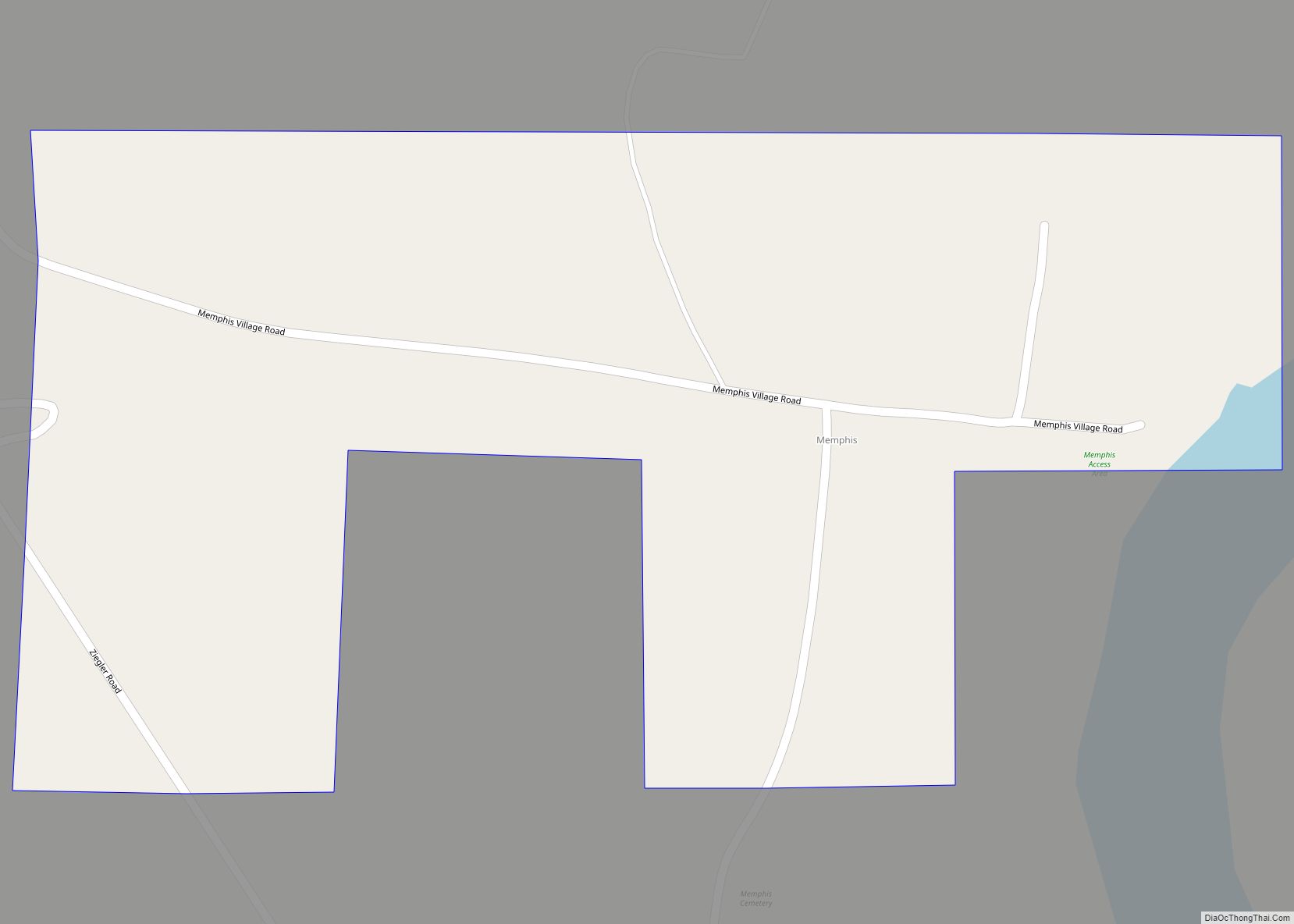
Memphis, also known as Old Memphis, is a town in Pickens County, Alabama, United States. The population was 29 at the 2010 census, down from 33 in 2000. As long ago as 1850, it was listed as an incorporated community on the U.S. Census, but did not appear again on the rolls until its reincorporation in 1976.
In 1981, it had the “dubious” distinction of being ranked the poorest incorporated community in the United States according to the U.S. Census. As of 1984, then-Mayor Jimmy Williams (b. c1922) stated the town received just $2,000 per year from state tax receipts and federal revenue-sharing funds and a sum total of $40 in the bank. It was hoped the completion of the Tennessee-Tombigbee Waterway would help raise the standard of living for the town.
| Name: | Memphis town |
|---|---|
| LSAD Code: | 43 |
| LSAD Description: | town (suffix) |
| State: | Alabama |
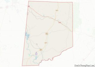
| County: | Pickens County |
| Elevation: | 167 ft (51 m) |
| Total Area: | 0.39 sq mi (1.01 km²) |
| Land Area: | 0.39 sq mi (1.00 km²) |
| Water Area: | 0.00 sq mi (0.01 km²) |
| Total Population: | 29 |
| Population Density: | 74.94/sq mi (28.92/km²) |
| FIPS code: | 0148052 |
| GNISfeature ID: | 0122652 |
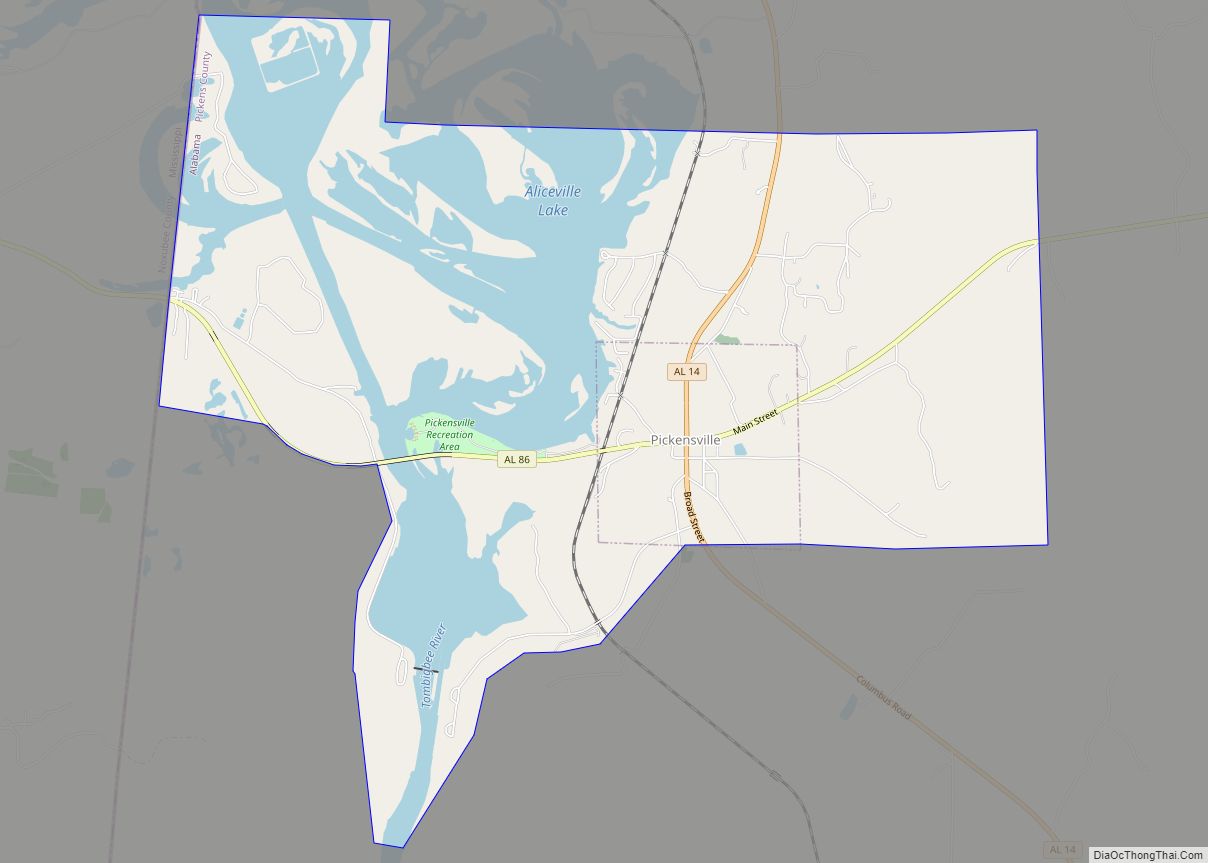
Online Interactive Map
Click on ![]() to view map in "full screen" mode.
to view map in "full screen" mode.
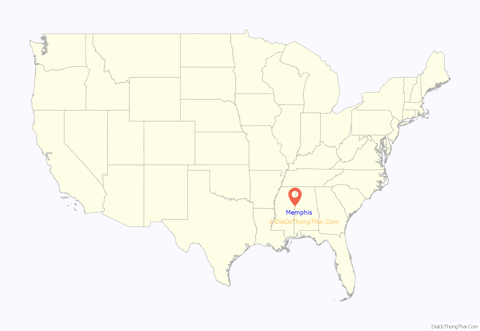
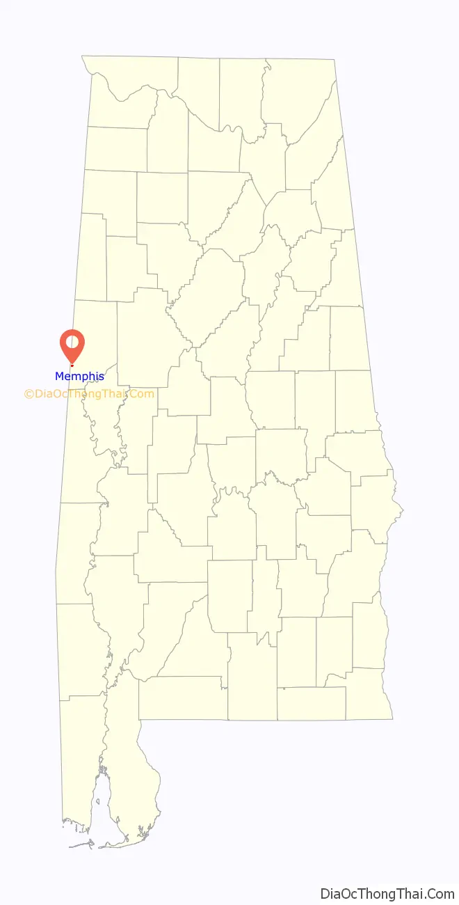
Memphis location map. Where is Memphis town?
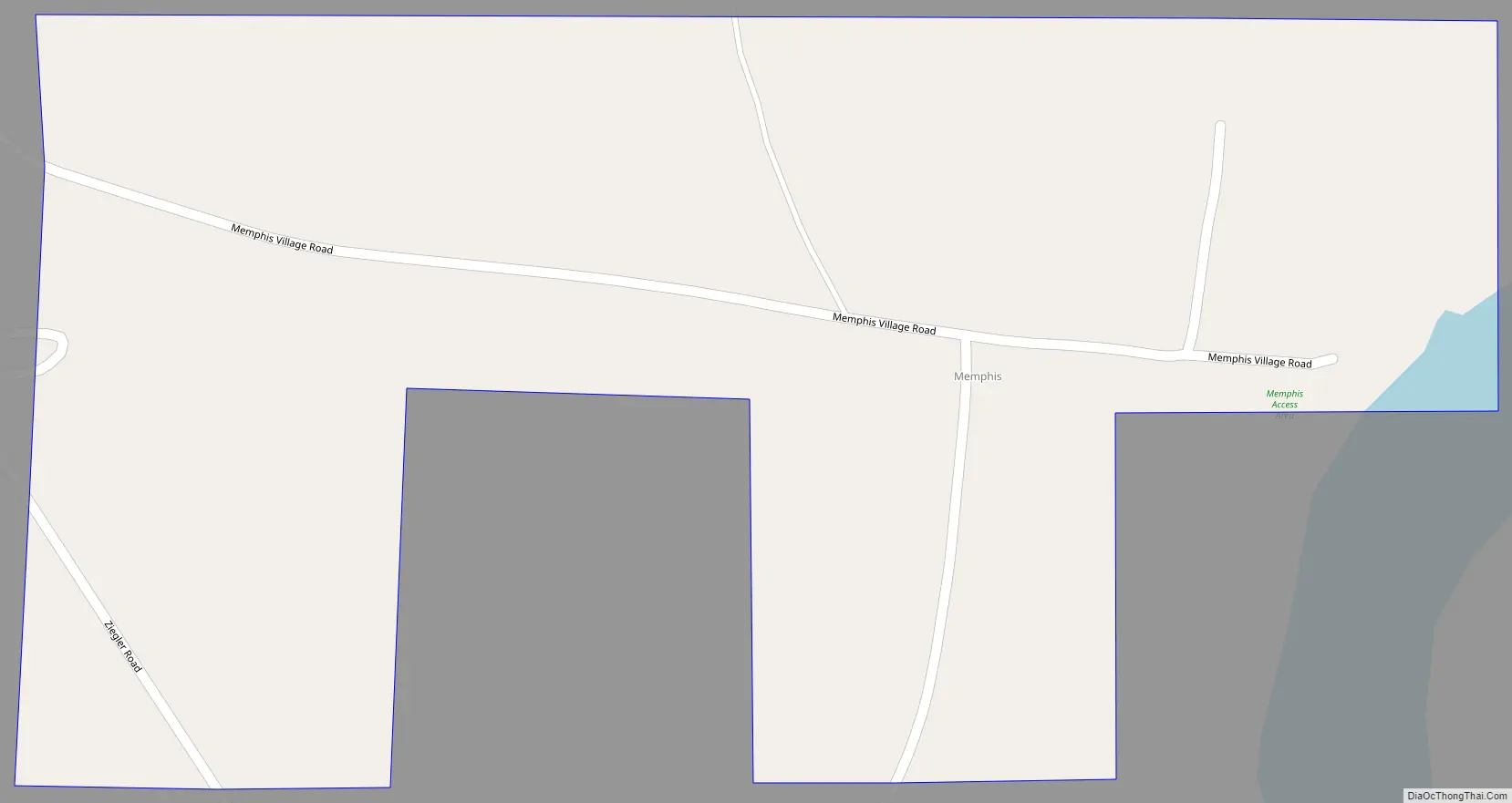
Memphis Road Map
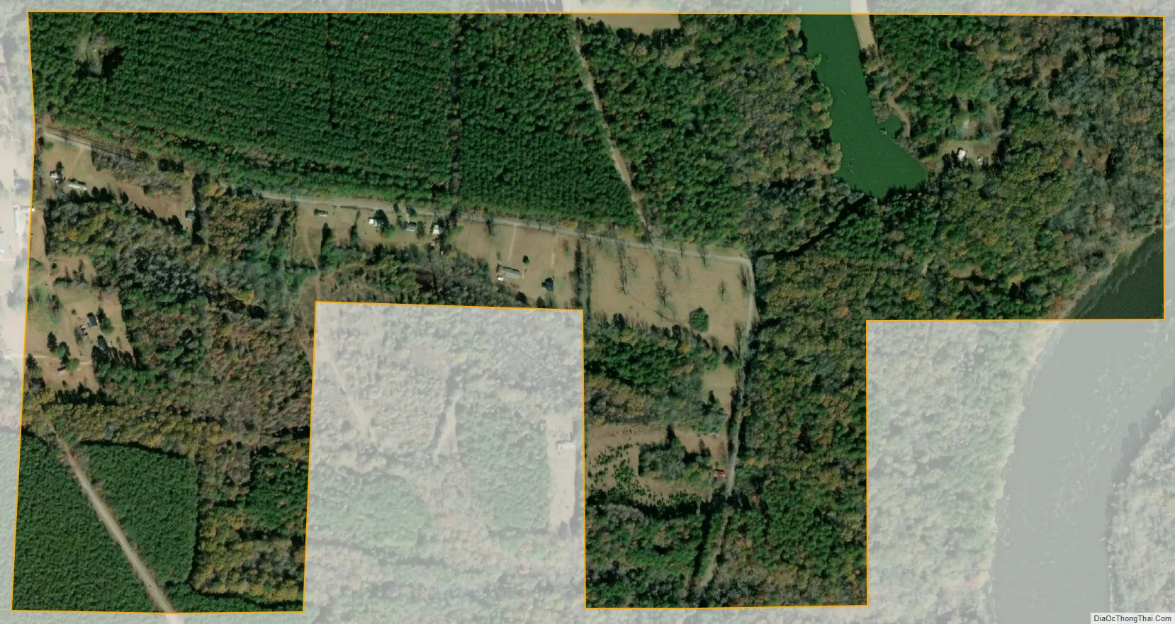
Memphis city Satellite Map
Geography
Memphis is located at 33°8′1″N 88°17′49″W / 33.13361°N 88.29694°W / 33.13361; -88.29694 (33.133678, -88.297023).
According to the U.S. Census Bureau, the town has a total area of 0.4 square miles (1.0 km), all land.
See also
Map of Alabama State and its subdivision:- Autauga
- Baldwin
- Barbour
- Bibb
- Blount
- Bullock
- Butler
- Calhoun
- Chambers
- Cherokee
- Chilton
- Choctaw
- Clarke
- Clay
- Cleburne
- Coffee
- Colbert
- Conecuh
- Coosa
- Covington
- Crenshaw
- Cullman
- Dale
- Dallas
- De Kalb
- Elmore
- Escambia
- Etowah
- Fayette
- Franklin
- Geneva
- Greene
- Hale
- Henry
- Houston
- Jackson
- Jefferson
- Lamar
- Lauderdale
- Lawrence
- Lee
- Limestone
- Lowndes
- Macon
- Madison
- Marengo
- Marion
- Marshall
- Mobile
- Monroe
- Montgomery
- Morgan
- Perry
- Pickens
- Pike
- Randolph
- Russell
- Saint Clair
- Shelby
- Sumter
- Talladega
- Tallapoosa
- Tuscaloosa
- Walker
- Washington
- Wilcox
- Winston
- Alabama
- Alaska
- Arizona
- Arkansas
- California
- Colorado
- Connecticut
- Delaware
- District of Columbia
- Florida
- Georgia
- Hawaii
- Idaho
- Illinois
- Indiana
- Iowa
- Kansas
- Kentucky
- Louisiana
- Maine
- Maryland
- Massachusetts
- Michigan
- Minnesota
- Mississippi
- Missouri
- Montana
- Nebraska
- Nevada
- New Hampshire
- New Jersey
- New Mexico
- New York
- North Carolina
- North Dakota
- Ohio
- Oklahoma
- Oregon
- Pennsylvania
- Rhode Island
- South Carolina
- South Dakota
- Tennessee
- Texas
- Utah
- Vermont
- Virginia
- Washington
- West Virginia
- Wisconsin
- Wyoming