| Name: | Mobile city |
|---|---|
| LSAD Code: | 25 |
| LSAD Description: | city (suffix) |
| State: | Alabama |
| County: | Mobile County |
| Founded: | 1702 |
| Elevation: | 33 ft (10 m) |
| Land Area: | 139.48 sq mi (361.26 km²) |
| Water Area: | 40.59 sq mi (105.14 km²) |
| Population Density: | 1,340.97/sq mi (517.75/km²) |
| Area code: | 251 |
| FIPS code: | 0150000 |
| GNISfeature ID: | 2404278 |
| Website: | www.cityofmobile.org |
Online Interactive Map
Click on ![]() to view map in "full screen" mode.
to view map in "full screen" mode.
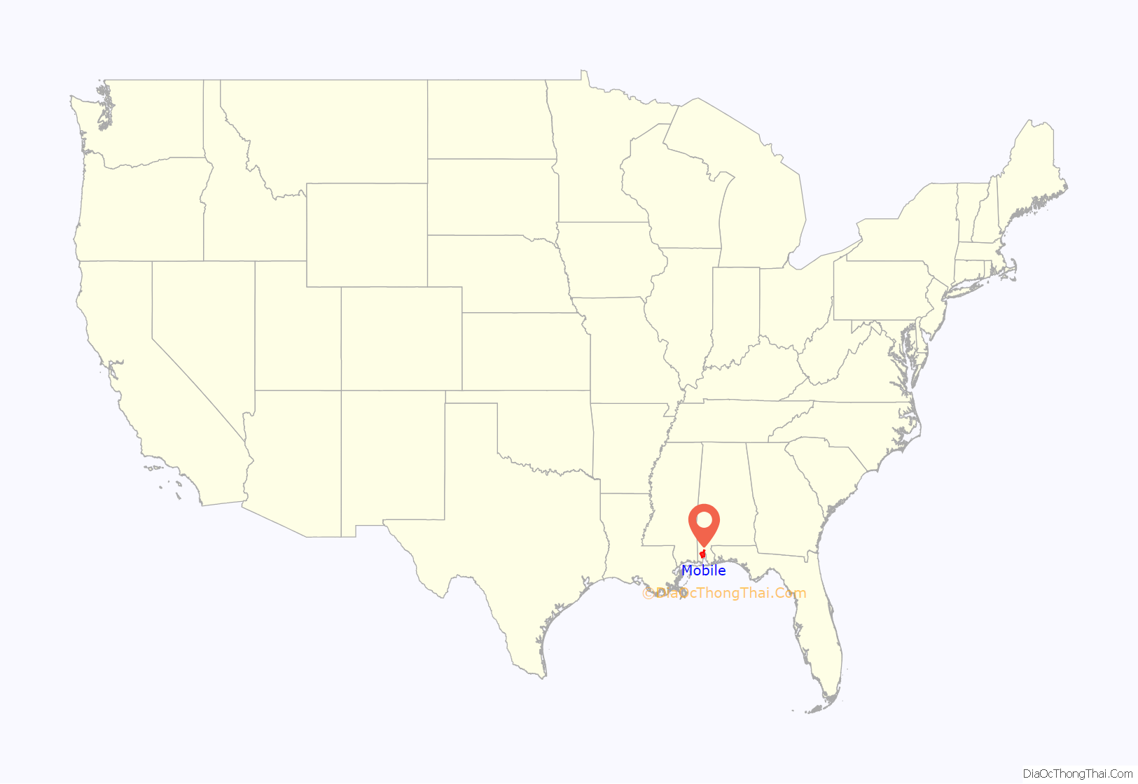
Mobile location map. Where is Mobile city?
History
Colonial
The European settlement of Mobile began with French colonists, who in 1702 constructed Fort Louis de la Louisiane, at Twenty-seven Mile Bluff on the Mobile River, as the first capital of the French colony of La Louisiane. It was founded by French Canadian brothers Pierre Le Moyne d’Iberville and Jean-Baptiste Le Moyne, Sieur de Bienville, to establish control over France’s claims to La Louisiane. Bienville was appointed as royal governor of French Louisiana in 1701. Mobile’s Roman Catholic parish was established on July 20, 1703, by Jean-Baptiste de la Croix de Chevrières de Saint-Vallier, Bishop of Quebec. The parish was the first French Catholic parish established on the Gulf Coast of the United States.
In 1704, the ship Pélican delivered 23 Frenchwomen to the colony; passengers had contracted yellow fever at a stop in Havana. Though most of the “Pélican girls” recovered, numerous colonists and neighboring Native Americans contracted the disease in turn and many died. This early period was also the occasion of the importation of the first African slaves, transported aboard a French supply ship from the French colony of Saint-Domingue in the Caribbean, where they had first been held. The population of the colony fluctuated over the next few years, growing to 279 persons by 1708, yet shrinking to 178 persons two years later due to disease.
These additional outbreaks of disease and a series of floods resulted in Bienville ordering in 1711 that the settlement be relocated several miles downriver to its present location at the confluence of the Mobile River and Mobile Bay. A new earth-and-palisade Fort Louis was constructed at the new site during this time. By 1712, when Antoine Crozat was appointed to take over administration of the colony, its population had reached 400 persons.
The capital of La Louisiane was moved in 1720 to Biloxi, leaving Mobile to serve as a regional military and trading center. In 1723 the construction of a new brick fort with a stone foundation began and it was renamed Fort Condé in honor of Louis Henri, Duke of Bourbon.
In 1763, the Treaty of Paris was signed, ending the Seven Years’ War, which Britain won, defeating France. By this treaty, France ceded its territories east of the Mississippi River to Britain. This area was made a part of the expanded British West Florida colony. The British changed the name of Fort Condé to Fort Charlotte, after Queen Charlotte.
The British were eager not to lose any useful inhabitants and promised religious tolerance to the French colonists; ultimately 112 French colonists remained in Mobile. The first permanent Jewish settlers came to Mobile in 1763 as a result of the new British rule and religious tolerance. Jews had not been allowed to officially reside in colonial French Louisiana due to the Code Noir, a decree passed by France’s King Louis XIV in 1685 that forbade the exercise of any religion other than Roman Catholicism, and ordered all Jews out of France’s colonies. Most of these colonial-era Jews in Mobile were merchants and traders from Sephardic Jewish communities in Savannah, Georgia and Charleston, South Carolina; they added to the commercial development of Mobile. In 1766 the total population was estimated to be 860, though the town’s borders were smaller than during the French colonial period. During the American Revolutionary War, West Florida and Mobile became a refuge for loyalists fleeing the other colonies.
While the British were dealing with their rebellious colonists along the Atlantic coast, the Spanish entered the war in 1779 as an ally of France. They took the opportunity to order Bernardo de Galvez, Governor of Louisiana, on an expedition east to retake West Florida. He captured Mobile during the Battle of Fort Charlotte in 1780, as part of this campaign. The Spanish wished to eliminate any British threat to their Louisiana colony west of the Mississippi River, which they had received from France in the 1763 Treaty of Paris. Their actions were condoned by the revolting American colonies, partially evidenced by the presence of Oliver Pollack, representative of the American Continental Congress. Due to strong trade ties, many residents of Mobile and West Florida remained loyal to the British Crown. The Spanish renamed the fort as Fortaleza Carlota, and held Mobile as a part of Spanish West Florida until 1813, when it was seized by United States General James Wilkinson during the War of 1812.
19th century
By the time Mobile was included in the Mississippi Territory in 1813, the population had dwindled to roughly 300 people. The city was included in the Alabama Territory in 1817, after Mississippi gained statehood. Alabama was granted statehood in 1819; Mobile’s population had increased to 809 by that time.
Mobile was well situated for trade, as its location tied it to a river system that served as the principal navigational access for most of Alabama and a large part of Mississippi. River transportation was aided by the introduction of steamboats in the early decades of the 19th century. By 1822, the city’s population had risen to 2,800.
The Industrial Revolution in Great Britain created shortages of cotton, driving up prices on world markets. Much land well suited to growing cotton lies in the vicinity of the Mobile River, and its main tributaries the Tombigbee and Alabama Rivers. A plantation economy using slave labor developed in the region and as a consequence Mobile’s population quickly grew. It came to be settled by attorneys, cotton factors, doctors, merchants and other professionals seeking to capitalize on trade with the upriver areas.
From the 1830s onward, Mobile expanded into a city of commerce with a primary focus on the cotton and slave trades. Many slaves were transported by ship in the coastwise slave trade from the Upper South. There were many businesses in the city related to the slave trade – people to make clothes, food, and supplies for the slave traders and their wards. The city’s booming businesses attracted merchants from the North; by 1850 10% of its population was from New York City, which was deeply involved in the cotton industry. Mobile was the slave-trading center of the state until the 1850s, when it was surpassed by Montgomery.
The prosperity stimulated a building boom that was underway by the mid-1830s, with the building of some of the most elaborate structures the city had seen up to that point. This was cut short in part by the Panic of 1837 and yellow fever epidemics. The waterfront was developed with wharves, terminal facilities, and fireproof brick warehouses. The exports of cotton grew in proportion to the amounts being produced in the Black Belt; by 1840 Mobile was second only to New Orleans in cotton exports in the nation.
With the economy so focused on one crop, Mobile’s fortunes were always tied to those of cotton, and the city weathered many financial crises. Mobile slaveholders owned relatively few slaves compared to planters in the upland plantation areas, but many households had domestic slaves, and many other slaves worked on the waterfront and on riverboats. The last slaves to enter the United States from the African trade were brought to Mobile on the slave ship Clotilda. Among them was Cudjoe Lewis, who in the 1920s became the last survivor of the slave trade.
By 1853, fifty Jewish families lived in Mobile, including Philip Phillips, an attorney from Charleston, South Carolina, who was elected to the Alabama State Legislature and then to the United States Congress. Many early Jewish families were descendants of Sephardic Jews who had been among the earliest colonial settlers in Charleston and Savannah.
By 1860 Mobile’s population within the city limits had reached 29,258 people; it was the 27th-largest city in the United States and 4th-largest in what would soon be the Confederate States of America. The free population in the whole of Mobile County, including the city, consisted of 29,754 citizens, of which 1,195 were free people of color. Additionally, 1,785 slave owners in the county held 11,376 people in bondage, about one-quarter of the total county population of 41,130 people.
During the American Civil War, Mobile was a Confederate city. The H. L. Hunley, the first submarine to sink an enemy ship, was built in Mobile. One of the most famous naval engagements of the war was the Battle of Mobile Bay, resulting in the Union taking control of Mobile Bay on August 5, 1864. On April 12, 1865, three days after Robert E. Lee’s surrender at Appomattox Courthouse, the city surrendered to the Union army to avoid destruction after Union victories at nearby Spanish Fort and Fort Blakely.
On May 25, 1865, the city suffered great loss when some three hundred people died as a result of an explosion at a federal ammunition depot on Beauregard Street. The explosion left a 30-foot (9 m) deep hole at the depot’s location, and sank ships docked on the Mobile River; the resulting fires destroyed the northern portion of the city.
Federal Reconstruction in Mobile began after the Civil War and effectively ended in 1874 when the local Democrats gained control of the city government. The last quarter of the 19th century was a time of economic depression and municipal insolvency for Mobile. One example can be provided by the value of Mobile’s exports during this period of depression. The value of exports leaving the city fell from $9 million in 1878 to $3 million in 1882.
20th century
The turn of the 20th century brought the Progressive Era to Mobile. The economic structure developed with new industries, generating new jobs and attracting a significant increase in population. The population increased from around 40,000 in 1900 to 60,000 by 1920. During this time the city received $3 million in federal grants for harbor improvements to deepen the shipping channels. During and after World War I, manufacturing became increasingly vital to Mobile’s economic health, with shipbuilding and steel production being two of the most important industries.
During this time, social justice and race relations in Mobile worsened, however. The state passed a new constitution in 1901 that disenfranchised most blacks and many poor whites; and the white Democratic-dominated legislature passed other discriminatory legislation. In 1902, the city government passed Mobile’s first racial segregation ordinance, segregating the city streetcars. It legislated what had been informal practice, enforced by convention. Mobile’s African-American population responded to this with a two-month boycott, but the law was not repealed. After this, Mobile’s de facto segregation was increasingly replaced with legislated segregation as whites imposed Jim Crow laws to maintain supremacy.
In 1911 the city adopted a commission form of government, which had three members elected by at-large voting. Considered to be progressive, as it would reduce the power of ward bosses, this change resulted in the elite white majority strengthening its power, as only the majority could gain election of at-large candidates. In addition, poor whites and blacks had already been disenfranchised. Mobile was one of the last cities to retain this form of government, which prevented smaller groups from electing candidates of their choice. But Alabama’s white yeomanry had historically favored single-member districts in order to elect candidates of their choice.
The red imported fire ant was first introduced into the United States via the Port of Mobile. Sometime in the late 1930s they came ashore off cargo ships arriving from South America. The ants were carried in the soil used as ballast on those ships. They have spread throughout the South and Southwest.
During World War II, the defense buildup in Mobile shipyards resulted in a considerable increase in the city’s white middle-class and working-class population, largely due to the massive influx of workers coming to work in the shipyards and at the Brookley Army Air Field. Between 1940 and 1943, more than 89,000 people moved into Mobile to work for war effort industries.
Mobile was one of eighteen United States cities producing Liberty ships. Its Alabama Drydock and Shipbuilding Company (ADDSCO) supported the war effort by producing ships faster than the Axis powers could sink them. ADDSCO also churned out a copious number of T2 tankers for the War Department. Gulf Shipbuilding Corporation, a subsidiary of Waterman Steamship Corporation, focused on building freighters, Fletcher-class destroyers, and minesweepers. The rapid increase of population in the city produced crowded conditions, increasing social tensions in the competition for housing and good jobs.
A race riot broke out in May 1943 of whites against blacks. ADDSCO management had long maintained segregated conditions at the shipyards, although the Roosevelt administration had ordered defense contractors to integrate facilities. That year ADDSCO promoted 12 blacks to positions as welders, previously reserved for whites; and whites objected to the change by rioting on May 24. The mayor appealed to the governor to call in the National Guard to restore order, but it was weeks before officials allowed African Americans to return to work, keeping them away for their safety.
In the late 1940s, the transition to the postwar economy was hard for the city, as thousands of jobs were lost at the shipyards with the decline in the defense industry. Eventually the city’s social structure began to become more liberal. Replacing shipbuilding as a primary economic force, the paper and chemical industries began to expand. No longer needed for defense, most of the old military bases were converted to civilian uses. Following the war, in which many African Americans had served, veterans and their supporters stepped up activism to gain enforcement of their constitutional rights and social justice, especially in the Jim Crow South. During the 1950s the City of Mobile integrated its police force and Spring Hill College accepted students of all races. Unlike in the rest of the state, by the early 1960s the city buses and lunch counters voluntarily desegregated.
The Alabama legislature passed the Cater Act in 1949, allowing cities and counties to set up industrial development boards (IDB) to issue municipal bonds as incentives to attract new industry into their local areas. The city of Mobile did not establish a Cater Act board until 1962. George E. McNally, Mobile’s first Republican mayor since Reconstruction, was the driving force behind the founding of the IDB. The Mobile Area Chamber of Commerce, believing its members were better qualified to attract new businesses and industry to the area, considered the new IDB as a serious rival. After several years of political squabbling, the Chamber of Commerce emerged victorious. While McNally’s IDB prompted the Chamber of Commerce to become more proactive in attracting new industry, the chamber effectively shut Mobile city government out of economic development decisions.
In 1963, three African-American students brought a case against the Mobile County School Board for being denied admission to Murphy High School. This was nearly a decade after the United States Supreme Court had ruled in Brown v. Board of Education (1954) that segregation of public schools was unconstitutional. The federal district court ordered that the three students be admitted to Murphy for the 1964 school year, leading to the desegregation of Mobile County’s school system.
The civil rights movement gained congressional passage of the Civil Rights Act of 1964 and Voting Rights Act of 1965, eventually ending legal segregation and regaining effective suffrage for African Americans. But whites in the state had more than one way to reduce African Americans’ voting power. Maintaining the city commission form of government with at-large voting resulted in all positions being elected by the white majority, as African Americans could not command a majority for their candidates in the informally segregated city.
In 1969 Brookley Air Force Base was closed by the Department of Defense, dealing Mobile’s economy a severe blow. The closing resulted in a 10% unemployment rate in the city. This and other factors related to industrial restructuring ushered in a period of economic depression that lasted through the 1970s. The loss of jobs created numerous problems and resulted in loss of population as residents moved away for work.
Mobile’s city commission form of government was challenged and finally overturned in 1982 in City of Mobile v. Bolden, which was remanded by the United States Supreme Court to the district court. Finding that the city had adopted a commission form of government in 1911 and at-large positions with discriminatory intent, the court proposed that the three members of the city commission should be elected from single-member districts, likely ending their division of executive functions among them. Mobile’s state legislative delegation in 1985 finally enacted a mayor-council form of government, with seven members elected from single-member districts. This was approved by voters. As white conservatives increasingly entered the Republican Party in the late 20th century, African-American residents of the city have elected members of the Democratic Party as their candidates of choice. Since the change to single-member districts, more women and African Americans were elected to the council than under the at-large system.
Beginning in the late 1980s, newly elected mayor Mike Dow and the city council began an effort termed the “String of Pearls Initiative” to make Mobile into a competitive city. The city initiated construction of numerous new facilities and projects, and the restoration of hundreds of historic downtown buildings and homes. City and county leaders also made efforts to attract new business ventures to the area.
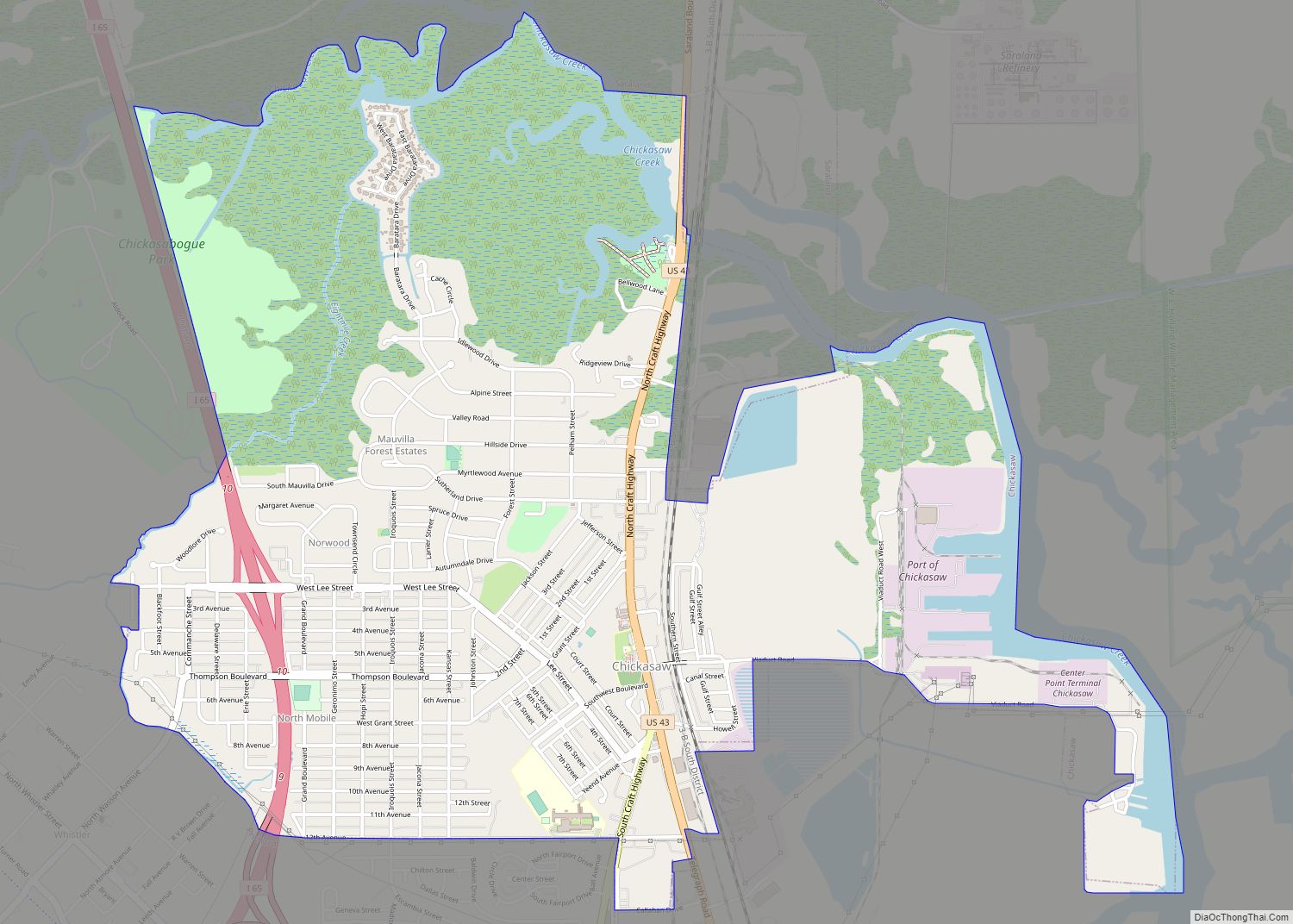
Mobile Road Map
Mobile city Satellite Map
Geography
Geography
Mobile is located in the southwestern part of the U.S. state of Alabama. It is 168 miles (270 km) by highway southwest of Montgomery, the state capital; 58 miles (93 km) west of Pensacola, Florida; and 144 miles (232 km) northeast of New Orleans.
According to the United States Census Bureau, the city has a total area of 180.1 square miles (466 km), with 139.5 square miles (361 km) of it being land, and 40.6 square miles (105.2 km), or 22.5% of the total, being covered by water. The elevation in Mobile ranges from 10 feet (3 m) on Water Street in downtown to 211 feet (64 m) at the Mobile Regional Airport.
Neighborhoods
Mobile has a number of notable historic neighborhoods. These include Ashland Place, Campground, Church Street East, De Tonti Square, Leinkauf, Lower Dauphin Street, Midtown, Oakleigh Garden, Old Dauphin Way, Spring Hill, and Toulminville.
Climate
Mobile’s geographical location on the Gulf of Mexico provides a mild subtropical climate (Köppen Cfa), with hot, humid summers and mild, rainy winters. The record low temperature was −1 °F (−18 °C), set on February 13, 1899, and the record high was 105 °F (41 °C), set on August 29, 2000.
A 2007 study by WeatherBill, Inc. determined that Mobile is the wettest city in the contiguous 48 states, with 66.3 inches (1,680 mm) of average annual rainfall over a 30-year period. Mobile averages 120 days per year with at least 0.01 inches (0.3 mm) of rain. Precipitation is heavy year-round. On average, July and August are the wettest months, with frequent and often-heavy shower and thunderstorm activity. October stands out as a slightly drier month than all others. Snow is rare in Mobile, with its last snowfall occurring on December 8, 2017; before this, the last snowfall had been nearly four years earlier, on January 27, 2014.
Mobile is occasionally affected by major tropical storms and hurricanes. The city suffered a major natural disaster on the night of September 12, 1979, when category-3 Hurricane Frederic passed over the heart of the city. The storm caused tremendous damage to Mobile and the surrounding area. Mobile had moderate damage from Hurricane Opal on October 4, 1995, and Hurricane Ivan on September 16, 2004.
Mobile suffered millions of dollars in damage from Hurricane Katrina on August 29, 2005, which damaged much of the Gulf Coast cities. A storm surge of 11.45 feet (3.49 m), topped by higher waves, damaged eastern sections of the city with extensive flooding in downtown, the Battleship Parkway, and the elevated Jubilee Parkway.
In late December 2012, the city suffered two tornado hits. On December 25, 2012, at 4:54 pm, a large wedge tornado touched down in the city. The tornado rapidly intensified as it moved north-northeast at speeds of up to 50 mph (80 km/h). The path took the tornado into Midtown, causing damage or destruction to at least 100 structures. The heaviest damage to houses was along Carlen Street, Rickarby Place, Dauphin Street, Old Shell Road, Margaret Street, Silverwood Street, and Springhill Avenue.
The tornado caused significant damage to the Carmelite Monastery, Little Flower Catholic Church, commercial real estate along Airport Boulevard and Government Street in the Midtown at the Loop neighborhood, Murphy High School, Trinity Episcopal Church, Springhill Avenue Temple, and Mobile Infirmary Hospital before moving into the neighboring city of Prichard. The tornado was classified as an EF2 tornado by the National Weather Service on December 26.
The path taken through the city was just a short distance east of the path taken days earlier, on December 20, by an EF1 tornado which had touched down near Davidson High School and taken a path ending in Prichard. Initial damage estimates for insured and uninsured ranged from $140 to $150 million.
See also
Map of Alabama State and its subdivision:- Autauga
- Baldwin
- Barbour
- Bibb
- Blount
- Bullock
- Butler
- Calhoun
- Chambers
- Cherokee
- Chilton
- Choctaw
- Clarke
- Clay
- Cleburne
- Coffee
- Colbert
- Conecuh
- Coosa
- Covington
- Crenshaw
- Cullman
- Dale
- Dallas
- De Kalb
- Elmore
- Escambia
- Etowah
- Fayette
- Franklin
- Geneva
- Greene
- Hale
- Henry
- Houston
- Jackson
- Jefferson
- Lamar
- Lauderdale
- Lawrence
- Lee
- Limestone
- Lowndes
- Macon
- Madison
- Marengo
- Marion
- Marshall
- Mobile
- Monroe
- Montgomery
- Morgan
- Perry
- Pickens
- Pike
- Randolph
- Russell
- Saint Clair
- Shelby
- Sumter
- Talladega
- Tallapoosa
- Tuscaloosa
- Walker
- Washington
- Wilcox
- Winston
- Alabama
- Alaska
- Arizona
- Arkansas
- California
- Colorado
- Connecticut
- Delaware
- District of Columbia
- Florida
- Georgia
- Hawaii
- Idaho
- Illinois
- Indiana
- Iowa
- Kansas
- Kentucky
- Louisiana
- Maine
- Maryland
- Massachusetts
- Michigan
- Minnesota
- Mississippi
- Missouri
- Montana
- Nebraska
- Nevada
- New Hampshire
- New Jersey
- New Mexico
- New York
- North Carolina
- North Dakota
- Ohio
- Oklahoma
- Oregon
- Pennsylvania
- Rhode Island
- South Carolina
- South Dakota
- Tennessee
- Texas
- Utah
- Vermont
- Virginia
- Washington
- West Virginia
- Wisconsin
- Wyoming
