Sumiton is a city in Jefferson and Walker counties in the State of Alabama. It incorporated in 1952. At the 2010 census the population was 2,520, down from 2,665 in 2000.
| Name: | Sumiton city |
|---|---|
| LSAD Code: | 25 |
| LSAD Description: | city (suffix) |
| State: | Alabama |
| County: | Jefferson County, Walker County |
| Elevation: | 515 ft (157 m) |
| Total Area: | 5.22 sq mi (13.52 km²) |
| Land Area: | 5.20 sq mi (13.47 km²) |
| Water Area: | 0.02 sq mi (0.06 km²) |
| Total Population: | 2,444 |
| Population Density: | 470.09/sq mi (181.50/km²) |
| ZIP code: | 35148 |
| Area code: | 205, 659 |
| FIPS code: | 0173848 |
| GNISfeature ID: | 0153607 |
| Website: | www.thecityofsumiton.com |
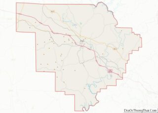
Online Interactive Map
Click on ![]() to view map in "full screen" mode.
to view map in "full screen" mode.
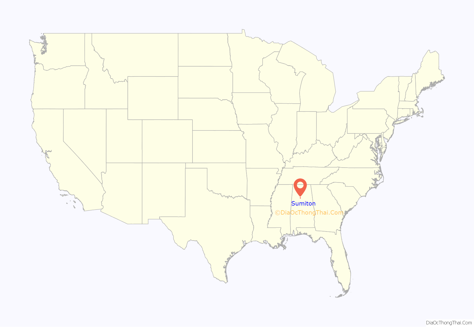
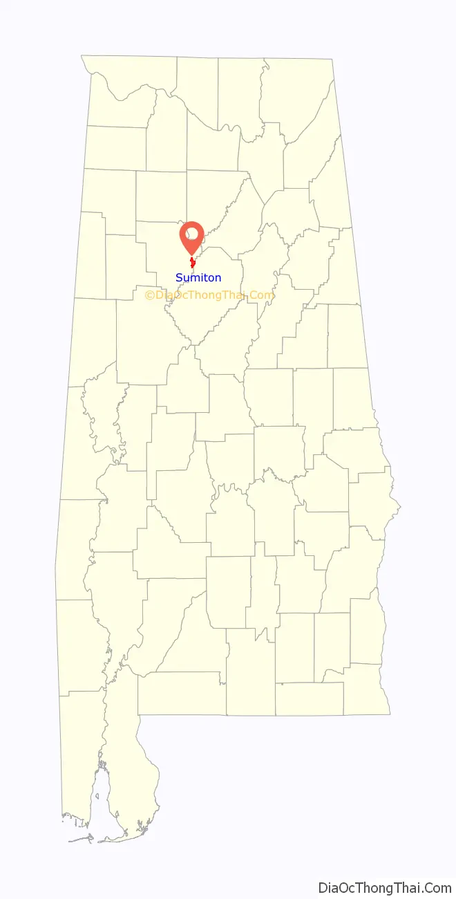
Sumiton location map. Where is Sumiton city?
History
The city’s original name was Summit, named by founder Nicholas M. Norris after the community’s high elevation. The current mayor of Sumiton is Branden L. Sellers, who is in his first term. The current council members are as follows: Place 1: Jake Persky, Place 2: Floyd Burton, Place 3: Kenneth Russell, Place 4: Bill Fowler, and Place 5: Jim Dodd.
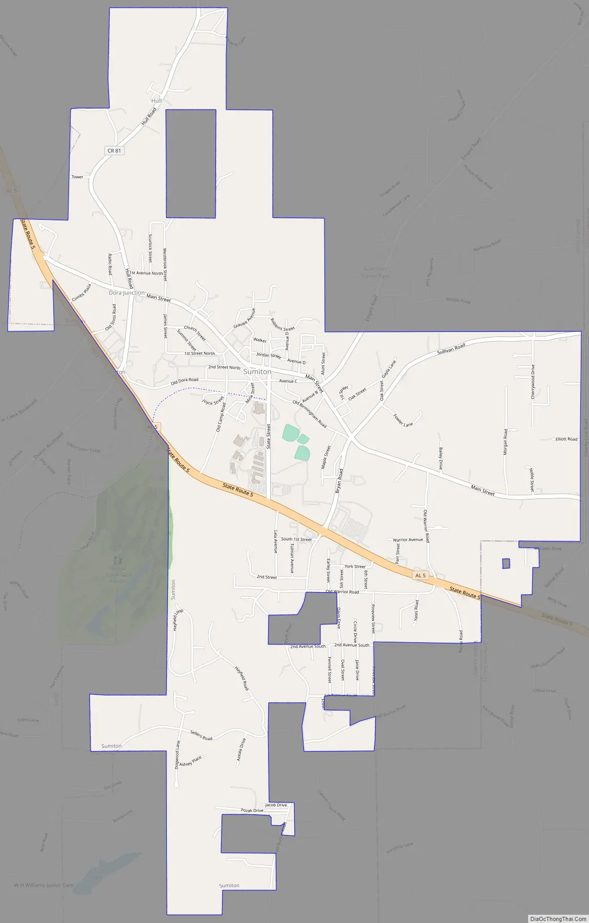
Sumiton Road Map
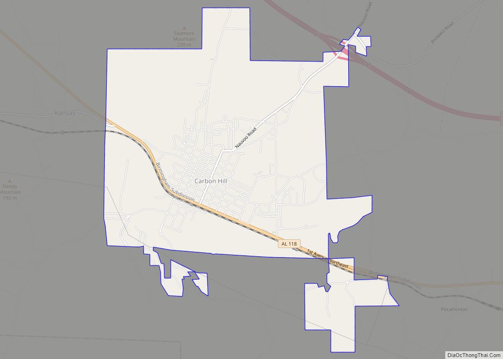
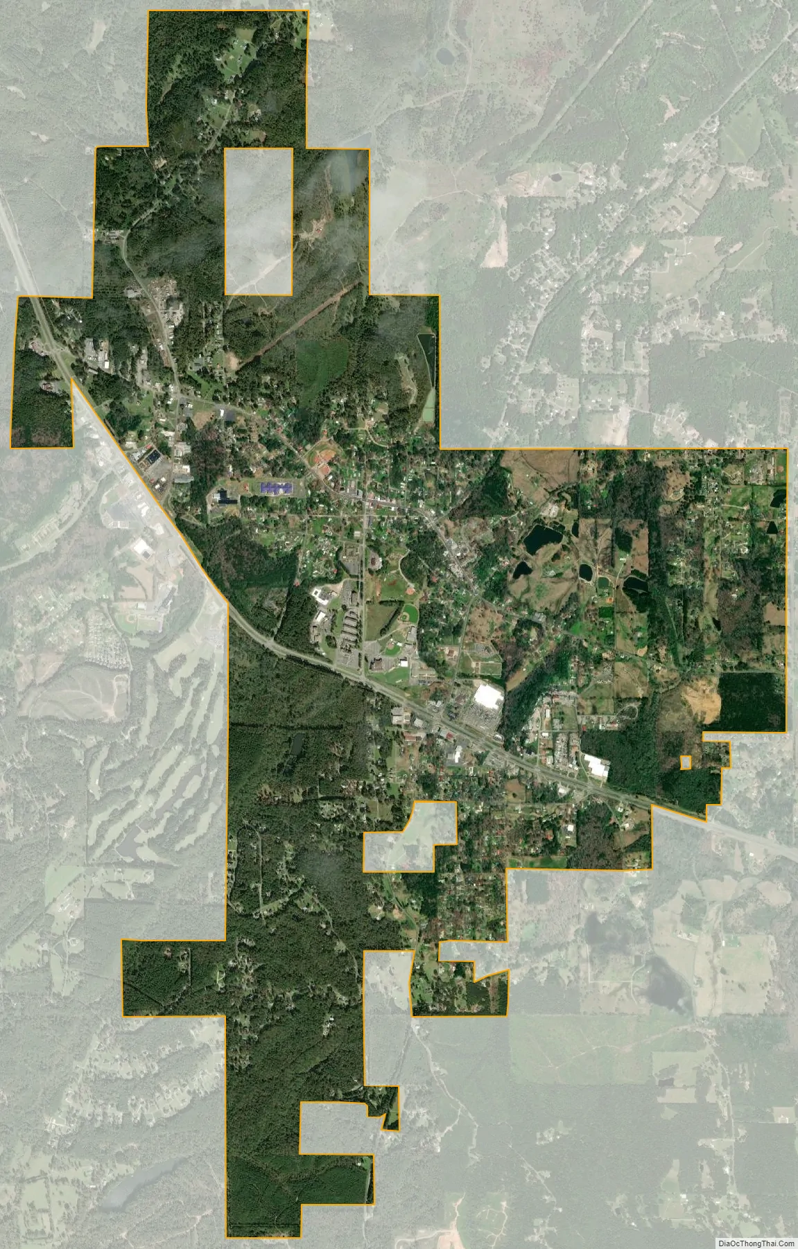
Sumiton city Satellite Map
Geography
Sumiton is located at 33°44′50″N 87°2′48″W / 33.74722°N 87.04667°W / 33.74722; -87.04667 (33.747213, -87.046716).
According to the U.S. Census Bureau, the city has a total area of 5.3 square miles (14 km), all land.
See also
Map of Alabama State and its subdivision:- Autauga
- Baldwin
- Barbour
- Bibb
- Blount
- Bullock
- Butler
- Calhoun
- Chambers
- Cherokee
- Chilton
- Choctaw
- Clarke
- Clay
- Cleburne
- Coffee
- Colbert
- Conecuh
- Coosa
- Covington
- Crenshaw
- Cullman
- Dale
- Dallas
- De Kalb
- Elmore
- Escambia
- Etowah
- Fayette
- Franklin
- Geneva
- Greene
- Hale
- Henry
- Houston
- Jackson
- Jefferson
- Lamar
- Lauderdale
- Lawrence
- Lee
- Limestone
- Lowndes
- Macon
- Madison
- Marengo
- Marion
- Marshall
- Mobile
- Monroe
- Montgomery
- Morgan
- Perry
- Pickens
- Pike
- Randolph
- Russell
- Saint Clair
- Shelby
- Sumter
- Talladega
- Tallapoosa
- Tuscaloosa
- Walker
- Washington
- Wilcox
- Winston
- Alabama
- Alaska
- Arizona
- Arkansas
- California
- Colorado
- Connecticut
- Delaware
- District of Columbia
- Florida
- Georgia
- Hawaii
- Idaho
- Illinois
- Indiana
- Iowa
- Kansas
- Kentucky
- Louisiana
- Maine
- Maryland
- Massachusetts
- Michigan
- Minnesota
- Mississippi
- Missouri
- Montana
- Nebraska
- Nevada
- New Hampshire
- New Jersey
- New Mexico
- New York
- North Carolina
- North Dakota
- Ohio
- Oklahoma
- Oregon
- Pennsylvania
- Rhode Island
- South Carolina
- South Dakota
- Tennessee
- Texas
- Utah
- Vermont
- Virginia
- Washington
- West Virginia
- Wisconsin
- Wyoming