Trafford is a town in Jefferson County, Alabama, United States. A small portion extends into Blount County. The town was incorporated in 1948. At the 2020 census, the population was 613.
| Name: | Trafford town |
|---|---|
| LSAD Code: | 43 |
| LSAD Description: | town (suffix) |
| State: | Alabama |
| County: | Blount County, Jefferson County |
| Elevation: | 489 ft (149 m) |
| Total Area: | 2.74 sq mi (7.10 km²) |
| Land Area: | 2.74 sq mi (7.10 km²) |
| Water Area: | 0.00 sq mi (0.00 km²) |
| Total Population: | 613 |
| Population Density: | 223.48/sq mi (86.29/km²) |
| Area code: | 205 & 659 |
| FIPS code: | 0176680 |
| GNISfeature ID: | 0153714 |
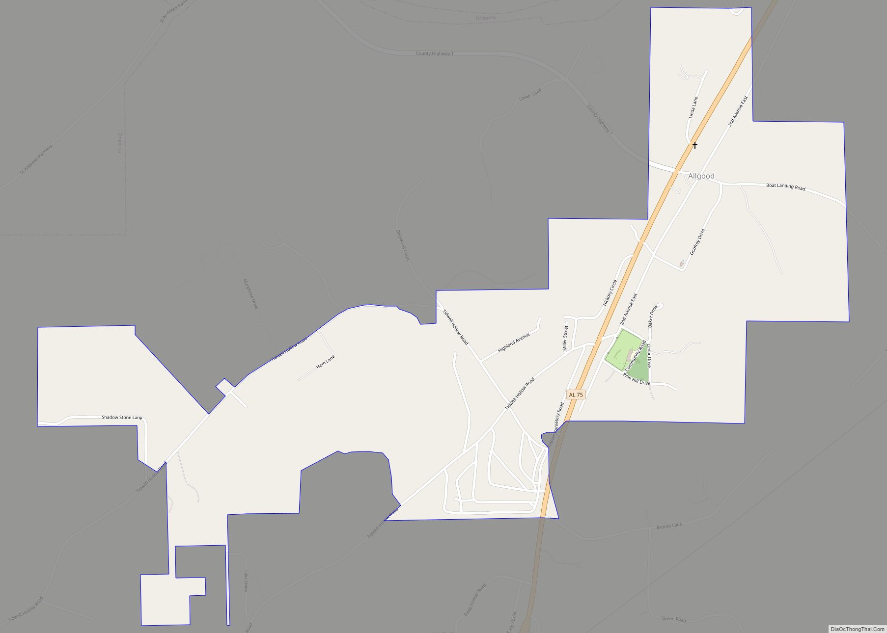
Online Interactive Map
Click on ![]() to view map in "full screen" mode.
to view map in "full screen" mode.
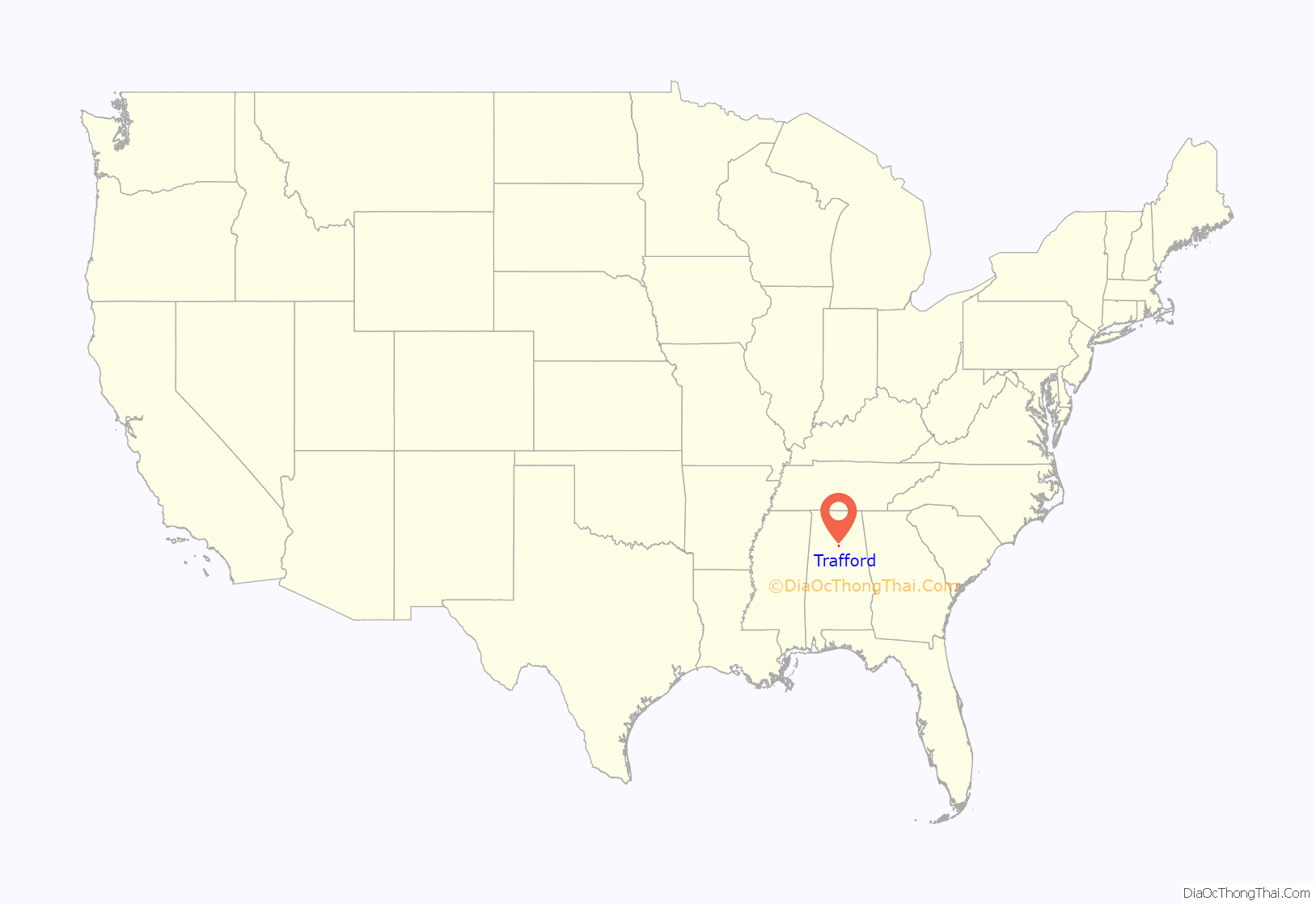
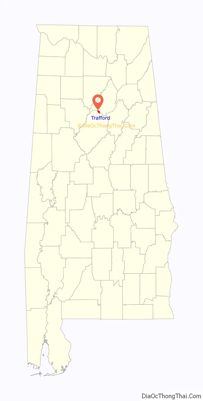
Trafford location map. Where is Trafford town?
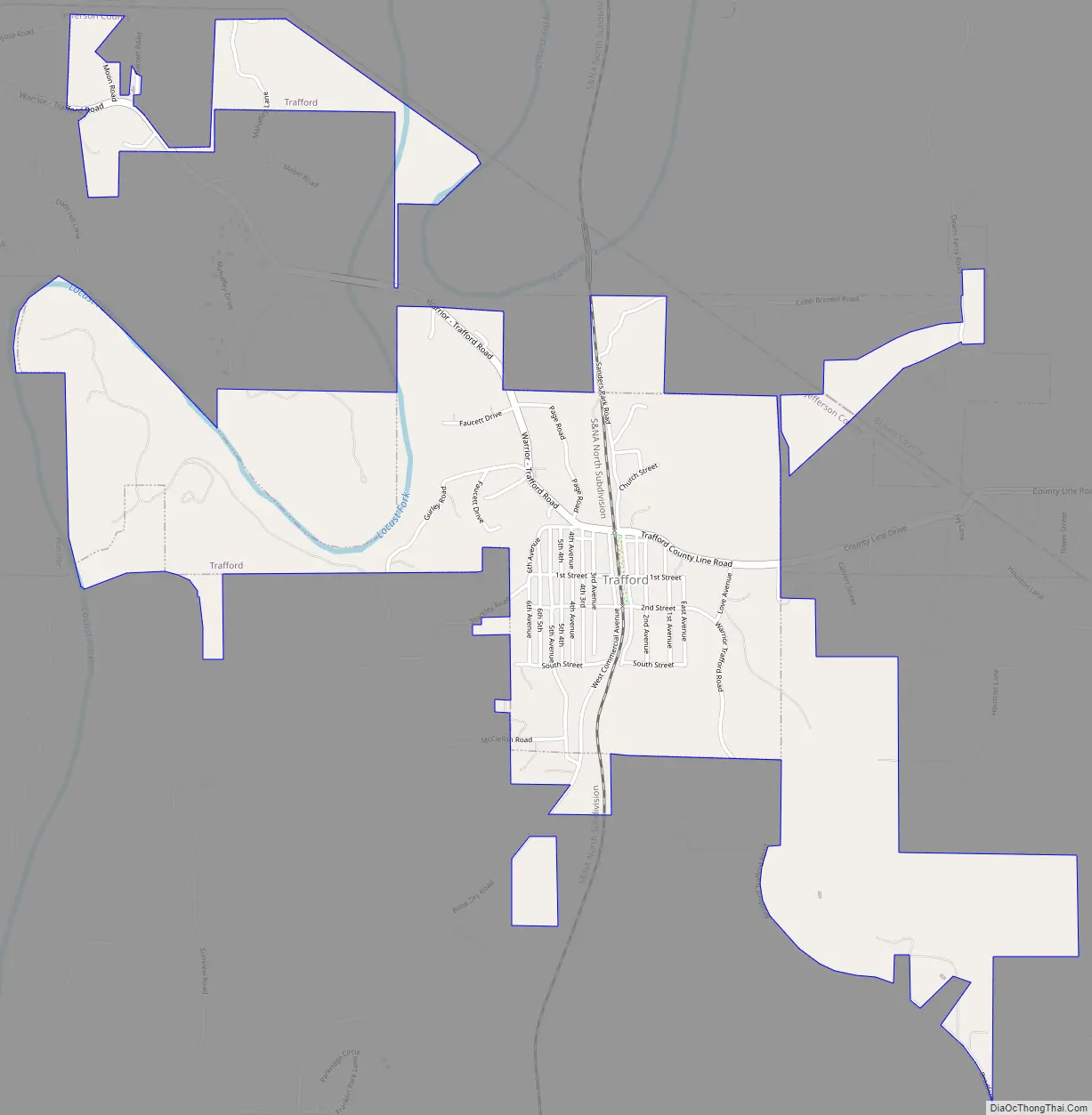
Trafford Road Map
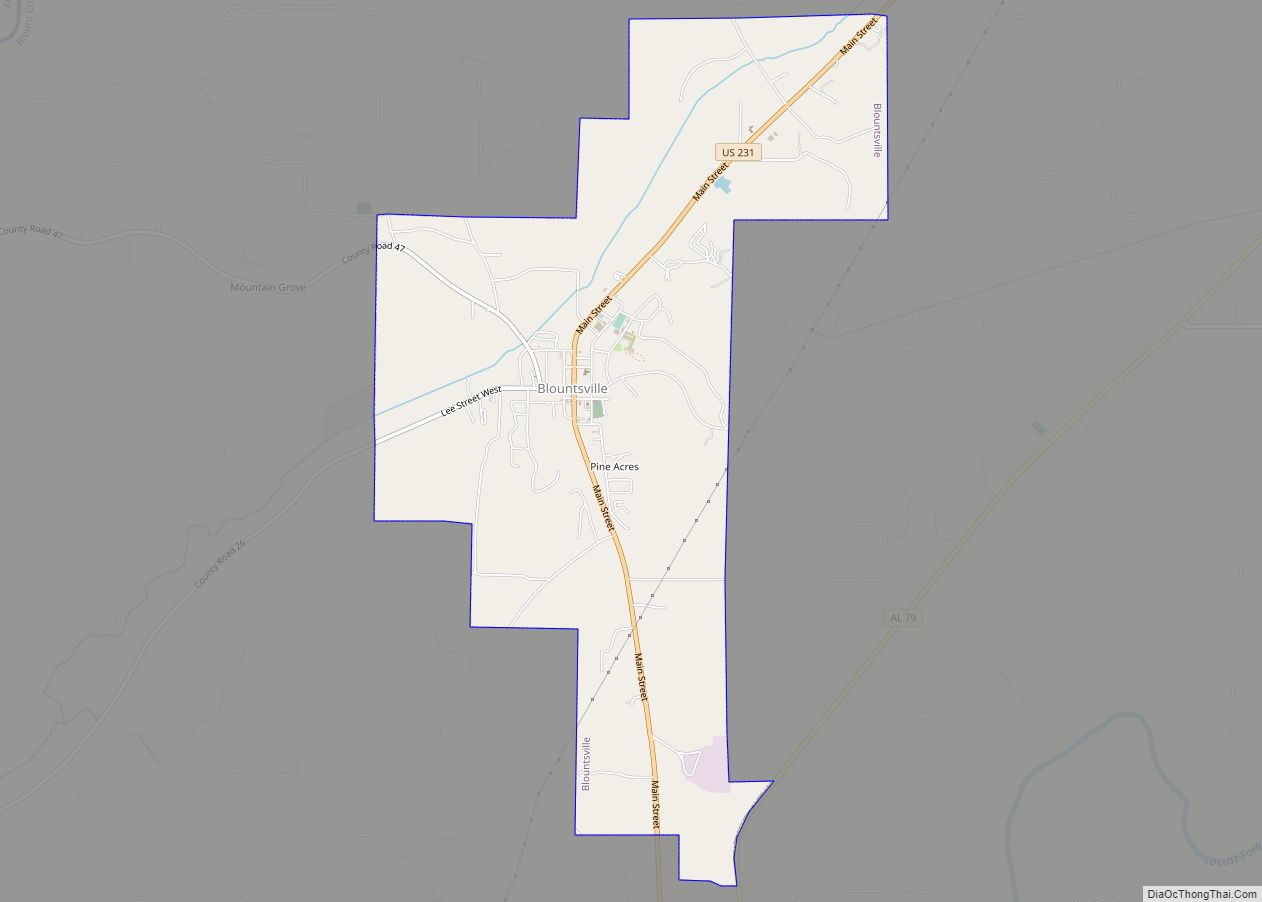
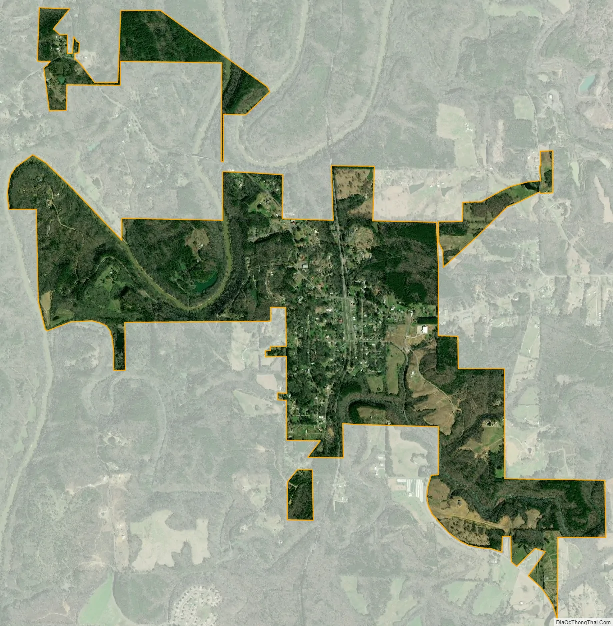
Trafford city Satellite Map
Geography
Trafford is located in northern Jefferson County at 33°49′8″N 86°44′48″W / 33.81889°N 86.74667°W / 33.81889; -86.74667 (33.818957, -86.746581). The Locust Fork of the Black Warrior River flows through the northwest part of town. The town of County Line borders the town to the east. Trafford is 26 miles (42 km) north of downtown Birmingham.
According to the U.S. Census Bureau, the town has a total area of 2.4 square miles (6.3 km), all land.
See also
Map of Alabama State and its subdivision:- Autauga
- Baldwin
- Barbour
- Bibb
- Blount
- Bullock
- Butler
- Calhoun
- Chambers
- Cherokee
- Chilton
- Choctaw
- Clarke
- Clay
- Cleburne
- Coffee
- Colbert
- Conecuh
- Coosa
- Covington
- Crenshaw
- Cullman
- Dale
- Dallas
- De Kalb
- Elmore
- Escambia
- Etowah
- Fayette
- Franklin
- Geneva
- Greene
- Hale
- Henry
- Houston
- Jackson
- Jefferson
- Lamar
- Lauderdale
- Lawrence
- Lee
- Limestone
- Lowndes
- Macon
- Madison
- Marengo
- Marion
- Marshall
- Mobile
- Monroe
- Montgomery
- Morgan
- Perry
- Pickens
- Pike
- Randolph
- Russell
- Saint Clair
- Shelby
- Sumter
- Talladega
- Tallapoosa
- Tuscaloosa
- Walker
- Washington
- Wilcox
- Winston
- Alabama
- Alaska
- Arizona
- Arkansas
- California
- Colorado
- Connecticut
- Delaware
- District of Columbia
- Florida
- Georgia
- Hawaii
- Idaho
- Illinois
- Indiana
- Iowa
- Kansas
- Kentucky
- Louisiana
- Maine
- Maryland
- Massachusetts
- Michigan
- Minnesota
- Mississippi
- Missouri
- Montana
- Nebraska
- Nevada
- New Hampshire
- New Jersey
- New Mexico
- New York
- North Carolina
- North Dakota
- Ohio
- Oklahoma
- Oregon
- Pennsylvania
- Rhode Island
- South Carolina
- South Dakota
- Tennessee
- Texas
- Utah
- Vermont
- Virginia
- Washington
- West Virginia
- Wisconsin
- Wyoming