Harrison is a city in and the county seat of Boone County, Arkansas, United States. It is named after Marcus LaRue Harrison, a surveyor who laid out the city along Crooked Creek at Stifler Springs. According to 2019 Census Bureau estimates, the population of the city was 13,069, up from 12,943 at the 2010 census and it is the 30th largest city in Arkansas based on official 2019 estimates from the U.S. Census Bureau. Harrison is the principal city of the Harrison Micropolitan Statistical Area, which includes all of Boone and Newton counties.
The community has a history of racism: there were two race riots in the early 20th century and an influx of white supremacist organizations during the late 20th and early 21st centuries. Because of this, a number of sources have called it “the most racist town in the United States”.
| Name: | Harrison city |
|---|---|
| LSAD Code: | 25 |
| LSAD Description: | city (suffix) |
| State: | Arkansas |
| County: | Boone County |
| Incorporated: | March 1, 1876 |
| Elevation: | 1,050 ft (320 m) |
| Total Area: | 11.23 sq mi (29.09 km²) |
| Land Area: | 11.21 sq mi (29.02 km²) |
| Water Area: | 0.03 sq mi (0.07 km²) |
| Total Population: | 13,069 |
| Population Density: | 1,166.35/sq mi (450.35/km²) |
| ZIP code: | 72601-72602 |
| Area code: | 870 |
| FIPS code: | 0530460 |
| GNISfeature ID: | 0077134 |
| Website: | www.cityofharrison.com |
Online Interactive Map
Click on ![]() to view map in "full screen" mode.
to view map in "full screen" mode.
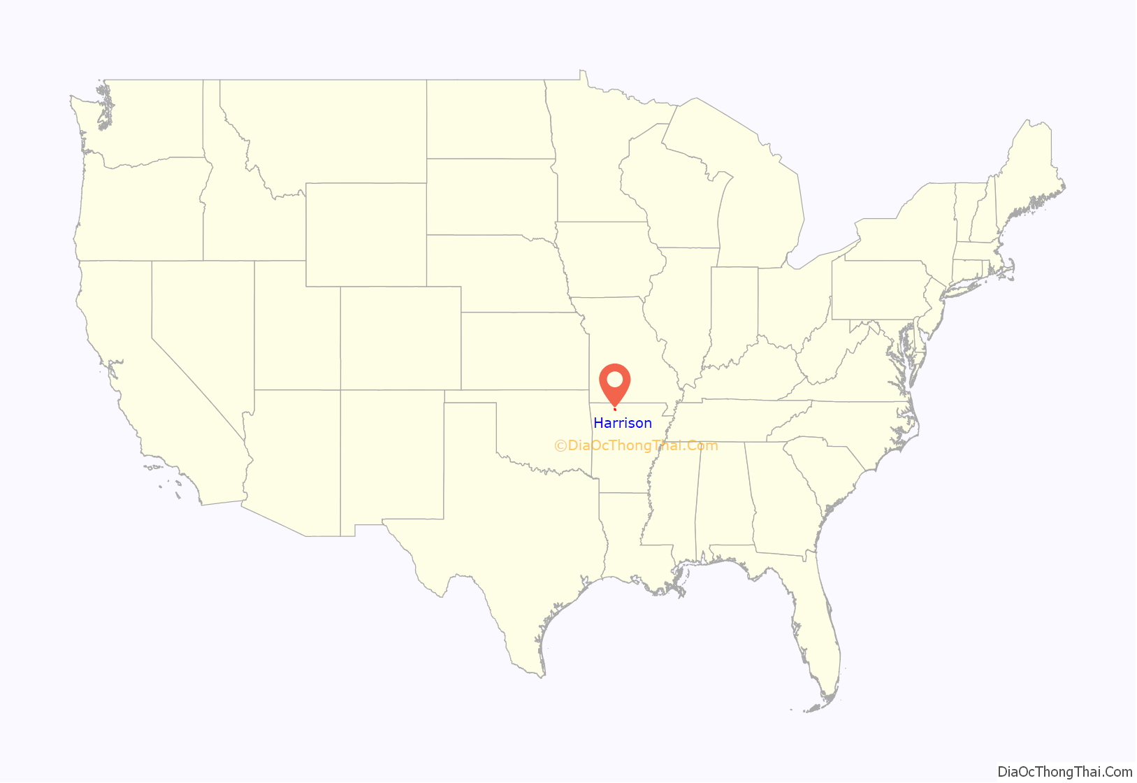
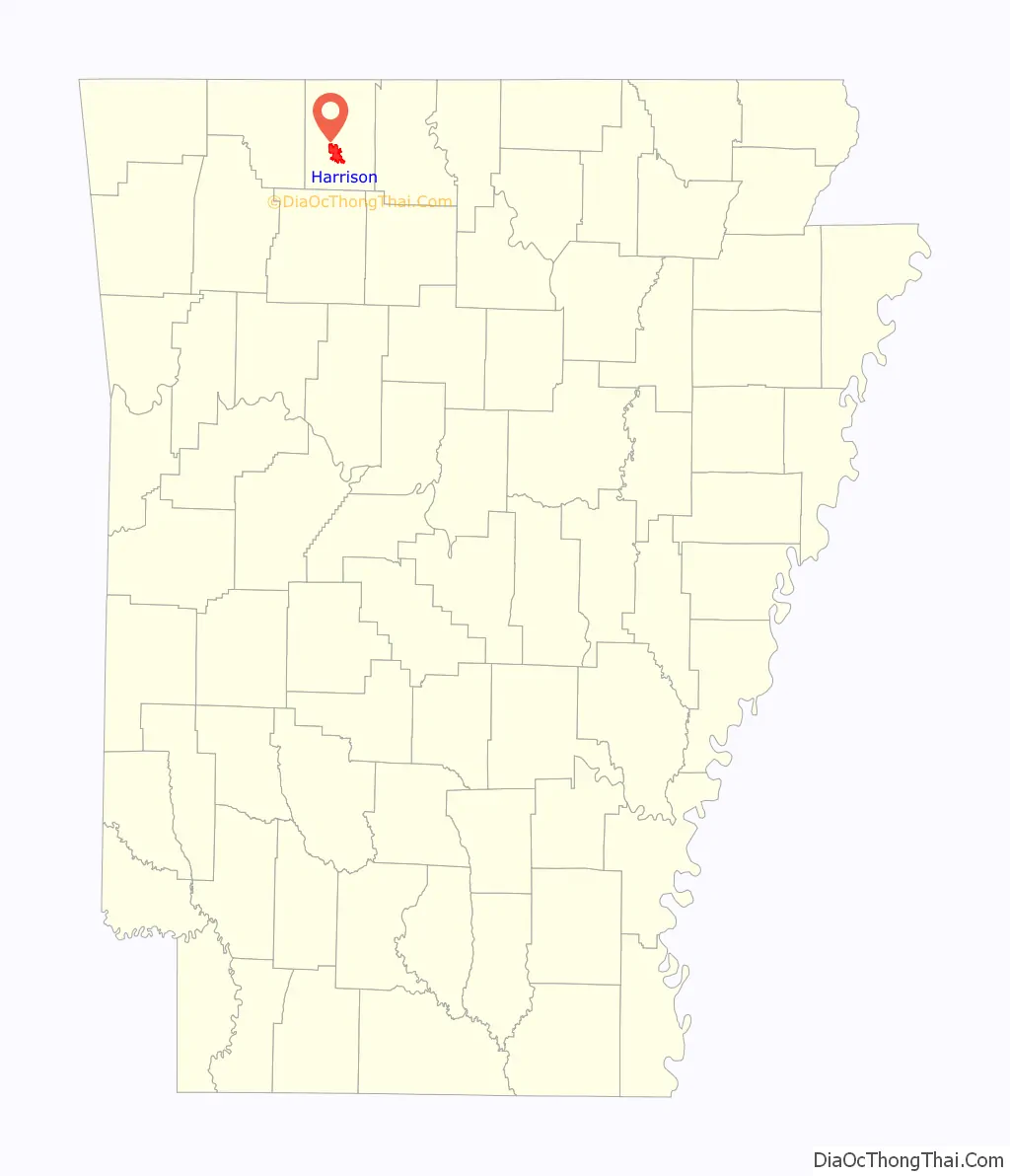
Harrison location map. Where is Harrison city?
History
Pre-colonial history
Native Americans were the earliest inhabitants of the area, probably beginning with cliff dwellers who lived in caves in the bluffs along the rivers. In later times, the Osage, a branch of the Sioux, was the main tribe in the Ozarks, and one of their larger villages is thought to have been to the east of the present site of Harrison. The Shawnee, Quapaw, and Caddo people were also familiar to the area.
The Cherokee arrived around 1816 and did not get along with the Osage. This hostility erupted into a full-scale war in the Ozark Mountains. By the 1830s, both tribes were removed to Indian Territory.
It is possible that the first Europeans to visit the area were some forty followers of Hernando de Soto and that they camped at a Native village on the White River at the mouth of Bear Creek. It is more likely that the discoverers were French hunters or trappers who followed the course of the White River.
19th century
In early 1857, the Baker-Fancher wagon train assembled at Beller’s Stand, south of Harrison. On September 11, 1857, approximately 120 members of this wagon train were murdered near Mountain Meadows, Utah Territory, by attacking local Mormon militia and members of the Paiute Indian tribe. In 1955, a monument to memorialize the victims of the massacre was placed on the Harrison town square.
Boone County was organized in 1869, during Reconstruction after the Civil War. Harrison was platted and made the county seat. It is named after Marcus LaRue Harrison, a Union officer who surveyed and platted the town. The town of Harrison was incorporated on March 1, 1876.
20th century
In 1905 and 1909, white race riots occurred in Harrison which drove away black residents and established the community as one of hundreds of sundown towns in the South.
The bank robber and convicted murderer Henry Starr was in Harrison on February 18, 1921, when Starr and three companions entered the People’s State Bank and robbed it of $6,000.00. During the robbery, Starr was shot by the former president of the bank, William J. Myers. Starr was carried to the town jail, where he died the next morning.
On May 7, 1961, heavy rain caused Crooked Creek, immediately south of the downtown business district, to flood the town square and much of the southwestern part of the city. Water levels inside buildings reached eight feet (2.5 m). Many small buildings and automobiles were swept away. According to the American Red Cross, four people died, 80 percent of the town’s business district was destroyed, and over 300 buildings were damaged or destroyed in losses exceeding $5.4 million. In 1962, Sam Walton opened his second Walmart store in Harrison.
In 1982, Kingdom Identity Ministries, an anti-gay Christian Identity outreach ministry identified as a hate group by the Southern Poverty Law Center, was founded in Harrison.
21st century
Harrison’s Community Task Force on Race Relations was established in 2003 to “promote diversity and respond to racial-bias accusations against the city”. City officials have made efforts to counteract organized racist activity with educational forums and billboards promoting tolerance. They also attempted to downplay the city’s racist reputation and improve its image by editing the town’s Wikipedia article.
In 2014, a peace march and vigil celebrating the life and legacy of Martin Luther King Jr. was held in downtown Harrison, hosted by the Arkansas Martin Luther King Jr. Commission. In December of the same year, a dedication was held for a Confederate monument in Harrison.
In 2017, Mayor Dan Sherrell and Boone County Judge Robert Hathaway signed proclamations recognizing June as Confederate Heritage and History Month.
Kevin Cheri, who became the first African-American employed in the area in 1978, received death threats shortly after his arrival, which prompted him to leave the area. He returned in 2007, and in 2019 was recognized by mayor Jerry Jackson when Harrison issued its first-ever Black History Month proclamation.
In June 2020, a group of around 300 gathered in Harrison to protest police brutality in the murder of George Floyd while 15 people armed with rifles and displaying Confederate and American flags looked on.
As of August 2021, the Southern Poverty Law center lists the following hate groups as having Harrison locations: Kingdom Identity Ministries (founded in Harrison), and League of the South.
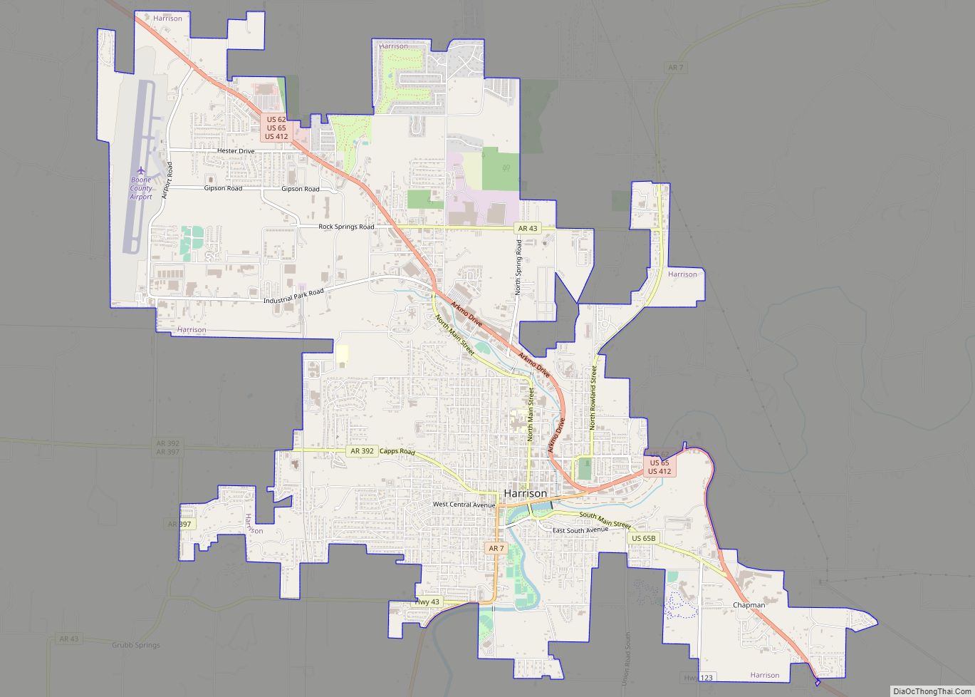
Harrison Road Map
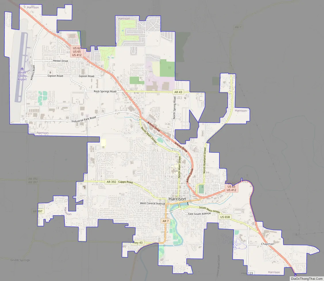
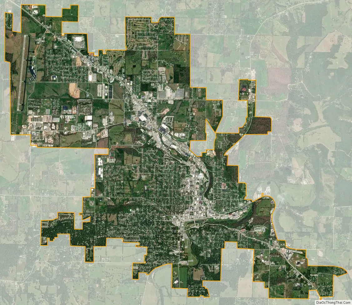
Harrison city Satellite Map
Geography
U.S. Routes 62, 65, and 412 pass through Harrison. U.S. 65 leads north 33 miles (53 km) to Branson, Missouri, and south 108 miles (174 km) to Conway, Arkansas. U.S. 62 leads west 43 miles (69 km) to Eureka Springs and beyond to Rogers and Bentonville. U.S. 412 leads west 73 miles (117 km) to Springdale. U.S. 62 and 412 combined lead east 48 miles (77 km) to Mountain Home.
According to the United States Census Bureau, the city has a total area of 11.1 square miles (28.8 km), of which 11.1 square miles (28.7 km) is land and 0.04 square miles (0.1 km), or 0.26%, is water.
Climate
The climate in this area is characterized by hot, humid summers and generally mild to cool winters. According to the Köppen Climate Classification system, Harrison has a humid subtropical climate, abbreviated “Cfa” on climate maps.
See also
Map of Arkansas State and its subdivision:- Arkansas
- Ashley
- Baxter
- Benton
- Boone
- Bradley
- Calhoun
- Carroll
- Chicot
- Clark
- Clay
- Cleburne
- Cleveland
- Columbia
- Conway
- Craighead
- Crawford
- Crittenden
- Cross
- Dallas
- Desha
- Drew
- Faulkner
- Franklin
- Fulton
- Garland
- Grant
- Greene
- Hempstead
- Hot Spring
- Howard
- Independence
- Izard
- Jackson
- Jefferson
- Johnson
- Lafayette
- Lawrence
- Lee
- Lincoln
- Little River
- Logan
- Lonoke
- Madison
- Marion
- Miller
- Mississippi
- Monroe
- Montgomery
- Nevada
- Newton
- Ouachita
- Perry
- Phillips
- Pike
- Poinsett
- Polk
- Pope
- Prairie
- Pulaski
- Randolph
- Saint Francis
- Saline
- Scott
- Searcy
- Sebastian
- Sevier
- Sharp
- Stone
- Union
- Van Buren
- Washington
- White
- Woodruff
- Yell
- Alabama
- Alaska
- Arizona
- Arkansas
- California
- Colorado
- Connecticut
- Delaware
- District of Columbia
- Florida
- Georgia
- Hawaii
- Idaho
- Illinois
- Indiana
- Iowa
- Kansas
- Kentucky
- Louisiana
- Maine
- Maryland
- Massachusetts
- Michigan
- Minnesota
- Mississippi
- Missouri
- Montana
- Nebraska
- Nevada
- New Hampshire
- New Jersey
- New Mexico
- New York
- North Carolina
- North Dakota
- Ohio
- Oklahoma
- Oregon
- Pennsylvania
- Rhode Island
- South Carolina
- South Dakota
- Tennessee
- Texas
- Utah
- Vermont
- Virginia
- Washington
- West Virginia
- Wisconsin
- Wyoming