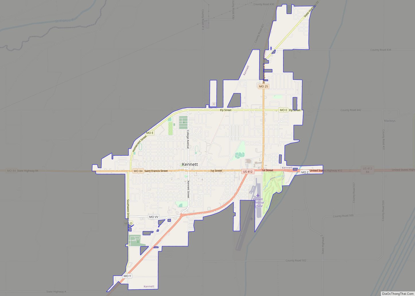
Kennett is a city in and the county seat of Dunklin County, Missouri, United States. The city is located in the southeast corner (or “Bootheel”) of Missouri, 4 miles (6.4 km) east of Arkansas and 20 miles (32 km) from the Mississippi River. It has a population of 10,932 according to the 2010 Census. Kennett is the largest city in the Bootheel, a mostly agricultural area.
| Name: | Kennett city |
|---|---|
| LSAD Code: | 25 |
| LSAD Description: | city (suffix) |
| State: | Missouri |
| County: | Dunklin County |
| Elevation: | 272 ft (83 m) |
| Total Area: | 7.00 sq mi (18.14 km²) |
| Land Area: | 7.00 sq mi (18.14 km²) |
| Water Area: | 0.00 sq mi (0.01 km²) |
| Total Population: | 10,515 |
| Population Density: | 1,501.71/sq mi (579.82/km²) |
| ZIP code: | 63857 |
| Area code: | 573 |
| FIPS code: | 2938306 |
| GNISfeature ID: | 2395508 |
| Website: | cityofkennettmo.com |
Online Interactive Map
Click on ![]() to view map in "full screen" mode.
to view map in "full screen" mode.
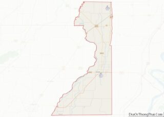
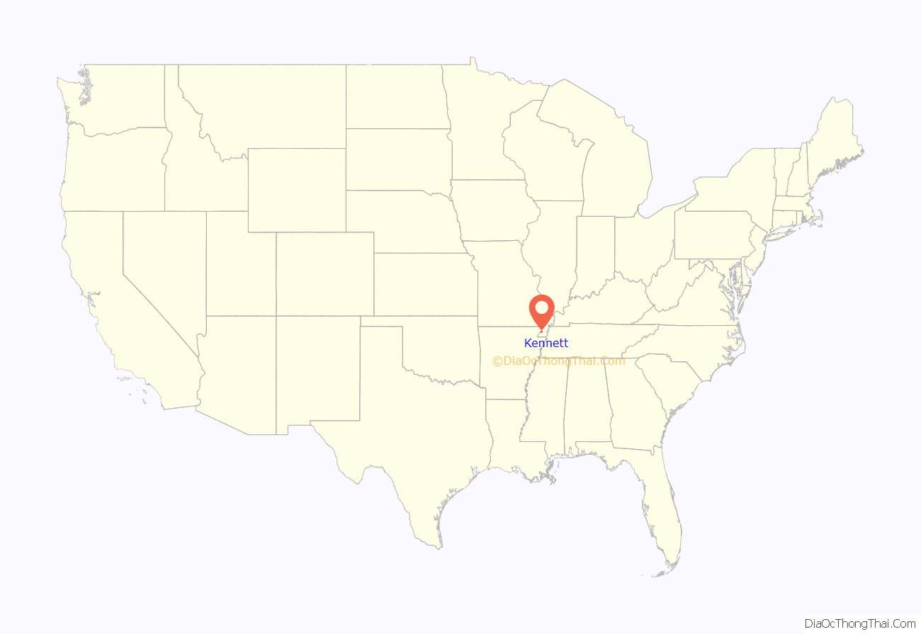
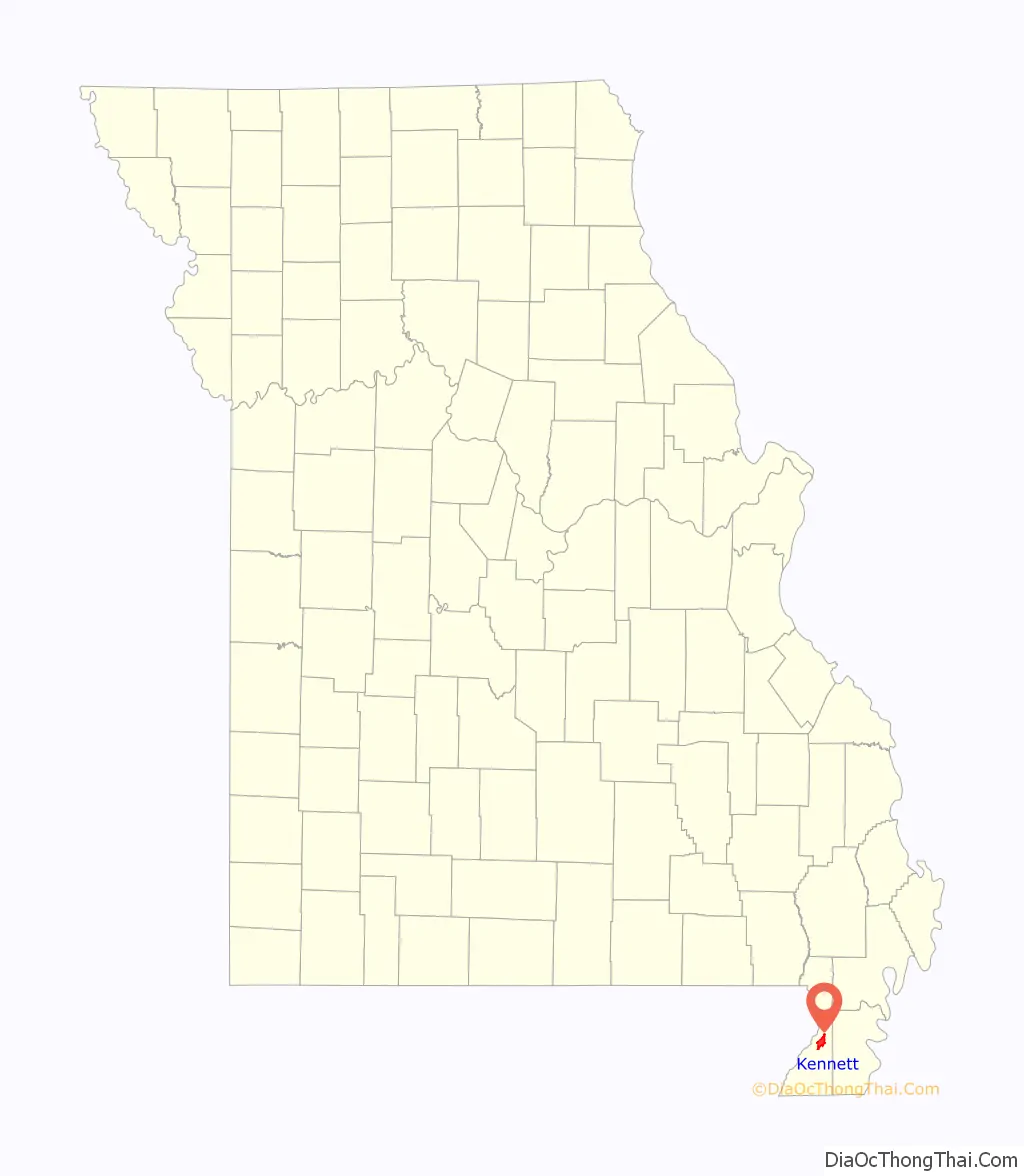
Kennett location map. Where is Kennett city?
History
Settlers built log cabins in the area in the first half of the 19th century, naming their settlement Chilletecaux in honor of a Delaware Indian chief who lived there. The town was renamed Butler in the late 1840s. Due to mail delivery problems because of other jurisdictions named the same, the settlement was renamed as Kennett, in honor of the mayor of the city of St. Louis, Luther M. Kennett.
In the 1890s, a railroad reached the area, stimulating growth in the town. In that same period, the state began construction of a massive drainage program in the St. Francis River basin, which was floodplain and wetlands. In the 20th century, after timber clearing, the area was developed for cultivation of cotton and other commodity crops.
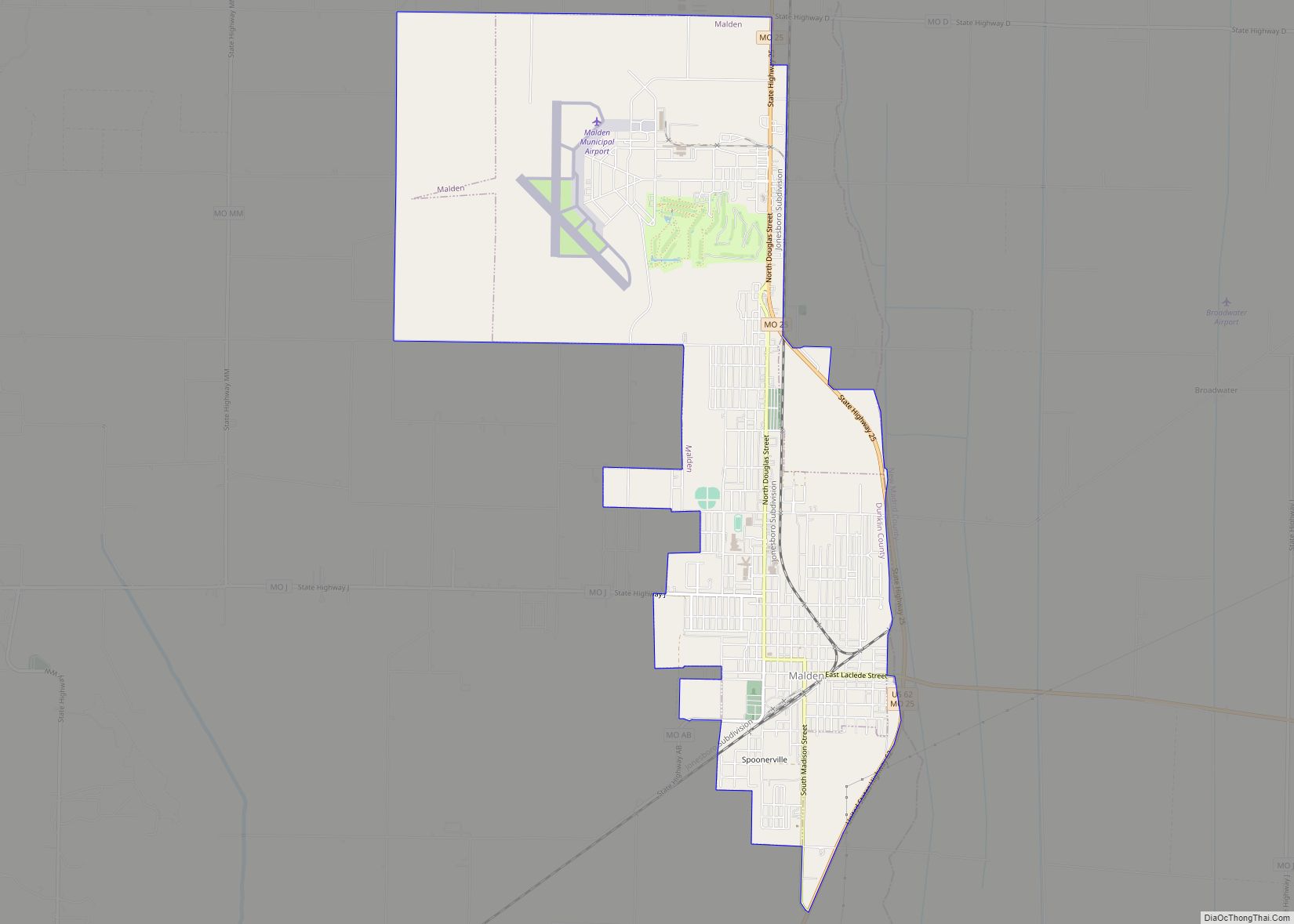
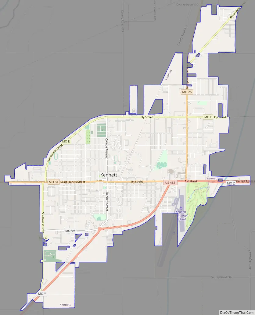
Kennett Road Map
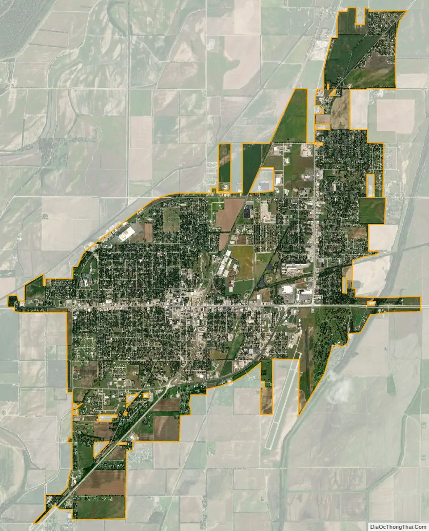
Kennett city Satellite Map
Geography
Kennett is located at 36°14′25″N 90°02′53″W / 36.24028°N 90.04806°W / 36.24028; -90.04806 (36.2403403, -90.0480886). According to the United States Census Bureau, the city has a total area of 6.96 square miles (18.03 km), all land.
As part of the southern extremity of Missouri, Kennett has a humid subtropical climate (Köppen climate classification Cfa) with cool winters and hot, humid summers, ample precipitation through much of the year, and is part of USDA Plant Hardiness Zone 7. The monthly daily average temperature ranges from 35.3 °F (1.8 °C) in January to 80.7 °F (27.1 °C) in July. On average, there are 4.9 days annually with 100 °F (38 °C)+ highs, 63 days of 90 °F (32 °C)+ highs, 9.4 days where the temperature does not rise above freezing, and 4.8 days with 10 °F (−12 °C) or lower minima.
See also
Map of Missouri State and its subdivision:- Adair
- Andrew
- Atchison
- Audrain
- Barry
- Barton
- Bates
- Benton
- Bollinger
- Boone
- Buchanan
- Butler
- Caldwell
- Callaway
- Camden
- Cape Girardeau
- Carroll
- Carter
- Cass
- Cedar
- Chariton
- Christian
- Clark
- Clay
- Clinton
- Cole
- Cooper
- Crawford
- Dade
- Dallas
- Daviess
- De Kalb
- Dent
- Douglas
- Dunklin
- Franklin
- Gasconade
- Gentry
- Greene
- Grundy
- Harrison
- Henry
- Hickory
- Holt
- Howard
- Howell
- Iron
- Jackson
- Jasper
- Jefferson
- Johnson
- Knox
- Laclede
- Lafayette
- Lawrence
- Lewis
- Lincoln
- Linn
- Livingston
- Macon
- Madison
- Maries
- Marion
- McDonald
- Mercer
- Miller
- Mississippi
- Moniteau
- Monroe
- Montgomery
- Morgan
- New Madrid
- Newton
- Nodaway
- Oregon
- Osage
- Ozark
- Pemiscot
- Perry
- Pettis
- Phelps
- Pike
- Platte
- Polk
- Pulaski
- Putnam
- Ralls
- Randolph
- Ray
- Reynolds
- Ripley
- Saint Charles
- Saint Clair
- Saint Francois
- Saint Louis
- Sainte Genevieve
- Saline
- Schuyler
- Scotland
- Scott
- Shannon
- Shelby
- Stoddard
- Stone
- Sullivan
- Taney
- Texas
- Vernon
- Warren
- Washington
- Wayne
- Webster
- Worth
- Wright
- Alabama
- Alaska
- Arizona
- Arkansas
- California
- Colorado
- Connecticut
- Delaware
- District of Columbia
- Florida
- Georgia
- Hawaii
- Idaho
- Illinois
- Indiana
- Iowa
- Kansas
- Kentucky
- Louisiana
- Maine
- Maryland
- Massachusetts
- Michigan
- Minnesota
- Mississippi
- Missouri
- Montana
- Nebraska
- Nevada
- New Hampshire
- New Jersey
- New Mexico
- New York
- North Carolina
- North Dakota
- Ohio
- Oklahoma
- Oregon
- Pennsylvania
- Rhode Island
- South Carolina
- South Dakota
- Tennessee
- Texas
- Utah
- Vermont
- Virginia
- Washington
- West Virginia
- Wisconsin
- Wyoming