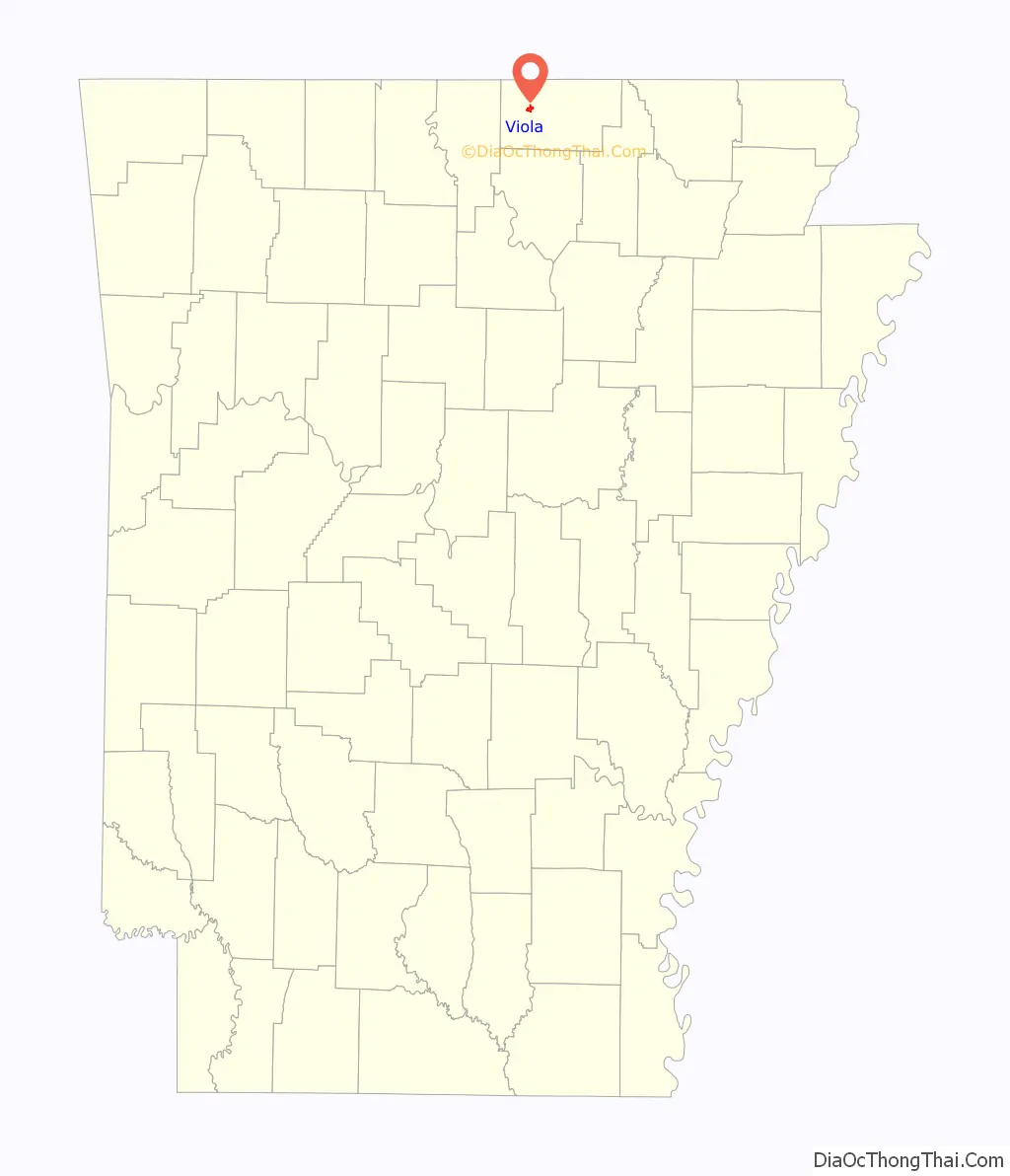
Viola is a town in Fulton County, Arkansas, United States. The population was 337 at the 2010 census, down from 381 in 2000.
| Name: | Viola town |
|---|---|
| LSAD Code: | 43 |
| LSAD Description: | town (suffix) |
| State: | Arkansas |
| County: | Fulton County |
| Elevation: | 879 ft (268 m) |
| Total Area: | 1.57 sq mi (4.08 km²) |
| Land Area: | 1.57 sq mi (4.07 km²) |
| Water Area: | 0.00 sq mi (0.01 km²) |
| Total Population: | 358 |
| Population Density: | 227.88/sq mi (87.99/km²) |
| ZIP code: | 72583 |
| Area code: | 870 |
| FIPS code: | 0572140 |
| GNISfeature ID: | 2406804 |
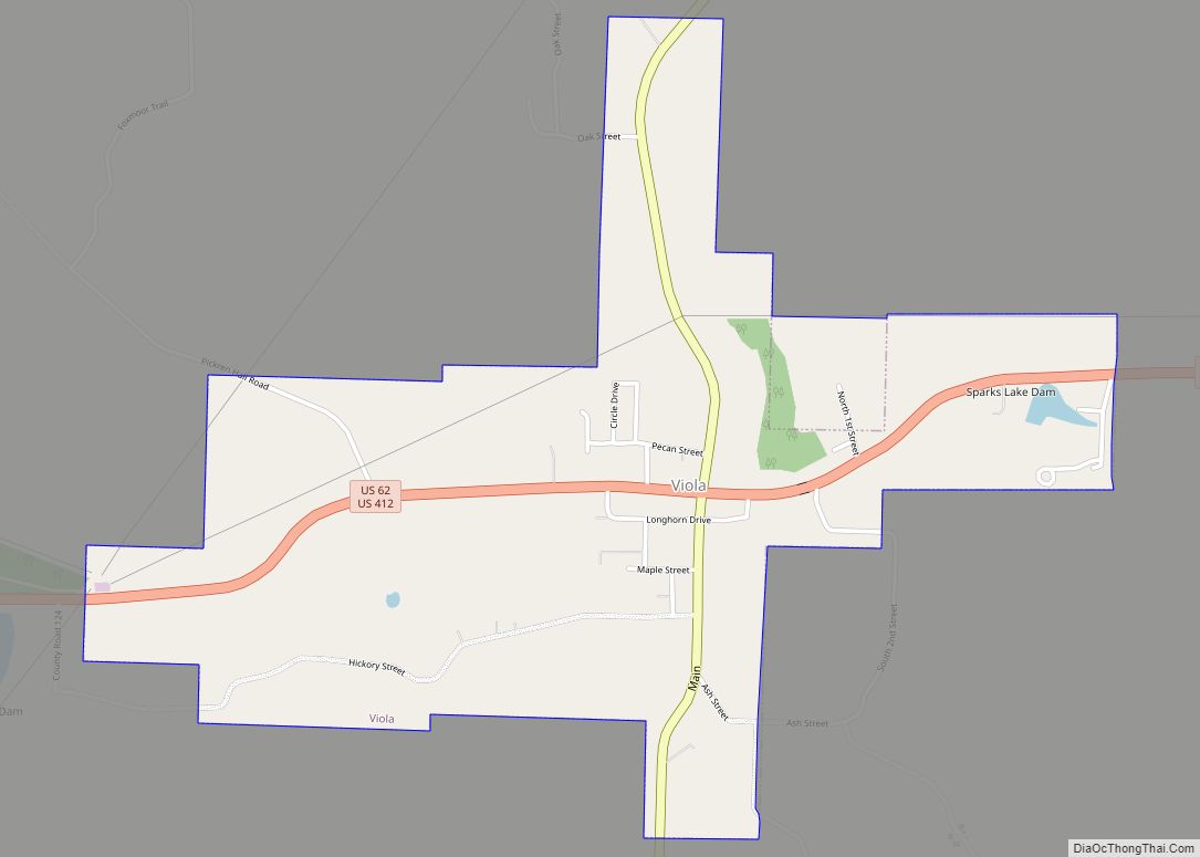
Online Interactive Map
Click on ![]() to view map in "full screen" mode.
to view map in "full screen" mode.
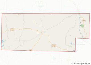
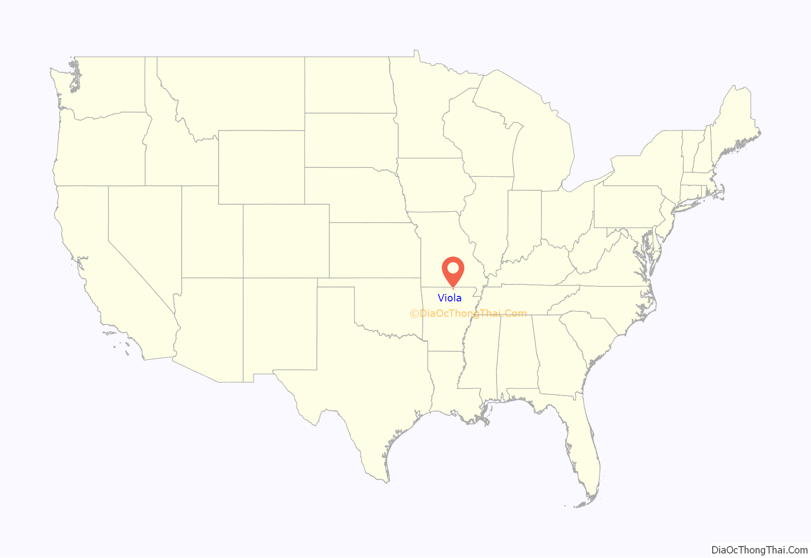
Viola location map. Where is Viola town?
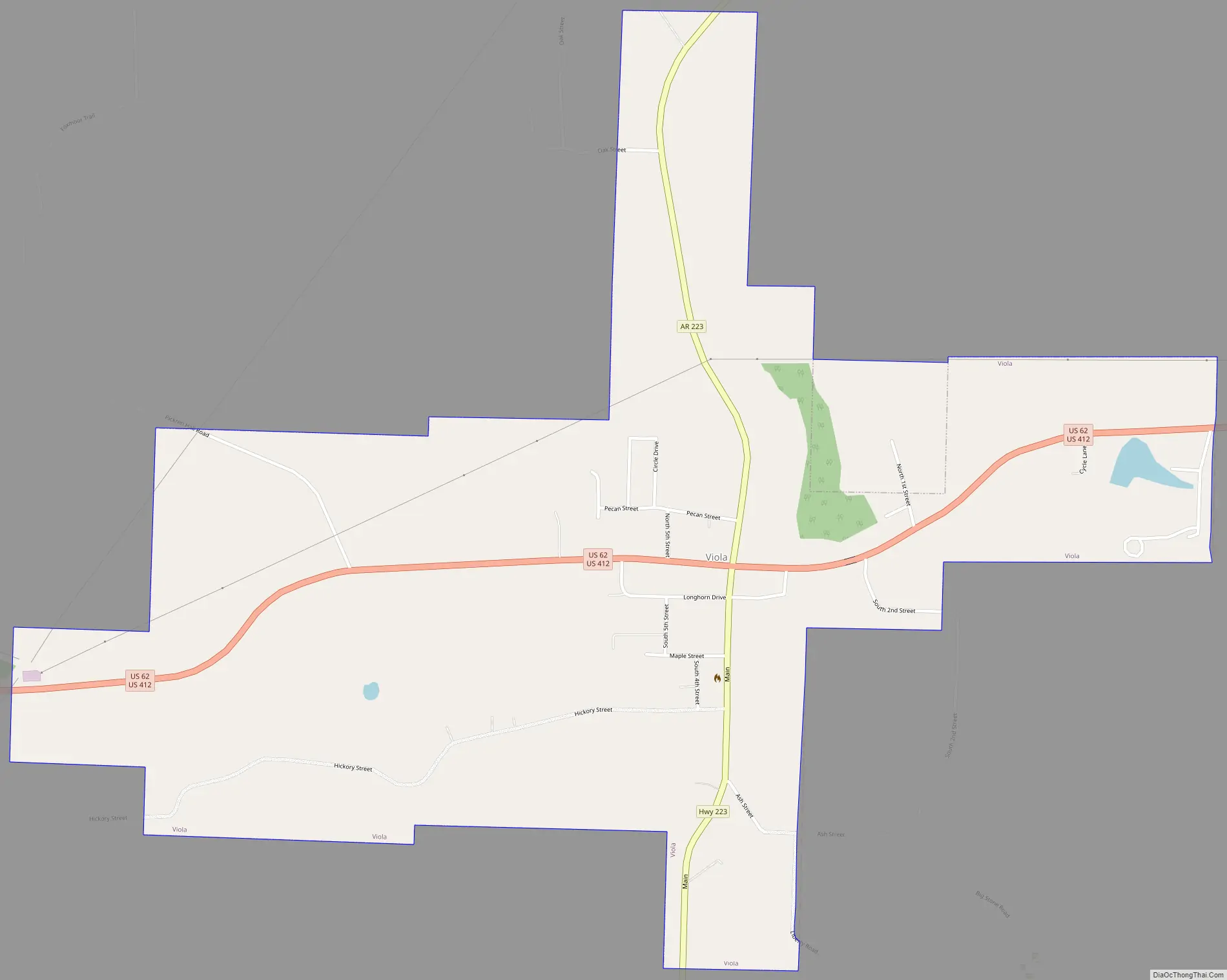
Viola Road Map
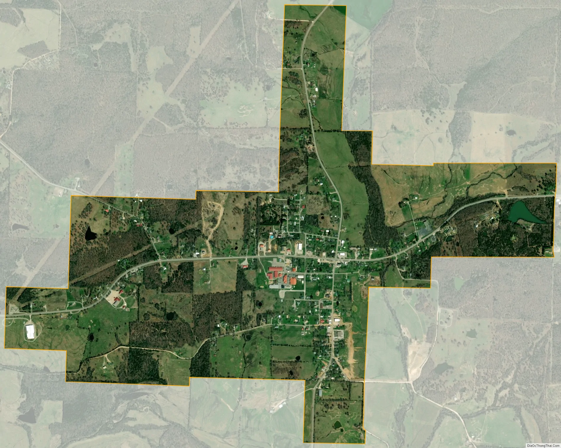
Viola city Satellite Map
Geography
Viola is located in western Fulton County at 36°23′50″N 91°59′0″W / 36.39722°N 91.98333°W / 36.39722; -91.98333, along U.S. Routes 62/412. The combined highways lead east 10 miles (16 km) to Salem, the county seat, and west 26 miles (42 km) to Mountain Home. Arkansas Highway 223 crosses US 62/412 in the center of Viola, leading north 8 miles (13 km) to the Missouri border and south 9 miles (14 km) to Bexar.
According to the United States Census Bureau, the town of Viola has a total area of 1.3 square miles (3.4 km), all land.
See also
Map of Arkansas State and its subdivision:- Arkansas
- Ashley
- Baxter
- Benton
- Boone
- Bradley
- Calhoun
- Carroll
- Chicot
- Clark
- Clay
- Cleburne
- Cleveland
- Columbia
- Conway
- Craighead
- Crawford
- Crittenden
- Cross
- Dallas
- Desha
- Drew
- Faulkner
- Franklin
- Fulton
- Garland
- Grant
- Greene
- Hempstead
- Hot Spring
- Howard
- Independence
- Izard
- Jackson
- Jefferson
- Johnson
- Lafayette
- Lawrence
- Lee
- Lincoln
- Little River
- Logan
- Lonoke
- Madison
- Marion
- Miller
- Mississippi
- Monroe
- Montgomery
- Nevada
- Newton
- Ouachita
- Perry
- Phillips
- Pike
- Poinsett
- Polk
- Pope
- Prairie
- Pulaski
- Randolph
- Saint Francis
- Saline
- Scott
- Searcy
- Sebastian
- Sevier
- Sharp
- Stone
- Union
- Van Buren
- Washington
- White
- Woodruff
- Yell
- Alabama
- Alaska
- Arizona
- Arkansas
- California
- Colorado
- Connecticut
- Delaware
- District of Columbia
- Florida
- Georgia
- Hawaii
- Idaho
- Illinois
- Indiana
- Iowa
- Kansas
- Kentucky
- Louisiana
- Maine
- Maryland
- Massachusetts
- Michigan
- Minnesota
- Mississippi
- Missouri
- Montana
- Nebraska
- Nevada
- New Hampshire
- New Jersey
- New Mexico
- New York
- North Carolina
- North Dakota
- Ohio
- Oklahoma
- Oregon
- Pennsylvania
- Rhode Island
- South Carolina
- South Dakota
- Tennessee
- Texas
- Utah
- Vermont
- Virginia
- Washington
- West Virginia
- Wisconsin
- Wyoming