Alamo (Spanish: Álamo; meaning “Poplar tree”) is an unincorporated community and census-designated place (CDP) in Contra Costa County, California, in the United States. It is a suburb located in the San Francisco Bay Area’s East Bay region, approximately 28 miles (45 km) east of San Francisco. Alamo is equidistant from the city of Walnut Creek and the incorporated town of Danville. As of the 2010 census, the population was 14,750.
Police services are provided by the Contra Costa County Office of the Sheriff. Fire and EMS services are provided by the San Ramon Valley Fire Protection District.
Alamo has a median household income of $300,000 (as of 2022). In August 2007, a group of citizens launched a new initiative to incorporate the community, the latest in a series of attempts that go back to the early 1960s or before; it was defeated by referendum in March 2009. Previous failed Alamo incorporation efforts always included parts of other nearby unincorporated areas: Alamo-Danville (1964) and Alamo-Danville-San Ramon (1976).
| Name: | Alamo CDP |
|---|---|
| LSAD Code: | 57 |
| LSAD Description: | CDP (suffix) |
| State: | California |
| County: | Contra Costa County |
| Elevation: | 259 ft (79 m) |
| Total Area: | 9.82 sq mi (25.42 km²) |
| Land Area: | 9.82 sq mi (25.42 km²) |
| Water Area: | 0.00 sq mi (0.00 km²) 0% |
| Total Population: | 15,314 |
| Population Density: | 1,560.11/sq mi (602.38/km²) |
| ZIP code: | 94507 |
| Area code: | 925 |
| FIPS code: | 0600618 |
Online Interactive Map
Click on ![]() to view map in "full screen" mode.
to view map in "full screen" mode.
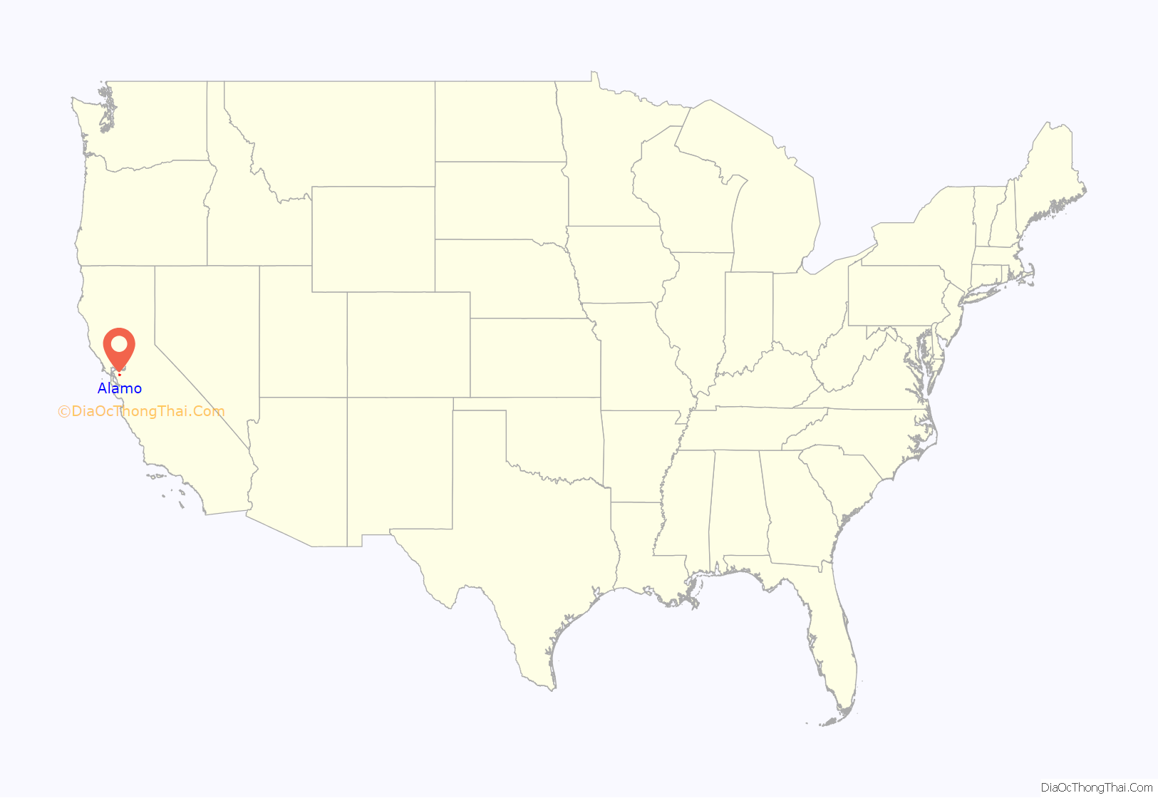
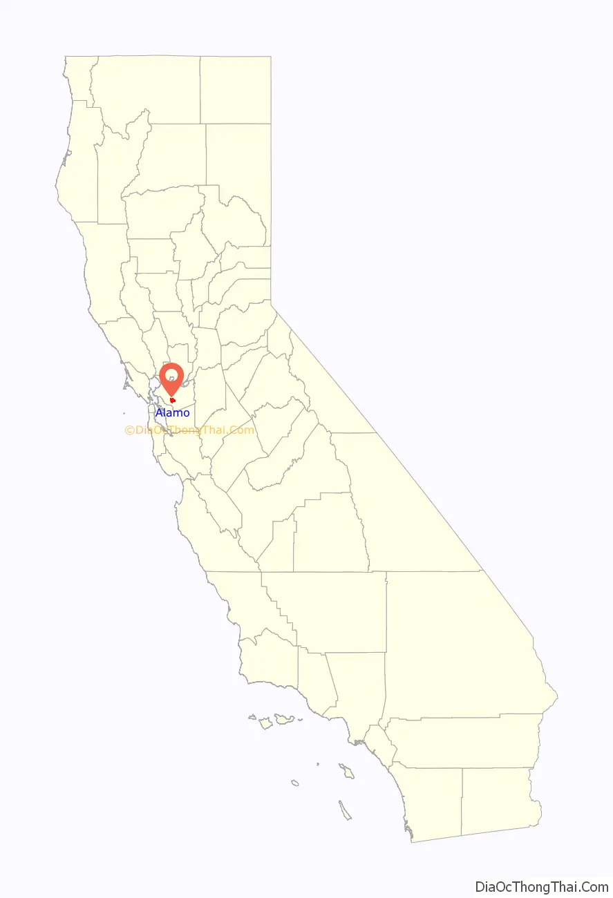
Alamo location map. Where is Alamo CDP?
History
Alamo was first inhabited by the Tatcan Indians over 5000 years ago. The Tatcan Indians, a Bay Miwok tribe closely connected to the Saclans of Walnut Creek, lived in Alamo in the eighteenth century.
After Mission San José was founded in 1797, its grazing area stretched throughout the San Ramon Valley. The Mexican land grant Rancho San Ramon was deeded to Mariano Castro and his uncle Bartolo Pacheco in 1833. It covered modern-day Danville and Alamo. Castro owned the northern half, which included Alamo.
In 1843 much of the Alamo, Las Trampas and Tice Valley areas were granted to brothers Inocencio and José Romero. It was called Rancho El Sobrante de San Ramon. Because of missing title papers, the brothers lost their ranch in American courts in 1857.
Pioneers Mary Ann and John Jones traveled through Alamo in 1847. She provided the earliest English description of the area in her diary. Her husband stopped the wagon saying, “Mary, look! Did you ever see anything so beautiful?” She wrote later:
The Jones family returned to Alamo in 1851, after California had become a state. John became the first postmaster in 1852 and she applied her considerable energies to schooling children and beginning a Cumberland Presbyterian church. Other early Alamo founders included David Glass, George Engelmeyer, Silas and Susanna Stone, Captain Wall, Joshua Bollinger, and James Foster.
The area was named Alamo, which comes from the Spanish word álamo, meaning “poplar” or “cottonwood.” Because of its location and climate, Alamo grew quickly. An early road from the redwoods near Moraga ran through Tice Valley to Alamo, since Americans preferred redwood for building materials instead of Mexican adobe brick.
The Hemme, Bollinger, Jones and Stone ranches began by grazing cattle and raising wheat and other grains. In 1891 the Hemme train station was placed near today’s Hemme Avenue; later it was renamed the Alamo station.
Eventually orchards and vineyards spread across the area. Almonds, walnuts, pears, grapes and other fruit thrived in the temperate climate. In 1873, Alamo pioneer Myron Hall grafted Persian cuttings to native walnut trees and helped start the prosperous walnut industry in Contra Costa County. This “mother tree” was tended for over 100 years.
The Alamo post office is the oldest continuously operated one in the valley. It was always an important community gathering place. According to longtime postmaster Bertha Linhares, when the mail was expected the men
Her father, brother and sister were also postmasters from 1905 to 1960.
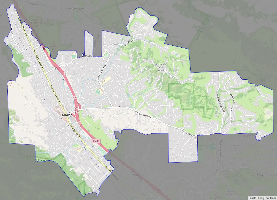
Alamo Road Map
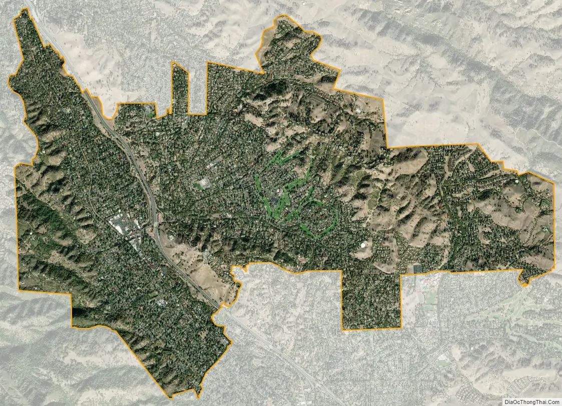
Alamo city Satellite Map
Geography
Alamo is located in Contra Costa County, at the northern end of the 20 miles (32 km)-long San Ramon Valley between two Coast Ranges − the Las Trampas Ridge to the west and the Diablo Range to the east. The city of San Ramon and the town of Danville are also located in this valley. Just to the north of Alamo lies the city of Walnut Creek. San Francisco and San Jose lie 28 miles (45 km) to the west and 46 miles (74 km) to the south, respectively. A few miles to the east of Alamo stands the 3,864 feet (1,178 m)-tall Mount Diablo.
According to the United States Census Bureau, the CDP has a total area of 9.7 square miles (25 km), all of it land.
Climate
Alamo experiences a warm-summer Mediterranean climate with hot, dry summers and cool, rainy winters. Summer high temperatures are hot, but due to the high degree of seasonal diurnal temperature variation, the mean temperature remains low enough to qualify as a warm-summer Mediterranean climate, staying below 71.6 °F (22.0 °C). Temperatures occasionally reach 100 °F (38 °C) or higher in the warmest months, and frost occurs on some clear mornings during the coldest months. There are, on average 42 days per annum with at least 0.1 inches (2.5 mm) of rain (days when it is considered useful to carry an umbrella). During cold winter storms, snow can fall on top of nearby Mount Diablo, but very seldom falls in the Valley.
On July 6, 2017 at 3:44 pm until January 9, 2018, the Cal Fire reported that the Alamo Fire occurred.
Parks
Located at the corner of Danville Blvd. & Jackson Way. This 1 acre park is named in memory of Alamo resident Andrew H. Young who was instrumental in preserving the charm of Alamo.
He served in 1980 as chairman of the county Planning Commission, and as a commissioner from 1977 to 1979 with the San Ramon Valley Area Planning Commission.
Young was a World War II veteran, serving in the Pacific campaign where he assisted in the evacuation of the Chinese Fifth Army from North Vietnam. He retired in 1965 from active reserve as a Navy lieutenant commander.
His participation in the Lafayette Local Government Study Committee in 1966–67 led to that city’s incorporation in 1968. His Boulevard of Trees project replanted dying trees along Danville Boulevard in Alamo.
He was on the Tao House study committee in Danville and the steering committee for San Ramon Valley Regional Medical Center. He was an executive director for the Contra Costa County Historical Society, as well its president from 1985–1986 and also was a president of the Alamo Park Foundation.
Located at the corner of Livorna Road & Miranda Avenue, this 4.4 acre community park features a large open-air gazebo, a bocce ball court, a multi-use sports court, playground structures, large play areas, drinking fountain, restrooms, two barbecue areas, ample grassed area and off-street parking.
During the summer months a series of concerts are held at the park in the early evenings typically over a weekend. The concerts are organized by the Alamo Municipal Advisory Committee.
The park also typically hosts a children’s Easter egg hunt each year on Easter Sunday. This is organized by the Rotary Club of Alamo.
Located at 180 Hemme Avenue, this 5.4 acre park features soccer and softball fields, playground structures and restroom facilities. Note that it is open to the public only after normal school hours.
Located at 100 Wilson Road, this 2.2 acre community park offers soccer and baseball fields, batting cages, two multi-use sport courts and a picnic area. Note that it is open to the public only after school hours.
Located on the Alamo-Danville Border at 1025 La Gonda Way. This 16.3 acre park has several historic structures and is managed jointly by Alamo and Danville. A barn façade at the park entrance memorializes the park’s former use as a ranch for longhorn steer with the owner being Hap Magee during the years of 1953 and 1985.
Before the cattle ranch, the site was a summer camp for San Francisco orphans, known as Camp Swain. The property was purchased in 1874 by Captain Isaac and Ann Trasker Swain on behalf of an orphanage in San Francisco. The Swains thought the children should have a warm place to go during San Francisco’s damp summers. In 1911 the San Francisco Protestant Orphanage first brought their children to Camp Swain. The orphans came to the valley from 1911 to 1952, using the train and then buses. There is a drinking fountain commemorating Camp Swain with a plaque and a brick rendering of children playing.
Today there are picnic facilities, children’s water play area, a large meadow with a spectacular heritage oak, dog parks and off-street parking. The park sits near the intersection of the Iron Horse Trail and the Las Trampas to Mt. Diablo Regional Trail.
Las Trampas Regional Wilderness is a 5,342-acre (2,162-hectare) park located to the immediate southwest of the town. The wilderness contains numerous plant and animal communities, including forested hillsides and riparian woods.
Geology
The Mount Diablo thrust fault runs through Alamo releasing small tremors about every other month. The fault line has never had a history of being dangerous. However, the Hayward Fault, a close neighbor, is extremely active.
See also
Map of California State and its subdivision:- Alameda
- Alpine
- Amador
- Butte
- Calaveras
- Colusa
- Contra Costa
- Del Norte
- El Dorado
- Fresno
- Glenn
- Humboldt
- Imperial
- Inyo
- Kern
- Kings
- Lake
- Lassen
- Los Angeles
- Madera
- Marin
- Mariposa
- Mendocino
- Merced
- Modoc
- Mono
- Monterey
- Napa
- Nevada
- Orange
- Placer
- Plumas
- Riverside
- Sacramento
- San Benito
- San Bernardino
- San Diego
- San Francisco
- San Joaquin
- San Luis Obispo
- San Mateo
- Santa Barbara
- Santa Clara
- Santa Cruz
- Shasta
- Sierra
- Siskiyou
- Solano
- Sonoma
- Stanislaus
- Sutter
- Tehama
- Trinity
- Tulare
- Tuolumne
- Ventura
- Yolo
- Yuba
- Alabama
- Alaska
- Arizona
- Arkansas
- California
- Colorado
- Connecticut
- Delaware
- District of Columbia
- Florida
- Georgia
- Hawaii
- Idaho
- Illinois
- Indiana
- Iowa
- Kansas
- Kentucky
- Louisiana
- Maine
- Maryland
- Massachusetts
- Michigan
- Minnesota
- Mississippi
- Missouri
- Montana
- Nebraska
- Nevada
- New Hampshire
- New Jersey
- New Mexico
- New York
- North Carolina
- North Dakota
- Ohio
- Oklahoma
- Oregon
- Pennsylvania
- Rhode Island
- South Carolina
- South Dakota
- Tennessee
- Texas
- Utah
- Vermont
- Virginia
- Washington
- West Virginia
- Wisconsin
- Wyoming


