Arroyo Grande (Spanish for “Big Creek”) is a city in San Luis Obispo County, California, United States. The population was 18,441 as of the 2020 census, up from 17,252 as of the 2010 Census.
| Name: | Arroyo Grande city |
|---|---|
| LSAD Code: | 25 |
| LSAD Description: | city (suffix) |
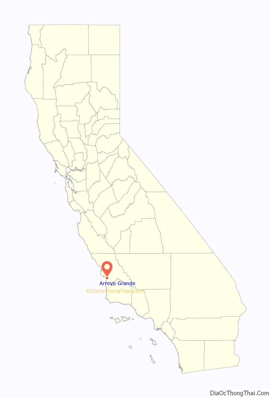
| State: | California |
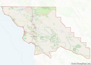
| County: | San Luis Obispo County |
| Incorporated: | July 10, 1911 |
| Elevation: | 118 ft (36 m) |
| Total Area: | 5.94 sq mi (15.38 km²) |
| Land Area: | 5.94 sq mi (15.38 km²) |
| Water Area: | 0.00 sq mi (0.00 km²) 0% |
| Total Population: | 18,441 |
| Population Density: | 3,104.55/sq mi (1,199.02/km²) |
| ZIP code: | 93420-93421 |
| Area code: | 805 |
| FIPS code: | 0602868 |
| Website: | www.arroyogrande.org |
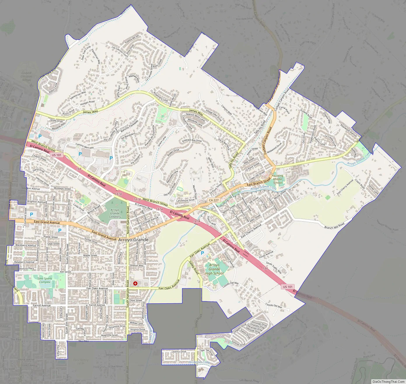
Online Interactive Map
Click on ![]() to view map in "full screen" mode.
to view map in "full screen" mode.
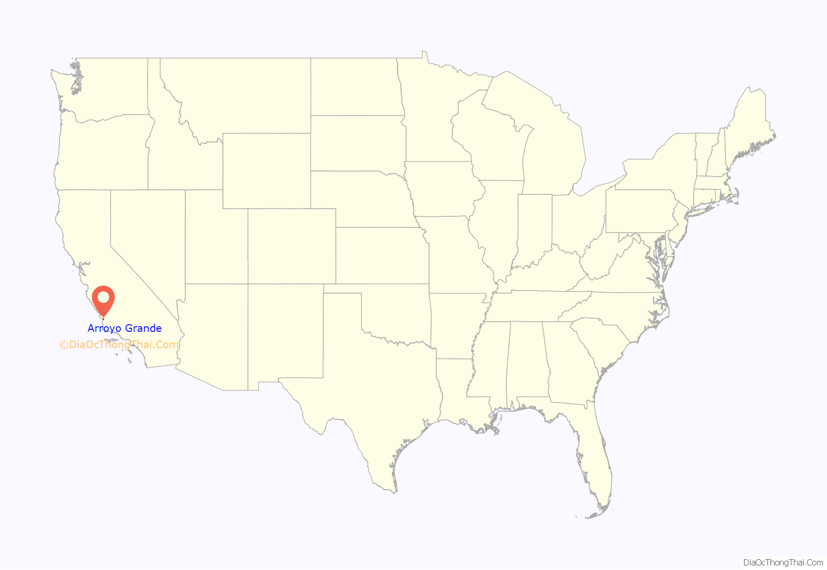
Arroyo Grande location map. Where is Arroyo Grande city?
History
The earliest inhabitants of the Arroyo Grande Valley were Chumash Indians, who conducted extensive trade with other Native American tribes at a considerable distance.
The first Europeans to see this stretch of coast were the crew of Portuguese explorer Juan Rodríguez Cabrillo (Cabrilho in Portuguese), working in the service of Spain. The Spanish Portolá expedition was the first European visit by land, passing through the area on September 4, 1769. When Mission San Luis Obispo de Tolosa was established nearby, the Portolà trail became part of the road connecting the 21 Spanish missions (today called El Camino Real). Later, agricultural activities expanded into the area. The Arroyo Grande Valley was found to have particularly fertile ground allowing a rich produce supply that continued to this day. The area was given a Spanish name that translates into multiple meanings, “Big Gulch”, “Muddy Creek”, “Big Ditch”, Arroyo Grande was to become a prosperous and important ranch and farm community.
Francis Ziba Branch, originally from New York, saw the area on a hunting expedition during the period when California was part of Mexico. Branch married María Manuela Carlón, and this marriage entitled Branch to file a claim for a Mexican land grant. In 1836 he, his wife, and infant son moved onto Rancho Santa Manuela. They were managing a successful cattle ranching operation when California became a U.S. territory, and then a U.S. state. Some years later, they suffered financial difficulties during a drought when many cattle died. They sold off smaller parcels of land to settlers.
In 1862, the San Luis Obispo Board of Supervisors established the township of Arroyo Grande. Businesses developed along a road called Branch Street to serve local agriculture. A railroad depot was built in 1882. The city of Arroyo Grande was incorporated on July 10, 1911.
Arroyo Grande experienced rapid growth in the 1970s and 1980s, partially due to the expansion of the wastewater treatment plant, under an EPA Clean Water Grant, that removed a growth constraint. This federal grant program required preparation of an Environmental Impact Report, which provided much of the initial environmental database for Arroyo Grande.
Arroyo Grande Road Map
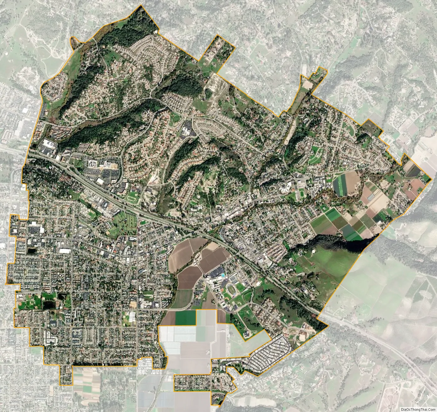
Arroyo Grande city Satellite Map
Geography
Arroyo Grande is a small coastal town with historic, suburban, and rural elements located at 35°7′15″N 120°35′12″W / 35.12083°N 120.58667°W / 35.12083; -120.58667 (35.120878, -120.586799).
Arroyo Grande is located in a coastal ecosystem within the California floristic province, and the native habitats include coast live oak woodland, central coastal scrub, willow and mixed riparian along Arroyo Grande Creek and numerous tributaries, native bunch-grass grassland, coastal prairie, dunes and intertidal zone, and non-native and agricultural areas.
It is one of the cities on the Central Coast known as the “Five Cities”. Which coastal communities are commonly thought of as being the Five Cities has changed over time, as population has grown and shifted geographically. Currently, Arroyo Grande, Grover Beach, Oceano, Pismo Beach, and Shell Beach are generally considered to make up the “Five Cities”. However, the following cities are the original Five Cities: Grover Beach, previously known as Grover City, Fair Oaks (later annexed by Arroyo Grande), Arroyo Grande, Oceano, and Halcyon. Oceano is historically one of the Five Cities, even though it is considered a Community Service District. Shell Beach is part of Pismo Beach. According to the United States Census Bureau, the city has a total area of 5.8 square miles (15 km), all of it land.
Climate
Arroyo Grande has a Temperate-Mediterranean climate (Köppen climate classification Csb).
See also
Map of California State and its subdivision:- Alameda
- Alpine
- Amador
- Butte
- Calaveras
- Colusa
- Contra Costa
- Del Norte
- El Dorado
- Fresno
- Glenn
- Humboldt
- Imperial
- Inyo
- Kern
- Kings
- Lake
- Lassen
- Los Angeles
- Madera
- Marin
- Mariposa
- Mendocino
- Merced
- Modoc
- Mono
- Monterey
- Napa
- Nevada
- Orange
- Placer
- Plumas
- Riverside
- Sacramento
- San Benito
- San Bernardino
- San Diego
- San Francisco
- San Joaquin
- San Luis Obispo
- San Mateo
- Santa Barbara
- Santa Clara
- Santa Cruz
- Shasta
- Sierra
- Siskiyou
- Solano
- Sonoma
- Stanislaus
- Sutter
- Tehama
- Trinity
- Tulare
- Tuolumne
- Ventura
- Yolo
- Yuba
- Alabama
- Alaska
- Arizona
- Arkansas
- California
- Colorado
- Connecticut
- Delaware
- District of Columbia
- Florida
- Georgia
- Hawaii
- Idaho
- Illinois
- Indiana
- Iowa
- Kansas
- Kentucky
- Louisiana
- Maine
- Maryland
- Massachusetts
- Michigan
- Minnesota
- Mississippi
- Missouri
- Montana
- Nebraska
- Nevada
- New Hampshire
- New Jersey
- New Mexico
- New York
- North Carolina
- North Dakota
- Ohio
- Oklahoma
- Oregon
- Pennsylvania
- Rhode Island
- South Carolina
- South Dakota
- Tennessee
- Texas
- Utah
- Vermont
- Virginia
- Washington
- West Virginia
- Wisconsin
- Wyoming