Boulder Creek (/ˈbəʊl.dər ˈkriːk/) is a small rural mountain community in the coastal Santa Cruz Mountains. It is a census-designated place (CDP) in Santa Cruz County, California, with a population of 5,429 as of the 2020 census. Throughout its history, Boulder Creek has been home to a logging town and a resort community, as well as a counter-culture haven. Today, it is identified as the gateway to Big Basin Redwoods State Park.
| Name: | Boulder Creek CDP |
|---|---|
| LSAD Code: | 57 |
| LSAD Description: | CDP (suffix) |
| State: | California |
| County: | Santa Cruz County |
| Founded: | 1868 |
| Elevation: | 479 ft (146 m) |
| Total Area: | 7.51 sq mi (19.46 km²) |
| Land Area: | 7.51 sq mi (19.46 km²) |
| Water Area: | 0.00 sq mi (0.00 km²) 0% |
| Total Population: | 5,429 |
| Population Density: | 722.71/sq mi (279.04/km²) |
| ZIP code: | 95006 |
| Area code: | 831 |
| FIPS code: | 0607652 |
| GNISfeature ID: | 277478 |
Online Interactive Map
Click on ![]() to view map in "full screen" mode.
to view map in "full screen" mode.
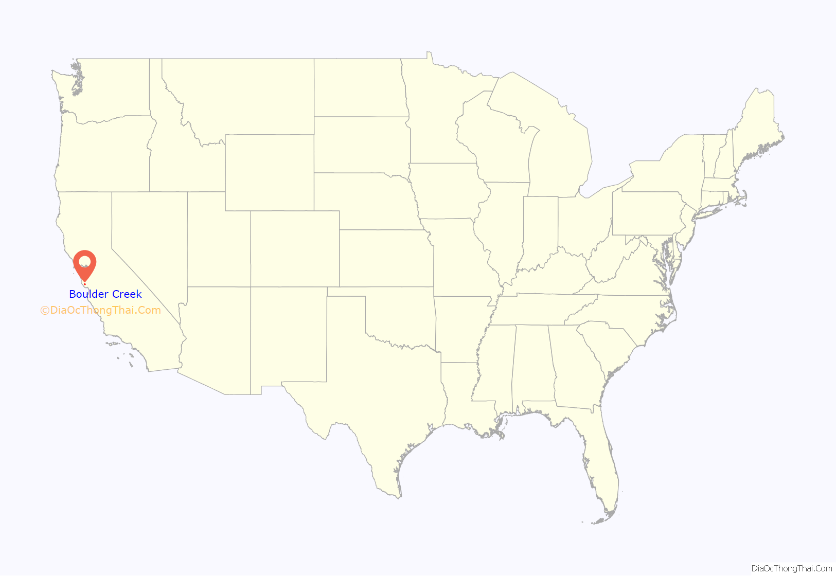
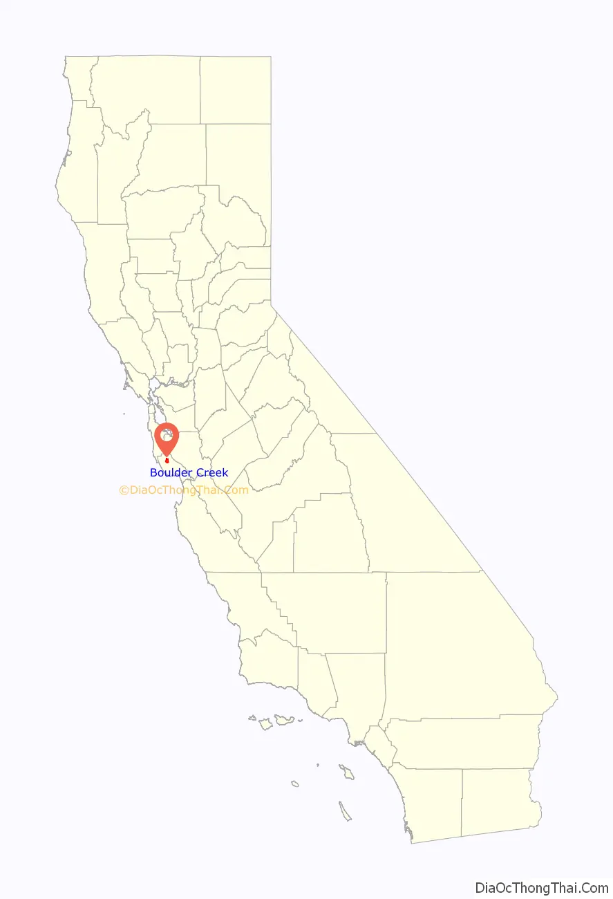
Boulder Creek location map. Where is Boulder Creek CDP?
History
The Boulder Creek area is in the traditional tribal territory of the Achistaca, an Awaswas speaking people of the Ohlone cultural unit, who were a group of contiguous bands that inhabited the coastal region of present-day California from the San Francisco Bay to the Monterey Peninsula and down to San José and Salinas Valley.
There are no living survivors of the Achistaca, who are spoken for by the Amah Mutsun Tribal Band.
According to one anthropologist, the indigenous name for the area was Achista and tentatively included Acsaggi.
The earliest European presence in the area was a Spanish exploratory party in 1769, led overland from Mexico by Don Gaspar de Portolá and Father Juan Crespí. On August 28, 1791, a Spanish mission, Mission Santa Cruz, was established by the Franciscans from Mission Santa Clara de Asís for the conversion of the Awaswas. The Awaswas were moved to Mission Santa Cruz and Mission San Juan Bautista, which claimed the land and peoples. The Awaswas language and its dialects became the main language spoken at Mission Santa Cruz.
Upon independence from Spain in 1821, the area became a part of Mexico. Although Spain had not awarded land grants in the Santa Cruz area, the Mexican government started issuing them in 1822 when it took over the administration of California. Most of the grants lay along the coast, with the only ones within the San Lorenzo Valley being Rancho Zayante and Rancho San Agustin. Under Mexican administration, only natural citizens could own land. Although not a Mexican citizen, in 1841, Isaac Graham purchased the Rancho Zayante land grant by proxy from frontiersman and naturalized Mexican citizen Joseph Ladd Majors. In 1843, together with Peter Lassen, Graham built one of the first water-powered sawmills in California and, with it, the first significant settlement in the area. Graham’s settlement marked the beginning of San Lorenzo Valley’s lumber-based economy.
Following the Mexican–American War of 1846–1848 and the California Gold Rush of 1848, the area steadily grew in population, including considerable immigration. While the Treaty of Guadalupe Hidalgo ending the War obliged the United States to honor Mexican land grants, the process took many years of court hearings. In the meantime, squatters and entrepreneurs moved into the valley to harvest its rich resources of timber and lime. Despite the lack of roads, many families braved the wilderness to homestead the upper San Lorenzo. There were few large operations in the upper San Lorenzo Valley, leading the pioneers to develop their own systems of harvesting and transporting to the lumber and tanning markets. Logging in the valley supplied large timbers to shore up the underground workings of the mines after the initial rush of gold-panning gave way to other mining techniques. By the late 1850s, early settlers and lumbermen were using the Turkey Foot floodplain as a gathering point for their mule and oxen teams.
Timber town
Branciford Alcorn was one of the first to settle along Bear Creek in 1865. Daniel Crediford and sons Wilfred and Stephen moved about four miles up Boulder Creek to the Sequoia district in 1867. West Virginian Joseph Wilbur Peery also settled in the Boulder area in 1867 and began a small-scale logging project along the San Lorenzo River. Peery built a dam across the river at Two Bar Creek to provide water power to his mill and for the one he later built two miles south of the junction of the river, Boulder and Bear creeks. Twin brothers Austin and Oscar Harmon assisted at the Two Bar Creek mill until its closure. The erection of the Two Bar Creek sawmill by Peery later helped in the establishment of the settlement of Boulder.
The year 1868 was the founding year for the settlement of Boulder. Transportation remained a problem, slowing development of the small communities that now dotted the valley. A road extension from Graham Hill Road linking the upper San Lorenzo valley with Santa Cruz through Felton was completed in May. It also marked the completion of the United States government’s survey of all land not held by grants in the Santa Cruz Mountains, which was then opened for purchase and homesteading. Government surveyors divided the largely unsettled San Lorenzo Valley into claimable sections. The area of Boulder Creek occupied two 160-acre tracts. The northern half, between Harmon and Bear Creeks, was awarded to John Alcorn, Branciford’s son. Loggers moved up the San Lorenzo and its tributaries removing every marketable tree that were then sold to the demanding market of the San Francisco Bay area. The lumbermen and their families moved into scattered cottages and homes around the periphery of Peery’s Two Bar Creek sawmill, while a general store, livery stable, and blacksmith shop arose nearby to support the mill and its visitors. The increase in the number of families with children determined the need for a school, the first one of which was started in a small building on Alcorn’s land on what is now West Park Drive.
Lumber could not be shipped over the mountains to Santa Clara Valley. Two years later in 1871, another road extension, the Saratoga Toll Road, was added from the summit at the Saratoga Gap and ran 11 miles to meet the road that ran about four miles above Boulder Creek. In June, the Maclay Turnpike officially opened. Alcorn erected a two-story boarding house, the Boulder Creek House. That same year, Peery was awarded a land grant and relocated his lumber mill a mile south to Lorenzo, a settlement that he laid out, which was bounded by what is now Harmon, West, South, and East Streets. With an access point to the greater San Francisco Bay Area came the establishment of a post office named Boulder Creek in 1872, with Peery becoming the first Postmaster. Mail runs were limited to twice a week because it took a mail carrier two days to travel from Santa Clara to Felton.
What is now Boulder Creek was originally once two settlements: Lorenzo at the southern end of town, and Boulder was north of the current town core.
Boulder Creek served as the upper terminus of the San Lorenzo Valley Logging Flume terminating in Felton, which began construction in 1874 and, when formally opened in October 1875, was augmented by a new rail line to transport logs to the wharf in Santa Cruz. In the 1880s, this lumber town which was called Lorenzo took the name of the Boulder Creek post office that had been established in the 1870s.
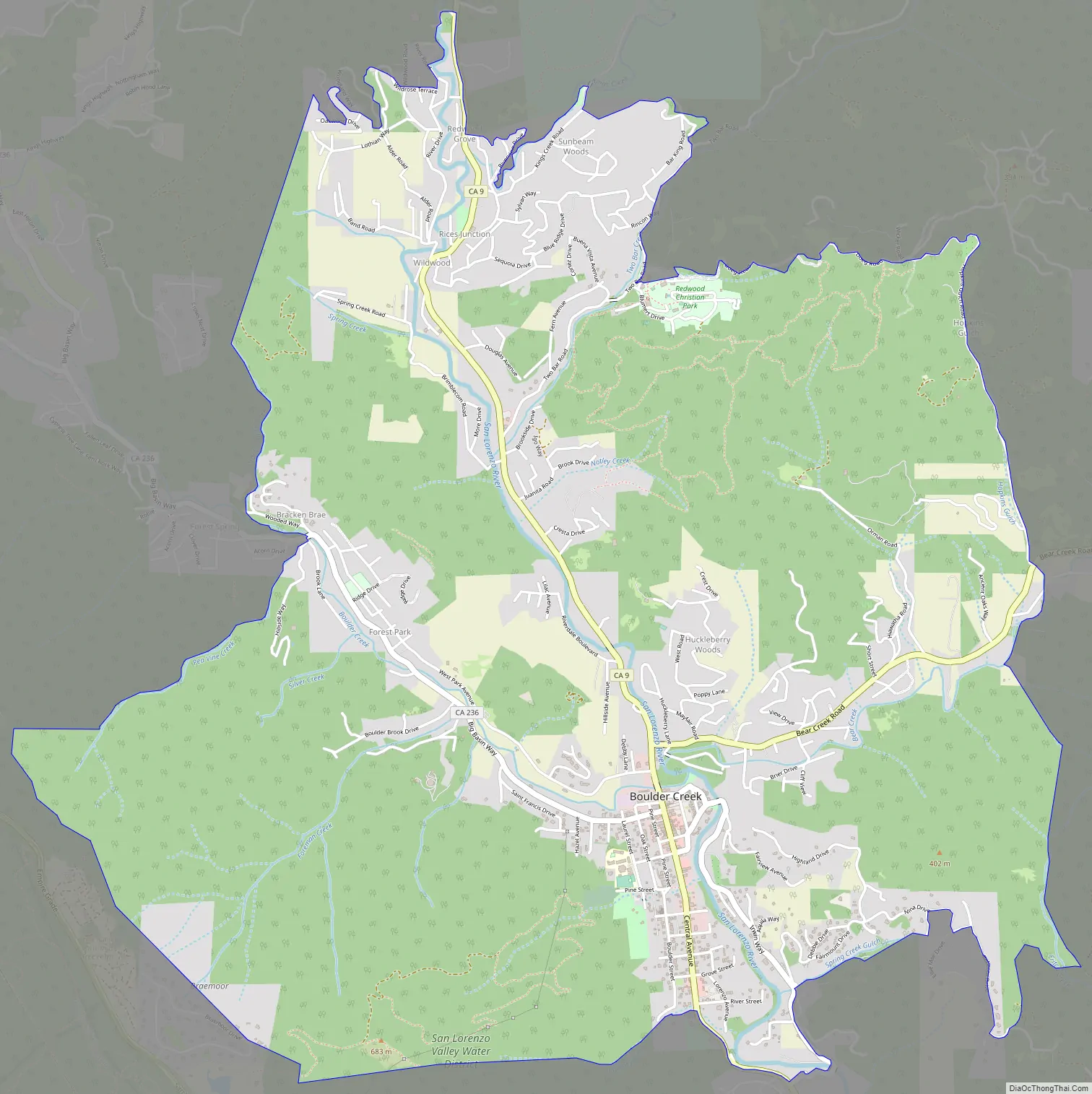
Boulder Creek Road Map
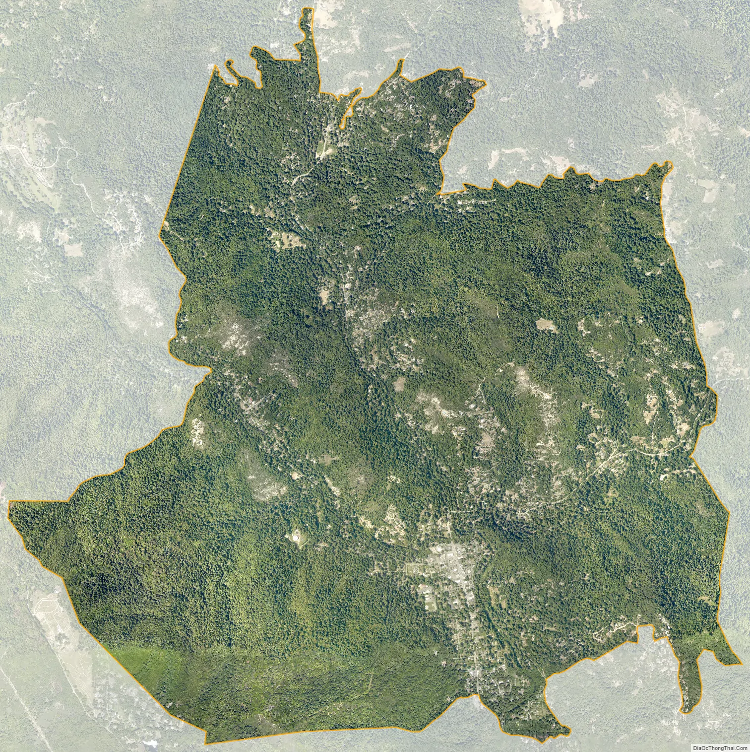
Boulder Creek city Satellite Map
Geography
Boulder Creek is located on the West Coast of the United States. The community has a total area of 7.5 square miles (19 km), of which all is land. The community is bordered by San Mateo County to the northwest; Santa Clara County to the northeast; Big Basin Redwoods State Park to the west; and Brookdale to the south. Boulder Creek is 15 miles (24 km) from Santa Cruz, 30 miles (48 km) from San Jose, 70 miles (110 km) from San Francisco, and 150 miles (240 km) from Sacramento.
Boulder Creek sits at the north end of the San Lorenzo Valley at the confluence of San Lorenzo River and Boulder Creek within the Santa Cruz Mountains, a Level IV ecoregion designated by the United States Environmental Protection Agency (EPA), an area surrounded by steep, redwood- and pine- covered hills formed by the river, creek, and their tributaries. The river flows through Boulder Creek on the east and south through Brookdale, Ben Lomond, and Felton, and continues south to the City of Santa Cruz where it enters Monterey Bay. Directly across from Boulder Creek’s confluence with the San Lorenzo River, Bear Creek flows into the river and creates a topographical feature known as the Turkey Foot. The Turkey Foot creates a floodplain, particularly on the western side of the river where the mountainside is less steep.
Climate
Boulder Creek has a warm-summer Mediterranean climate (Köppen Csb) characteristic of California’s coast, with moist, mild winters and dry summers. Located about 15 miles inland, the Boulder Creek skies can be overcast due to moisture from the Pacific Coast marine layer.
The dry period of May to October is mild to warm, with the normal monthly mean temperature peaking in August at 81.0 °F (27.2 °C). The rainy period of November to April is slightly cooler, with the normal monthly mean temperature reaching its lowest in December at 38.0 °F (3.3 °C). On average, there are 75 rainy days a year, and annual precipitation averages 52 inches (1,321 mm). Variation in precipitation from year to year is high, with a maximum of 112 inches (2,845 mm) in 1983 and a minimum of 19 inches (483 mm) in 1986. Above-average rain years are often associated with warm El Niño conditions in the Pacific while dry years often occur in cold water La Niña periods.
Boulder Creek falls under the USDA 9b Plant hardiness zone.
Flooding of the San Lorenzo River, caused by a combination of high tide, storm surge, and runoff, has been known to cause extensive damage. A Santa Cruz Surf newspaper article from January 25, 1890 mentioned the San Lorenzo River being at its highest known since 1849 with Boulder Creek having received 90 inches of rainfall up to that date during the 1889-90 winter season. A log jam was reported at the junction of the river and Bear Creek, with Boulder Creek being “higher than ever known”. Bear Creek Bridge gave way and a cottage from the tributary Hesse Creek was carried by flood waters down to Boulder Creek, where it was stopped by rescue parties. There was one casualty. In a April 19th article of the San Francisco Examiner that same year, Boulder Creek held first place in the season’s precipitation with 122.11 inches of rain received.
According to a March 24 article of the Santa Cruz Morning Sentinel, the 1907 flood destroyed and swept away all five bridges within town limits that connected the eastern and western sides of Boulder Creek – Booth, Schroder, Swinging Bridge, Barker, and Grover Dam bridge.
Modern records began in 1937 with the highest river level rise recorded during the December 1955 storm from December 22 to 23. According to the Santa Cruz Sentinel-News, Boulder Creek recorded 32.42 inches of rain during that flood storm. Within the area, Highway 9 in the vicinity of Wildwood Grove had minor undercutting of the road fill and Riverside Grove experienced principal residential damage.
During the January 1982 El Niño storm, from January 3 to 4, 12.74 inches of rainfall occurred in Boulder Creek over the period of 24 hours. This generated debris flows and shallow landslides. During the El Niño winter of 1996 and 1997, higher concentrations of debris flows was observed in the area around Boulder Creek.
Fires have occurred throughout Boulder Creek’s history.
Two conflagration-sized fires nearly destroyed downtown Boulder Creek and the nearby village of Lorenzo on July 17, 1891.
The CZU Lightning Complex fires started on August 16, 2020 due to a severe thunderstorm that initially started several separate fires. Due to a change in wind conditions, these separate fires merged together and rapidly spread through nearby communities, including Boulder Creek. The CZU fire incident was finally contained on September 22, after destroying a number of houses but sparing the town’s historic main street.
See also
Map of California State and its subdivision:- Alameda
- Alpine
- Amador
- Butte
- Calaveras
- Colusa
- Contra Costa
- Del Norte
- El Dorado
- Fresno
- Glenn
- Humboldt
- Imperial
- Inyo
- Kern
- Kings
- Lake
- Lassen
- Los Angeles
- Madera
- Marin
- Mariposa
- Mendocino
- Merced
- Modoc
- Mono
- Monterey
- Napa
- Nevada
- Orange
- Placer
- Plumas
- Riverside
- Sacramento
- San Benito
- San Bernardino
- San Diego
- San Francisco
- San Joaquin
- San Luis Obispo
- San Mateo
- Santa Barbara
- Santa Clara
- Santa Cruz
- Shasta
- Sierra
- Siskiyou
- Solano
- Sonoma
- Stanislaus
- Sutter
- Tehama
- Trinity
- Tulare
- Tuolumne
- Ventura
- Yolo
- Yuba
- Alabama
- Alaska
- Arizona
- Arkansas
- California
- Colorado
- Connecticut
- Delaware
- District of Columbia
- Florida
- Georgia
- Hawaii
- Idaho
- Illinois
- Indiana
- Iowa
- Kansas
- Kentucky
- Louisiana
- Maine
- Maryland
- Massachusetts
- Michigan
- Minnesota
- Mississippi
- Missouri
- Montana
- Nebraska
- Nevada
- New Hampshire
- New Jersey
- New Mexico
- New York
- North Carolina
- North Dakota
- Ohio
- Oklahoma
- Oregon
- Pennsylvania
- Rhode Island
- South Carolina
- South Dakota
- Tennessee
- Texas
- Utah
- Vermont
- Virginia
- Washington
- West Virginia
- Wisconsin
- Wyoming


