Brookdale is a census-designated place (CDP) in Santa Cruz County, California. Brookdale sits at an elevation of 405 feet (123 m). It is located in the San Lorenzo Valley between Boulder Creek and Ben Lomond on Highway 9. The 2010 United States census reported Brookdale’s population was 1,991.
The ZIP Code is 95007 and the community is inside area code 831. There is no mail delivery in Brookdale, though no home is more than 1.5 miles from the post office.
| Name: | Brookdale CDP |
|---|---|
| LSAD Code: | 57 |
| LSAD Description: | CDP (suffix) |
| State: | California |
| County: | Santa Cruz County |
| Elevation: | 405 ft (123 m) |
| Total Area: | 3.85 sq mi (9.96 km²) |
| Land Area: | 3.85 sq mi (9.96 km²) |
| Water Area: | 0.00 sq mi (0.00 km²) 0% |
| Total Population: | 2,043 |
| Population Density: | 531.06/sq mi (205.06/km²) |
| ZIP code: | 95007 |
| Area code: | 831 |
| FIPS code: | 0608478 |
| GNISfeature ID: | 2582951 |
Online Interactive Map
Click on ![]() to view map in "full screen" mode.
to view map in "full screen" mode.
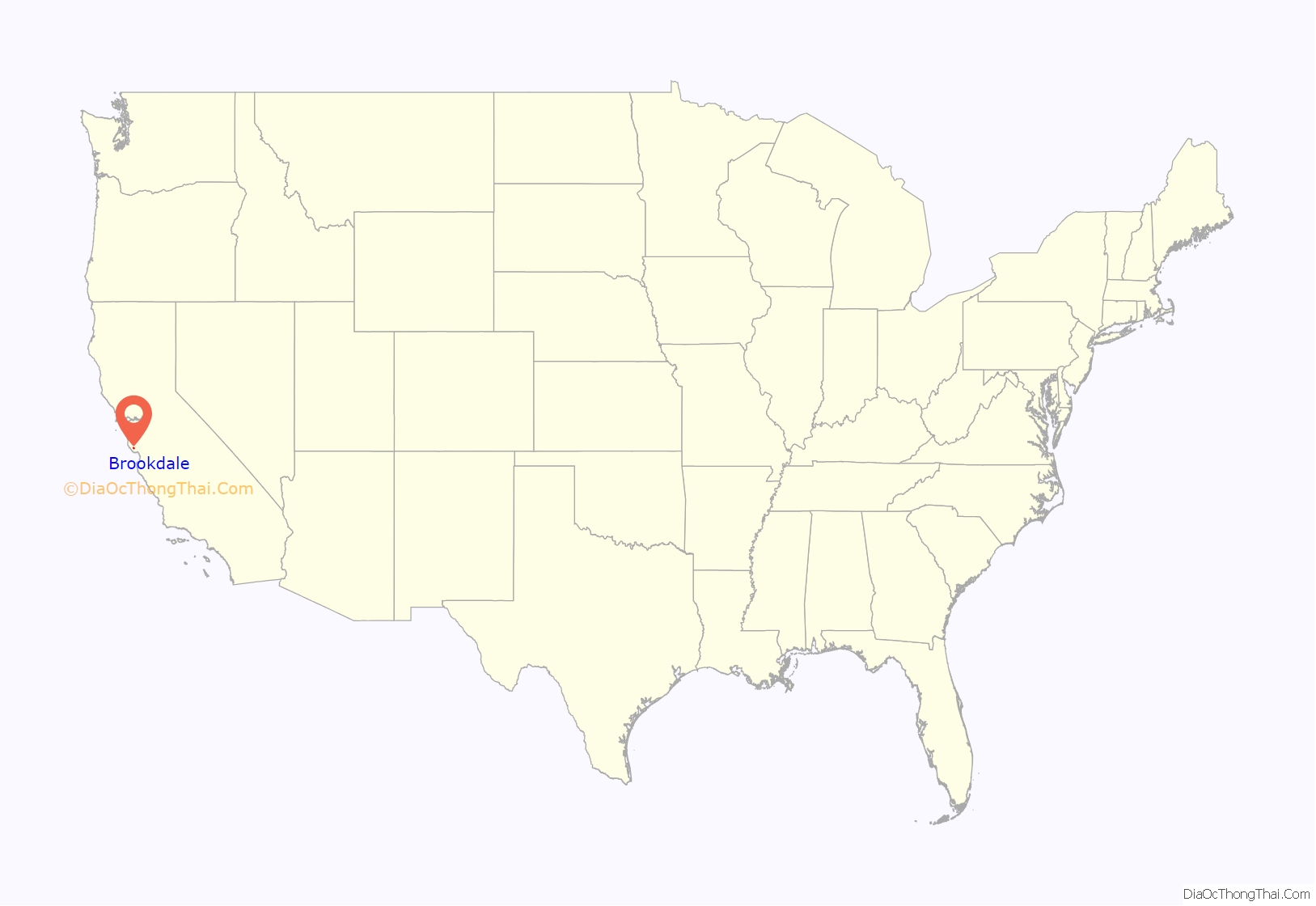
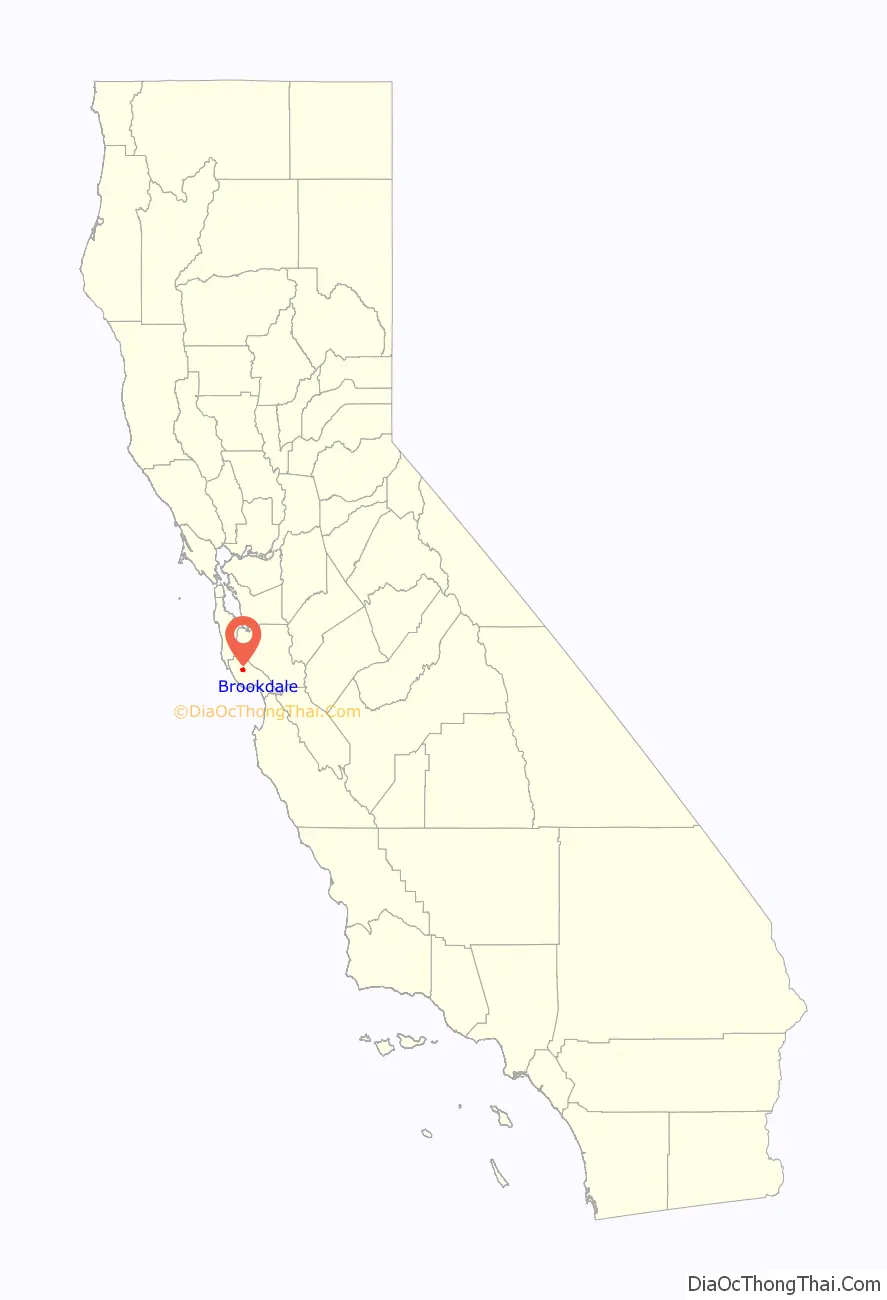
Brookdale location map. Where is Brookdale CDP?
History
The area was previously known as Clear Creek and then Brookville, and was the site of the Grover Lumber Mill by 1870. Logging and lumber was the major industry throughout the Santa Cruz Mountains at the time. James Harvey Logan, a Santa Cruz judge and creator of the loganberry, purchased the mill in 1900, created a creekside resort with cabins and camping, and established the Brookdale post office in 1902.
The Brookdale Lodge
Brookdale Lodge, a historic resort complex, is the main business in Brookdale. It was famous for decades, known especially for the stream running through its primary restaurant, the Brook Room (closed for renovation as of 2019). It currently has a reputation for being haunted by numerous ghosts. Started by Judge Logan, by 1922 it was owned by Dr. F. K. Camp, a Seventh-day Adventist physician, who envisioned a dining room spanning the creek and hired Horace Cotton of San Francisco to design it.
The lodge has changed hands many times since, and was condemned after a fire in 2009. Since 2016 it has been owned by Pravin and Naina Patel. The lodge appeared on the paranormal show Ghost Adventures in 2012. The property has once again been sold and is undergoing intensive renovations.
Fires
There have been three large fires at the Lodge, the last of suspicious origin.
The first occurred on October 24, 1956. In that fire the dining room and an adjoining 12-room house were destroyed. A group of stores adjacent to the dining room were also badly damaged. Damage from the 1956 fire was estimated at $200,000.
The second occurred in 2005 in the same area of the main hotel as the 2009 fire.
On August 18, 2009, a fire engulfed a two-story section of the lodge near the rear of the main building that contains apartments mostly occupied by lodge employees. There were no reports of injuries to anybody staying at the inn, though some firefighters suffered minor injuries while fighting the blaze.
The origin of the fire is still under investigation and the U.S. Bureau of Alcohol, Tobacco, Firearms and Explosives is helping to determine the cause of the three-alarm fire. According to the Boulder Creek Fire Chief the fire started under suspicious circumstances.
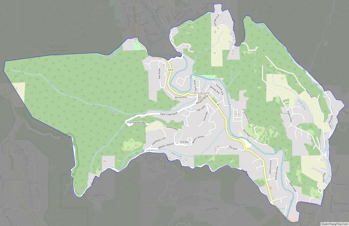
Brookdale Road Map
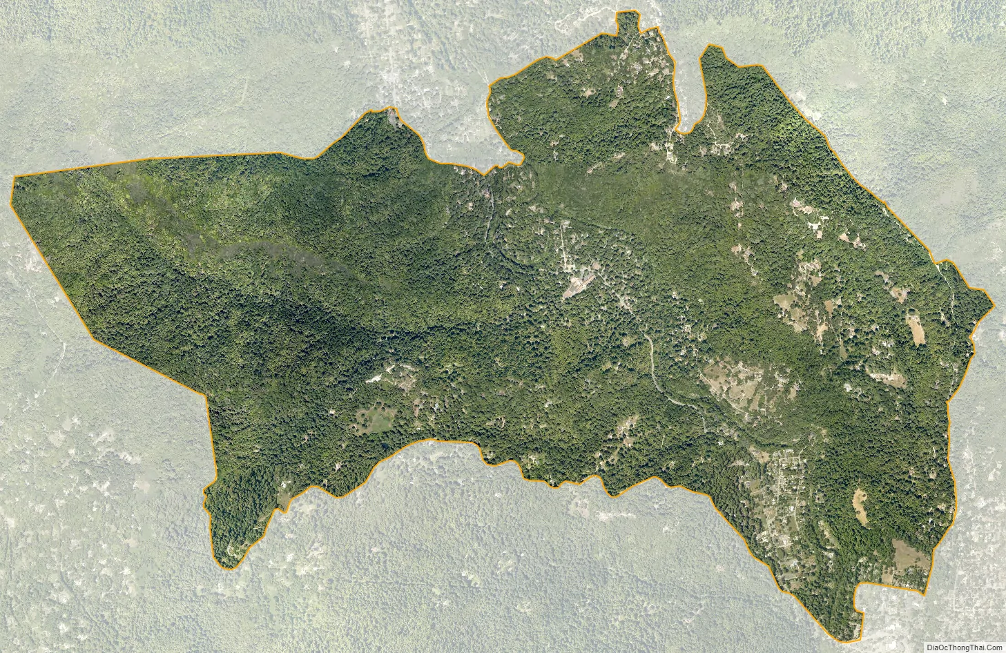
Brookdale city Satellite Map
Geography
According to the United States Census Bureau, the CDP covers an area of 3.8 square miles (10.0 km), all of it land.
Climate
This region experiences warm (but not hot) and dry summers, with no average monthly temperatures above 71.6 °F. According to the Köppen Climate Classification system, Brookdale has a warm-summer Mediterranean climate, abbreviated “Csb” on climate maps.
See also
Map of California State and its subdivision:- Alameda
- Alpine
- Amador
- Butte
- Calaveras
- Colusa
- Contra Costa
- Del Norte
- El Dorado
- Fresno
- Glenn
- Humboldt
- Imperial
- Inyo
- Kern
- Kings
- Lake
- Lassen
- Los Angeles
- Madera
- Marin
- Mariposa
- Mendocino
- Merced
- Modoc
- Mono
- Monterey
- Napa
- Nevada
- Orange
- Placer
- Plumas
- Riverside
- Sacramento
- San Benito
- San Bernardino
- San Diego
- San Francisco
- San Joaquin
- San Luis Obispo
- San Mateo
- Santa Barbara
- Santa Clara
- Santa Cruz
- Shasta
- Sierra
- Siskiyou
- Solano
- Sonoma
- Stanislaus
- Sutter
- Tehama
- Trinity
- Tulare
- Tuolumne
- Ventura
- Yolo
- Yuba
- Alabama
- Alaska
- Arizona
- Arkansas
- California
- Colorado
- Connecticut
- Delaware
- District of Columbia
- Florida
- Georgia
- Hawaii
- Idaho
- Illinois
- Indiana
- Iowa
- Kansas
- Kentucky
- Louisiana
- Maine
- Maryland
- Massachusetts
- Michigan
- Minnesota
- Mississippi
- Missouri
- Montana
- Nebraska
- Nevada
- New Hampshire
- New Jersey
- New Mexico
- New York
- North Carolina
- North Dakota
- Ohio
- Oklahoma
- Oregon
- Pennsylvania
- Rhode Island
- South Carolina
- South Dakota
- Tennessee
- Texas
- Utah
- Vermont
- Virginia
- Washington
- West Virginia
- Wisconsin
- Wyoming


