Cambrian is a neighborhood of San Jose, California, located in West San Jose. Though most of the neighborhood is incorporated as part of San Jose, a small portion exists as an unincorporated census-designated place called Cambrian Park.
| Name: | Cambrian Park CDP |
|---|---|
| LSAD Code: | 57 |
| LSAD Description: | CDP (suffix) |
| State: | California |
| County: | Santa Clara County |
| Elevation: | 236 ft (72 m) |
| Total Area: | 0.61 sq mi (1.58 km²) |
| Land Area: | 0.61 sq mi (1.58 km²) |
| Water Area: | 0.00 sq mi (0.00 km²) 0% |
| Total Population: | 3,719 |
| Population Density: | 6,096.72/sq mi (2,353.42/km²) |
| ZIP code: | 95124 |
| Area code: | 408 |
| FIPS code: | 0610088 |
Online Interactive Map
Click on ![]() to view map in "full screen" mode.
to view map in "full screen" mode.
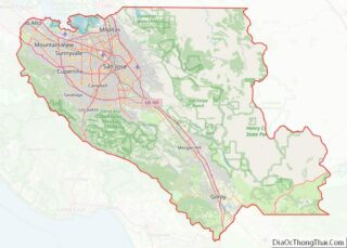
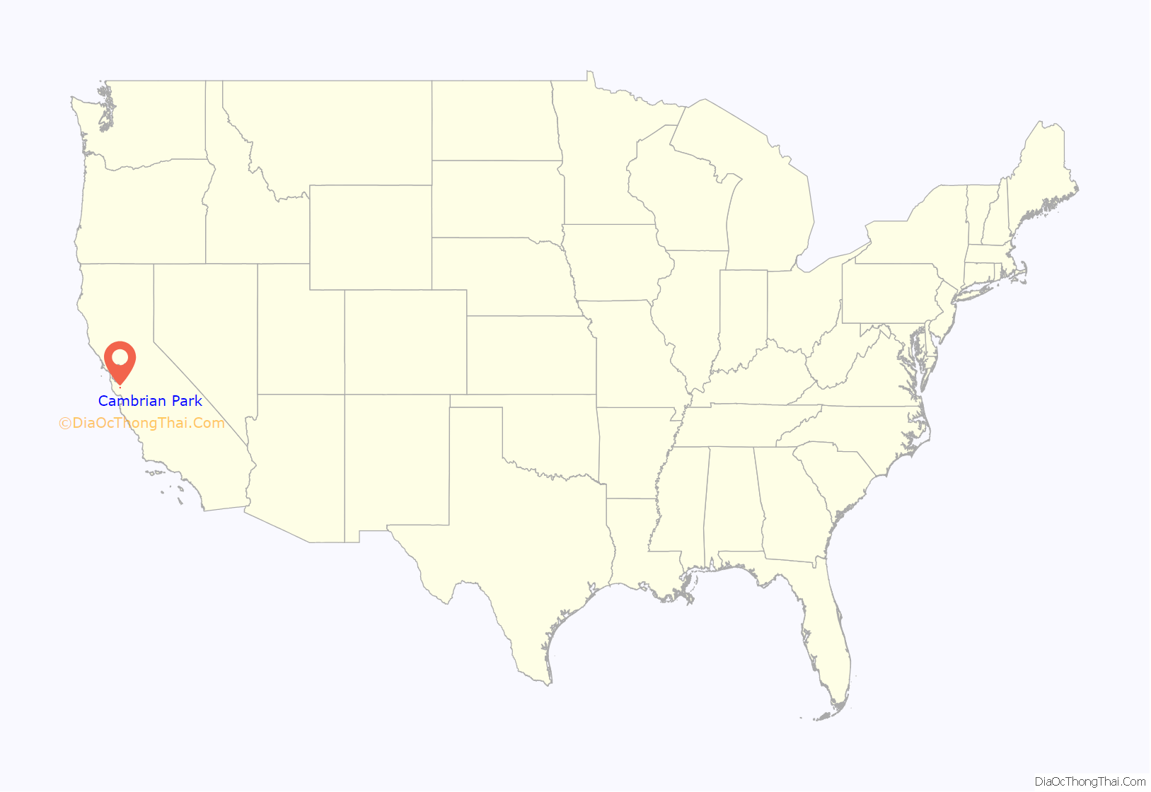
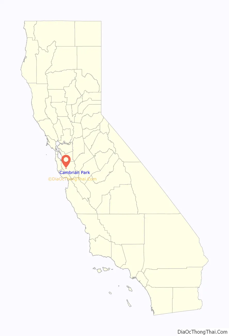
Cambrian Park location map. Where is Cambrian Park CDP?
History
The name “Cambrian Park” was used regularly since the 1950s by the then San Jose Mercury and San Jose News newspapers (now The San Jose Mercury News) to refer to a portion of the Union school and Cambrian school areas, the latter school named in the 1870s by ranch hand David Lewis of the Jeremiah D. Casey Ranch for Cambria, the Latinized name for Wales (Welsh, Cymru), the country of Lewis’s birth. Due to the relative isolation of adjacent population centers within then rural Santa Clara County, place names and later, municipalities, were often defined by their public school service boundaries. These indistinct boundaries persisted until WWII, after which a rapidly expanding population and demand for municipal services resulted in more precise boundaries being established. The Cambrian Park area continues to be recognized as a distinct, partly unincorporated neighborhood bordering the cities of San Jose and Campbell and the town of Los Gatos.
We and Our Neighbors women’s club was established in the adjacent Union School District area in 1892, “…to promote social ties, intellectual and cultural pursuits, charitable deeds, and recreation for the farm families of the neighborhood.” Their clubhouse, built in 1910, is a San Jose Historic Landmark and appears in the National Register of Historic Places.
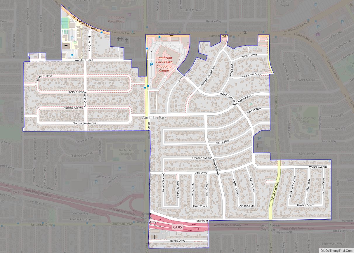
The commerce center for the Cambrian Park area has always been the Cambrian Park Plaza. Located at the crossroads of Camden and Union Avenues, the center was originally built in 1953. Today the center maintains the country charm and construction style, across over 170,000 square feet of stores. Through the years, the center has housed a mix of local shops and national brands. The iconic colorful carousel atop the center sign is a historical landmark. This is of particular interest in the community as the center was sold for the first time ever in 2015, to Texas-based Weingarten Realty.
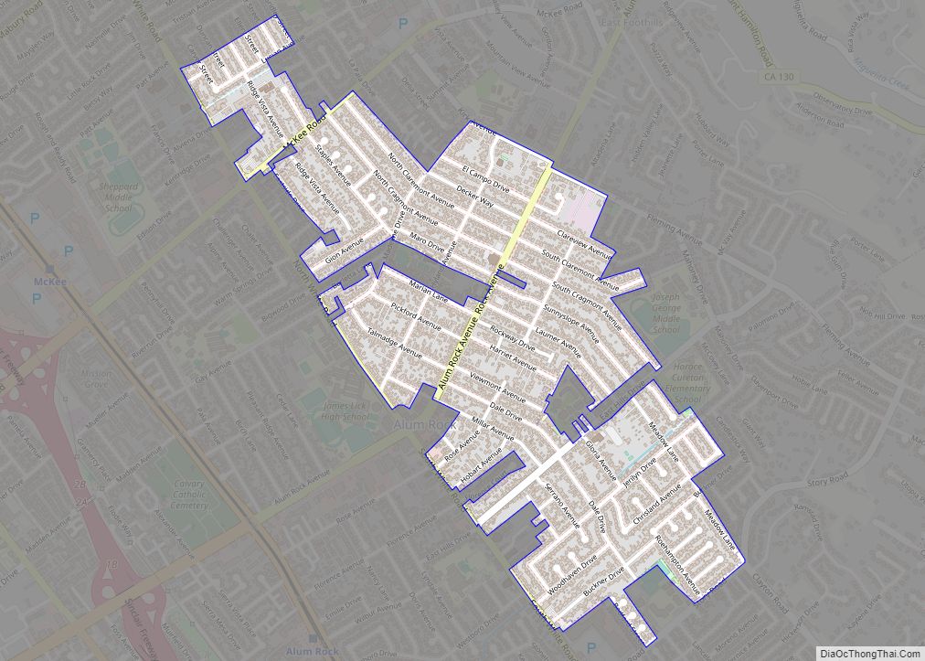
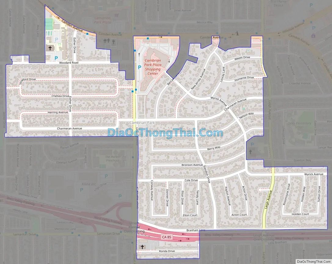
Cambrian Park Road Map
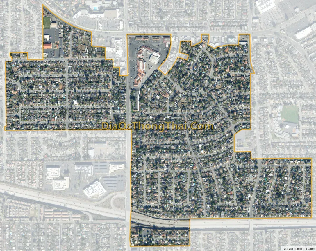
Cambrian Park city Satellite Map
Geography
Cambrian Park is located at 37°15′20″N 121°55′44″W / 37.25556°N 121.92889°W / 37.25556; -121.92889 (37.255593, −121.928915).
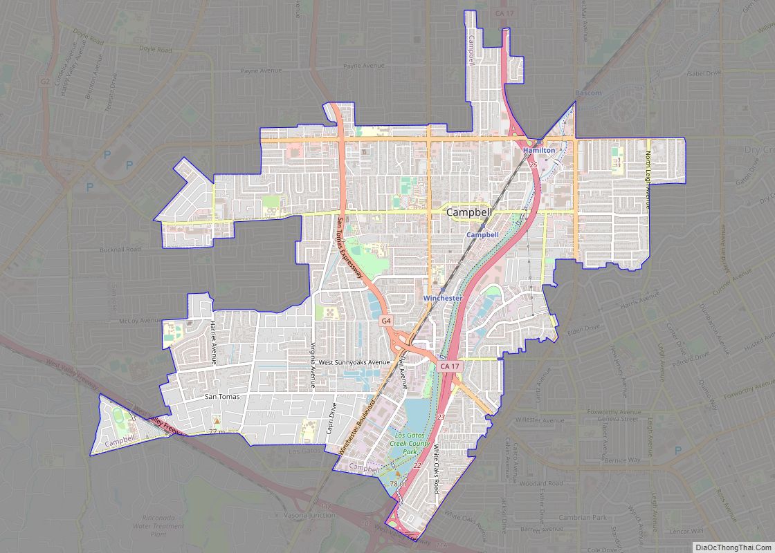
Cambrian is located in the South San Jose region of the city. Willow Glen is to its north, Los Gatos is to its south and west, Campbell is to its northwest, and Almaden is to its east.
Most of Cambrian lies within San Jose’s city limits, though a small portion is an unincorporated county pocket. A large swath of the pocket was annexed by the City of Campbell in 2012, under an agreement with the City of San Jose, while the rest will eventually be annexed by San Jose. According to the United States Census Bureau, the CDP had a total area of 0.6 square miles (1.6 km), all of it land.
See also
Map of California State and its subdivision:- Alameda
- Alpine
- Amador
- Butte
- Calaveras
- Colusa
- Contra Costa
- Del Norte
- El Dorado
- Fresno
- Glenn
- Humboldt
- Imperial
- Inyo
- Kern
- Kings
- Lake
- Lassen
- Los Angeles
- Madera
- Marin
- Mariposa
- Mendocino
- Merced
- Modoc
- Mono
- Monterey
- Napa
- Nevada
- Orange
- Placer
- Plumas
- Riverside
- Sacramento
- San Benito
- San Bernardino
- San Diego
- San Francisco
- San Joaquin
- San Luis Obispo
- San Mateo
- Santa Barbara
- Santa Clara
- Santa Cruz
- Shasta
- Sierra
- Siskiyou
- Solano
- Sonoma
- Stanislaus
- Sutter
- Tehama
- Trinity
- Tulare
- Tuolumne
- Ventura
- Yolo
- Yuba
- Alabama
- Alaska
- Arizona
- Arkansas
- California
- Colorado
- Connecticut
- Delaware
- District of Columbia
- Florida
- Georgia
- Hawaii
- Idaho
- Illinois
- Indiana
- Iowa
- Kansas
- Kentucky
- Louisiana
- Maine
- Maryland
- Massachusetts
- Michigan
- Minnesota
- Mississippi
- Missouri
- Montana
- Nebraska
- Nevada
- New Hampshire
- New Jersey
- New Mexico
- New York
- North Carolina
- North Dakota
- Ohio
- Oklahoma
- Oregon
- Pennsylvania
- Rhode Island
- South Carolina
- South Dakota
- Tennessee
- Texas
- Utah
- Vermont
- Virginia
- Washington
- West Virginia
- Wisconsin
- Wyoming