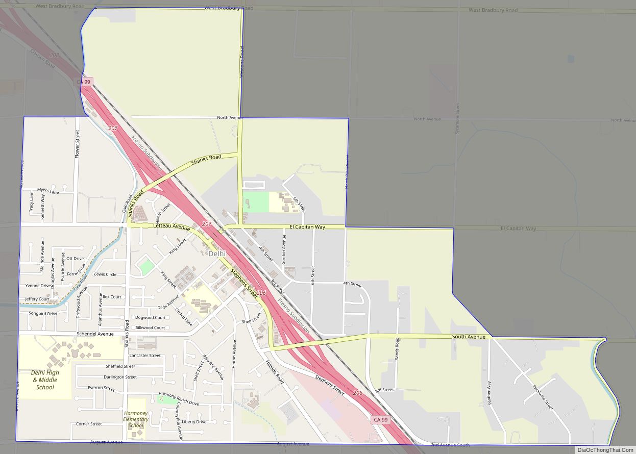
Delhi (/ˈdɛlhaɪ/ DEL-hye) is a census-designated place (CDP) in Merced County in the U.S. state of California. Delhi is 18 miles (29 km) west-northwest of Merced, at an elevation of 118 feet (36 m). According to the 2020 census, the population was 10,656.
| Name: | Delhi CDP |
|---|---|
| LSAD Code: | 57 |
| LSAD Description: | CDP (suffix) |
| State: | California |
| County: | Merced County |
| Elevation: | 118 ft (36 m) |
| Total Area: | 3.51 sq mi (9.09 km²) |
| Land Area: | 3.51 sq mi (9.09 km²) |
| Water Area: | 0.00 sq mi (0.00 km²) 0% |
| Total Population: | 10,656 |
| Population Density: | 3,035.90/sq mi (1,172.01/km²) |
| ZIP code: | 95315 |
| Area code: | 209 |
| FIPS code: | 0618464 |
Online Interactive Map
Click on ![]() to view map in "full screen" mode.
to view map in "full screen" mode.
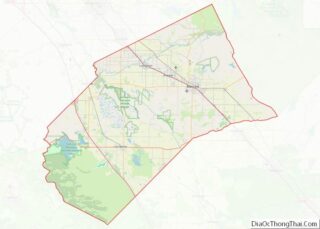
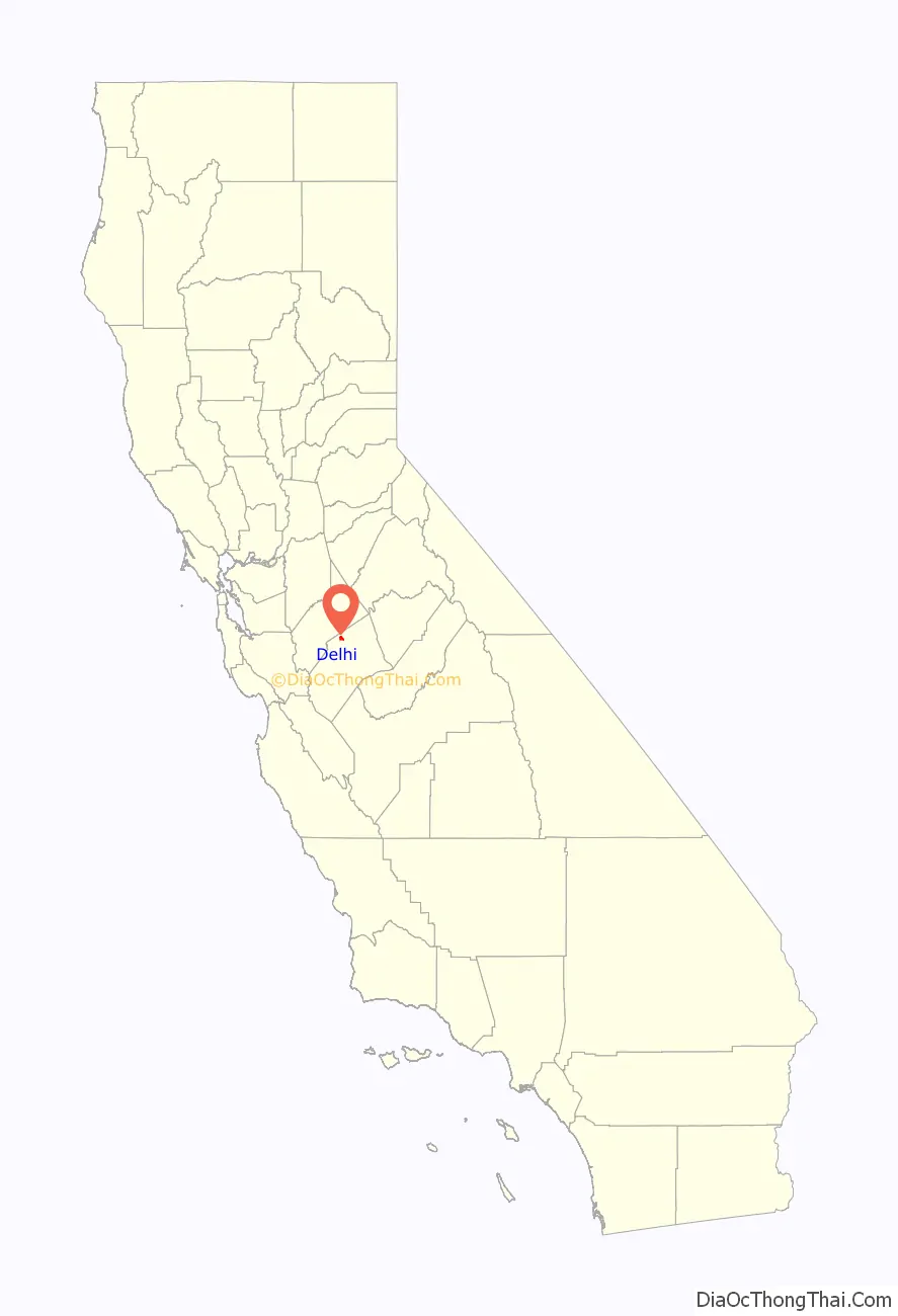
Delhi location map. Where is Delhi CDP?

History
The Delhi post office opened in 1912, closed in 1918, and reopened in 1920.
The building housing the New Beginnings Christian Center, a Delhi church, was built for display at the World’s Fair in San Francisco, in 1939. The building was to be torn down after the fair, but Enoch Christoffersen, who was a mayor of Turlock, California, said it was too nice of a church so it was bought and the structure was disassembled and shipped by train to Delhi, where it was re-assembled at its current location at 9711 N. Stephens Street.
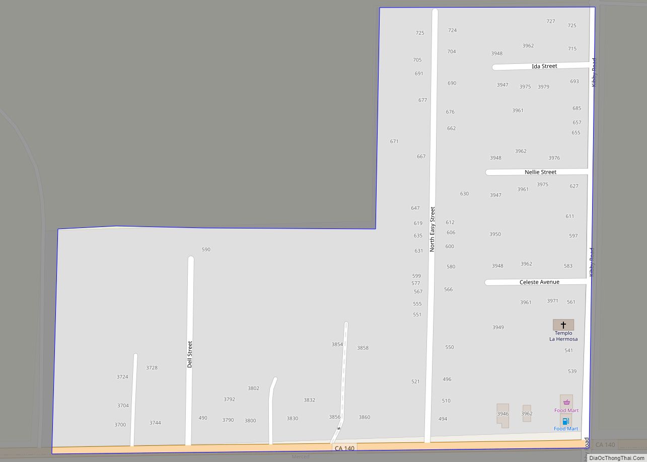
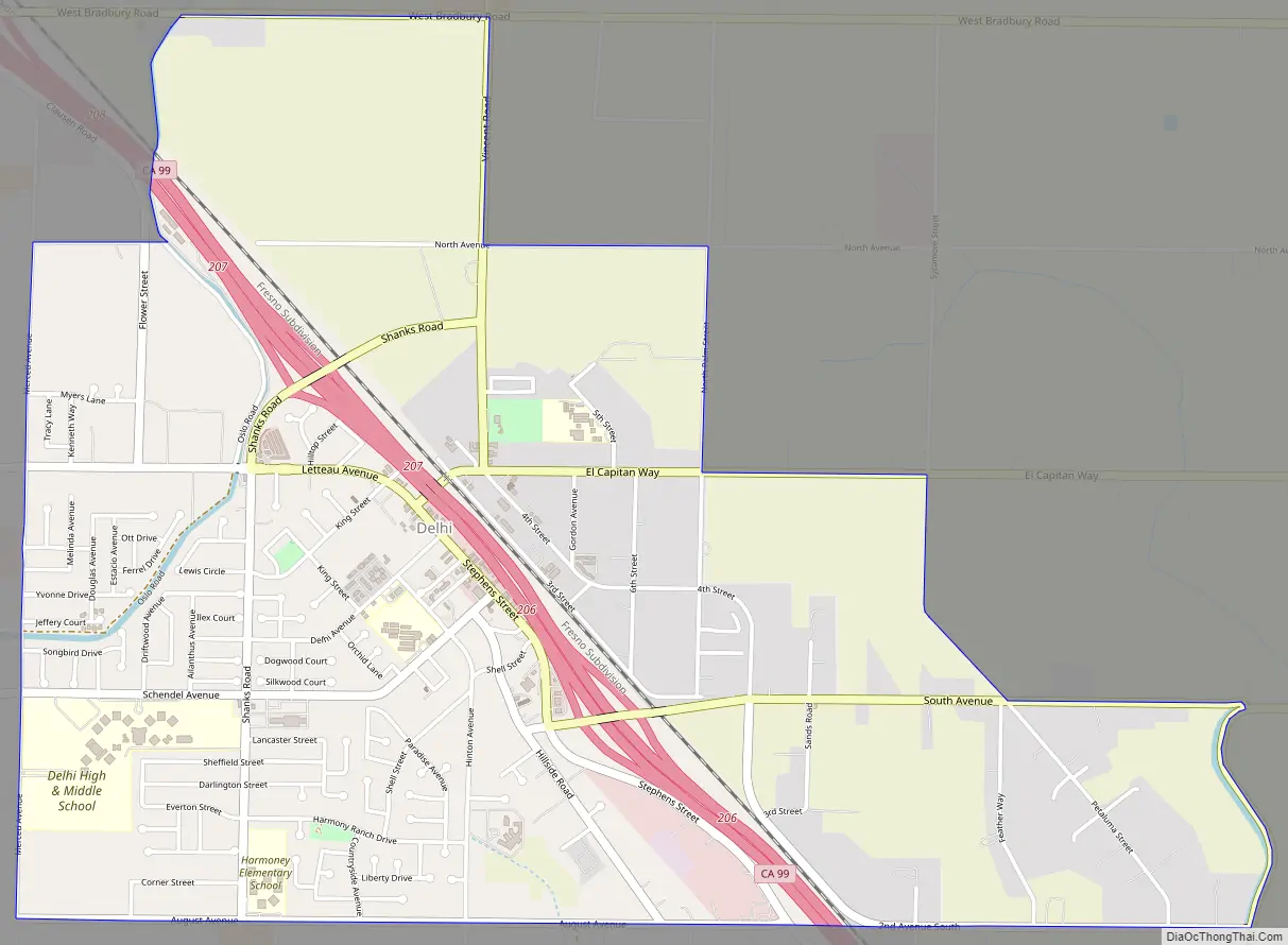
Delhi Road Map
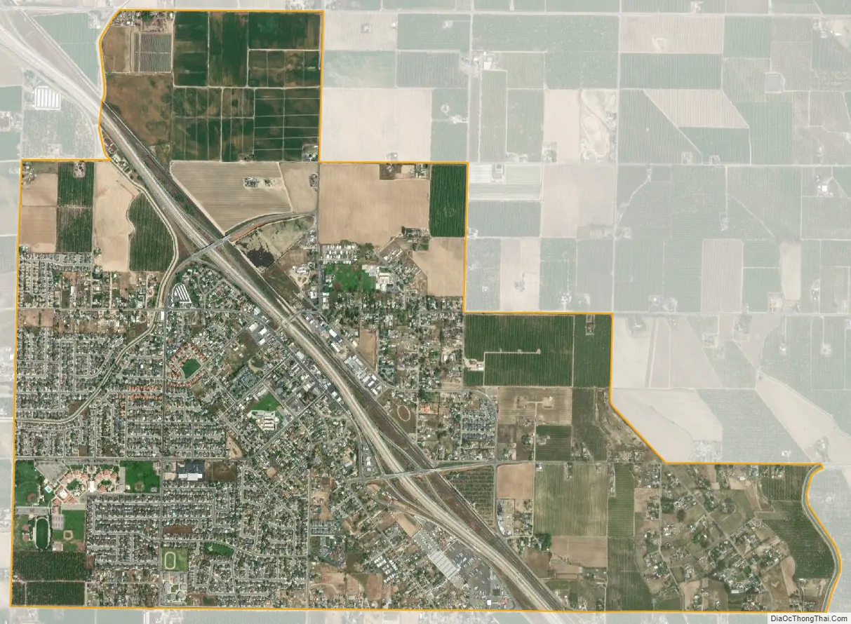
Delhi city Satellite Map
Geography
Delhi is located in northern Merced County at 37°25′56″N 120°46′43″W / 37.43222°N 120.77861°W / 37.43222; -120.77861. It lies northwest across the Merced River from Livingston. Hilmar is to the west, Turlock is to the north, and Ballico is to the east.
According to the United States Census Bureau, the Delhi CDP has a total area of 3.5 square miles (9.1 km), all of it land.
See also
Map of California State and its subdivision:- Alameda
- Alpine
- Amador
- Butte
- Calaveras
- Colusa
- Contra Costa
- Del Norte
- El Dorado
- Fresno
- Glenn
- Humboldt
- Imperial
- Inyo
- Kern
- Kings
- Lake
- Lassen
- Los Angeles
- Madera
- Marin
- Mariposa
- Mendocino
- Merced
- Modoc
- Mono
- Monterey
- Napa
- Nevada
- Orange
- Placer
- Plumas
- Riverside
- Sacramento
- San Benito
- San Bernardino
- San Diego
- San Francisco
- San Joaquin
- San Luis Obispo
- San Mateo
- Santa Barbara
- Santa Clara
- Santa Cruz
- Shasta
- Sierra
- Siskiyou
- Solano
- Sonoma
- Stanislaus
- Sutter
- Tehama
- Trinity
- Tulare
- Tuolumne
- Ventura
- Yolo
- Yuba
- Alabama
- Alaska
- Arizona
- Arkansas
- California
- Colorado
- Connecticut
- Delaware
- District of Columbia
- Florida
- Georgia
- Hawaii
- Idaho
- Illinois
- Indiana
- Iowa
- Kansas
- Kentucky
- Louisiana
- Maine
- Maryland
- Massachusetts
- Michigan
- Minnesota
- Mississippi
- Missouri
- Montana
- Nebraska
- Nevada
- New Hampshire
- New Jersey
- New Mexico
- New York
- North Carolina
- North Dakota
- Ohio
- Oklahoma
- Oregon
- Pennsylvania
- Rhode Island
- South Carolina
- South Dakota
- Tennessee
- Texas
- Utah
- Vermont
- Virginia
- Washington
- West Virginia
- Wisconsin
- Wyoming