Desert Center is a census designated place in the Colorado Desert in Riverside County, California. It is in southern California, between the cities of Indio and Blythe at the junction of Interstate 10 and State Route 177, about halfway between Phoenix and Los Angeles. The ZIP Code is 92239, and the community is in telephone area codes 442 and 760. The elevation is 656 feet (200 m). The population was 204 at the 2010 census.
| Name: | Desert Center CDP |
|---|---|
| LSAD Code: | 57 |
| LSAD Description: | CDP (suffix) |
| State: | California |
| County: | Riverside County |
| Elevation: | 656 ft (200 m) |
| Total Area: | 30.43 sq mi (78.80 km²) |
| Land Area: | 30.43 sq mi (78.80 km²) |
| Water Area: | 0.00 sq mi (0.00 km²) 0% |
| Total Population: | 256 |
| Population Density: | 8.41/sq mi (3.25/km²) |
| ZIP code: | 92239 |
| Area code: | 442 and 760 |
| FIPS code: | 0618982 |
| GNISfeature ID: | 2582993 |
Online Interactive Map
Click on ![]() to view map in "full screen" mode.
to view map in "full screen" mode.
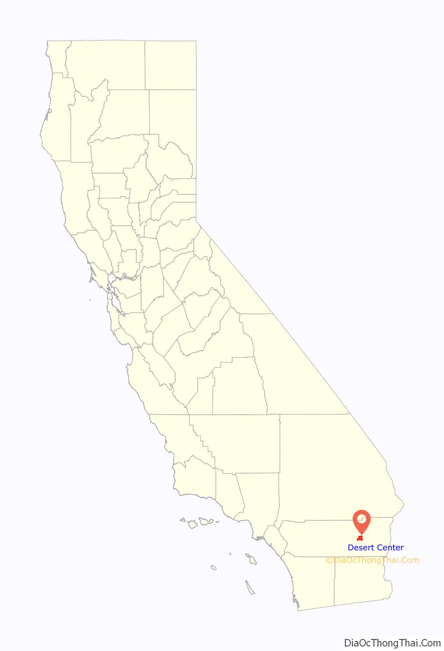
Desert Center location map. Where is Desert Center CDP?

History
Beginnings: “Desert Steve” Ragsdale
The town was founded in 1921 by Stephen A. Ragsdale, also known as “Desert Steve”, and his wife, Lydia. Ragsdale was an itinerant preacher and cotton farmer, originally from Arkansas. In 1915, he left his farm in the Palo Verde Valley along the Colorado River to attend to some business in Los Angeles. The road between Phoenix and Los Angeles was mostly sand, and Ragsdale’s vehicle broke down near a place called Gruendyke’s Well. This featured a hand-dug well and was inhabited by a prospector named Bill Gruendyke. Gruendyke rescued Ragsdale and gave him food, shelter, and water until his vehicle was repaired and he could resume his journey to Los Angeles.
Upon his return, Ragsdale bought out Gruendyke and moved his family to the remote spot, where they constructed a small shack with a lean-to that served as a repair garage. A Model T truck was modified to serve as a tow car. Gasoline was pumped by hand from a 55-gallon drum. Lydia served food and refreshments to thirsty and weary travelers. In spite of the remote location—50 miles (80 km) in any direction from anything—the Ragsdales prospered. Ragsdale named his outpost “Desert Center”. In 1921, it was announced that the sand road running through Desert Center would be relocated about 5 miles (8.0 km) north, straightened, paved, and named U.S. Route 60, a modern “high-speed” highway. In March 1926, The San Bernardino Daily Sun reported that 21 miles of grading was being done on a new road from Desert Center to Hopkins Well, changing the location of the desert highway and running over better soil.
Ragsdale abandoned “old Desert Center” and built a poured-concrete café in the adobe style with an attached gasoline station and a huge service garage. Across the road, a series of wooden structures were built, including a market (which at one time was the largest Coleman camping equipment dealer in the country), and a post office. He also built several cabins for travelers, and a large “plunge” (swimming pool) next to the café where travelers could escape the desert heat.
Ragsdale was a desert eccentric of the first order, and his advertising for Desert Center in publications such as Desert Magazine reflected his personality: “U Need Us – We Need U”, “Our Main Street is 100-miles long!”, “We lost our keys…we can’t close!” (a reference to the fact that the café has been open 24 hours a day, 365 days a year since it opened in 1921), “Free Room and Board Every Day The Sun Doesn’t Shine In Desert Center”, “If You Don’t Believe Me, You Can Go To Hell, or Visit Me in Desert Center in August! Nuf sed, Steve”.
When Ragsdale needed a teacher for his own children and the few others in the town, the county declined to send one; there weren’t enough students to warrant the expense. Ragsdale hastily built a basic structure of stick framing with paper board walls to use as a schoolhouse, and placed an ad in Los Angeles newspapers asking for an auto mechanic with a large family, which he got, and a teacher was indeed provided by the county.
Ragsdale frequently retreated to his writing shack near the north tip of the rock formation called “The Alligator” (across I-10 from Desert Center) where he composed poetry—the stanzas are referred to as “Spasm #1”, etc.—to be distributed in booklet form to travelers. Ragsdale was a close friend of many classic “desert people” such as Randall Henderson, founder of Desert Magazine; Marshall South, the hermit of Ghost Mountain; desert painter John Hilton; noted biologist Edmund C. Jaeger; and Harry Oliver, with whom Steve co-founded the annual Pegleg Smith Liar’s Contest in Anza-Borrego. Oliver often printed items about Desert Steve in his ‘newspaper,’ the Desert Rat Scrap Book.
Within a few years, Ragsdale operated a number of satellite businesses in locations such as Cactus City, Hell, Skyway, Box Canyon, and Shaver’s Well. Around 1950, he left Desert Center, living the rest of his days at his log cabin retreat near the summit of Santa Rosa Mountain. His sons, Stanley, Thurman, and Herbert, took over operations of Desert Center, and Stanley eventually purchased the town from his father. Stanley ran it for decades, adding a hamburger stand and the Stanco gasoline station.
Early prepaid health insurance
In the early 1930s, Dr. Sidney R. Garfield, who had just graduated from University of Southern California, went to visit a former classmate with a practice in Indio. The practice was thriving to capacity, while Garfield was nearly without business in Depression-era Los Angeles. Garfield’s friend explained that he was the closest doctor (50 miles) to 5,000 men digging the Colorado River Aqueduct under direction of Six Companies, Inc.. The project site’s headquarters was just southeast of Desert Center. Garfield borrowed money from his father and constructed a 4-bed clinic near the construction site. The clinic was cooled by an ammonia air-conditioning system and at the time was the only air-conditioned building between Riverside and Phoenix. Garfield would treat the men, who would promise to pay on payday, but who would usually go to Blythe or Indio and drink their paychecks. Within a year, Garfield was broke and announced that he would pull up stakes.
Hearing this, Henry J. Kaiser, whose division of the Six Companies, Inc. was building the stretch of the Colorado River Aqueduct through the Desert Center vicinity, visited Garfield at his clinic. His idea was to take a nickel a day out of each man’s paycheck to prepay for that man’s future medical treatments, should an injury occur while he was working. If the man wanted to be covered for the remainder of the day, after work hours, another nickel would be deducted. If the man had a wife and/or children he wanted to cover, this would cost another nickel. Within a short time, Garfield had a steady income stream and things improved for him immensely. When the aqueduct project was finished, Kaiser’s next venture was the construction of the Grand Coulee Dam, and he took Garfield with him to manage the workers’ health care, but this time there were 50,000 men, not just 5,000.
Garfield’s Contractors General Hospital evolved into Kaiser Permanente, the largest managed health care system in the world, but its origins are in Desert Center. In 1992 a roadside historical marker at the site was unveiled by Garfield’s sister next to the grocery honoring Desert Center as the birthplace of Kaiser Permanente.
General Patton – Desert Training Center
By 1942, Desert Center had very few residents. It was then that the Army, under the direction of Maj. General George S. Patton, established the Desert Center Army Air Field and the Camp Desert Center to support operations in the California-Arizona Maneuver Area. The base covered 18,000 square miles (47,000 km). Its purpose was to train troops for combat in the deserts of North Africa against the forces of German Field Marshal Erwin Rommel. The enormous operation came to a close in 1944, when the Allies were victorious in the North African theatre. A museum honoring Patton and his training complex is located in Chiriaco Summit.
After the military’s departure, the town became quiet again, remaining relatively unchanged as the old U.S. Route 60/70 was replaced by Interstate 10.
Eagle Mountain Mine and Prison
The site of Kaiser Steel Eagle Mountain Mine, which was one of the largest open-pit iron mining operations in the world at the time of opening, is located about 13 miles (21 km) north of Desert Center. The rich iron ore deposit was discovered by geologists employed by Henry J. Kaiser during construction of the Colorado River Aqueduct in the early 1930s. The Eagle Mountain Mine operated at capacity from World War II until Kaiser closed the mine and the town of Eagle Mountain in early 1982.
Movies & TV shows have used the mine as a filming location, including scenes from the Terminator 2: Judgment Day—first Terminator movie in 3-D.
A for-profit prison was operated by Utah’s Management and Training Corporation here in facilities leased from Kaiser Steel. Nine weeks before it was closed on December 31, 2003, a race riot claimed the lives of two black prisoners.
Plans for a project to operate an enormous waste management landfill at the mine site were stopped by environmentalists’ legal actions taken to protect the surrounding Colorado Desert ecosystem and the groundwater aquifer.
Desert Center Road Map

Desert Center city Satellite Map

Geography
According to the United States Census Bureau, the CDP covers an area of 30.4 square miles (79 km), all of it land.
In the vicinity of Desert Center are the Chuckwalla Mountains, Corn Springs, Eagle Mountain (Kaiser Steel’s former iron mine), and Chiriaco Summit and museum.
Climate
As the name suggests, the town is in a desert—a hot desert (Köppen BWh).
See also
Map of California State and its subdivision:- Alameda
- Alpine
- Amador
- Butte
- Calaveras
- Colusa
- Contra Costa
- Del Norte
- El Dorado
- Fresno
- Glenn
- Humboldt
- Imperial
- Inyo
- Kern
- Kings
- Lake
- Lassen
- Los Angeles
- Madera
- Marin
- Mariposa
- Mendocino
- Merced
- Modoc
- Mono
- Monterey
- Napa
- Nevada
- Orange
- Placer
- Plumas
- Riverside
- Sacramento
- San Benito
- San Bernardino
- San Diego
- San Francisco
- San Joaquin
- San Luis Obispo
- San Mateo
- Santa Barbara
- Santa Clara
- Santa Cruz
- Shasta
- Sierra
- Siskiyou
- Solano
- Sonoma
- Stanislaus
- Sutter
- Tehama
- Trinity
- Tulare
- Tuolumne
- Ventura
- Yolo
- Yuba
- Alabama
- Alaska
- Arizona
- Arkansas
- California
- Colorado
- Connecticut
- Delaware
- District of Columbia
- Florida
- Georgia
- Hawaii
- Idaho
- Illinois
- Indiana
- Iowa
- Kansas
- Kentucky
- Louisiana
- Maine
- Maryland
- Massachusetts
- Michigan
- Minnesota
- Mississippi
- Missouri
- Montana
- Nebraska
- Nevada
- New Hampshire
- New Jersey
- New Mexico
- New York
- North Carolina
- North Dakota
- Ohio
- Oklahoma
- Oregon
- Pennsylvania
- Rhode Island
- South Carolina
- South Dakota
- Tennessee
- Texas
- Utah
- Vermont
- Virginia
- Washington
- West Virginia
- Wisconsin
- Wyoming


