Indio (Spanish for “Indian”) is a city in Riverside County, California, United States, in the Coachella Valley of Southern California’s Colorado Desert region. It lies 23 miles (37 km) east of Palm Springs, 75 miles (121 km) east of Riverside, 127 miles (204 km) east of Los Angeles, 148 miles (238 km) northeast of San Diego, and 250 miles (400 km) west of Phoenix.
The population was 89,137 in the 2020 United States Census, up from 76,036 at the 2010 census, an increase of 17%. Indio is the most populous city in the Coachella Valley, and was formerly referred to as the Hub of the Valley after a Chamber of Commerce slogan used in the 1970s. It was later nicknamed the City of Festivals, a reference to the numerous cultural events held in the city, most notably the Coachella Valley Music and Arts Festival.
Indio is the principal city of an urban area defined by the United States Census Bureau that is located in the Coachella Valley: the Indio–Palm Desert–Palm Springs CA urban area had a population of 361,075 as of the 2020 census, making it the 114th largest in the United States.
| Name: | Indio city |
|---|---|
| LSAD Code: | 25 |
| LSAD Description: | city (suffix) |
| State: | California |
| County: | Riverside County |
| Incorporated: | May 16, 1930 |
| Elevation: | −13 ft (−4 m) |
| Land Area: | 33.23 sq mi (86.06 km²) |
| Water Area: | 0.01 sq mi (0.02 km²) 0.03% |
| Population Density: | 2,700/sq mi (1,000/km²) |
| Area code: | 442/760 |
| FIPS code: | 0636448 |
| Website: | indio.org |
Online Interactive Map
Click on ![]() to view map in "full screen" mode.
to view map in "full screen" mode.
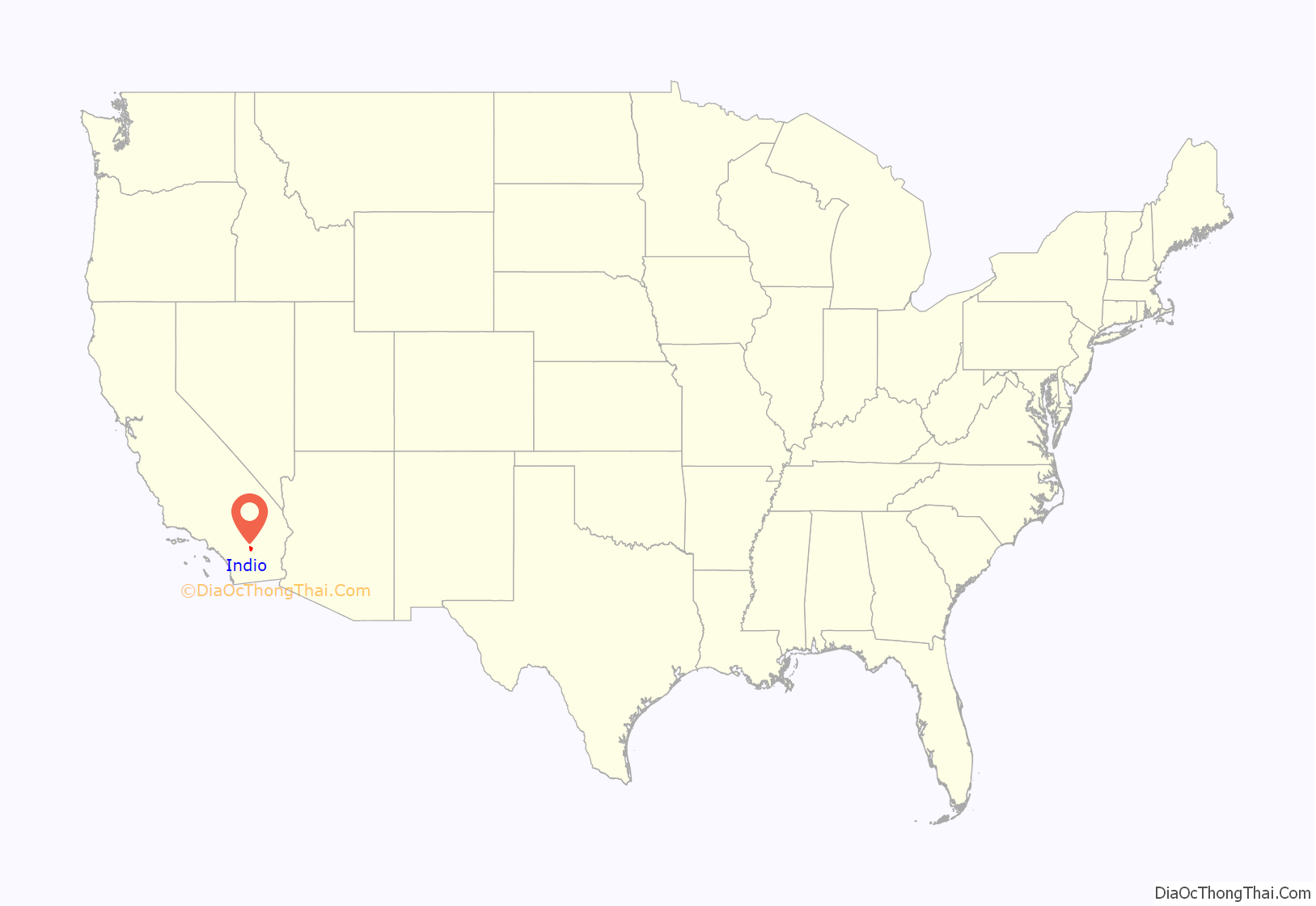
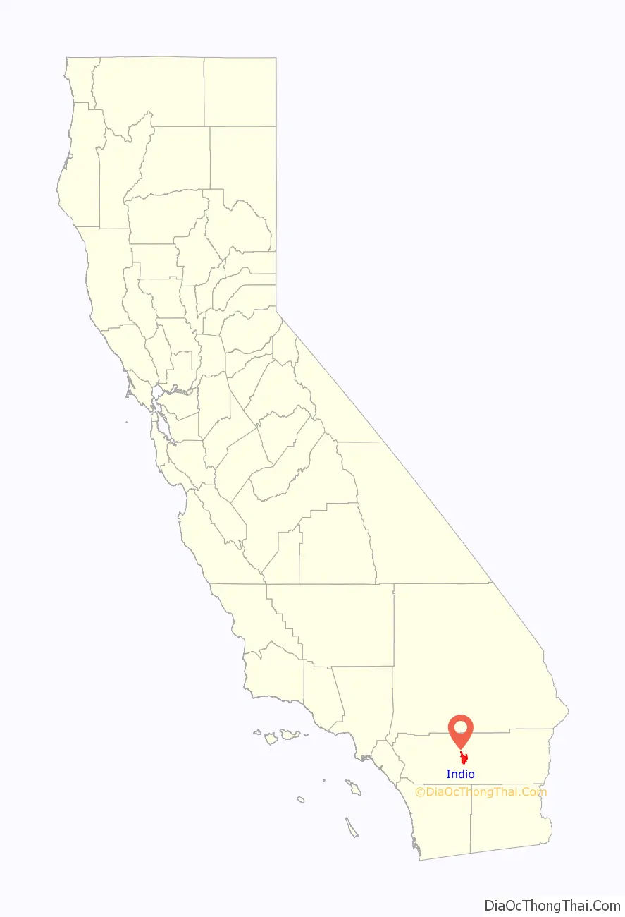
Indio location map. Where is Indio city?
History
Indio is within the ancestral lands the Desert Cahuilla Indians whose headquarters is in Thermal, California.
Railroad line construction east out of Los Angeles began in 1873. Trains were operated to Colton on July 16, 1875, and to Indio (then Indian Wells) on May 29, 1876. Moving on eastward from Indio, the railroad reached the west bank of the Colorado River opposite Yuma on May 23, 1877 (a village known as Arizona City prior to 1873). There was a delay in getting military authority to lay tracks across the Yuma Indian reservation, and it was September that year before the bridge was completed so trains could operate into Yuma. The Southern Pacific Railroad was to have joined those of the Texas & Pacific, one of several railroads then holding, or seeking, federal authority to build lines from various sections of the country west to the Pacific Coast. But the rail-head of the T & P was at a standstill far off in Texas, so Southern Pacific continued building eastward.
The City of Indio came about because of the need for a halfway point for the Southern Pacific Railroad between Yuma, Arizona and Los Angeles, since the engines needed to be refilled with water. At first, the would-be city was called Indian Wells, but since many other areas already had that name, Indio (after a Spanish variation of the word “Indian”) was chosen instead. After the railroad’s arrival in 1876, Indio really started to grow. The first permanent building was the craftsman-style Southern Pacific Depot station and hotel. Southern Pacific tried to make life as comfortable as it could for their workers to keep them from leaving such a difficult area to live in at the time. It was at the center of all social life in the desert with a fancy dining room and hosting dances on Friday nights.
While Indio started as a railroad town, it soon became agricultural. Onions, cotton, grapes, citrus and dates thrived in the arid climate due to the ingenuity of farmers finding various means of attaining water, first through artesian wells and later through the valley’s branch of the All-American Canal. However, water also was a major problem for Indio and the city was flooded several times until the storm water canals were created throughout the Coachella Valley.
Businessmen and women found this last frontier land of the continental United States as an ideal place to start fresh. Dr. Harry Smiley and his wife Nell were early residents and stayed in Indio after their car broke down on the way to Los Angeles and became people of influence and helped shape the area. A. G. Tingman was an early store owner and first Postmaster of Indio, but also well known for taking advantage of miners as they headed to the mountains, selling at rather high prices. Later Dr. June Robertson McCarroll became a leading philanthropist and successful doctor in Indio. She was responsible along with the Indio Woman’s Club for pressuring California into adopting the placing of white lines down the streets after she was nearly hit one too many times by passing vehicles. Even though these early founders of the city are considered pioneers, they still partook in the lifestyles of their friends living in such areas as Los Angeles. Indio established itself quickly and kept up with the trends as they were brought in by the railroads.
By the turn of the 20th century, Indio was already more than a fading railroad town. Schools were built, the La Casita hospital provided medical services, and families established roots. By 1920, about one to two thousand year-round residents lived in Indio, while it ballooned from 2,500 to 5,000 during the winter months and was advertised as a health resort for senior citizens and those with respiratory diseases and ailments in the rest of the 20th century.
Indio also served as the home of the USDA’s Date Station, a place where leading scientific research was taking place on the fruit that would become a major part of the culture of Indio. The station started in 1907 and was responsible for the ability of local farmers to better understand this unique crop and make the Coachella Valley a leader in American date crops. This also created a tie to the Middle East that led to the theme for the County Fair with the Middle Eastern flair known as the Riverside County Fair and National Date Festival .
Coachella and Thermal soon became larger cities than Indio, but Indio remained the “Hub of the Valley”, as it was called. With the burning of the majority of Thermal and the decline of Coachella, Indio grew again. By 1930, Indio was a thriving area and incorporated. On September 6, 1930, storekeeper Fred Kohler received the first business license in Indio.
Indio was also aided by the visiting soldiers from Patton’s training grounds in Chiriaco Summit located 30 miles to the east.
In the second half of the 20th century, Indio saw another decline as the valley’s population begin to move west towards newer cities such as Palm Desert. However, there is now a reversal in this trend.
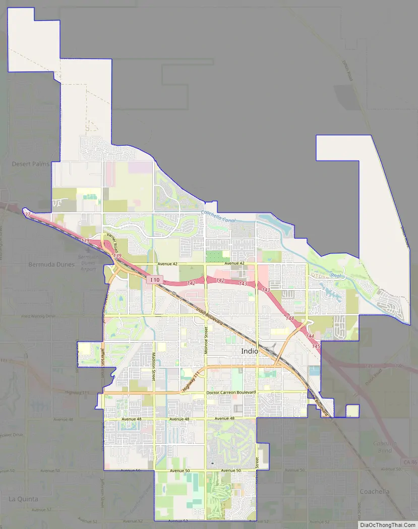
Indio Road Map
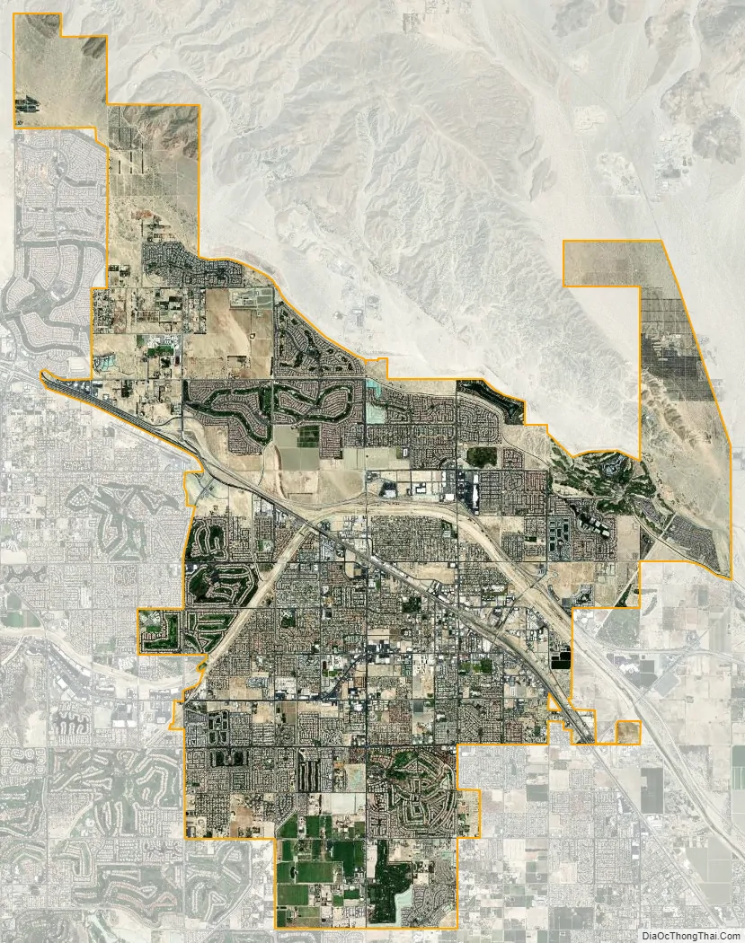
Indio city Satellite Map
Geography
Indio is located at 33°43′12″N 116°13′55″W / 33.72000°N 116.23194°W / 33.72000; -116.23194 (33.719871, −116.231889). According to the United States Census Bureau, the city has a total area of 75.6 square kilometers (29 sq mi), 99.97% of which is land and 0.03% is water.
The telephone area code is 760. The city’s ZIP codes are 92201 and 92203 north of Interstate 10. About 3 miles (5 km) north and east of Indio is the San Andreas Fault, a major tectonic plate boundary of the Pacific and North American plates.
Indio is home of Riverside County’s eastern administration offices. Palm Springs had more people from 1955 to 1992, when the US census announced that Indio surpassed Palm Springs and that title was returned to them. The official elevation of Indio is below sea level; the city hall is 14 feet (4 m) below sea level, as the eastern half of the Coachella Valley drops as low as 150 feet (50 m) below sea level (the lakeshore of the Salton Sea is 15 miles (24 km) south of Indio).
Climate
The climate of the Coachella Valley is influenced by the surrounding geography. High mountain ranges on three sides contribute to its unique and year-round warm climate, with some of warmest winters west of the Rocky Mountains. Indio has a warm winter/hot summer desert climate (Köppen: BWh): Its average annual high temperature is 89.5 °F (31.9 °C) and average annual low is 62.1 °F (16.7 °C) but summer highs above 108 °F (42 °C) are common and sometimes exceed 120 °F (49 °C), while summer night lows often stay above 82 °F (28 °C). Monsoon related thunderstorms can occur in the summer months. In September 1939, a thunderstorm from the remains of a tropical storm, brought more than 6″ of rain in less than 24 hours. Winters are warm with daytime highs often between 68–86 °F (20–30 °C). Under 4 inches (100 mm) of annual precipitation are average, with over 348 days of sunshine per year. The hottest temperature ever recorded there was 125 °F (52 °C) on July 6, 1905. The mean annual temperature is 75.8 °F (24.3 °C).
Nature and wildlife
Indio is in the Colorado Desert region of the Sonoran Desert. It is adjacent to the geologic Salton Sink and within the site of historic Lake Cahuilla of the Lower Colorado River Valley. Indio is an official National Bird Sanctuary, because of the seasonal bird migration flight routes that cross the town en route to the Salton Sea.
- Geography of the Colorado Desert
- Fauna of the Colorado Desert
- Sonoran Desert wildflowers
See also
Map of California State and its subdivision:- Alameda
- Alpine
- Amador
- Butte
- Calaveras
- Colusa
- Contra Costa
- Del Norte
- El Dorado
- Fresno
- Glenn
- Humboldt
- Imperial
- Inyo
- Kern
- Kings
- Lake
- Lassen
- Los Angeles
- Madera
- Marin
- Mariposa
- Mendocino
- Merced
- Modoc
- Mono
- Monterey
- Napa
- Nevada
- Orange
- Placer
- Plumas
- Riverside
- Sacramento
- San Benito
- San Bernardino
- San Diego
- San Francisco
- San Joaquin
- San Luis Obispo
- San Mateo
- Santa Barbara
- Santa Clara
- Santa Cruz
- Shasta
- Sierra
- Siskiyou
- Solano
- Sonoma
- Stanislaus
- Sutter
- Tehama
- Trinity
- Tulare
- Tuolumne
- Ventura
- Yolo
- Yuba
- Alabama
- Alaska
- Arizona
- Arkansas
- California
- Colorado
- Connecticut
- Delaware
- District of Columbia
- Florida
- Georgia
- Hawaii
- Idaho
- Illinois
- Indiana
- Iowa
- Kansas
- Kentucky
- Louisiana
- Maine
- Maryland
- Massachusetts
- Michigan
- Minnesota
- Mississippi
- Missouri
- Montana
- Nebraska
- Nevada
- New Hampshire
- New Jersey
- New Mexico
- New York
- North Carolina
- North Dakota
- Ohio
- Oklahoma
- Oregon
- Pennsylvania
- Rhode Island
- South Carolina
- South Dakota
- Tennessee
- Texas
- Utah
- Vermont
- Virginia
- Washington
- West Virginia
- Wisconsin
- Wyoming


