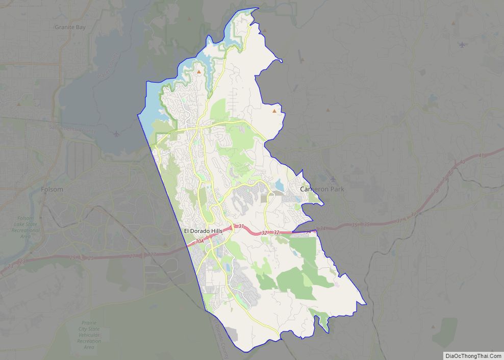
El Dorado Hills (El Dorado, Spanish for “The Golden”) is an unincorporated town and census-designated place in El Dorado County, California. Located in the Greater Sacramento region of Northern California, it had a population was 50,547 at the 2020 census, up from 42,108 at the 2010 census. El Dorado Hills is primarily an affluent suburb of Sacramento.
| Name: | El Dorado Hills CDP |
|---|---|
| LSAD Code: | 57 |
| LSAD Description: | CDP (suffix) |
| State: | California |
| County: | El Dorado County |
| Elevation: | 768 ft (234 m) |
| Total Area: | 48.606 sq mi (125.888 km²) |
| Land Area: | 48.454 sq mi (125.494 km²) |
| Water Area: | 0.152 sq mi (0.394 km²) 0.31% |
| Total Population: | 50,547 |
| Population Density: | 1,000/sq mi (400/km²) |
| ZIP code: | 95762 |
| FIPS code: | 0621880 |
Online Interactive Map
Click on ![]() to view map in "full screen" mode.
to view map in "full screen" mode.
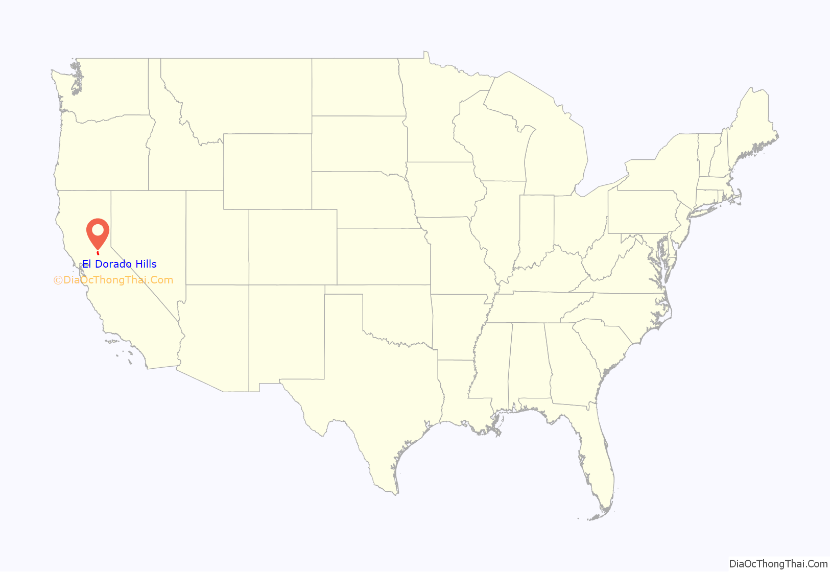
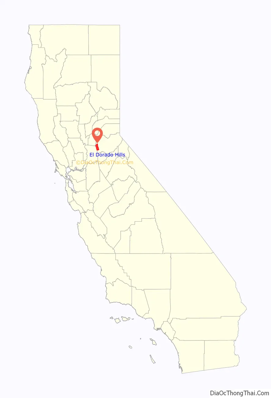
El Dorado Hills location map. Where is El Dorado Hills CDP?
History
During the California Gold Rush, gold was washed down the South Fork of the American River, into areas now in El Dorado Hills and Folsom, but farming and ranching supplanted mining or panning for gold. Portions of two Pony Express routes in this area from 1860 to 1861 remain as modern El Dorado Hills roads.
The modern history of El Dorado Hills dates back to the early 1960s when original developer Allan Lindsey began its development as a master-planned community. The original master plan, prepared by architect Victor Gruen, covered the area generally north of U.S. Highway 50, and part of the area south of US 50 now considered to be part of the community. El Dorado Hills was envisioned as a large-scale master-planned community that would be completely planned from its inception as a group of residential “villages”. Other land uses in the master plan included a business park, 18-hole golf course, community parks, schools, a community shopping center, and small commercial centers in each village. The master plan emphasized open space between villages and the opportunity for outdoor recreation.
Between the late 1960s and mid-1990s, growth occurred at a moderate pace as new families relocated from Sacramento, Southern California and the Bay Area. This growth consisted primarily of residential housing, as retail developments were limited to two shopping centers on the corners Green Valley & Francisco and El Dorado Hills Boulevard & US 50. Each neighborhood created during this time period was given a name and referred to as a “village” by local inhabitants. The original villages of El Dorado Hills include Ridgeview, Park, Saint Andrews, Crown, and Governors. In the 1980s and 1990s, the major part of Lake Hills Estates north of Green Valley Road was reorganized into Lake Forest Village, containing the neighborhoods of Waterford, The Summit, Green Valley Hills, Winterhaven, Marina Woods and Windsor Point. Additional villages that have developed subsequently include Fairchild, Sterlingshire, Highland Hills, Highland View, Bridlewood, Hills of El Dorado, Woodridge, Laurel Oaks and the master-planned community of Serrano.
The El Dorado Hills Town Center, just south of US 50, is a mixed-use project developed by The Mansour Company. Occupying 100 acres of land and, at completion, one million square feet of buildings, it is the center of town and of the region.
El Dorado Hills Road Map
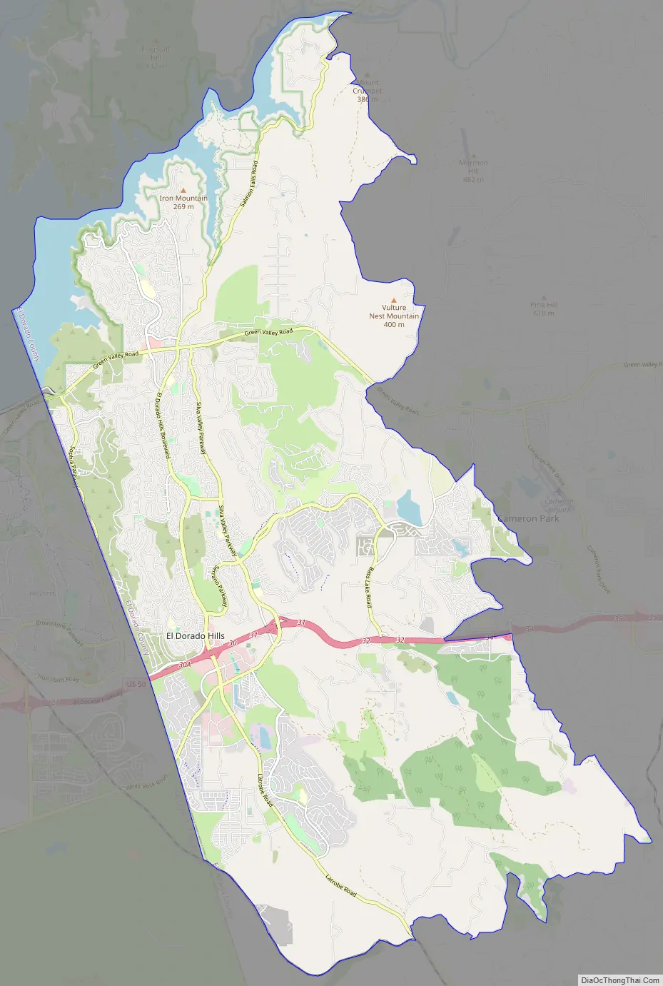
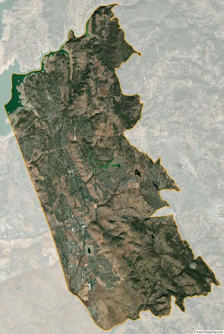
El Dorado Hills city Satellite Map
Geography
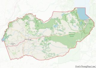
El Dorado Hills (EDH), as defined by the 2010 census-designated place (CDP), is at the western border of El Dorado County, between the City of Folsom and the unincorporated community of Cameron Park. The northern limits of the CDP are Folsom Lake and the South Fork of the American River, where river rafters use Skunk Hollow and Salmon Falls as takeout landings. West of Latrobe Road, the south edge of the CDP follows railroad tracks formerly used by the Southern Pacific between the cities of Folsom and Placerville. East of Latrobe Road the south edge follows topography running roughly east–west.
The 2010 CDP has a land area of 48.606 square miles (125.89 km), more than double the size of its boundaries in 2000 CDP, which was 17.9 square miles (46 km).
The subsurface environment of El Dorado Hills is relatively free of groundwater and soil contamination, based upon an areawide analysis of the potential for pesticide contamination and evaluation of underground storage tanks.(Earth Metrics, 1989)
Climate
According to the Köppen climate classification, El Dorado Hills has a hot-summer Mediterranean climate (abbreviated Csa).
See also
Map of California State and its subdivision:- Alameda
- Alpine
- Amador
- Butte
- Calaveras
- Colusa
- Contra Costa
- Del Norte
- El Dorado
- Fresno
- Glenn
- Humboldt
- Imperial
- Inyo
- Kern
- Kings
- Lake
- Lassen
- Los Angeles
- Madera
- Marin
- Mariposa
- Mendocino
- Merced
- Modoc
- Mono
- Monterey
- Napa
- Nevada
- Orange
- Placer
- Plumas
- Riverside
- Sacramento
- San Benito
- San Bernardino
- San Diego
- San Francisco
- San Joaquin
- San Luis Obispo
- San Mateo
- Santa Barbara
- Santa Clara
- Santa Cruz
- Shasta
- Sierra
- Siskiyou
- Solano
- Sonoma
- Stanislaus
- Sutter
- Tehama
- Trinity
- Tulare
- Tuolumne
- Ventura
- Yolo
- Yuba
- Alabama
- Alaska
- Arizona
- Arkansas
- California
- Colorado
- Connecticut
- Delaware
- District of Columbia
- Florida
- Georgia
- Hawaii
- Idaho
- Illinois
- Indiana
- Iowa
- Kansas
- Kentucky
- Louisiana
- Maine
- Maryland
- Massachusetts
- Michigan
- Minnesota
- Mississippi
- Missouri
- Montana
- Nebraska
- Nevada
- New Hampshire
- New Jersey
- New Mexico
- New York
- North Carolina
- North Dakota
- Ohio
- Oklahoma
- Oregon
- Pennsylvania
- Rhode Island
- South Carolina
- South Dakota
- Tennessee
- Texas
- Utah
- Vermont
- Virginia
- Washington
- West Virginia
- Wisconsin
- Wyoming