Florin is a census-designated place (CDP) in Sacramento County, California, United States. It is part of the Sacramento–Roseville–Folsom Metropolitan Statistical Area. The population was 52,388 at the 2020 census, up from 47,513 at the 2010 census and 27,653 at the 2000 census.
| Name: | Florin CDP |
|---|---|
| LSAD Code: | 57 |
| LSAD Description: | CDP (suffix) |
| State: | California |
| County: | Sacramento County |
| Elevation: | 33 ft (10 m) |
| Total Area: | 8.703 sq mi (22.54 km²) |
| Land Area: | 8.703 sq mi (22.54 km²) |
| Water Area: | 0 sq mi (0 km²) 0% |
| Total Population: | 52,388 |
| Population Density: | 6,000/sq mi (2,300/km²) |
| ZIP code: | 95828 |
| Area code: | 916, 279 |
| FIPS code: | 0624498 |
| GNISfeature ID: | 0277515 |
Online Interactive Map
Click on ![]() to view map in "full screen" mode.
to view map in "full screen" mode.
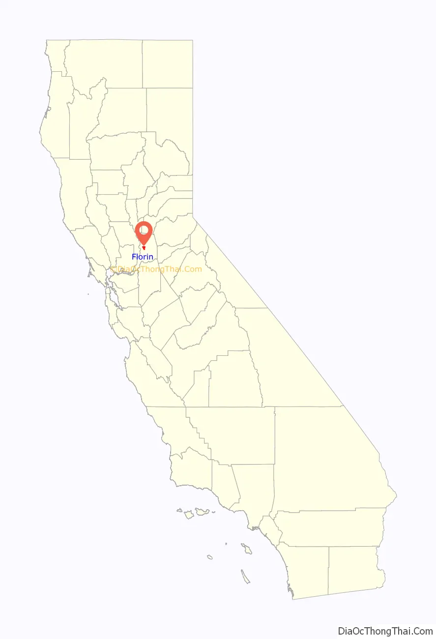
Florin location map. Where is Florin CDP?

History
Prewar
During the early 20th century Florin’s economy focused on agricultural production. Strawberries were the most common produce grown. Japanese immigrants were the dominant group in Florin and they were the predominant farmers in Florin, making the area noted for being a Japanese immigrant community. This immigrant group’s rendering of land in Florin had some popular renown. “In his report to Governor William Stephens, Colonel John P. Irish, president of the California Delta Association, described Japanese triumph: ‘They [the Californians] had seen the Japanese convert the barren land like that at Florin and Livingston into productive and profitable fields, orchards and vineyards, and intelligence of their industry.'”
The presence of Japanese immigrants in Florin was not always met with such good will as expressed by Colonel Irish. “As soon as a Jap can produce a lease,” the Sacramento Bee warned, “he is entitled to a wife. He sends a copy of his lease back home and gets a picture bride and they increase like rats. Florin [a valley farming town] is producing 85 American-born Japs a year.” This article was in critical response to the Gentlemen’s Agreement of 1907 between the US and Japan.
World War II
Local and federal treatment of Nisei (Japanese immigrants and US-born Japanese Americans) in Florin took a drastic downturn upon the bombing of Pearl Harbor and the subsequent war between the US and Japan. At the time, about 2,500 Florin residents were Nikkei, forming a majority of the town’s population. With a little fear and a lot of racial hostility, the federal government sent Japanese and Japanese Americans to internment camps according to FDR’s Executive Order 9066. Florin Japanese American resident and educator Mary Tsukamoto recalled “everyone was given short notice for removal. Signs had been nailed to the telephone poles saying that we had to report to various spots.” Florin’s Japanese and Japanese American residents were forced to “register as families. We had to report to the Elk Grove Masonic Building where we were given our family numbers, No. 2076.” The Elk Grove Masonic Building referred to by Tsukamoto was located in neighboring Elk Grove near a railroad station where the Florin residents were shipped in rail cars to distribution hubs. At these distribution hubs Florin’s residents of Japanese descent were then sent to internment camps far from the coast.
The internment forever changed the character of Florin. Japanese and Japanese American residents had to sell their property within only a few days and often at prices far below their fair market value. When the Japanese and Japanese Americans were released from the internment camps some were able to return to Florin and start over. Most had to move on to other areas. Florin ceased to be a Japanese American community as it was before the internment.
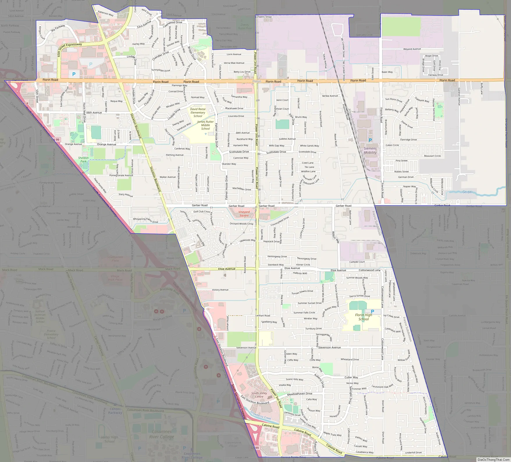
Florin Road Map
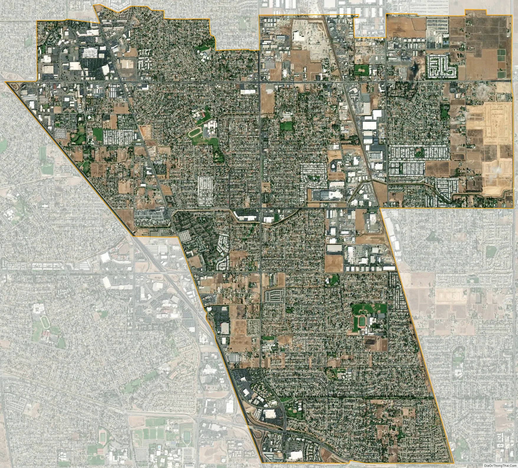
Florin city Satellite Map
Geography
Florin is located at 38°29′25″N 121°24′39″W / 38.49028°N 121.41083°W / 38.49028; -121.41083 (38.490157, -121.410862).
According to the United States Census Bureau, the CDP has a total area of 8.7 square miles (23 km), all of it land.
See also
Map of California State and its subdivision:- Alameda
- Alpine
- Amador
- Butte
- Calaveras
- Colusa
- Contra Costa
- Del Norte
- El Dorado
- Fresno
- Glenn
- Humboldt
- Imperial
- Inyo
- Kern
- Kings
- Lake
- Lassen
- Los Angeles
- Madera
- Marin
- Mariposa
- Mendocino
- Merced
- Modoc
- Mono
- Monterey
- Napa
- Nevada
- Orange
- Placer
- Plumas
- Riverside
- Sacramento
- San Benito
- San Bernardino
- San Diego
- San Francisco
- San Joaquin
- San Luis Obispo
- San Mateo
- Santa Barbara
- Santa Clara
- Santa Cruz
- Shasta
- Sierra
- Siskiyou
- Solano
- Sonoma
- Stanislaus
- Sutter
- Tehama
- Trinity
- Tulare
- Tuolumne
- Ventura
- Yolo
- Yuba
- Alabama
- Alaska
- Arizona
- Arkansas
- California
- Colorado
- Connecticut
- Delaware
- District of Columbia
- Florida
- Georgia
- Hawaii
- Idaho
- Illinois
- Indiana
- Iowa
- Kansas
- Kentucky
- Louisiana
- Maine
- Maryland
- Massachusetts
- Michigan
- Minnesota
- Mississippi
- Missouri
- Montana
- Nebraska
- Nevada
- New Hampshire
- New Jersey
- New Mexico
- New York
- North Carolina
- North Dakota
- Ohio
- Oklahoma
- Oregon
- Pennsylvania
- Rhode Island
- South Carolina
- South Dakota
- Tennessee
- Texas
- Utah
- Vermont
- Virginia
- Washington
- West Virginia
- Wisconsin
- Wyoming


