Glendale is a city in the San Fernando Valley and Verdugo Mountains regions of Los Angeles County, California, United States. At the 2020 U.S. Census the population was 196,543, up from 191,719 at the 2010 census, making it the fourth-largest city in Los Angeles County and the 24th-largest city in California. It is located about 10 miles (16 km) north of downtown Los Angeles.
Glendale lies in the Verdugo Mountains, and is a suburb in the Los Angeles metropolitan area. The city is bordered to the northwest by the Sun Valley and Tujunga neighborhoods of Los Angeles; to the northeast by La Cañada Flintridge and the unincorporated area of La Crescenta; to the west by Burbank and Griffith Park; to the east by Eagle Rock and Pasadena; to the south by the Atwater Village neighborhood of Los Angeles; and to the southeast by Glassell Park neighborhood of Los Angeles. The Golden State, Ventura, Glendale, and Foothill freeways run through the city.
| Name: | Glendale city |
|---|---|
| LSAD Code: | 25 |
| LSAD Description: | city (suffix) |
| State: | California |
| County: | Los Angeles County |
| Incorporated: | February 15, 1906 |
| Elevation: | 522 ft (159 m) |
| Total Area: | 30.60 sq mi (79.25 km²) |
| Land Area: | 30.47 sq mi (78.92 km²) |
| Water Area: | 0.13 sq mi (0.33 km²) 0.43% |
| Total Population: | 196,543 |
| Population Density: | 6,450.4/sq mi (2,519.7/km²) |
| Area code: | 747 and 818 |
| FIPS code: | 0630000 |
| Website: | glendaleca.gov |
Online Interactive Map
Click on ![]() to view map in "full screen" mode.
to view map in "full screen" mode.
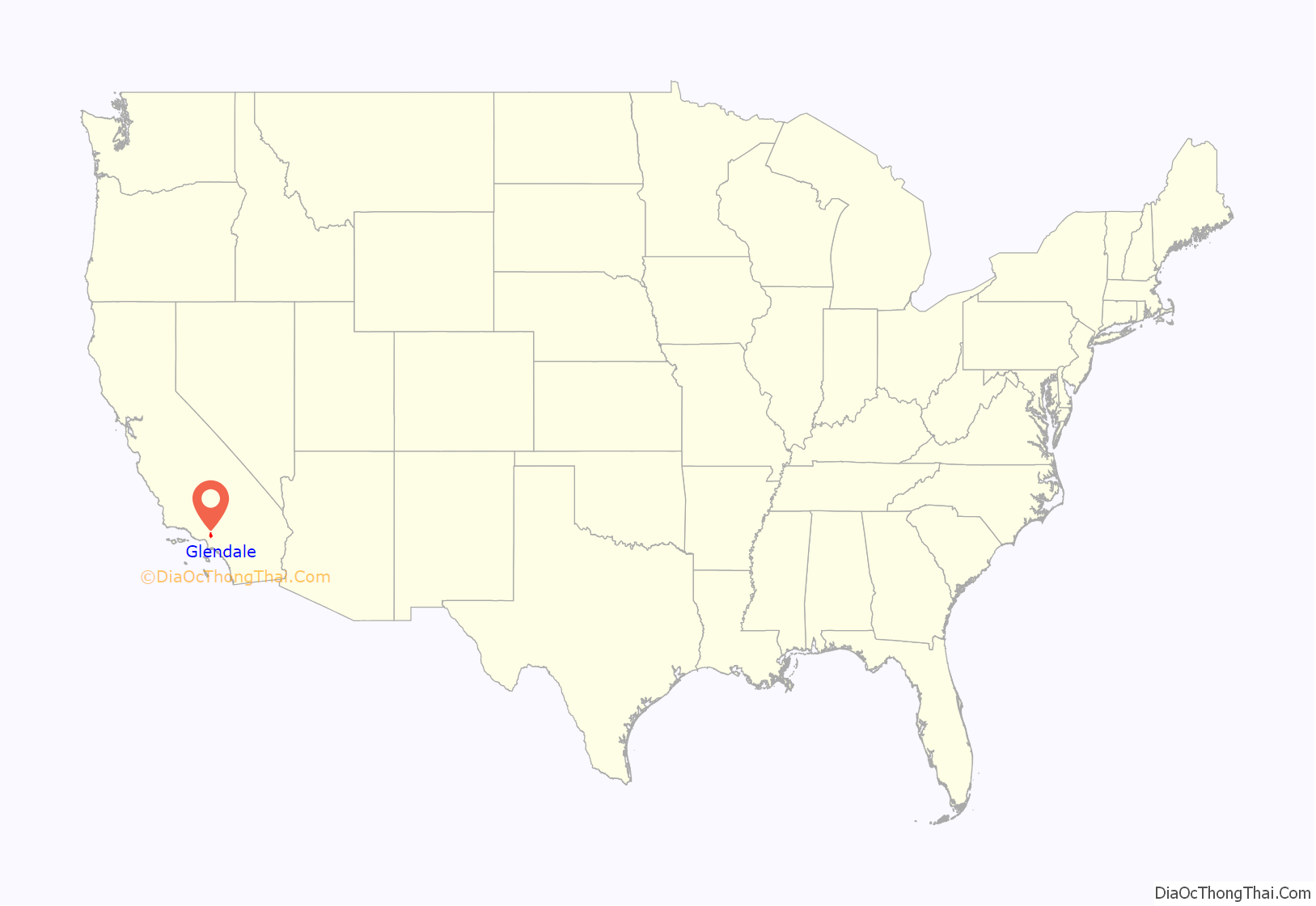
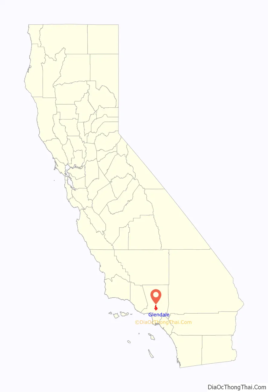
Glendale location map. Where is Glendale city?
History
Spanish rule
In 1798, José María Verdugo, a corporal in the Spanish army from Baja California, received the Rancho San Rafael from Governor Diego de Borica, formalizing his possession and use of land on which he had been grazing livestock and farming since 1784. Rancho San Rafael was a Spanish concession, of which 25 were made in California. Unlike the later Mexican land grants, the concessions were similar to grazing permits, with the title remaining with the Spanish crown.
Mexican rule
New Spain achieved its independence from the Spanish Empire in 1821, and from 1824, Rancho San Rafael existed within the new Mexican Republic.
1847 to present
Mexican rule ended during the Mexican–American War: Americans took control from the Californios after a series of battles, culminating with the signing of the Treaty of Cahuenga on January 13, 1847. With the cession of California to the United States following the Mexican–American War, the 1848 Treaty of Guadalupe Hidalgo provided that the land grants would be honored. As required by the Land Act of 1851, a claim was filed with the Public Land Commission in 1852, confirmed by the Commission in 1855, and the grant was patented to Julio and Catalina Verdugo in 1882.
In 1860, José María Verdugo’s grandson Teodoro Verdugo built the Catalina Verdugo Adobe, which is the oldest building in Glendale. The property is the location of the Oak of Peace, where early Californio leaders including Pio Pico met in 1847 and decided to surrender to Lieutenant Colonel John C. Frémont.
Verdugo’s descendants sold the ranch in various parcels, some of which are included in present-day Atwater Village, Eagle Rock, and Highland Park neighborhoods of Los Angeles.
In 1883, soon after Atwater Village was settled, the Atwater Tract Office brought train service to the area. In 1884, residents gathered to form a townsite and chose the name “Glendale”. It was bounded by First Street (now Lexington Drive) on the north, Fifth Street (now Harvard Street) on the south, Central Avenue on the west, and the Childs Tract on the east. Residents to the southwest formed “Tropico” in 1887.
An important civic booster of the era was Leslie Coombs Brand (1859–1925), who built an estate in 1904 called El Miradero, featuring an eye-catching mansion, the architecture of which combined characteristics of Spanish, Moorish, and Indian styles, copied from the East Indian Pavilion at the 1893 World’s Columbian Exposition held in Chicago, which he visited.
Brand partnered with Henry E. Huntington to bring the Pacific Electric Railway, or the “Red Cars”, to the area. The Glendale–Burbank Line, which was operational from 1904 to 1955, ran from Downtown Los Angeles to Burbank via Glendale. The dual-track streetcars entered the Glendale city limit by crossing San Fernando Road, and the line continued northerly in the pavement of Brand Boulevard, crossing Los Feliz Boulevard, Chevy Chase Boulevard, Colorado Boulevard, Broadway and Lexington Drive. The main line continued north to Verdugo Wash where the line became a single track. At Arden Junction at Glenoaks Boulevard, the line branched. The old main line continued north in the pavement of Brand Boulevard to a terminus in North Glendale at Mountain Avenue. The Burbank Line diverged westerly as a single-track line on private way in the center of Glenoaks Boulevard, then continued westerly past Central, Pacific, Highland, western, and Alameda Avenues to a terminus in Burbank at Cypress Avenue.
Brand loved to fly, and built a private airstrip in 1919 and hosted “fly-in” parties, providing a direct link to the soon-to-be-built nearby Grand Central Airport. The grounds of El Miradero are now city-owned Brand Park and the mansion is the Brand Library, according to the terms of his will.
The Forest Lawn Cemetery opened in 1906 and was renamed Forest Lawn Memorial-Park in 1917. Pioneering endocrinologist and entrepreneur Henry R. Harrower opened his clinic in Glendale in 1920, which for many years was the largest business in the city.
In 1922, the Atwater Tract Office was demolished, and construction began on the Glendale Transportation Center.
The city flag was adopted by Glendale on September 18, 1924, and was designed by Hugh A. Maron, who also won $100 dollars for designing it. The flag was then changed to the current one (seen above) in 2001.
The American Green Cross, an early conservation and tree preservation society, was formed in 1926 (it disbanded three years later and the current organization of that name is unrelated).
Grand Central Airport was the departure point for the first commercial west-to-east transcontinental flight flown by Charles Lindbergh.
Sundown town status
Until as late as the 1960s, Glendale was a sundown town. Nonwhites were required to leave city limits by a certain time each day or risk arrest and possible violence. In the 1930s, Glendale and Burbank prevented the Civilian Conservation Corps from stationing African American workers in a local park, citing sundown town ordinances that both cities had adopted. In 1964, Glendale was selected by George Lincoln Rockwell to be the West Coast headquarters of the American Nazi Party. After a legal battle with the city of Glendale, the party moved their headquarters to El Monte in 1966.
The emergence of increasingly visible ethnic groups — including Armenians, Cubans and Filipinos and Koreans — changed the official discourse in Glendale. In 1972, C.E. Perkins, then city manager, encouraged the Rotary Club of Glendale to prepare itself as the city could no longer remain isolated in an increasingly diverse America.
Historic architecture
Glendale began its historic preservation program in 1977 with the designation of 28 properties as city landmarks. In 1997, the program evolved with the establishment of the Glendale Register of Historic Resources. The register now has over 100 properties. In addition, 11 properties in Glendale are listed on the National Register of Historic Places. The city’s most honored historic properties include the Catalina Verdugo Adobe, Brand Library & Art Center, Glendale Southern Pacific Railroad Depot, Grand Central Air Terminal, and Alex Theatre.
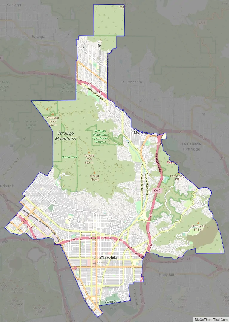
Glendale Road Map
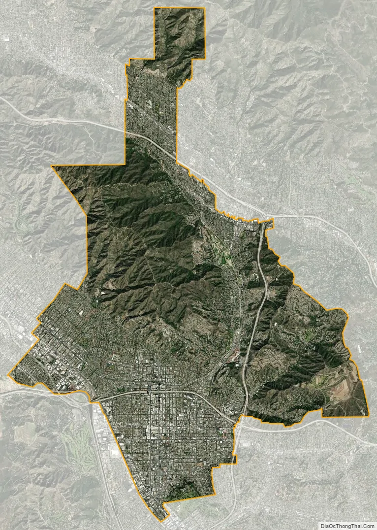
Glendale city Satellite Map
Geography
Glendale is located in the southeastern San Fernando Valley. According to the United States Census Bureau, the city has a total area of 30.6 sq mi (79.212 km); 30.5 square miles (79 km) of it is land and 0.13 square miles (0.34 km) of it (0.43%) is covered by water. Glendale is the fourth largest city within Los Angeles County. It is bordered to the north by the foothill communities of La Cañada Flintridge, La Crescenta, and Tujunga; to the south by the Atwater Village and Glassell Park communities incorporated by the city of Los Angeles; to the east by Pasadena and Eagle Rock (also incorporated within Los Angeles); and to the west by Griffith Park and the city of Burbank. Glendale is located 10 miles (16 km) north of downtown Los Angeles.
Geology
Several known earthquake faults criss-cross the Glendale area and adjacent mountains, as in much of Southern California. Among the more recognized faults are the Sierra Madre and Hollywood faults, situated in the city’s northern and southwestern portions, respectively. Additionally, the Verdugo and Raymond faults intersect through the city’s central and southeastern areas. The San Gabriel fault, meanwhile, is located northeast of the city. Roughly 75 miles (121 km) northeast of Glendale is a major portion of the San Andreas Fault known as the “Big Bend”, where quake-recurrence tracking shows major activity roughly every 140–160 years. The closest portion of the San Andreas is actually 29 miles (47 km) from Glendale. The last major quake along the southern San Andreas was recorded in 1857.
In the 1971 San Fernando earthquake, which took place along the western edge of the Sierra Madre Fault, surface ruptures were nearly 12 miles (19 km) long, including one portion a few miles northwest of Glendale. Most of the damage was in the northern San Fernando Valley, though 31 structures in Glendale suffered major damage and had to be demolished, plus numerous chimneys collapsed. The 1994 Northridge earthquake had an epicenter about 18 miles (29 km) from Glendale. The city suffered severe damage to a public parking structure and sections of the Glendale Galleria parking structures and exterior columns incurred damages.
Climate
Glendale has a Mediterranean climate (Köppen climate classification: Csa), with hot summers and mild winters with occasional rainfall. The highest recorded temperature in Glendale was 115 °F (46 °C) on September 6, 2020. The lowest recorded temperature was 17 °F (−8 °C) on February 15, 1990. The warmest month is August and the coolest month is January.
The annual average precipitation is just over 21 inches (530 mm), mostly falling between November and April. Rainfall totals are highly variable from year to year, with the wettest years (sometimes over 30 inches (760 mm) of rainfall) usually associated with warm El Niño conditions, and the drier years (sometimes under 10 inches (250 mm) of rainfall) with cool La Niña episodes in the Pacific.
The hills and mountains of northern Glendale very rarely have snow, owing to its warmer temperatures during the winter. It may only occur about every five to ten years. The last time it snowed was February 26, 2011, in which snow accumulation of approximately 3 inches (7.6 cm) occurred and sleet was present. Frost sometimes occurs at night from late November to early March. Heavy rains and thunderstorms are also common during the winter. The spring brings pleasant weather, with very little rain. The summer is usually fairly warm, with highs from 85 °F (29 °C), to the low 100s (40 °C). Summer is usually very dry, but thunderstorms can come from Arizona, bringing high humidity into the area. These rare days cause heat indices over 120 °F (49 °C). Fall brings nice weather, but can be gusty due to the Santa Ana winds, blowing in once or twice a year from October to December. Santa Ana winds can reach up to 70 miles per hour (110 km/h), with gusts up to 100 miles per hour (160 km/h) in mountain passes and canyons. Thunderstorms occur very rarely and they are accompanied by gusty winds and hail.
See also
Map of California State and its subdivision:- Alameda
- Alpine
- Amador
- Butte
- Calaveras
- Colusa
- Contra Costa
- Del Norte
- El Dorado
- Fresno
- Glenn
- Humboldt
- Imperial
- Inyo
- Kern
- Kings
- Lake
- Lassen
- Los Angeles
- Madera
- Marin
- Mariposa
- Mendocino
- Merced
- Modoc
- Mono
- Monterey
- Napa
- Nevada
- Orange
- Placer
- Plumas
- Riverside
- Sacramento
- San Benito
- San Bernardino
- San Diego
- San Francisco
- San Joaquin
- San Luis Obispo
- San Mateo
- Santa Barbara
- Santa Clara
- Santa Cruz
- Shasta
- Sierra
- Siskiyou
- Solano
- Sonoma
- Stanislaus
- Sutter
- Tehama
- Trinity
- Tulare
- Tuolumne
- Ventura
- Yolo
- Yuba
- Alabama
- Alaska
- Arizona
- Arkansas
- California
- Colorado
- Connecticut
- Delaware
- District of Columbia
- Florida
- Georgia
- Hawaii
- Idaho
- Illinois
- Indiana
- Iowa
- Kansas
- Kentucky
- Louisiana
- Maine
- Maryland
- Massachusetts
- Michigan
- Minnesota
- Mississippi
- Missouri
- Montana
- Nebraska
- Nevada
- New Hampshire
- New Jersey
- New Mexico
- New York
- North Carolina
- North Dakota
- Ohio
- Oklahoma
- Oregon
- Pennsylvania
- Rhode Island
- South Carolina
- South Dakota
- Tennessee
- Texas
- Utah
- Vermont
- Virginia
- Washington
- West Virginia
- Wisconsin
- Wyoming


