El Monte (Spanish for “The Mountain”) is a city in Los Angeles County, California, United States. The city lies in the San Gabriel Valley, east of the city of Los Angeles.
El Monte’s slogan is “Welcome to Friendly El Monte” and is historically known as “The End of the Santa Fe Trail”. As of the 2020 census, the city had a total population of 109,450, down from 113,475 at the 2010 census. As of 2020, El Monte was the 64th-largest city in California.
| Name: | El Monte city |
|---|---|
| LSAD Code: | 25 |
| LSAD Description: | city (suffix) |
| State: | California |
| County: | Los Angeles County |
| Incorporated: | November 18, 1912 |
| Elevation: | 299 ft (91 m) |
| Total Area: | 9.65 sq mi (24.99 km²) |
| Land Area: | 9.56 sq mi (24.77 km²) |
| Water Area: | 0.09 sq mi (0.22 km²) 0.89% |
| Total Population: | 109,450 |
| Population Density: | 11,341.97/sq mi (4,379.75/km²) |
| Area code: | 626 |
| FIPS code: | 0622230 |
| Website: | elmonteca.gov |
Online Interactive Map
Click on ![]() to view map in "full screen" mode.
to view map in "full screen" mode.
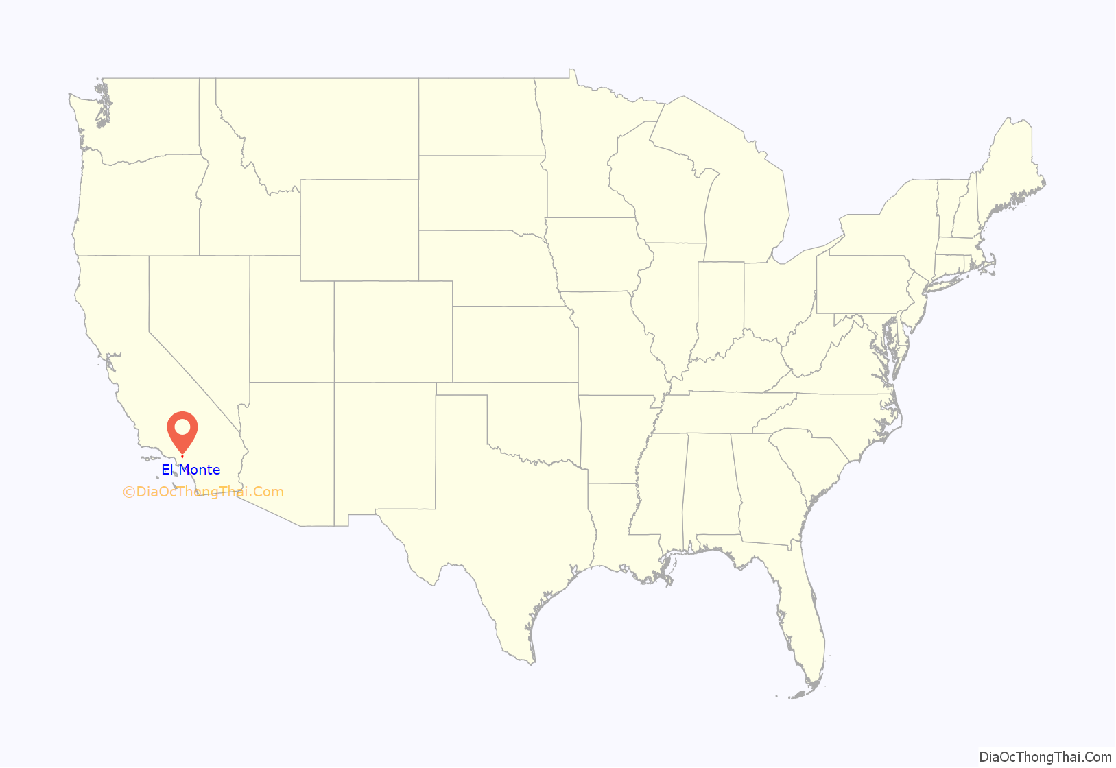
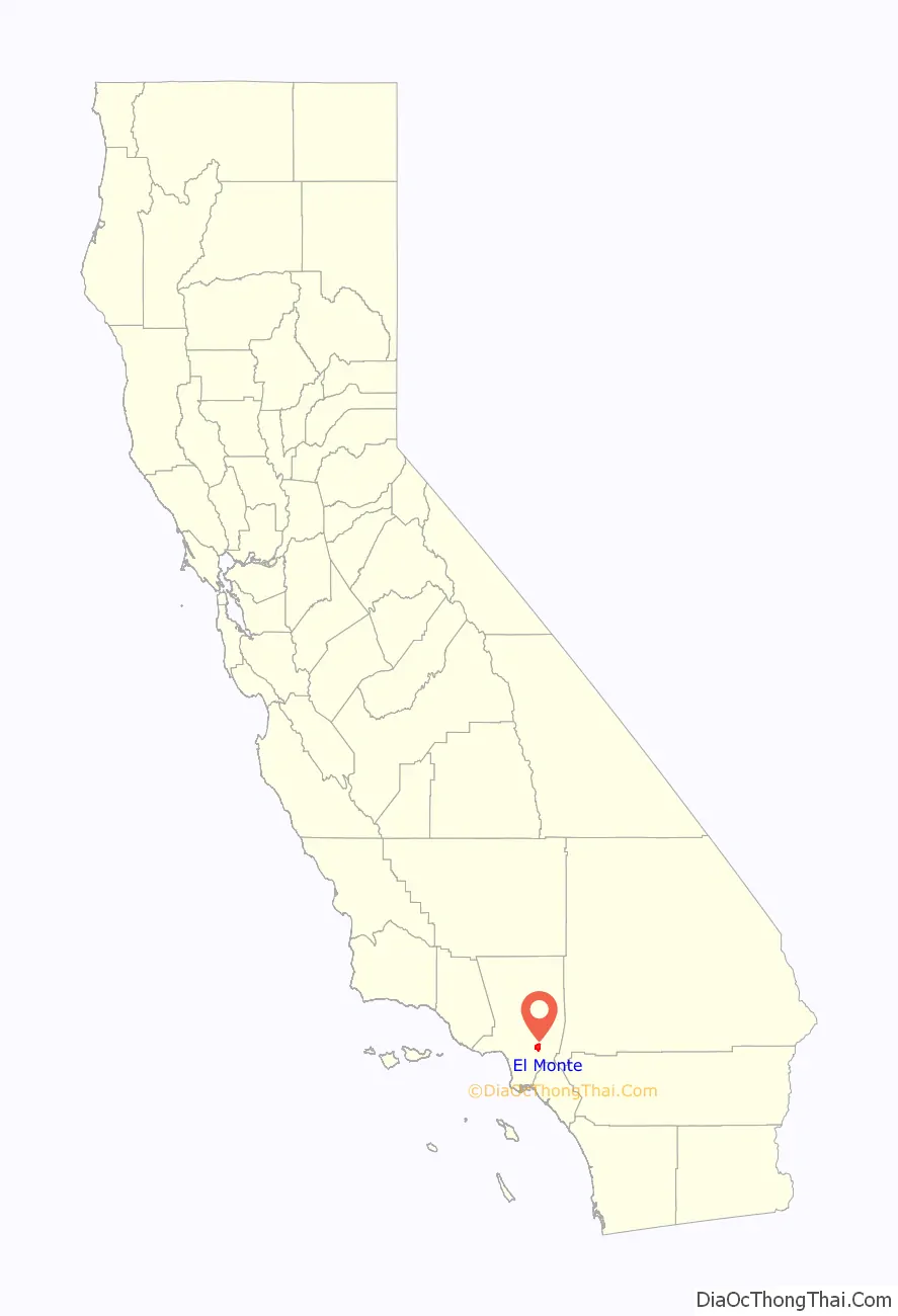
El Monte location map. Where is El Monte city?
History
The area, beside the San Gabriel River, is part of the homeland of the Tongva people as it has been for thousands of years. The Spanish Portolá expedition of missionaries and soldiers passed through the area in 1769–1770. Mission San Gabriel Arcángel was the center of colonial activities in the area. The site was within the Mexican land grant Rancho La Puente.
19th Century
The Old Spanish Trail trade route was first established by Antonio Armijo in 1829. It passed through El Monte to its terminus at the Mission San Gabriel via what is now Valley Boulevard. The trade was woolen and other products from New Mexico for California horses and mules.
Using the Old Spanish Trail route at the end of 1841, a group of travelers and settlers, now referred to as the Workman-Rowland Party, arrived in the Pueblo of Los Angeles and this area in Alta California from Santa Fe de Nuevo México. Rowland and Workman became grantees of the Rancho La Puente in 1845.
The Old Spanish Trail from Santa Fe was continued east via the Santa Fe Trail trade route, established in 1821 as a trail and wagon road connecting Kansas City in Missouri Territory to Santa Fe, still within México.
From 1847, the Santa Fe Trail was also connected westward through the Southern Emigrant Trail, and in 1848 by the Mormon Road from Utah, passing by the El Monte area, to the Pueblo of Los Angeles. Immigrant settlement began in 1848, El Monte was a stopping place for the American immigrants going to the gold fields during the California Gold Rush. The first permanent residents arrived in El Monte around 1849-1850 mostly from Texas, Arkansas and Missouri, during a time when thousands migrated to California in search of gold. The first settlers with families were Nicholas Schmidt, Ira W. Thompson, G. and F. Cuddeback, J. Corbin, and J. Sheldon.
These migrants ventured upon the bounty of fruitful, rich land along the San Gabriel River and began to build homesteads there. The farmers were very pleased at the increasing success of El Monte’s agricultural community, and it steadily grew over the years.
In the 1850s the settlement was briefly named Lexington by American settlers, but soon returned to being called El Monte or Monte. It was at the crossroad of routes between Los Angeles, San Bernardino, and the natural harbor at San Pedro. In the early days, it had a reputation as a rough town where men often settled disputes with knives and guns in its gambling saloons. Defense against Indian raids and the crimes of bandit gangs, such as that of Joaquin Murrieta, led to the formation of a local militia company called the Monte Rangers in February 1854. After the Monte Rangers disbanded, justice for Los Angeles County, in the form of volunteer posses, as in the 1857 hunt for the bandit gang of Juan Flores and Pancho Daniel, or a lynching, was often provided by the local vigilantes called the “El Monte Boys”.
In 1858 the adobe Monte Station was established, a stagecoach stop on the Butterfield Overland Mail Section 2 route.
By 1861 El Monte had become a sizeable settlement, and during the American Civil War was considered a Confederate stronghold sympathetic to the secession of Southern California from California to support the Confederate States of America. A. J. King an Undersheriff of Los Angeles County (and former member of the earlier “Monte Rangers” or “Monte Boys”) with other influential men in El Monte, formed a secessionist militia company, like the Los Angeles Mounted Rifles, called the Monte Mounted Rifles on March 23, 1861. However, the attempt failed when following the battle of Fort Sumter, A. J. King marched through the streets with a portrait of the Confederate General P. G. T. Beauregard and was arrested by a U.S. Marshal. State arms sent from Governor John G. Downey for the unit were held up by Union officers at the port of San Pedro. Union troops established New Camp Carleton near the town in March 1862 to suppress any rebellion, it was shut down three years later at the end of the war.
El Monte was listed as a township in the 1860 and 1870 Censuses, with a population of 1,004 in 1860 and 1,254 in 1870. The 1860 township comprised several of the old ranchos in the El Monte area, including Rancho Potrero Grande, Rancho La Puente and Rancho La Merced. (This area presently includes the cities of El Monte, Monterey Park and La Puente, among others). The 1870 census added in the former Azusa township.
Southern Pacific built a railroad depot in town in 1873, stimulating the growth of local agriculture.
20th Century
El Monte was incorporated as a municipality in 1912. During the 1930s, the city became a vital site for the New Deal’s federal Subsistence Homestead project, a Resettlement Administration program that helped grant single-family ranch houses to qualifying applicants. It became home to many 1930s white Americans from the Dust Bowl Migration.
Photographer Dorothea Lange took over a dozen photographs of the newly built Homestead homes for her work for the Farm Security Administration in Feb. 1936. Lange stopped in El Monte a month before she took her most well-known photograph from the period, the Migrant Mother. “In contrast to the apparently positive scene in El Monte… in San Luis Obispo County, Lange captured a far gloomier scene of a Native-American mother with her children.” San Gabriel Valley in Time observed.
The area also experienced social and labor conflict during this period, as the El Monte Berry Strike of 1933 shed light upon institutional racism experienced by Japanese tenant farmers and Latino farm laborers.
The city has evolved into a majority Hispanic community. Representing the historical significance of the Santa Fe Trail, El Monte built the Santa Fe Trail Historical Park in 1989, at Valley Blvd and Santa Anita Ave. The trail remained America’s greatest route for several decades thereafter. The El Monte Historical Museum at 3150 Tyler Avenue is considered to be one of the best community museums in the state of California.
21st Century
By 2008 there had been an influx of Asians into El Monte. Bang Tran, a resident of Monrovia and a former El Monte resident quoted in the Los Angeles Times, stated that year that there was overpopulation in Alhambra, Monterey Park, and other nearby heavily Asian municipalities; this is why Asians began moving to El Monte.
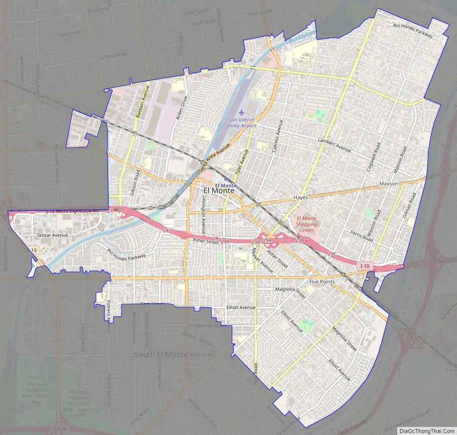
El Monte Road Map
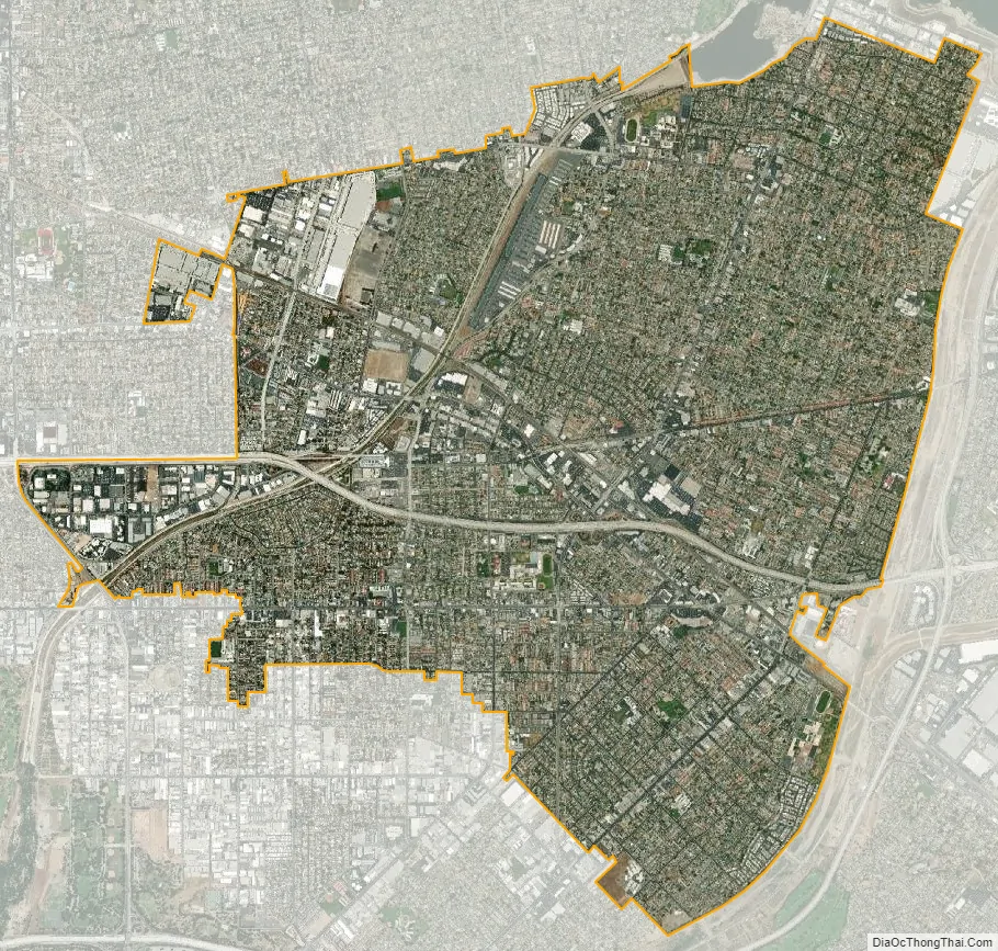
El Monte city Satellite Map
Geography
El Monte is located at 34°4′24″N 118°1′39″W / 34.07333°N 118.02750°W / 34.07333; -118.02750 (34.073276, -118.027491). According to the United States Census Bureau, the city has a total area of 9.6 square miles (25 km), of which 9.6 square miles (25 km) of it is land and 0.1 square miles (0.26 km) of it (0.89%) is water.
Climate
El Monte has a Mediterranean climate (Köppen climate classification Csa).
See also
Map of California State and its subdivision:- Alameda
- Alpine
- Amador
- Butte
- Calaveras
- Colusa
- Contra Costa
- Del Norte
- El Dorado
- Fresno
- Glenn
- Humboldt
- Imperial
- Inyo
- Kern
- Kings
- Lake
- Lassen
- Los Angeles
- Madera
- Marin
- Mariposa
- Mendocino
- Merced
- Modoc
- Mono
- Monterey
- Napa
- Nevada
- Orange
- Placer
- Plumas
- Riverside
- Sacramento
- San Benito
- San Bernardino
- San Diego
- San Francisco
- San Joaquin
- San Luis Obispo
- San Mateo
- Santa Barbara
- Santa Clara
- Santa Cruz
- Shasta
- Sierra
- Siskiyou
- Solano
- Sonoma
- Stanislaus
- Sutter
- Tehama
- Trinity
- Tulare
- Tuolumne
- Ventura
- Yolo
- Yuba
- Alabama
- Alaska
- Arizona
- Arkansas
- California
- Colorado
- Connecticut
- Delaware
- District of Columbia
- Florida
- Georgia
- Hawaii
- Idaho
- Illinois
- Indiana
- Iowa
- Kansas
- Kentucky
- Louisiana
- Maine
- Maryland
- Massachusetts
- Michigan
- Minnesota
- Mississippi
- Missouri
- Montana
- Nebraska
- Nevada
- New Hampshire
- New Jersey
- New Mexico
- New York
- North Carolina
- North Dakota
- Ohio
- Oklahoma
- Oregon
- Pennsylvania
- Rhode Island
- South Carolina
- South Dakota
- Tennessee
- Texas
- Utah
- Vermont
- Virginia
- Washington
- West Virginia
- Wisconsin
- Wyoming


