Hermosa Beach (Hermosa, Spanish for “Beautiful”) is a beachfront city in Los Angeles County in the U.S. state of California, United States. Its population was 19,728 at the 2020 U.S. Census. The city is located in the South Bay region of the Greater Los Angeles area; it is one of the three Beach Cities. Hermosa Beach is bordered by the other two, Manhattan Beach to the north and Redondo Beach to the south and east.
The city’s beach is popular for sunbathing, beach volleyball, surfing, paddleboarding, bars, cycling and running. The city itself extends only about 15 blocks from east to west and 40 blocks from north to south, with Pacific Coast Highway running down the middle. Situated on the Pacific Ocean, Hermosa’s average temperature is 70 °F (22 °C) in the summer and 55 °F (13 °C) in the winter. Westerly sea breezes lessen what can be high summertime temperatures in Los Angeles and elsewhere in the county and help keep the smog away 360 days of the year.
A paved path, called The Strand, runs along Hermosa’s beach from Torrance Beach in the south approximately twenty miles north to Santa Monica. The Hermosa Beach Pier is at the end of Pier Avenue, which is one of the beach community’s main shopping, dining and entertainment areas.
| Name: | Hermosa Beach city |
|---|---|
| LSAD Code: | 25 |
| LSAD Description: | city (suffix) |
| State: | California |
| County: | Los Angeles County |
| Elevation: | 26 ft (8 m) |
| Total Area: | 1.43 sq mi (3.69 km²) |
| Land Area: | 1.43 sq mi (3.69 km²) |
| Water Area: | 0.00 sq mi (0.00 km²) 0% |
| Total Population: | 19,728 |
| Population Density: | 14,000/sq mi (5,300/km²) |
| ZIP code: | 90254 |
| Area code: | 310 and 424 |
| FIPS code: | 0633364 |
| Website: | hermosabeach.gov |
Online Interactive Map
Click on ![]() to view map in "full screen" mode.
to view map in "full screen" mode.
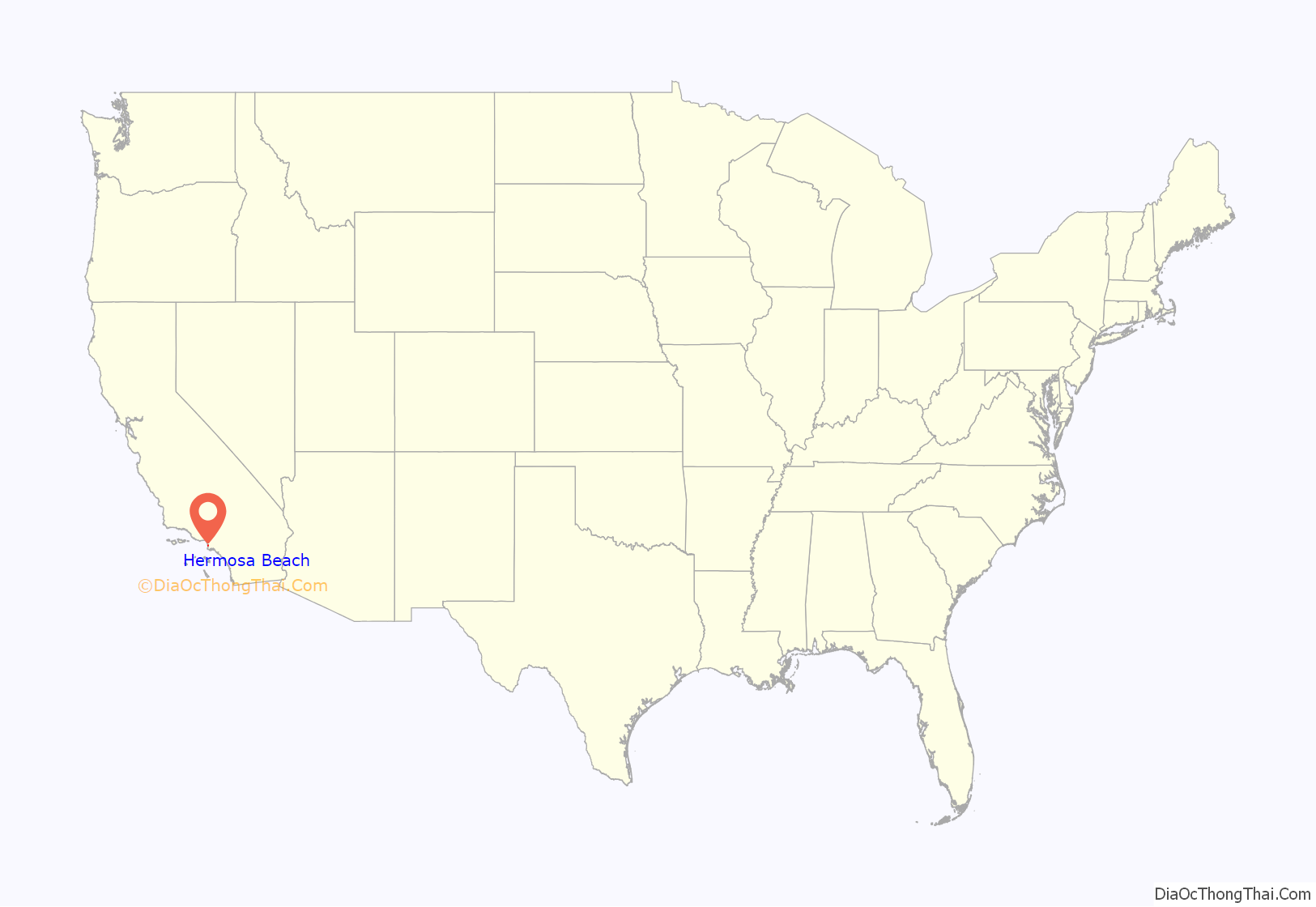
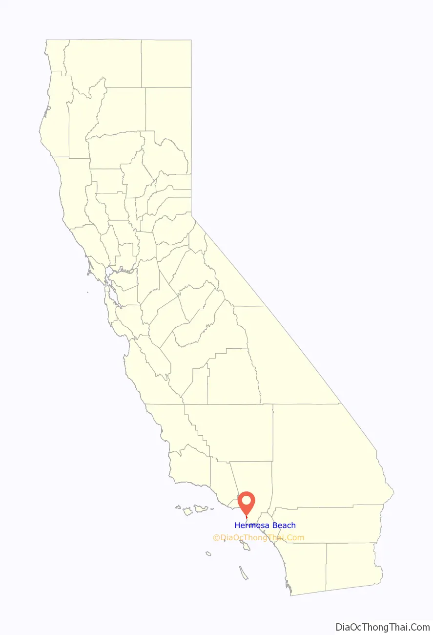
Hermosa Beach location map. Where is Hermosa Beach city?
History
Hermosa Beach was originally part of the 1784 Rancho San Pedro Spanish land grant that later became the ten-mile (16 km) ocean frontage of Rancho Sausal Redondo. In 1900, a tract of 1,500 acres (6.1 km) was purchased for $35 per acre from A. E. Pomroy, then owner of the greater part of Rancho Sausal Redondo. Messrs. Burbank and Baker, agents, bought this land for Sherman and Clark who organized and retained the controlling interest in the Hermosa Beach Land and Water Company.
In early days, Hermosa Beach — like so many of its neighboring cities (Inglewood, Lawndale, Torrance) — was one vast sweep of rolling hills covered with fields of grain, mostly barley. During certain seasons of the year large herds of sheep were grazed over this land, and corrals and large barns for storing the grain, as well as providing shelter for horses and farm implements, were located on the ranch between Hermosa and Inglewood. The Spanish words Rancho Sausal Redondo mean a large circular ranch of pasture of grazing land, with a grove of willow on it.
The first official survey was made in the year 1901 for the board walk on the Strand, Hermosa Avenue and Santa Fe Avenue; work on these projects commenced soon after. In 1904 the first pier was built. It was constructed entirely of wood even to the pilings and it extended five hundred feet out into the ocean. The pier was constructed by the Hermosa Beach Land and Water Company. In 1913 this old pier was partly washed away and later torn down and a new one built to replace it. This pier was built of concrete 1,000 feet (300 m) long, and paved with asphalt its entire length. Small tiled pavilions were erected at intervals along the sides to afford shade for fishermen and picnic parties. A bait stand was built eventually out on the end. Soon after, about 1914, an auditorium building was constructed; it has housed various enterprises and at present the public rest rooms, the Los Angeles Life Guard Service, and the local branch of the Los Angeles County Public Library occupy rooms in the building. This pier is municipally owned.
The Los Angeles Pacific Railway, a trolley system, was the first trolley service in Hermosa Beach, running the entire length of Hermosa Ave. on its way from L.A. to Redondo Beach. A few years later it was merged with most other trolley companies in the region to form the new Pacific Electric Railway Company, informally called the Red Cars.
The Santa Fe Railway was the first railroad to run through Hermosa Beach. It was seven blocks from the beach. The street that led to the tracks was called Santa Fe Avenue, but was later renamed Pier Avenue. There was no Santa Fe railway station for Hermosa, but Burbank and Baker built a railway platform on the west side of the tracks near Santa Fe Avenue, and later the railroad company donated an old boxcar to be used as a storage place for freight. In 1926, the Santa Fe built a modern stucco depot and installed Western Union telegraph service in it.
The first city election for city officers was held December 24, 1906. On January 14, 1907, Hermosa Beach became the nineteenth incorporated city of Los Angeles County.
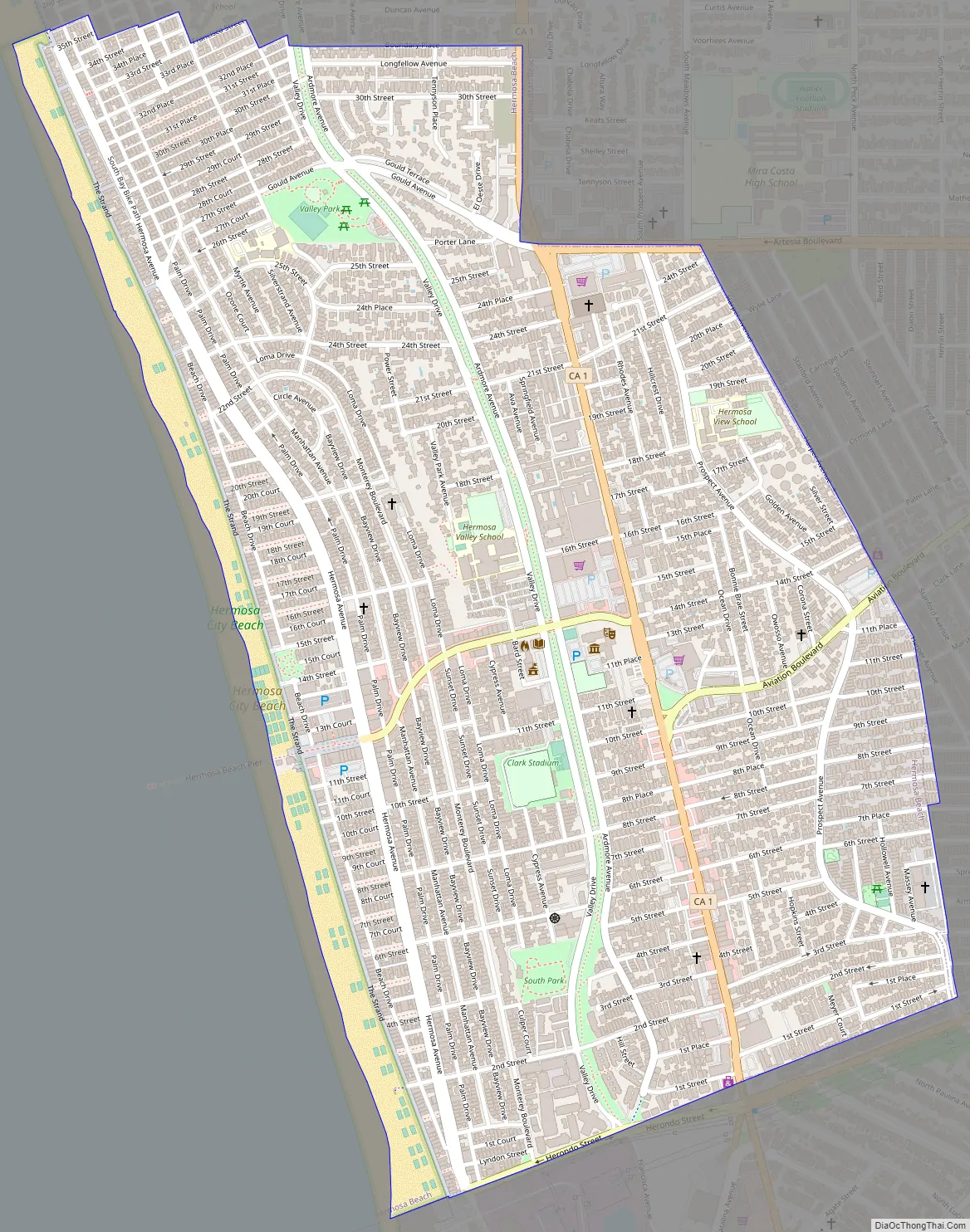
Hermosa Beach Road Map
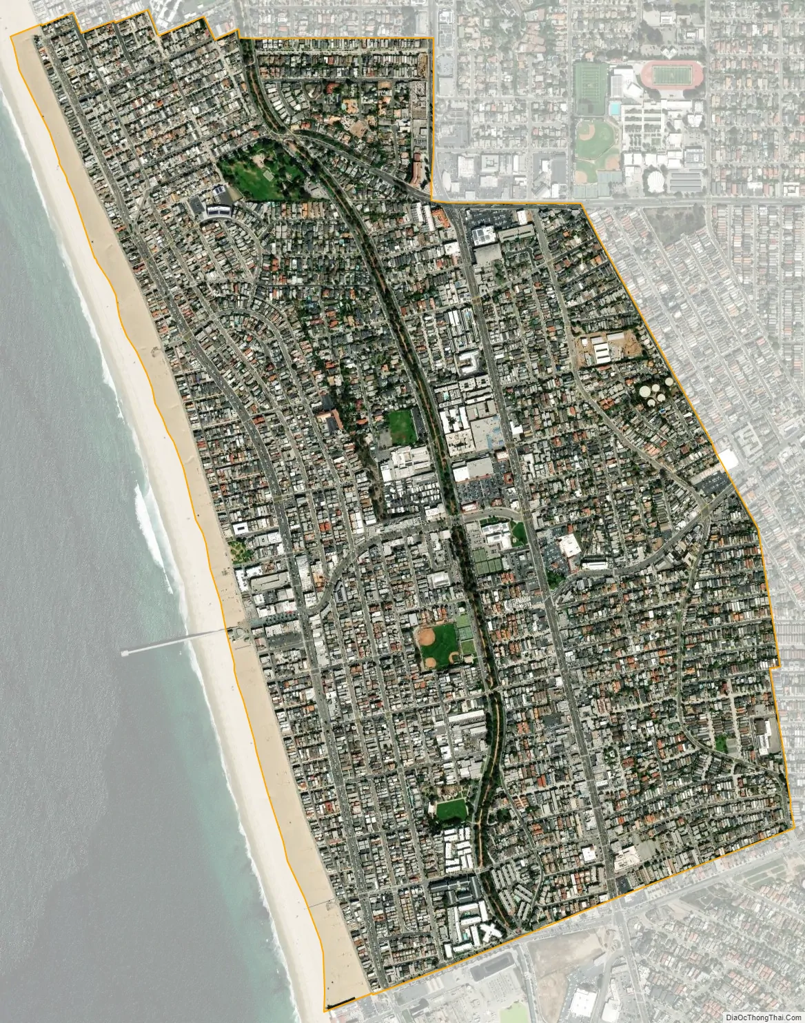
Hermosa Beach city Satellite Map
Geography
Hermosa Beach is located at 33°51′59″N 118°23′59″W / 33.86639°N 118.39972°W / 33.86639; -118.39972 (33.866314, -118.399681).
According to the United States Census Bureau, the city has a total area of 1.4 square miles (3.6 km), all of it land.
Climate
Average air temperature – (summer 74 °F (23.3 °C)/ winter, 55 °F (12.7 °C))
Average water temperature – 60 °F (15.5 °C) (summer 68 °F (20 °C)/ winter 50 °F (10 °C))
Hermosa Beach has an average of 325 days of sunshine a year. Because of its location, nestled on a vast open bay (Santa Monica Bay), morning fog and haze is a common phenomenon in May, June and early July (caused by ocean temperature variations and currents). Locals have a particular terminology for this phenomenon: the “May Gray” and the “June Gloom”. Overcast skies are common for June mornings, but usually the strong sun burns the fog off by noon. Nonetheless, it will sometimes stay cloudy and cool all day during June, even as other parts of the Los Angeles area will enjoy sunny skies and warmer temperatures. At times, the sun shines east of PCH, while the beach area is overcast.
As a general rule, the temperature is from 5 to 10 °F (3 to 5.5 °C) cooler than it is inland. A typical spring day (mid-April) is sunny, pleasant and about 68 °F (20 °C). In the summer, which stretches basically from May to late October, temperatures can reach to the mid-80s Fahrenheit (about 30 °C) at the beach. In early November, it is about 68 °F (20 °C). In late January, temperatures are around 63 °F (17 °C). It is winter, however, when the hot, dry Santa Ana winds are most common. In mid-December 2004, temperatures soared to 84 °F (28 °C) in Santa Monica, for a few straight days, with perfectly sunny skies.
The rainy season is from late October through late March. Winter storms usually approach from the northwest and pass quickly through the Southland. There is very little rain during the rest of the year, on average, there is just about 14 inches of rain per year in the city.
Hermosa Beach usually enjoys a cool breeze blowing in from the ocean, keeping the air fresh and clean. Therefore, smog is less a problem for Hermosa Beach than elsewhere around Los Angeles.
See also
Map of California State and its subdivision:- Alameda
- Alpine
- Amador
- Butte
- Calaveras
- Colusa
- Contra Costa
- Del Norte
- El Dorado
- Fresno
- Glenn
- Humboldt
- Imperial
- Inyo
- Kern
- Kings
- Lake
- Lassen
- Los Angeles
- Madera
- Marin
- Mariposa
- Mendocino
- Merced
- Modoc
- Mono
- Monterey
- Napa
- Nevada
- Orange
- Placer
- Plumas
- Riverside
- Sacramento
- San Benito
- San Bernardino
- San Diego
- San Francisco
- San Joaquin
- San Luis Obispo
- San Mateo
- Santa Barbara
- Santa Clara
- Santa Cruz
- Shasta
- Sierra
- Siskiyou
- Solano
- Sonoma
- Stanislaus
- Sutter
- Tehama
- Trinity
- Tulare
- Tuolumne
- Ventura
- Yolo
- Yuba
- Alabama
- Alaska
- Arizona
- Arkansas
- California
- Colorado
- Connecticut
- Delaware
- District of Columbia
- Florida
- Georgia
- Hawaii
- Idaho
- Illinois
- Indiana
- Iowa
- Kansas
- Kentucky
- Louisiana
- Maine
- Maryland
- Massachusetts
- Michigan
- Minnesota
- Mississippi
- Missouri
- Montana
- Nebraska
- Nevada
- New Hampshire
- New Jersey
- New Mexico
- New York
- North Carolina
- North Dakota
- Ohio
- Oklahoma
- Oregon
- Pennsylvania
- Rhode Island
- South Carolina
- South Dakota
- Tennessee
- Texas
- Utah
- Vermont
- Virginia
- Washington
- West Virginia
- Wisconsin
- Wyoming


