La Mirada (Spanish for “The Look”) is a city in southeast Los Angeles County, California United States, and is one of the Gateway Cities. The population was 48,527 at the 2010 census, up from 46,783 at the 2000 census. The La Mirada Theatre for the Performing Arts and the Splash! La Mirada Regional Aquatics Center are two of its major attractions. It is the home of Biola University, an evangelical Christian institution of higher education.
| Name: | La Mirada city |
|---|---|
| LSAD Code: | 25 |
| LSAD Description: | city (suffix) |
| State: | California |
| County: | Los Angeles County |
| Incorporated: | March 23, 1960 |
| Elevation: | 194 ft (59 m) |
| Total Area: | 7.84 sq mi (20.30 km²) |
| Land Area: | 7.82 sq mi (20.26 km²) |
| Water Area: | 0.02 sq mi (0.04 km²) 0.22% |
| Total Population: | 48,527 |
| Population Density: | 6,159.93/sq mi (2,378.23/km²) |
| ZIP code: | 90637–90639 |
| Area code: | 562, 657/714 |
| FIPS code: | 0640032 |
| Website: | www.cityoflamirada.org |
Online Interactive Map
Click on ![]() to view map in "full screen" mode.
to view map in "full screen" mode.
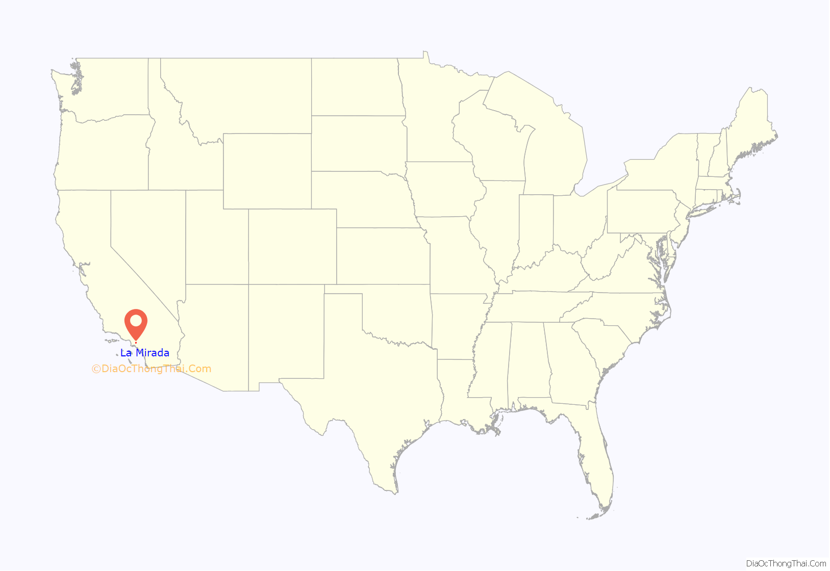
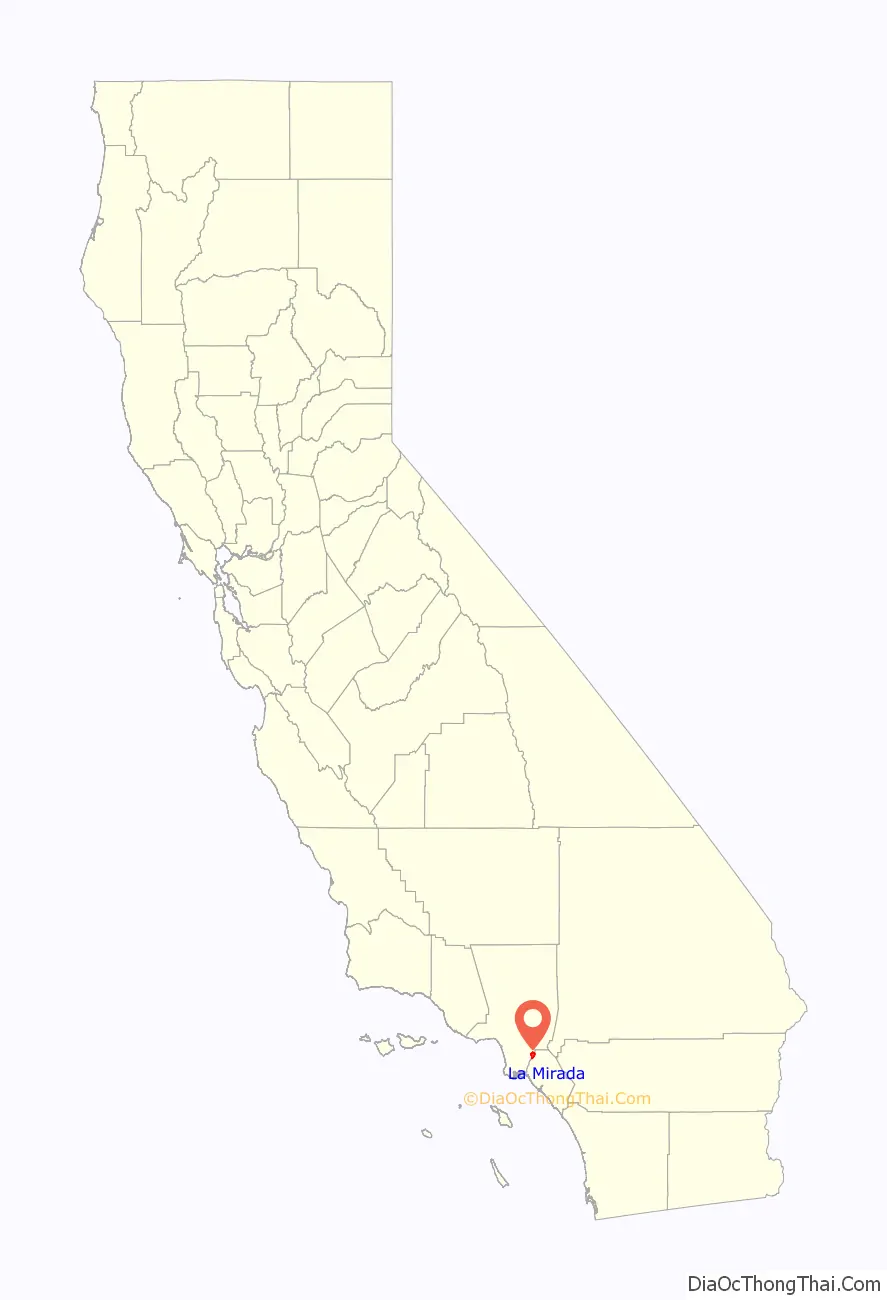
La Mirada location map. Where is La Mirada city?
History
La Mirada (Spanish for the look) was the creation of two men, Andrew McNally, a printer and mapmaker from Chicago (see Rand McNally) and his son-in-law Edwin Neff. In 1888, McNally purchased over 2,200 acres (8.9 km) of Rancho Los Coyotes, south of Whittier, for $200,000. He developed 700 acres (2.8 km) into his own home called Windermere Ranch and surrounded it with olive, orange and lemon groves. McNally built a plant to process the olive oil, which was of the best quality, as well as a railroad station on Stage Road. From here his olive oil and fruit were shipped all over the U.S.
In 1896, McNally turned his property over to his daughter and his son-in-law. McNally and Neff formed the La Mirada Land Company, which published a booklet entitled “The Country Gentleman in California”, advertising parcels of land for sale including pictures, a map and descriptions of the scenic olive, alfalfa, lemon and grapefruit groves.
In 1946, “Along Your Way”, a “Station by Station Description of the Santa Fe Route Through the Southwest,” describes La Mirada with a population of 213, surrounded by orange, lemon, walnut and olive groves; oil wells; olive oil factory; and fruit packing houses.
The city received a lot of attention for the fact that it was going to be completely structured and planned out. Referred to as “the Nation’s completely planned city” during the early 1950s, the city of La Mirada received a lot of attention from the State Fair. The Fair praised the city for planning for the future while still maintaining practicality for today.
In 1953, the land was sold to subdivisions for 5.2 million dollars, one of the largest real estate transactions in California. In 1954, Louis M. Halper, a prominent Southland residential and commercial builder, purchased 2,100 acres of La Mirada land for $8,000,000. Halper launched construction on what was to be a $150,000,000 community with schools, shopping centers, and 10,000 homes that he completed by the end of two years. His firm had taken over the acreage from a group of corporations and Harold L. Shaw, who launched the original La Mirada development. He said at the time the entire community would be redesigned for maximum advantages of a modern planned city. Halper had developed a new pattern for community development by wholesaling land to other builders and establishing the La Mirada Civic Council to control quality. Three and four-bedroom homes were sold in the $13,000 price range. By 1960, the year the city was incorporated, La Mirada had grown from a mere 100 homes to over 8,000. The city was incorporated as “Mirada Hills” on March 23, 1960. On November 8, 1960, voters approved a change of name to the current La Mirada, which was officially certified on December 15, 1960.
Today, the current population is just over 50,000 with the addition of a new subdivision on the eastern portion of the town.
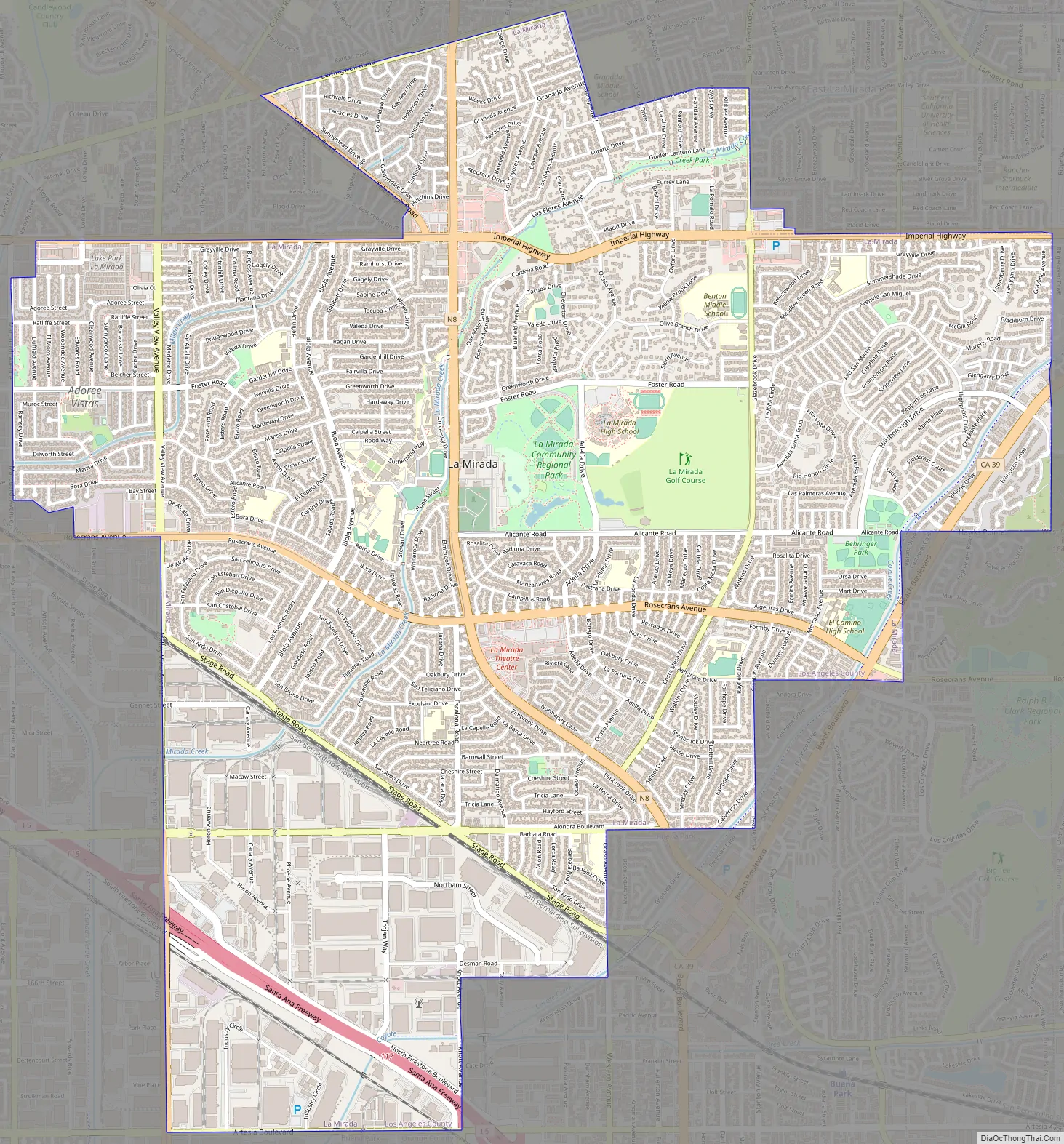
La Mirada Road Map
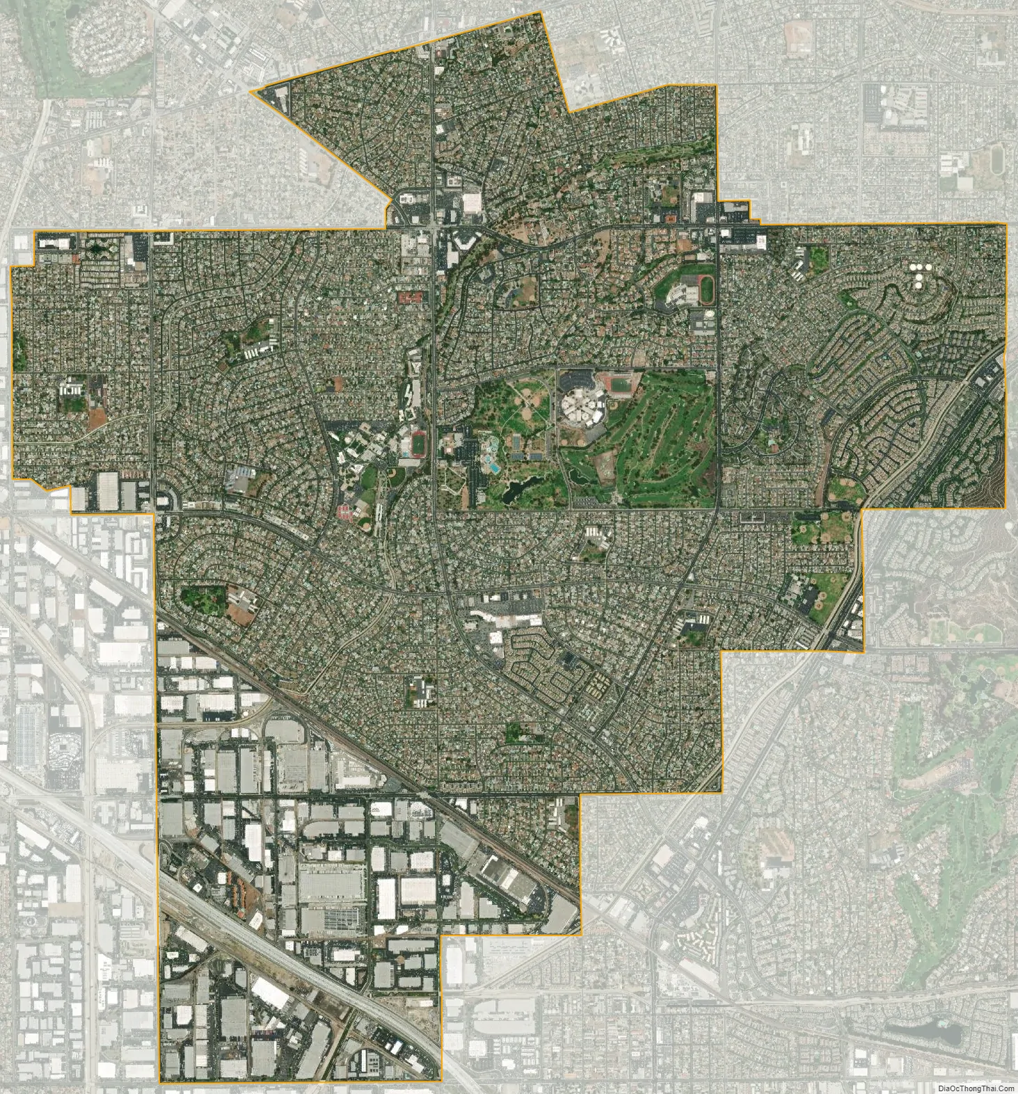
La Mirada city Satellite Map
Geography
According to the United States Census Bureau, the city has a total area of 7.9 square miles (20 km). 7.8 square miles (20 km) of it is land and 0.02 square miles (0.052 km) of it (0.22%) is water. The city is on the border between Orange and Los Angeles counties. The cities that border it on the Los Angeles County side are Santa Fe Springs to the west and Cerritos to the southwest; and unincorporated areas of Los Angeles County such as East Whittier, and South Whittier to the north. The cities bordering it in Orange County are Fullerton and La Habra to the east and Buena Park to the south.
See also
Map of California State and its subdivision:- Alameda
- Alpine
- Amador
- Butte
- Calaveras
- Colusa
- Contra Costa
- Del Norte
- El Dorado
- Fresno
- Glenn
- Humboldt
- Imperial
- Inyo
- Kern
- Kings
- Lake
- Lassen
- Los Angeles
- Madera
- Marin
- Mariposa
- Mendocino
- Merced
- Modoc
- Mono
- Monterey
- Napa
- Nevada
- Orange
- Placer
- Plumas
- Riverside
- Sacramento
- San Benito
- San Bernardino
- San Diego
- San Francisco
- San Joaquin
- San Luis Obispo
- San Mateo
- Santa Barbara
- Santa Clara
- Santa Cruz
- Shasta
- Sierra
- Siskiyou
- Solano
- Sonoma
- Stanislaus
- Sutter
- Tehama
- Trinity
- Tulare
- Tuolumne
- Ventura
- Yolo
- Yuba
- Alabama
- Alaska
- Arizona
- Arkansas
- California
- Colorado
- Connecticut
- Delaware
- District of Columbia
- Florida
- Georgia
- Hawaii
- Idaho
- Illinois
- Indiana
- Iowa
- Kansas
- Kentucky
- Louisiana
- Maine
- Maryland
- Massachusetts
- Michigan
- Minnesota
- Mississippi
- Missouri
- Montana
- Nebraska
- Nevada
- New Hampshire
- New Jersey
- New Mexico
- New York
- North Carolina
- North Dakota
- Ohio
- Oklahoma
- Oregon
- Pennsylvania
- Rhode Island
- South Carolina
- South Dakota
- Tennessee
- Texas
- Utah
- Vermont
- Virginia
- Washington
- West Virginia
- Wisconsin
- Wyoming


