Live Oak is a census-designated place (CDP) in Santa Cruz County, California between the cities of Santa Cruz and Capitola and north of the former Union Pacific railroad. Live Oak sits at an elevation of 102 feet (31 m). The population was 17,038 at the 2020 census. The population of the greater Live Oak area, including Twin Lakes and Pleasure Point, was 27,921.
| Name: | Live Oak CDP |
|---|---|
| LSAD Code: | 57 |
| LSAD Description: | CDP (suffix) |
| State: | California |
| County: | Santa Cruz County |
| Elevation: | 102 ft (31 m) |
| Total Area: | 3.243 sq mi (8.398 km²) |
| Land Area: | 3.243 sq mi (8.398 km²) |
| Water Area: | 0 sq mi (0 km²) 0% |
| Total Population: | 17,038 |
| Population Density: | 5,300/sq mi (2,000/km²) |
| ZIP code: | 95062 |
| Area code: | 831 |
| FIPS code: | 0641922 |
Online Interactive Map
Click on ![]() to view map in "full screen" mode.
to view map in "full screen" mode.
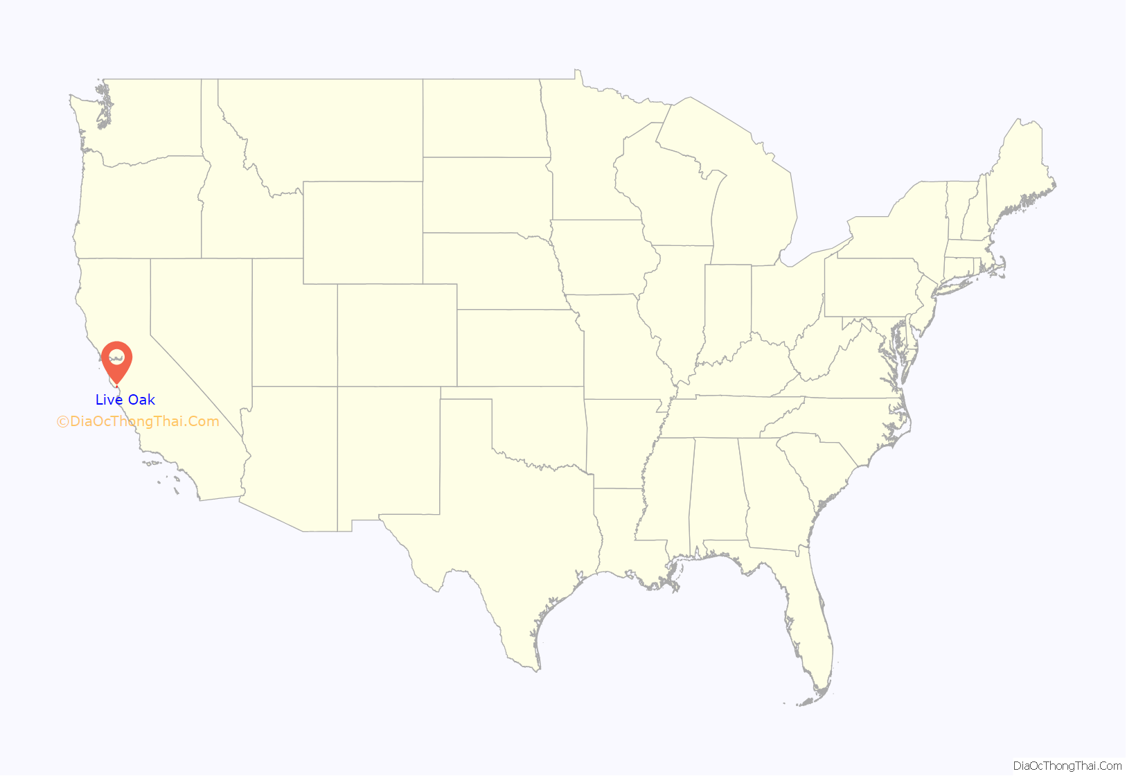
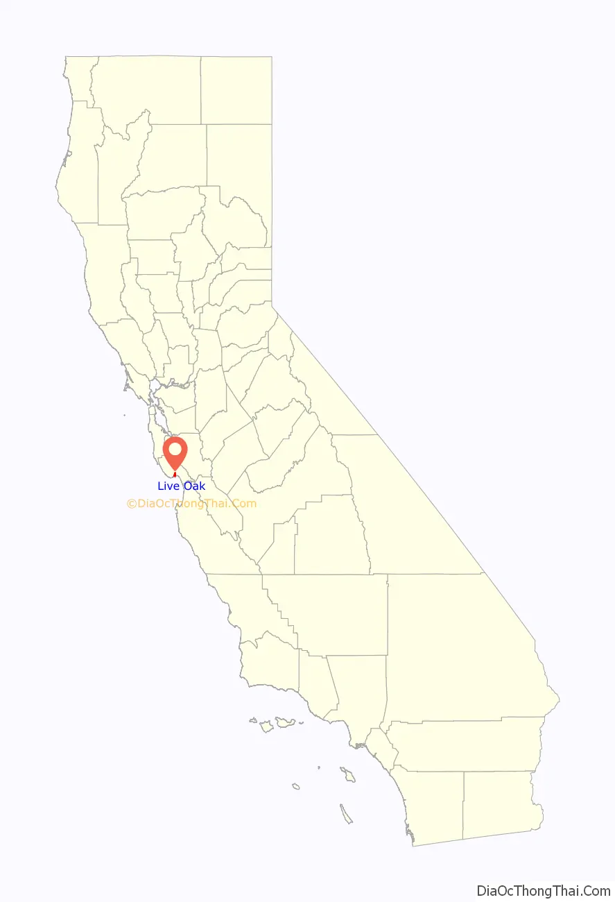
Live Oak location map. Where is Live Oak CDP?
History
For several thousand years, the Awaswas-speaking Ohlone people inhabited the area from Half Moon Bay to Aptos, including the area now known as Live Oak. When missionaries established the Mission Santa Cruz in 1791, they noted “an area to the east of the San Lorenzo River “in sight of the Sea” that was crisscrossed by “steep gulches containing running water” and three “reed-lined” lagoons. Spanish colonial settlers, who later established the secular pueblo of Villa de Branciforte on the east side of the San Lorenzo, ran their herds of cattle and horses in the “common lands” of this area.
In 1834 and 1837, territorial governors divided these lands between two brothers, Alejandro and Francisco Rodriguez. Alejandro Rodriguez was granted Rancho Arroyo del Rodeo, named for the rodeo (cattle roundup) area located in a low-lying natural amphitheater along Rodeo Creek. (These grounds were later filled in during the construction of Highway 1.) Francisco Rodriguez was granted a rancho bearing the name “Los Esteros” (never patented) because of the sizeable estuaries forming two of its boundaries. Originally known as Twin Lakes, the westernmost of the “twins” is now the Santa Cruz Harbor.
With the discovery of gold in California in 1848 and American statehood in 1849, legal maneuvering turned the Rodriguez brothers’ holdings over to a handful of white settler-farmers. Their farms produced wheat, oats, and barley, supporting small households of adobe and rough-cut lumber. The farmers prospered, establishing a Grange Hall and, in 1872, a small schoolhouse called the “Live Oak School”, named for the evergreen live oak trees that dot the area. The Live Oak School District has maintained a facility at this location, now the intersection of 17th Avenue and Capitola Road, to the present day.
By the start of the 20th century, fifty years of wheat and oat farming had depleted the soil such that farmers turned to cultivating fruits and vegetables. Owing to the irrigation needs of these crops, these farms eventually failed and were replaced by a large poultry operation near the present-day intersection of Capitola Road and Soquel Drive, and a floriculture bulb nursery (specializing in callas, narcissus, freesias and begonias) near the present-day intersection of 17th Avenue and East Cliff Drive.
Around 1910, two Santa Cruz real estate agents, the brothers Frank and David Wilson, purchased and subdivided several of the old 19th century wheat farms. The new lots were long and narrow, normally of 2.5 acres (1.0 ha), and came with a “poultry unit” that included a kit for a two-bedroom house, and one or two large chicken coops stocked with a flock of 500 or 1,000 hens and roosters. The layout and shape of these lots has left a distinctive mark on the area’s subsequent development. A feed mill to serve the area soon followed.
Egg and poultry prices plummeted in the early years of the Great Depression, and this difficulty was compounded by a double plague of Pullorum Disease and Coccidiosis, which swept through the chicken coops of Live Oak in 1931.
Paved roads and utilities were brought to the area during the 1940s, which also saw the incorporation of Capitola to the east. Bulb nurseries, particularly those specializing in begonias, thrived throughout this period and into the 1950s, when the area was beginning to develop into a residential suburb of Santa Cruz. The west-to-east serial numbering of Live Oak’s north–south streets during that period reflected the expectation that the area would soon be annexed to the city of Santa Cruz. Annexation never came, and a movement for Live Oak to incorporate itself as a municipality was abandoned too, in light of the expense of providing the needed services to the area. In the 1970s, Capitola expanded westward, incorporating the tax-rich commercial neighborhood along 41st Avenue. Residential and commercial development in Live Oak continued at a steady pace, under the direction of Santa Cruz County.
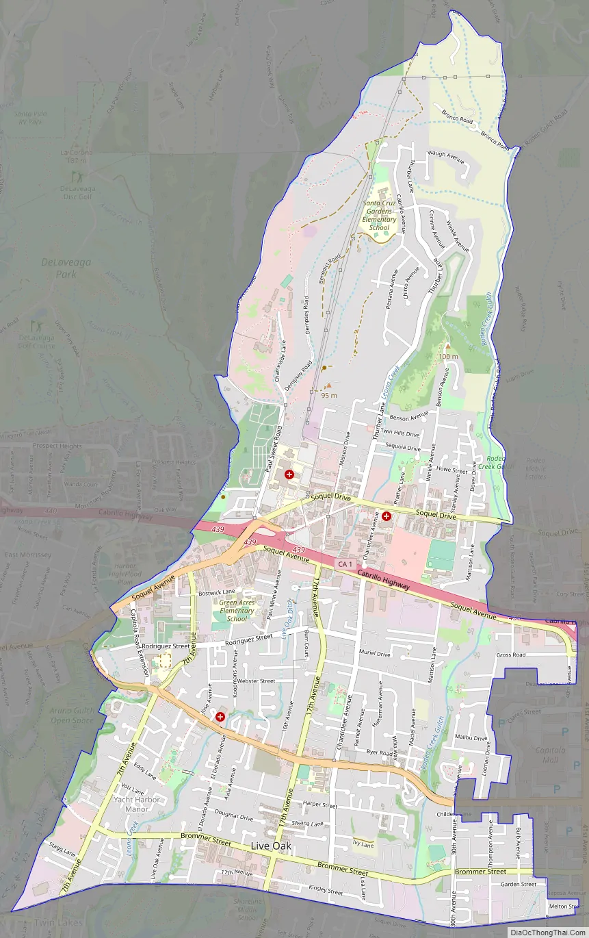
Live Oak Road Map
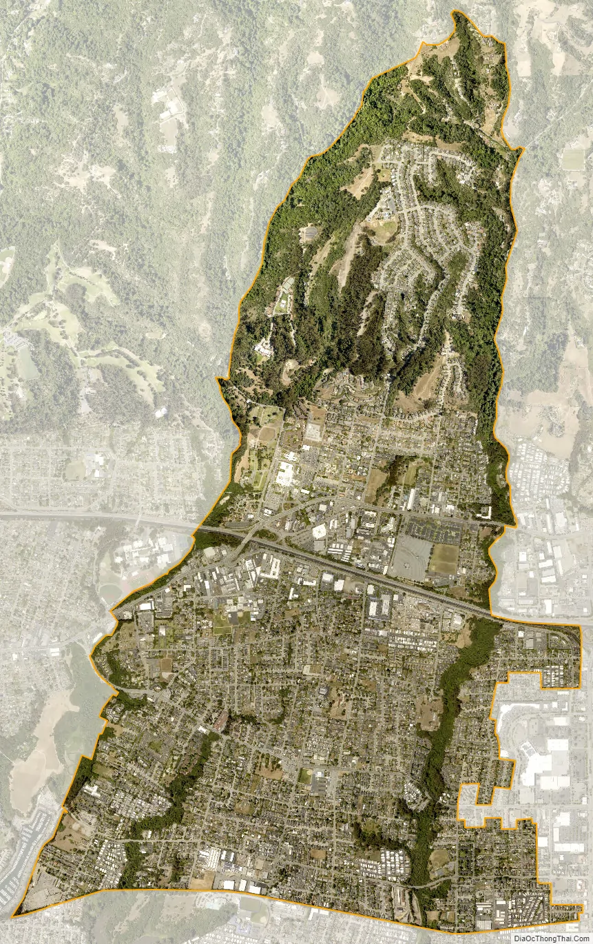
Live Oak city Satellite Map
Geography
Live Oak is located at 36°58′53″N 121°58′50″W / 36.98139°N 121.98056°W / 36.98139; -121.98056 (36.981363, -121.980476).
According to the United States Census Bureau, the CDP has a total area of 3.2 square miles (8.4 km), all of it land.
See also
Map of California State and its subdivision:- Alameda
- Alpine
- Amador
- Butte
- Calaveras
- Colusa
- Contra Costa
- Del Norte
- El Dorado
- Fresno
- Glenn
- Humboldt
- Imperial
- Inyo
- Kern
- Kings
- Lake
- Lassen
- Los Angeles
- Madera
- Marin
- Mariposa
- Mendocino
- Merced
- Modoc
- Mono
- Monterey
- Napa
- Nevada
- Orange
- Placer
- Plumas
- Riverside
- Sacramento
- San Benito
- San Bernardino
- San Diego
- San Francisco
- San Joaquin
- San Luis Obispo
- San Mateo
- Santa Barbara
- Santa Clara
- Santa Cruz
- Shasta
- Sierra
- Siskiyou
- Solano
- Sonoma
- Stanislaus
- Sutter
- Tehama
- Trinity
- Tulare
- Tuolumne
- Ventura
- Yolo
- Yuba
- Alabama
- Alaska
- Arizona
- Arkansas
- California
- Colorado
- Connecticut
- Delaware
- District of Columbia
- Florida
- Georgia
- Hawaii
- Idaho
- Illinois
- Indiana
- Iowa
- Kansas
- Kentucky
- Louisiana
- Maine
- Maryland
- Massachusetts
- Michigan
- Minnesota
- Mississippi
- Missouri
- Montana
- Nebraska
- Nevada
- New Hampshire
- New Jersey
- New Mexico
- New York
- North Carolina
- North Dakota
- Ohio
- Oklahoma
- Oregon
- Pennsylvania
- Rhode Island
- South Carolina
- South Dakota
- Tennessee
- Texas
- Utah
- Vermont
- Virginia
- Washington
- West Virginia
- Wisconsin
- Wyoming


