Monte Sereno (Spanish for “Serene Mountain”) is a city in Santa Clara County, California, United States. The population was 3,479 at the 2020 census. The city is located in the foothills of the Santa Cruz Mountains, about 10 miles (16 km) southwest of San Jose, and is bordered by the town of Los Gatos to the north, east, and south, the Santa Cruz Mountains to the southwest, and the city of Saratoga to the northwest. The city is named for the 2,580-foot (790 m) El Sereno Mountain, upon the slopes of which the southern portion of the city is built. The community is entirely residential with no commercial zoning and 99% single-family housing. It is an upscale Silicon Valley bedroom community. Monte Sereno shares the 95030 ZIP code with the town of Los Gatos. Many municipal services are provided under contract by Los Gatos.
| Name: | Monte Sereno city |
|---|---|
| LSAD Code: | 25 |
| LSAD Description: | city (suffix) |
| State: | California |
| County: | Santa Clara County |
| Incorporated: | May 14, 1957 |
| Elevation: | 515 ft (157 m) |
| Total Area: | 1.66 sq mi (4.30 km²) |
| Land Area: | 1.66 sq mi (4.30 km²) |
| Water Area: | 0.00 sq mi (0.00 km²) 0% |
| Total Population: | 3,479 |
| Population Density: | 2,100/sq mi (810/km²) |
| ZIP code: | 95030 |
| Area code: | 408/669 |
| FIPS code: | 0648956 |
| GNISfeature ID: | 277610 |
| Website: | http://www.montesereno.org/ |
Online Interactive Map
Click on ![]() to view map in "full screen" mode.
to view map in "full screen" mode.
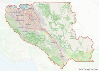
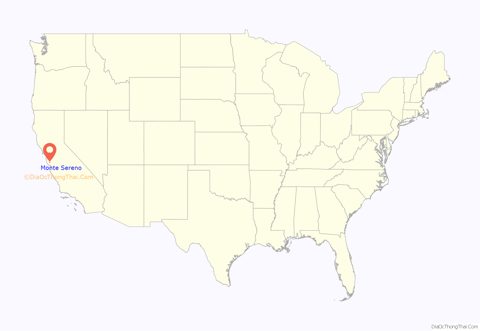
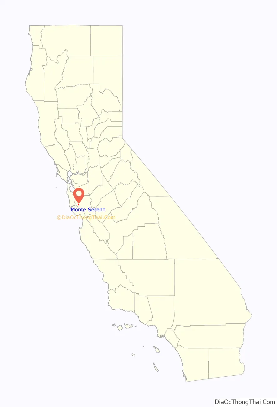
Monte Sereno location map. Where is Monte Sereno city?
History
The Monte Sereno area was part of the 1839 Alta California land grant of Rancho Rinconada de Los Gatos. The city incorporated on May 14, 1957, to protect its semi-rural atmosphere. Its first Mayor was Retired Vice Admiral and former Director of Naval Intelligence, Thomas B. Inglis.
John Steinbeck wrote The Grapes of Wrath and Of Mice and Men in a wooded home at 16250 Greenwood Lane in what is now Monte Sereno.
Beat generation figure Neal Cassady lived in a Monte Sereno ranch house in the 1950s. Painter Thomas Kinkade lived in Monte Sereno in the later years of his life and until his death.
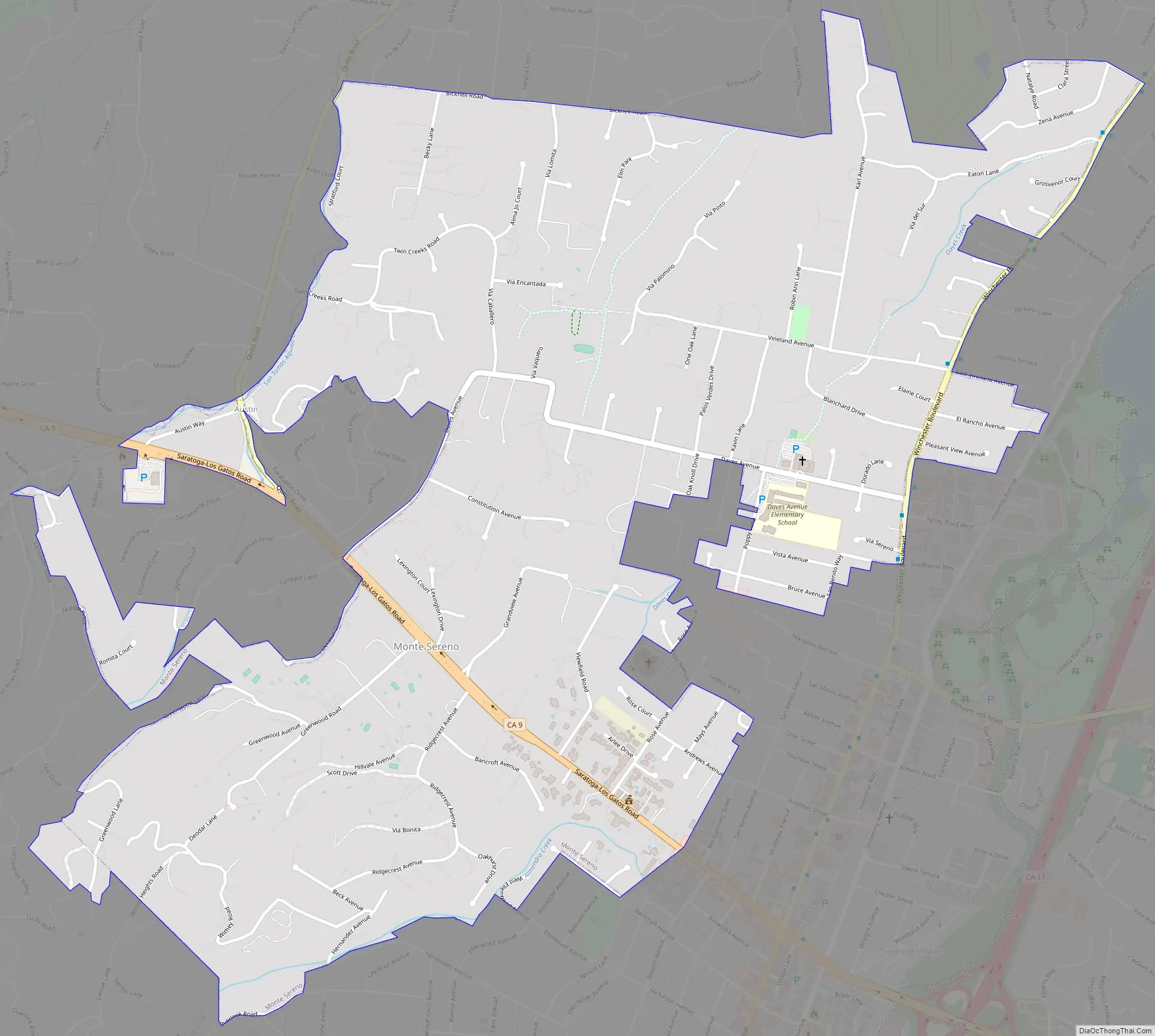
Monte Sereno Road Map
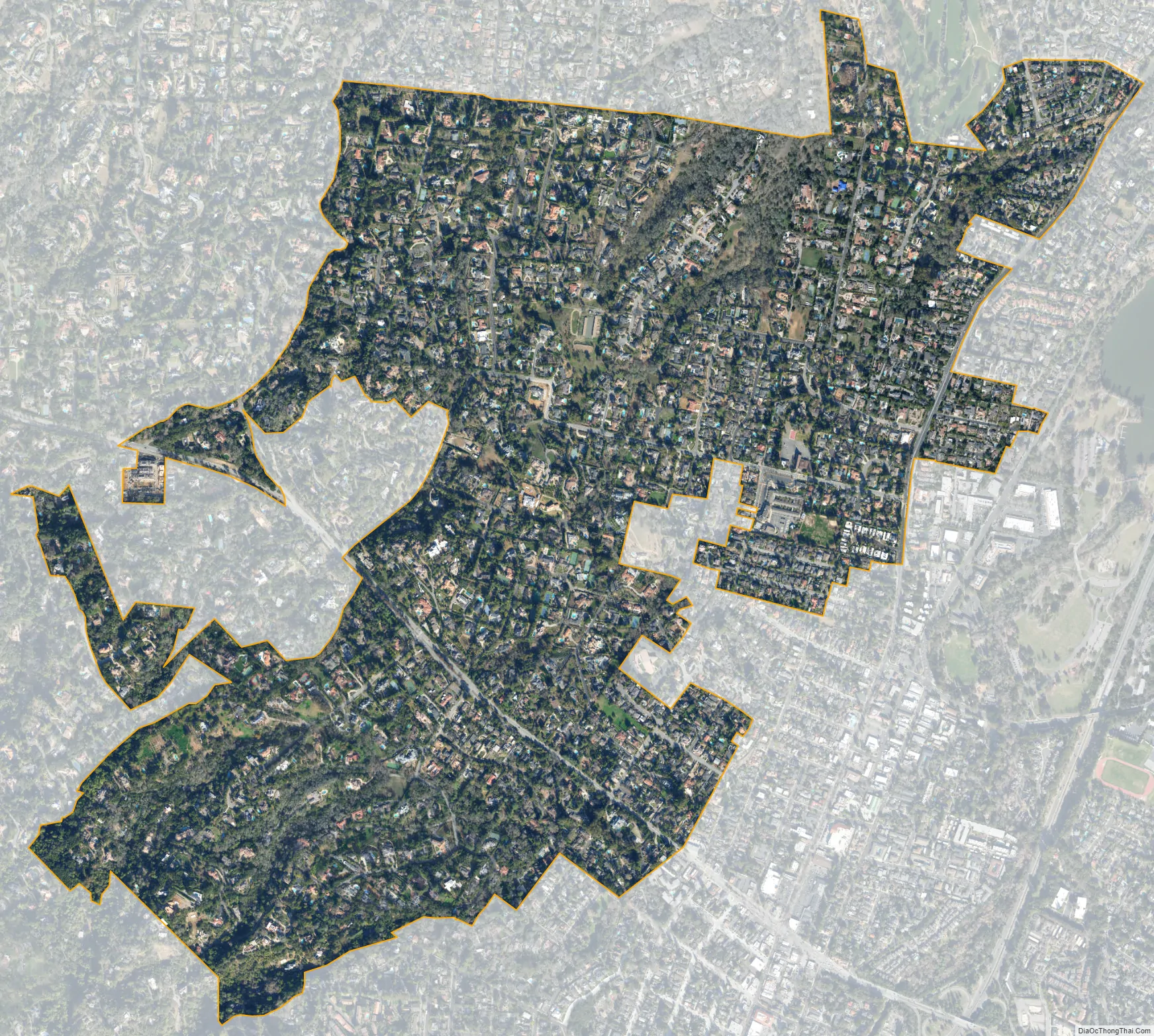
Monte Sereno city Satellite Map
Geography
Monte Sereno is located at 37°14′17″N 121°59′22″W / 37.238194°N 121.989475°W / 37.238194; -121.989475.
According to the United States Census Bureau, the city has a total area of 1.6 square miles (4.1 km), all of it land. Saratoga-Los Gatos Road (State Route 9) runs through the city.
The El Sereno Open Space Preserve is immediately south of the city and covers the top and portions of the flanks of El Sereno mountain.
See also
Map of California State and its subdivision:- Alameda
- Alpine
- Amador
- Butte
- Calaveras
- Colusa
- Contra Costa
- Del Norte
- El Dorado
- Fresno
- Glenn
- Humboldt
- Imperial
- Inyo
- Kern
- Kings
- Lake
- Lassen
- Los Angeles
- Madera
- Marin
- Mariposa
- Mendocino
- Merced
- Modoc
- Mono
- Monterey
- Napa
- Nevada
- Orange
- Placer
- Plumas
- Riverside
- Sacramento
- San Benito
- San Bernardino
- San Diego
- San Francisco
- San Joaquin
- San Luis Obispo
- San Mateo
- Santa Barbara
- Santa Clara
- Santa Cruz
- Shasta
- Sierra
- Siskiyou
- Solano
- Sonoma
- Stanislaus
- Sutter
- Tehama
- Trinity
- Tulare
- Tuolumne
- Ventura
- Yolo
- Yuba
- Alabama
- Alaska
- Arizona
- Arkansas
- California
- Colorado
- Connecticut
- Delaware
- District of Columbia
- Florida
- Georgia
- Hawaii
- Idaho
- Illinois
- Indiana
- Iowa
- Kansas
- Kentucky
- Louisiana
- Maine
- Maryland
- Massachusetts
- Michigan
- Minnesota
- Mississippi
- Missouri
- Montana
- Nebraska
- Nevada
- New Hampshire
- New Jersey
- New Mexico
- New York
- North Carolina
- North Dakota
- Ohio
- Oklahoma
- Oregon
- Pennsylvania
- Rhode Island
- South Carolina
- South Dakota
- Tennessee
- Texas
- Utah
- Vermont
- Virginia
- Washington
- West Virginia
- Wisconsin
- Wyoming