Morgan Hill is a city in Santa Clara County, California, at the southern tip of Silicon Valley, in the San Francisco Bay Area. Morgan Hill is an affluent residential community, the seat of several high-tech companies, and a dining, entertainment, and recreational destination, owing to its luxury hospitality, wineries, and nature parks.
| Name: | Morgan Hill city |
|---|---|
| LSAD Code: | 25 |
| LSAD Description: | city (suffix) |
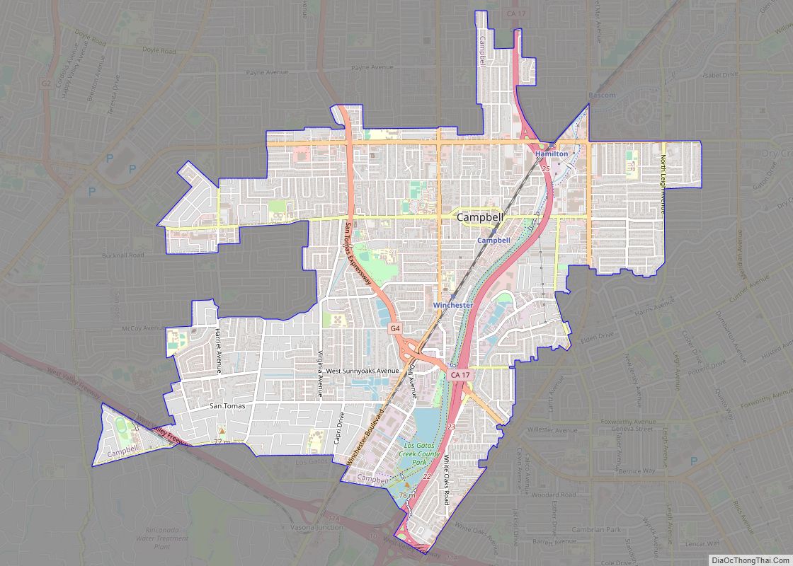
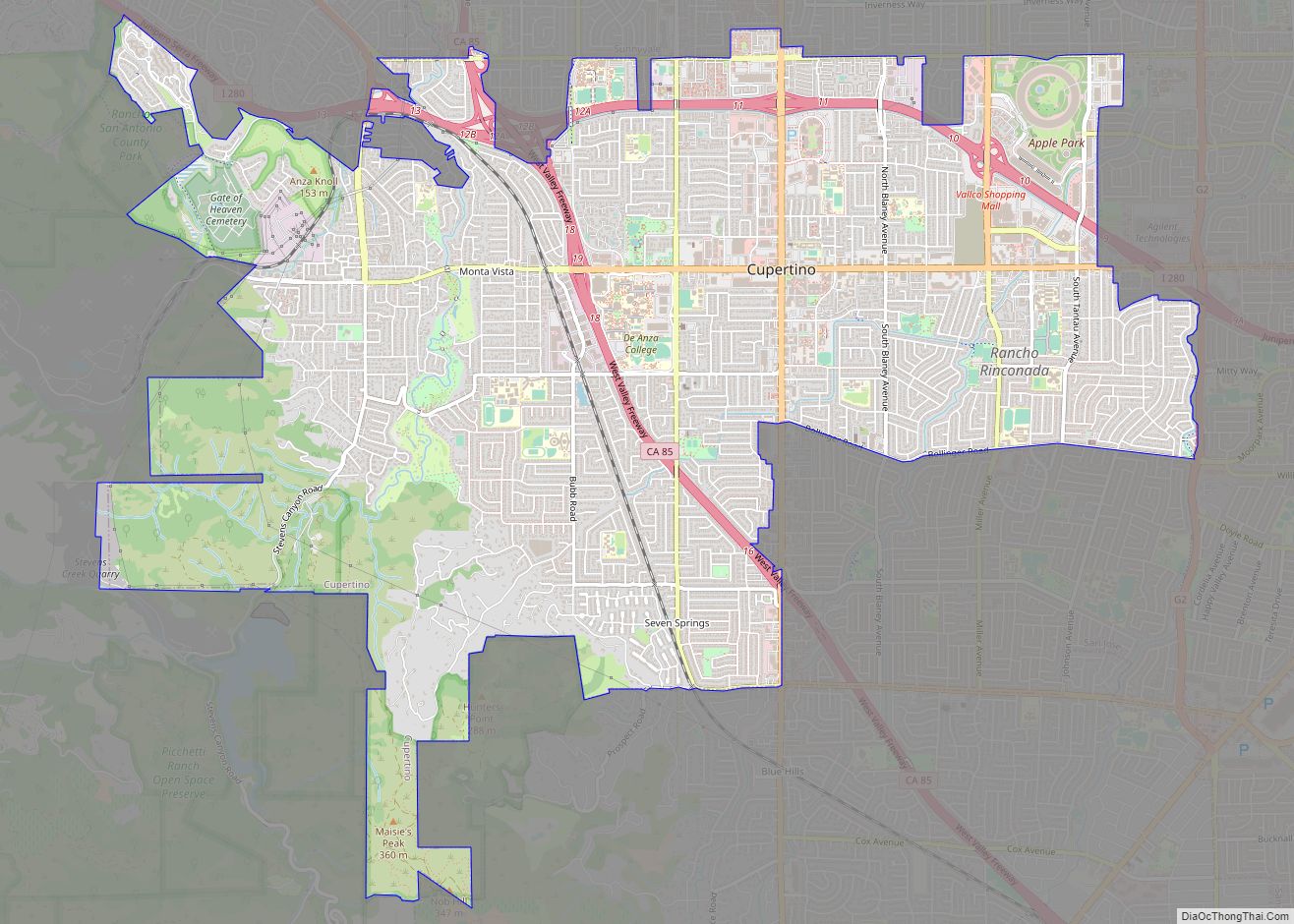
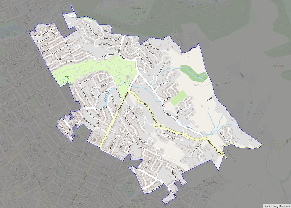
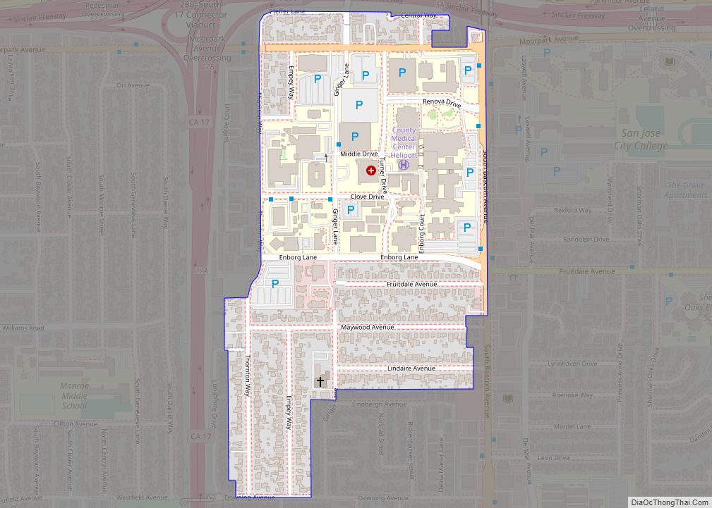
| State: | California |
| County: | Santa Clara County |
| Incorporated: | November 10, 1906 |
| Elevation: | 350 ft (107 m) |
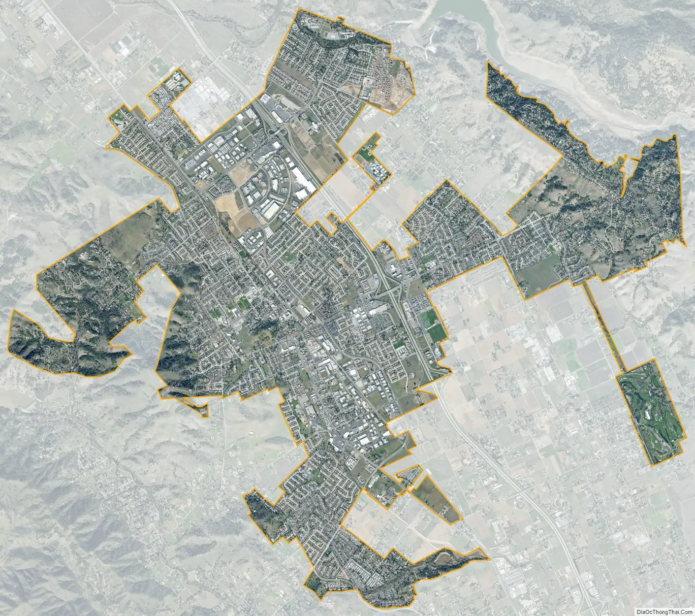
| Total Area: | 12.94 sq mi (33.51 km²) |
| Land Area: | 12.94 sq mi (33.51 km²) |
| Water Area: | 0.00 sq mi (0.00 km²) |
| Total Population: | 44,686 |
| Population Density: | 3,500/sq mi (1,300/km²) |
| ZIP code: | 95037-95038 |
| Area code: | 408/669 |
| FIPS code: | 0649278 |
| GNISfeature ID: | 1659174 |
| Website: | morgan-hill.ca.gov |
Online Interactive Map
Click on ![]() to view map in "full screen" mode.
to view map in "full screen" mode.
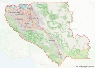
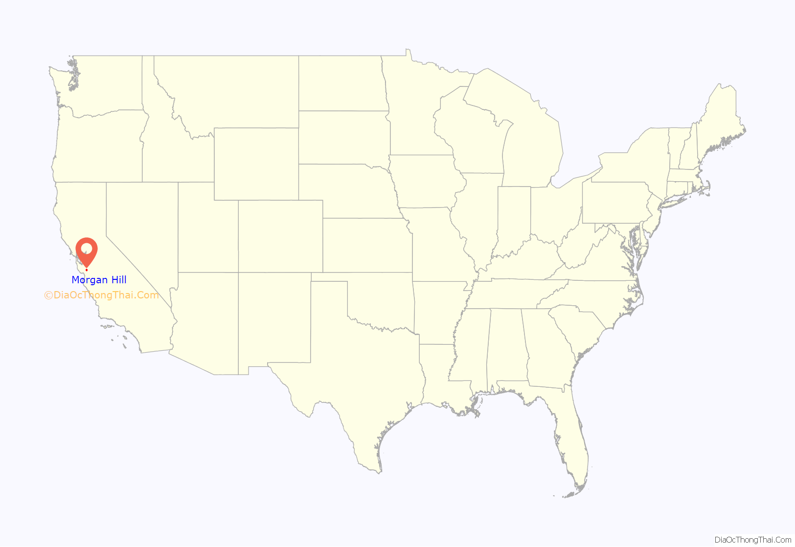
Morgan Hill location map. Where is Morgan Hill city?

History
Prior to the arrival of Spanish colonists, the area of the Santa Clara Valley had been inhabited by the Tamyen nation of Ohlone people for more than 6,000 years. In the area of what is now Morgan Hill, the Matalan tribe lived in a hunter-gatherer society.
Before the area was colonized as part of the Alta California province of the Viceroyalty of New Spain, the 1772 Spanish expedition, led by Pedro Fages and Father Juan Crespí, camped in what is now Morgan Hill, alongside Llagas Creek. The location of their camp subsequently became a popular campsite for Spanish soldiers on their way from New Spain to Alta California. With the founding of Mission Santa Clara de Asís, in 1777, the lands of present-day Morgan Hill were granted to the Roman Catholic Church.
Following Mexico’s independence from Spain, land was redistributed to Mexican citizens across California and the land encompassing modern-day Morgan Hill was granted to Juan Maria Hernandez, in 1835. In 1845, Martin Murphy Sr., an Irish-born Mexican citizen, acquired the area and named it Rancho Ojo del Agua de la Coche.
In 1850, Martin Murphy Sr.’s youngest son, Daniel Murphy, married Maria Fisher, heiress of the neighboring 19,000-acre (7,700 ha) Rancho Laguna Seca, thus combining the two estates. In 1853, Martin Murphy Sr.’s father, Bernard Murphy, died leaving the majority of the estate to Martin Murphy Sr., but a substantial portion to a Martin Murphy Sr.’s mother, Catherine, who then married James Dunne. By 1870, the Murphy family had acquired around 70,000 acres (28,000 ha) of the Morgan Hill area. In the history of Morgan Hill, the Murphy, Dunne, and Hill families are some of the most prominent.
By the late 1850’s, Californio ranchero José María Malaguerra began cultivating vineyards in Madrone, then an independent township just north of Morgan Hill. In 1869, he founded the Malaguerra Winery, the oldest extant winery in Santa Clara Valley, which is listed on the National Register of Historic Places.
In 1882, Daniel and Maria Murphy’s daughter, Diana Murphy, fell in love with Missouri businessman Hiram Morgan Hill. They married in secret, on account of his being a Quaker and her being from a prominent Roman Catholic family. When Daniel Murphy died, Diana and Hiram Morgan Hill inherited the 4,500 acres (1,800 ha) surrounding the original Murphy estate, near Murphy’s Peak (now known as El Toro). In 1884, the Hills built their weekend estate, as the family primarily lived in San Francisco, dubbed Villa Mira Monte (Spanish for Mountain-View Estate).
By 1886, the family chose to live primarily at the Ojo del Agua rancho, as they jointly inherited 22,000 acres (8,900 ha) around the estate. However, the move was temporary, as scandal caused by the marital complications of Hiram Morgan Hill’s prominent socialite sister, Sarah Althea Hill, and her husband, Senator William Sharon, made the Hills a source of social ridicule, thus causing them to start spending the majority of their time between San Francisco and Washington, D.C., thus leaving their rancho untouched for long periods of time.
In 1892, Hiram Morgan Hill contracted land developer C. H. Phillips to divide and liquidate the Rancho Ojo del Agua de la Coche, only retaining the Villa Mira Monte estate and the surrounding 200 acres (81 ha), which the Hill family would hold until 1916. By 1898, a significant community had built around what was then known as Morgan Hill’s Ranch, and a Southern Pacific Railroad station was built in the Huntington area. Rather than ask to stop at Huntington station, passengers would ask to stop at “Morgan Hill’s Ranch”, which eventually shortened to “Morgan Hill”.
On November 10, 1906, the planned community, a result of the divisions of C. H. Phillips, was incorporated as the Town of Morgan Hill. Hiram Morgan and Diana Hill’s only child, Diana Murphy Hill, married the French nobleman, Baron Hadouin de Reinach-Werth, and thus Baron Hadouin started to help manage Hiram Morgan Hill’s properties between California and Nevada. However, the baron was called back to France to serve in the military and never returned. In 1913, Hiram Morgan Hill died at his Elko estate in Nevada, thus leaving his properties to his daughter. Diana Murphy Hill later remarried, in 1916, to Sir George Rhodes, thus causing the Murphy heiress of the Morgan Hill estate to relocate to the United Kingdom, taking her and Hiram Morgan Hill’s daughter, Diana Murphy Hill, thus finally selling off the Villa Mira Monte and ending the Hill family presence in the community named after them.
In 1959, Morgan Hill annexed Madrone, turning the former township into a Morgan Hill’s northernmost district, bordering San Jose and Coyote Valley.
Morgan Hill Road Map
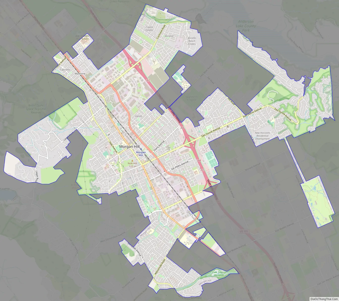
Morgan Hill city Satellite Map
Geography
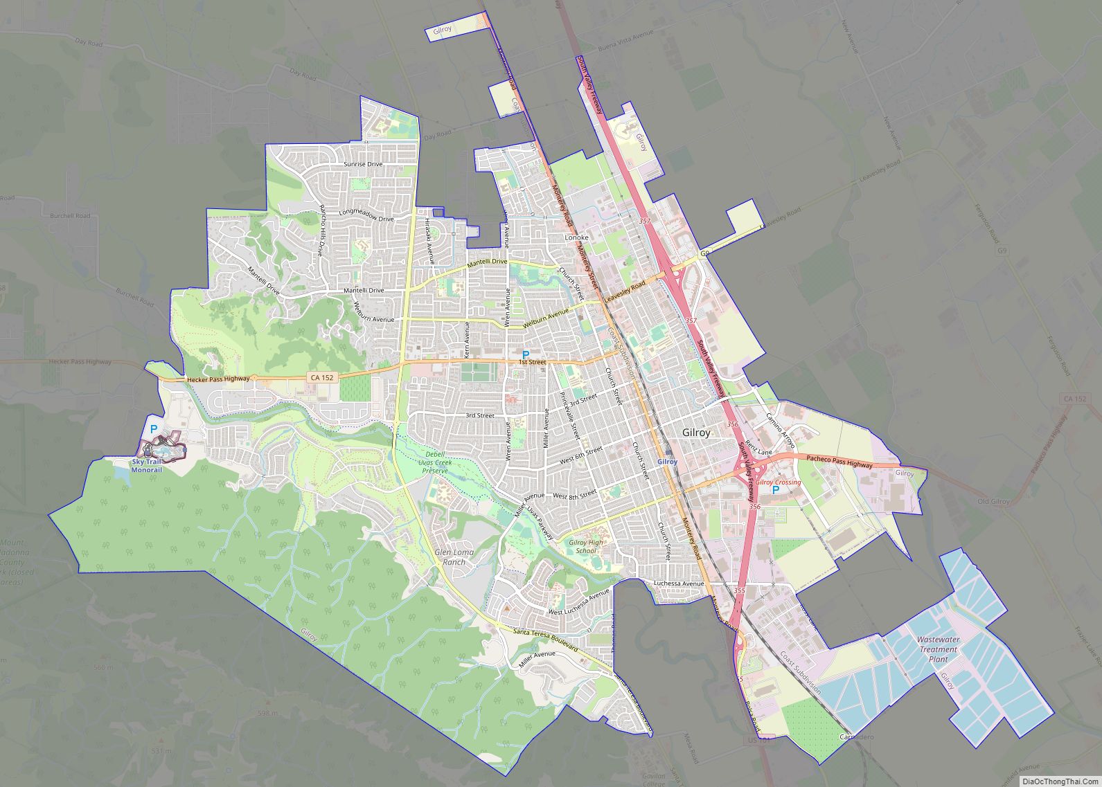
Morgan Hill is approximately 24 mi (39 km) south of downtown San Jose, 13 mi (21 km) north of Gilroy, and 15 mi (24 km) inland from the Pacific coast. Lying in a roughly 4-mile-wide (6 km) southern extension of the Santa Clara Valley, it is bounded by the Santa Cruz Mountains to the west and the Diablo Range to the east. At the valley floor, Morgan Hill lies at an elevation of about 350 feet (107 m) above MSL.
According to the U.S. Census Bureau, the city encompasses an area of 12.9 square miles (33 km), all land. Although there are no natural lakes or ponds within the city limits, there are several flood-control and water storage reservoirs in the adjacent hills which are operated by the Santa Clara Valley Water District, with recreational activities such as boating, etc., administered by the Santa Clara County Department of Parks and Recreation.
Morgan Hill is located within the seismically active San Francisco Bay region. The significant earthquakes in the region are generally associated with crustal movements along well-defined, active fault zones. The nearest known active faults are the San Andreas Fault, approximately 12 mi (19 km) southwest, and the Calaveras Fault, approximately 0.99 mi (1.6 km) northeast. Both faults have produced major earthquakes in the past, and have estimated maximum credible Richter magnitudes of 8.3 and 7.3, respectively. The 1984 Morgan Hill earthquake registered at a 6.2 magnitude.
Within Morgan Hill’s area are a number of lakes and reservoirs, including Anderson Lake (eastern Morgan Hill), Uvas Reservoir (west), Chesbro Reservoir (west), and Coyote Lake (south).
The Sargent-Berrocal Fault, a potentially active fault, lies 9.9 mi (16 km) away from the sites and has an estimated maximum credible Richter magnitude of 7.4. The Coyote Creek Fault is located in Morgan Hill and is classified as potentially active as well. In addition, several unnamed faults traverse the western slopes of the upland areas. Geomorphic evidence suggests that these faults were active during recent geologic time. However, these fault-related geomorphic features are not as fresh as those of the active Calaveras Fault and are considered to be somewhat older.
Morgan Hill is one of very few sources for a type of semi-precious gemstone marketed under the name “Morgan Hill poppy jasper”. According to geologists, this local variety of orbicular jasper formed through a combination of volcanic and seismic activity on the slopes of El Toro. Known extant deposits of the mineral are located on private lands, not accessible to the public. A local business, El Toro Brewing Company, has a collection of poppy jasper on display at their rural Morgan Hill brewery and on a large bar top inlaid with the stone at their brewpub in downtown Morgan Hill. Examples are also on display at the Morgan Hill Museum and at the Morgan Hill Community and Cultural Center. The local Poppy Jasper Film Festival is also named after the mineral.
The highlight of local geography is El Toro. According to a local legend of the early 1900s, author Bret Harte named the hill when he climbed it and discovered two bulls fighting near the summit (they subsequently chased him back down). The official name shown on the U.S. Geological Survey’s maps is simply “El Toro”, although locals may refer to the hill as “Murphy’s Peak”. Visitors, not aware of the origin of the town’s name, often mistakenly assume that El Toro is “Morgan” Hill. It is USGS Feature ID# 223063 in the Geographic Names Information System (GNIS), maintained by the United States Board on Geographic Names. Elevation at the summit is about 1,427 ft (435 m). The iconic hill overshadowing the town to the west has been incorporated into the city’s seal and official logo.
Neighborhoods
Morgan Hill is divided into numerous neighborhoods, which can in turn be divided into smaller communities or areas. Morgan Hill’s principal neighborhoods are:
- Downtown (Morgan Hill’s central entertainment and business district)
- Madrone (former township which constitutes Morgan Hill’s northwestern district)
- Paradise Valley & Chesbro Lake
- Llagas Valley
- San Martin/South Morgan Hill (including unincorporated San Martin)
- Coyote Valley/North Morgan Hill (including unincorporated Coyote Valley)
- Anderson Lake (including residents of Henry W. Coe State Park)
Climate
Due to the moderating influence of the Pacific Ocean, Morgan Hill experiences a mild, Mediterranean climate. Temperatures range from an average midsummer maximum of 90.2 °F (32.3 °C) to an average midwinter low of 33.6 °F (0.9 °C). Average annual precipitation is 18.9 inches (480 mm), and the summer months are typically dry. Snowfall is rare, about once every 20 years, and is light and short-lived when it occurs. Summer months are characterized by coastal fog which arrives from the ocean around 10 p.m. and dissipates the next morning by 10 a.m. Winter months have many sunny and partly cloudy days, with frequent breaks between rainstorms. The local terrain is inconducive to tornadoes, severe windstorms and thunderstorms. The local climate supports chaparral and grassland biomes, with stands of live oak at higher elevations.
See also
Map of California State and its subdivision:- Alameda
- Alpine
- Amador
- Butte
- Calaveras
- Colusa
- Contra Costa
- Del Norte
- El Dorado
- Fresno
- Glenn
- Humboldt
- Imperial
- Inyo
- Kern
- Kings
- Lake
- Lassen
- Los Angeles
- Madera
- Marin
- Mariposa
- Mendocino
- Merced
- Modoc
- Mono
- Monterey
- Napa
- Nevada
- Orange
- Placer
- Plumas
- Riverside
- Sacramento
- San Benito
- San Bernardino
- San Diego
- San Francisco
- San Joaquin
- San Luis Obispo
- San Mateo
- Santa Barbara
- Santa Clara
- Santa Cruz
- Shasta
- Sierra
- Siskiyou
- Solano
- Sonoma
- Stanislaus
- Sutter
- Tehama
- Trinity
- Tulare
- Tuolumne
- Ventura
- Yolo
- Yuba
- Alabama
- Alaska
- Arizona
- Arkansas
- California
- Colorado
- Connecticut
- Delaware
- District of Columbia
- Florida
- Georgia
- Hawaii
- Idaho
- Illinois
- Indiana
- Iowa
- Kansas
- Kentucky
- Louisiana
- Maine
- Maryland
- Massachusetts
- Michigan
- Minnesota
- Mississippi
- Missouri
- Montana
- Nebraska
- Nevada
- New Hampshire
- New Jersey
- New Mexico
- New York
- North Carolina
- North Dakota
- Ohio
- Oklahoma
- Oregon
- Pennsylvania
- Rhode Island
- South Carolina
- South Dakota
- Tennessee
- Texas
- Utah
- Vermont
- Virginia
- Washington
- West Virginia
- Wisconsin
- Wyoming