Morro Bay (Morro, Spanish for “Hill”) is a seaside city in San Luis Obispo County, California. Located on the Central Coast of California, the city population was 10,757 as of the 2020 census, up from 10,234 at the 2010 census. The town overlooks Morro Bay, a natural embayment with an all-weather small craft commercial and recreational harbor.
| Name: | Morro Bay city |
|---|---|
| LSAD Code: | 25 |
| LSAD Description: | city (suffix) |
| State: | California |
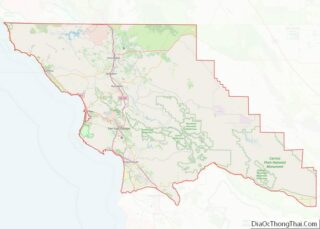
| County: | San Luis Obispo County |
| Founded: | 1870 |
| Incorporated: | July 17, 1964 |
| Elevation: | 62 ft (19 m) |
| Total Area: | 10.32 sq mi (26.74 km²) |
| Land Area: | 5.33 sq mi (13.80 km²) |
| Water Area: | 5.00 sq mi (12.94 km²) 48.63% |
| Total Population: | 10,757 |
| Population Density: | 1,000/sq mi (400/km²) |
| ZIP code: | 93442–93443 |
| Area code: | 805 |
| FIPS code: | 0649362 |
| GNISfeature ID: | 1661062 |
| Website: | www.morro-bay.ca.us |
Online Interactive Map
Click on ![]() to view map in "full screen" mode.
to view map in "full screen" mode.
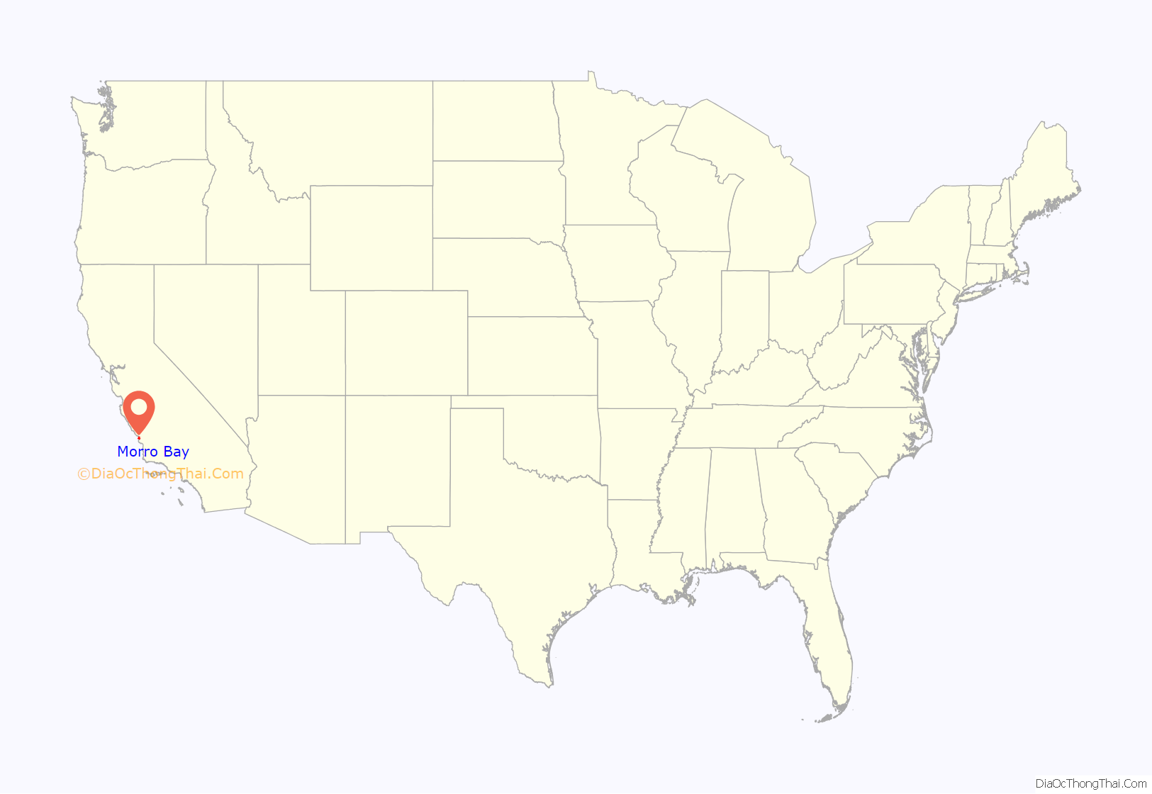
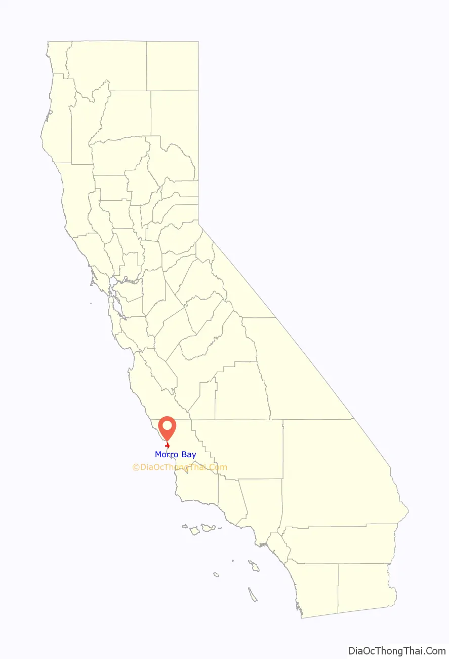
Morro Bay location map. Where is Morro Bay city?
History
The prehistory of Morro Bay relates to Chumash settlement, particularly near the mouth of Morro Creek. At least as early as the Millingstone Horizon thousands of years before present, there was an extensive settlement along the banks and terraces above Morro Creek. A tribal site on present-day Morro Bay was named tsɨtqawɨ, Obispeño for “Place of the Dogs”.
The first European land exploration of Alta California, the Spanish Portolá expedition, came down Los Osos Valley and camped near today’s Morro Bay on September 8, 1769. Franciscan missionary and expedition member Juan Crespí noted in his diary that “we saw a great rock in the form of a round morro”.
The first recorded Filipinos to visit America arrived at Morro Bay on October 18, 1587, from the Spanish galleon Nuestra Señora de la Esperanza; one of whom was killed by local Native Americans while scouting ahead.
While governed by Mexico, large land grants split the surrounding area into cattle and dairy ranchos. These ranchos needed shipping to bring in dry goods and to carry their crops, animals, and other farm products to cities.
The town of Morro Bay was founded by Franklin Riley in 1870 as a port for the export of dairy and ranch products. He was instrumental in the building of a wharf which has now become the Embarcadero. During the 1870s, schooners could often be seen at the Embarcadero picking up wool, potatoes, barley, and dairy products.
A subspecies of butterfly, the “Morro Bay Blue” or ” Morro Blue” (Icaricia icarioides moroensis) was first found at Morro beach, by the entomologist Robert F. Sternitzky, in June 1929.
During World War II, there was a U.S. Navy base, Amphibious Training Base Morro Bay on the north side of Morro Rock where sailors were trained to operate LCVPs. The breakwater on the southwest side of the Rock was built in 1944–45 to protect the LCVPs entering and leaving the harbor. Soldiers from Camp San Luis Obispo would come to Morro Bay and practice loading into the LCVPs. Many of those men were at Normandy on D-Day.
In the 1940s, Morro Bay developed an abalone fishing industry; it peaked in 1957, and stocks of abalone have declined significantly due to overfishing. Halibut, sole, rockfish, albacore, and many other species are still caught by both commercial and sport vessels. In addition, oysters are aquacultured in the shallow back bay.
The Pacific Gas and Electric Company built the Morro Bay Power Plant in the early 1950s which created jobs and increased the tax base. The city incorporated in 1964.
Morro Bay Road Map
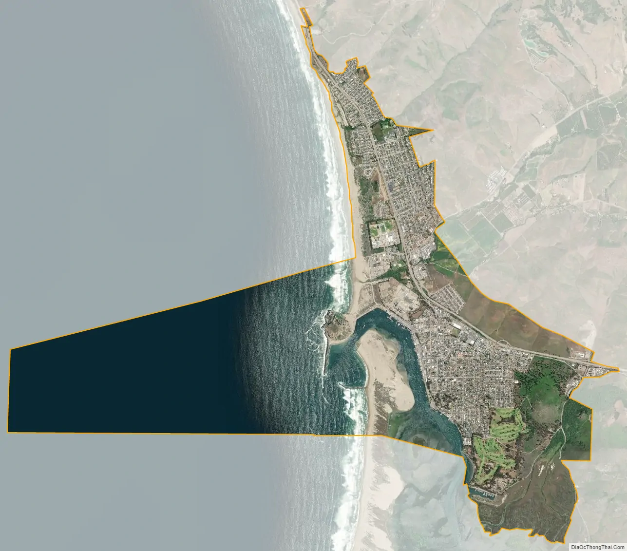
Morro Bay city Satellite Map
Geography
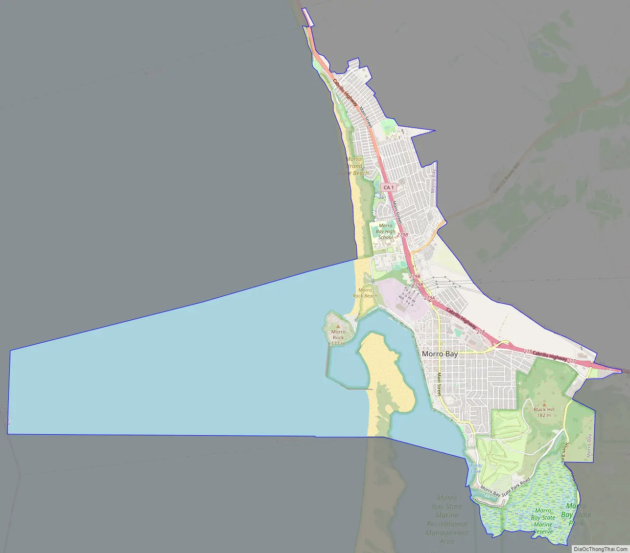
Morro Bay is the name of the large estuary that is situated along the northern shores of the bay itself. The larger bay on which the local area lies is Estero Bay, which also encompasses the communities of Cayucos and Los Osos. The city of Morro Bay is 20 km (12 mi) northwest of San Luis Obispo and is located on Highway 1. Los Osos Creek discharges into Morro Bay.
According to the United States Census Bureau, the city has a total area of 10.3 square miles (27 km), of which, 5.3 square miles (14 km) of it is land and 5.0 square miles (13 km) of it (48.63%) is water.
Morro Rock
Morro Rock is a 576 foot (176 m) high volcanic plug located at the entrance to the harbor. The descriptive term morro is common to the Spanish, Portuguese, and Italian languages, and the word is part of many place names where there is a distinctive and prominent hill-shaped rock formation. Originally, it was surrounded by water, but the northern channel was filled in to make the harbor. It was quarried from 1889 to 1969, and in 1968, it was designated a Historical Landmark.
The area around the base of Morro Rock is open to visitors, with parking lots and paths. Climbing the rock is prohibited due to risk of injury, and because it is a peregrine falcon reserve.
Morro Rock is one in a series of similar plugs that stretch in a line inland called the Nine Sisters.
Morro Bay Harbor
Morro Bay is a natural embayment with an artificial harbor constructed by the U.S. Army Corps of Engineers. It is the only all-weather small craft commercial and recreational harbor between Santa Barbara and Monterey. Morro Rock was originally surrounded by water, but the Army built a large artificial breakwater and road across the north end of the harbor, linking Morro Rock and the mainland. Some of the rock used for this and for the artificial breakwaters was quarried from Morro Rock itself. Other rock was imported by barge from Catalina Island. The bay extends inland and parallels the shore for a distance of about 6.4 km (4.0 mi) south of its entrance at Morro Rock. Morro Bay is recognized for protection by the California Bays and Estuaries Policy.
There is usually a small summer colony of otters in the kelp near the harbor entrance.
Climate
Morro Bay experiences a mild warm-summer Mediterranean climate (Köppen Csb) characteristic of coastal California featuring dry, warm summers and wet, mild winters. The city is located next to the Pacific Ocean, which helps moderate temperatures and create an overall pleasant mild year-round climate, resulting in warmer winters and cooler summers compared with places farther inland, such as Atascadero. Summers in Morro Bay are cool for a city located on the 35th parallel north latitude, with July averaging around 60 °F (16 °C). Winters are mild, with January averaging at 55 °F (13 °C) with around 8 days of measurable precipitation.
See also
Map of California State and its subdivision:- Alameda
- Alpine
- Amador
- Butte
- Calaveras
- Colusa
- Contra Costa
- Del Norte
- El Dorado
- Fresno
- Glenn
- Humboldt
- Imperial
- Inyo
- Kern
- Kings
- Lake
- Lassen
- Los Angeles
- Madera
- Marin
- Mariposa
- Mendocino
- Merced
- Modoc
- Mono
- Monterey
- Napa
- Nevada
- Orange
- Placer
- Plumas
- Riverside
- Sacramento
- San Benito
- San Bernardino
- San Diego
- San Francisco
- San Joaquin
- San Luis Obispo
- San Mateo
- Santa Barbara
- Santa Clara
- Santa Cruz
- Shasta
- Sierra
- Siskiyou
- Solano
- Sonoma
- Stanislaus
- Sutter
- Tehama
- Trinity
- Tulare
- Tuolumne
- Ventura
- Yolo
- Yuba
- Alabama
- Alaska
- Arizona
- Arkansas
- California
- Colorado
- Connecticut
- Delaware
- District of Columbia
- Florida
- Georgia
- Hawaii
- Idaho
- Illinois
- Indiana
- Iowa
- Kansas
- Kentucky
- Louisiana
- Maine
- Maryland
- Massachusetts
- Michigan
- Minnesota
- Mississippi
- Missouri
- Montana
- Nebraska
- Nevada
- New Hampshire
- New Jersey
- New Mexico
- New York
- North Carolina
- North Dakota
- Ohio
- Oklahoma
- Oregon
- Pennsylvania
- Rhode Island
- South Carolina
- South Dakota
- Tennessee
- Texas
- Utah
- Vermont
- Virginia
- Washington
- West Virginia
- Wisconsin
- Wyoming