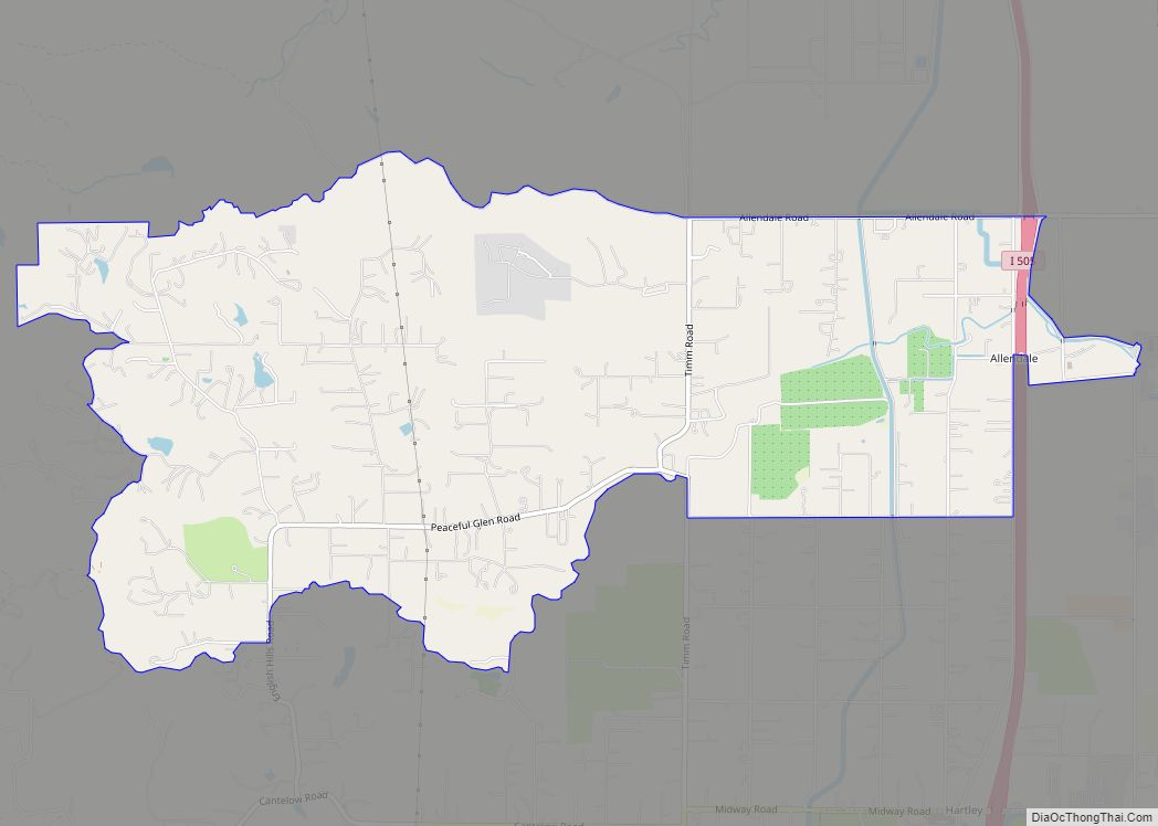
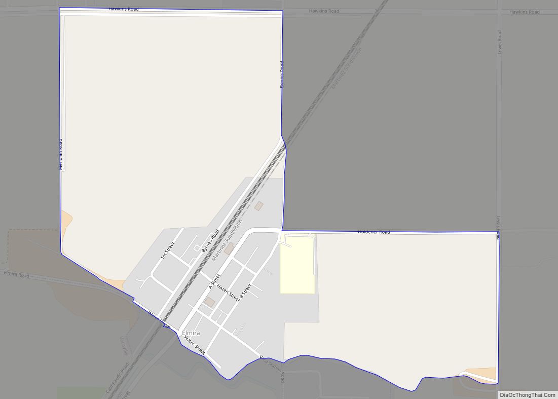
Elmira is a census-designated place (CDP) in Solano County, California, United States. The population was 188 at the 2010 census.
| Name: | Elmira CDP |
|---|---|
| LSAD Code: | 57 |
| LSAD Description: | CDP (suffix) |
| State: | California |
| County: | Solano County |
| Elevation: | 75 ft (23 m) |
| Total Area: | 0.531 sq mi (1.376 km²) |
| Land Area: | 0.531 sq mi (1.376 km²) |
| Water Area: | 0 sq mi (0 km²) 0% |
| Total Population: | 188 |
| Population Density: | 350/sq mi (140/km²) |
| ZIP code: | 95625 |
| Area code: | 707 |
| FIPS code: | 0622146 |
| GNISfeature ID: | 1655995 |
Online Interactive Map
Click on ![]() to view map in "full screen" mode.
to view map in "full screen" mode.
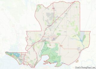
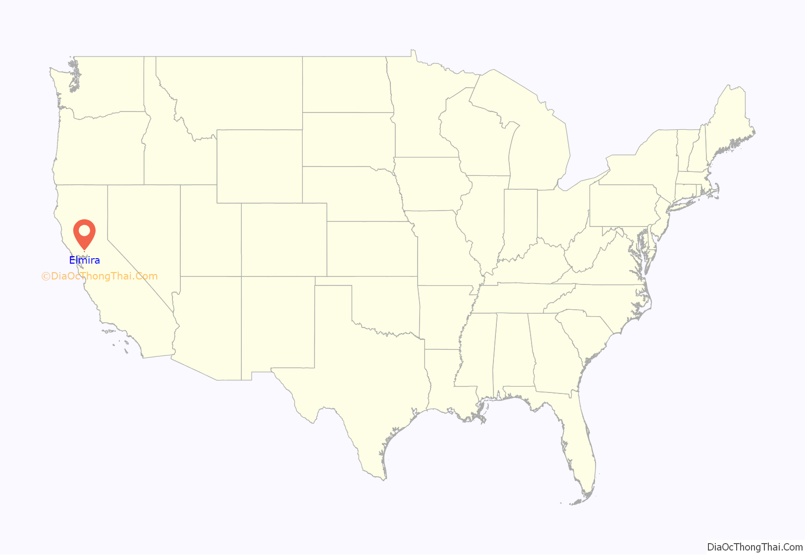
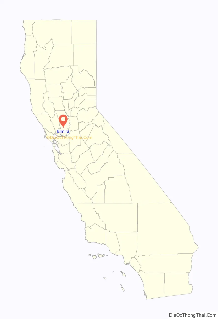
Elmira location map. Where is Elmira CDP?
History
Elmira, California, is named after Elmira, New York.
In the 19th and early 20th century, Elmira was the major railroad stop between Fairfield and Davis. To get to Vacaville, travelers had to take a spur from Elmira. When U.S. Route 40 was built through Vacaville, the population of Vacaville increased in size, while the population of Elmira declined.
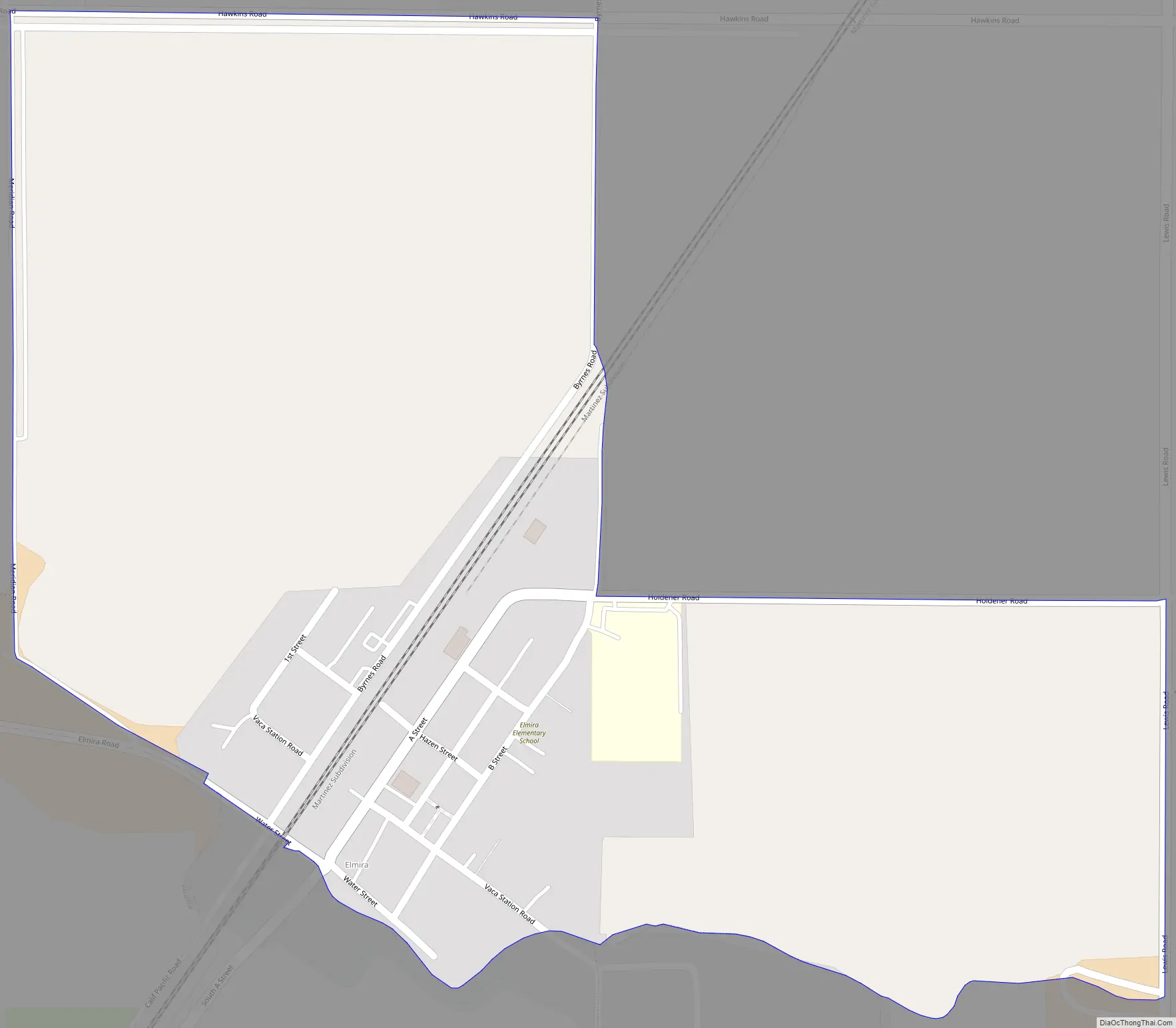
Elmira Road Map
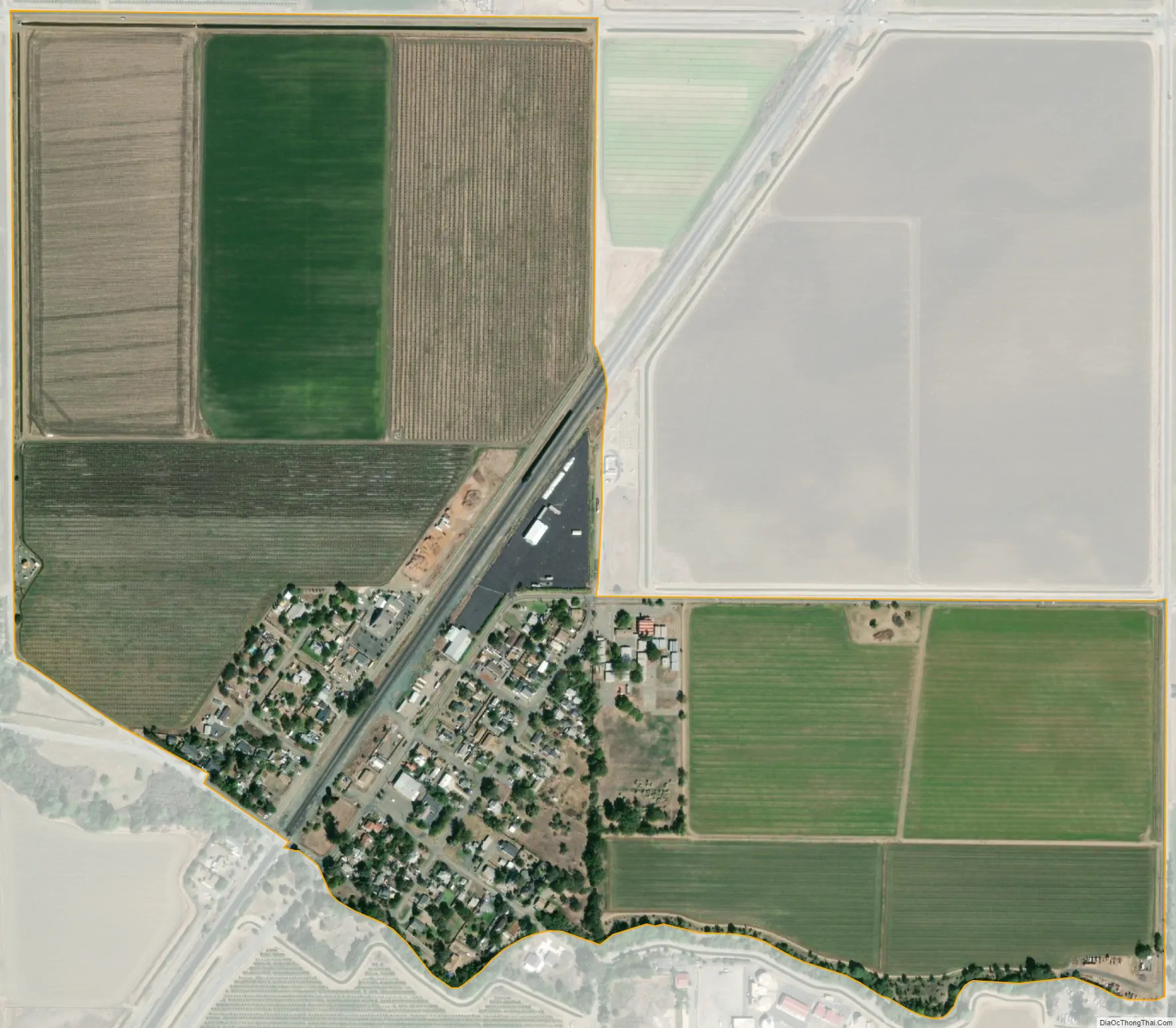
Elmira city Satellite Map
Geography
According to the United States Census Bureau, the CDP has a total area of 0.531 square miles (1.38 km), all of it land.
See also
Map of California State and its subdivision:- Alameda
- Alpine
- Amador
- Butte
- Calaveras
- Colusa
- Contra Costa
- Del Norte
- El Dorado
- Fresno
- Glenn
- Humboldt
- Imperial
- Inyo
- Kern
- Kings
- Lake
- Lassen
- Los Angeles
- Madera
- Marin
- Mariposa
- Mendocino
- Merced
- Modoc
- Mono
- Monterey
- Napa
- Nevada
- Orange
- Placer
- Plumas
- Riverside
- Sacramento
- San Benito
- San Bernardino
- San Diego
- San Francisco
- San Joaquin
- San Luis Obispo
- San Mateo
- Santa Barbara
- Santa Clara
- Santa Cruz
- Shasta
- Sierra
- Siskiyou
- Solano
- Sonoma
- Stanislaus
- Sutter
- Tehama
- Trinity
- Tulare
- Tuolumne
- Ventura
- Yolo
- Yuba
- Alabama
- Alaska
- Arizona
- Arkansas
- California
- Colorado
- Connecticut
- Delaware
- District of Columbia
- Florida
- Georgia
- Hawaii
- Idaho
- Illinois
- Indiana
- Iowa
- Kansas
- Kentucky
- Louisiana
- Maine
- Maryland
- Massachusetts
- Michigan
- Minnesota
- Mississippi
- Missouri
- Montana
- Nebraska
- Nevada
- New Hampshire
- New Jersey
- New Mexico
- New York
- North Carolina
- North Dakota
- Ohio
- Oklahoma
- Oregon
- Pennsylvania
- Rhode Island
- South Carolina
- South Dakota
- Tennessee
- Texas
- Utah
- Vermont
- Virginia
- Washington
- West Virginia
- Wisconsin
- Wyoming