Rohnert Park is a city in Sonoma County, California, United States, located approximately 50 miles (80 km) north of San Francisco. The population at the 2020 United States Census was 44,390. It is an early planned city and is the sister city of Hashimoto in Japan. Sonoma State University, part of the California State University system, is located nearby.
| Name: | Rohnert Park city |
|---|---|
| LSAD Code: | 25 |
| LSAD Description: | city (suffix) |
| State: | California |
| County: | Sonoma County |
| Incorporated: | August 28, 1962 |
| Elevation: | 105 ft (32 m) |
| Total Area: | 7.29 sq mi (18.88 km²) |
| Land Area: | 7.29 sq mi (18.87 km²) |
| Water Area: | 0.01 sq mi (0.01 km²) 0.07% |
| Total Population: | 44,390 |
| Population Density: | 6,093/sq mi (2,352.4/km²) |
| ZIP code: | 94926–94928 |
| Area code: | 707 |
| FIPS code: | 0662546 |
| Website: | www.rpcity.org |
Online Interactive Map
Click on ![]() to view map in "full screen" mode.
to view map in "full screen" mode.
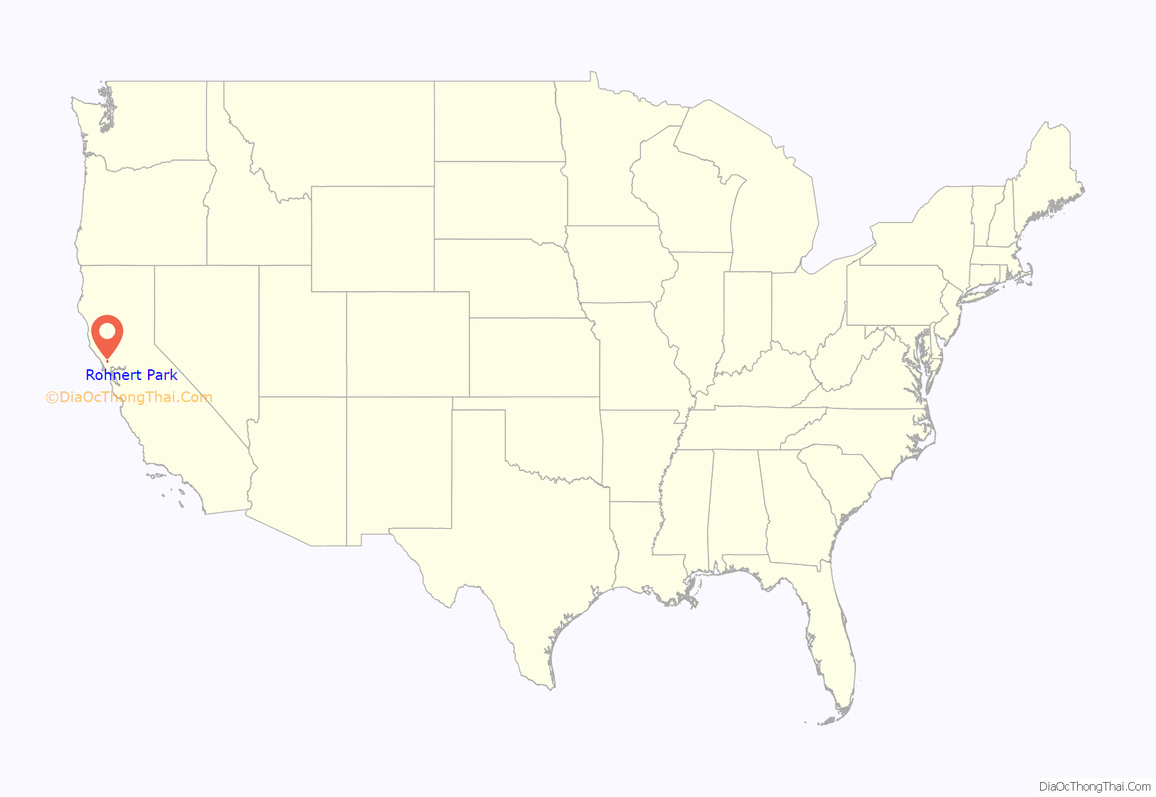
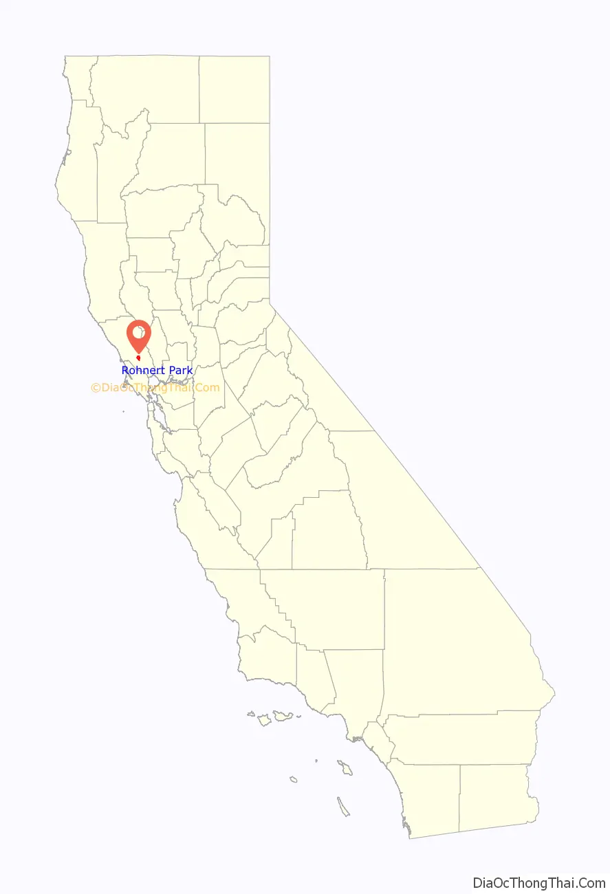
Rohnert Park location map. Where is Rohnert Park city?
History
Originally home of the Coast Miwok native people, the Mexican government granted Rancho Cotate to Captain Juan Castaneda in July 1844 for his military services in the region. The grant encompassed present-day Penngrove, Cotati and Rohnert Park. “Cotate Rancho is a part of the Vallejo Township which is the plain between Sonoma Mountain and Petaluma Creek San Pablo Bay, and an east and west line dividing the tract from Santa Rosa Township.” In 1849, Dr. Thomas S. Page, of Cotati, bought Rancho Cotate. Over time, the property was broken up and sold off piecemeal to incoming settlers.
The town of Rohnert Park was named after the Rohnert family, which owned the Rohnert Seed Farm. In 1929, a successful businessman, Waldo Emerson Rohnert (1869–1933), a native of Detroit, Michigan, purchased a large ranch in the area and minimized flooding in the fields with a crude drainage system. He died shortly thereafter. His son, Fred Rohnert, a graduate of Stanford Law School, took over the ranch and developed a seed growing business, the Rohnert Seed Farm, which became a major horticultural success for the county.
In 1956, only four adults resided within the district boundaries. In 1956 and 1957, with the U.S. Route 101 Freeway recently completed at the Cotati bypass, Rohnert Park began to be laid out and built as a planned city. In a summer election in 1962, Rohnert Park was incorporated, comprising 1,325 acres (536 ha), housing an estimated 2,775 persons. It was the first town to incorporate in Sonoma County since 1905. The neighboring town of Cotati, California, voted to incorporate the following year.
21st-century development
Sonoma Mountain Village Rohnert Park is a 200-acre (0.81 km), solar-powered, zero-waste community currently under development.
The Graton Resort & Casino opened on November 5, 2013.
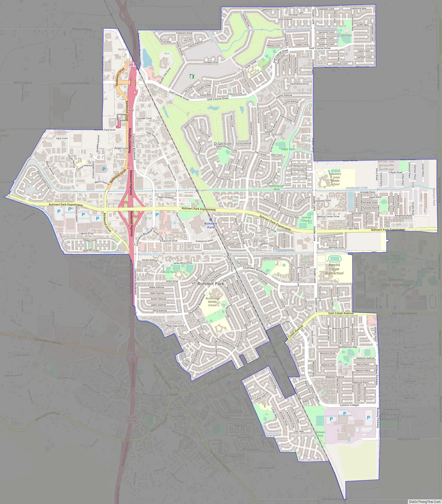
Rohnert Park Road Map
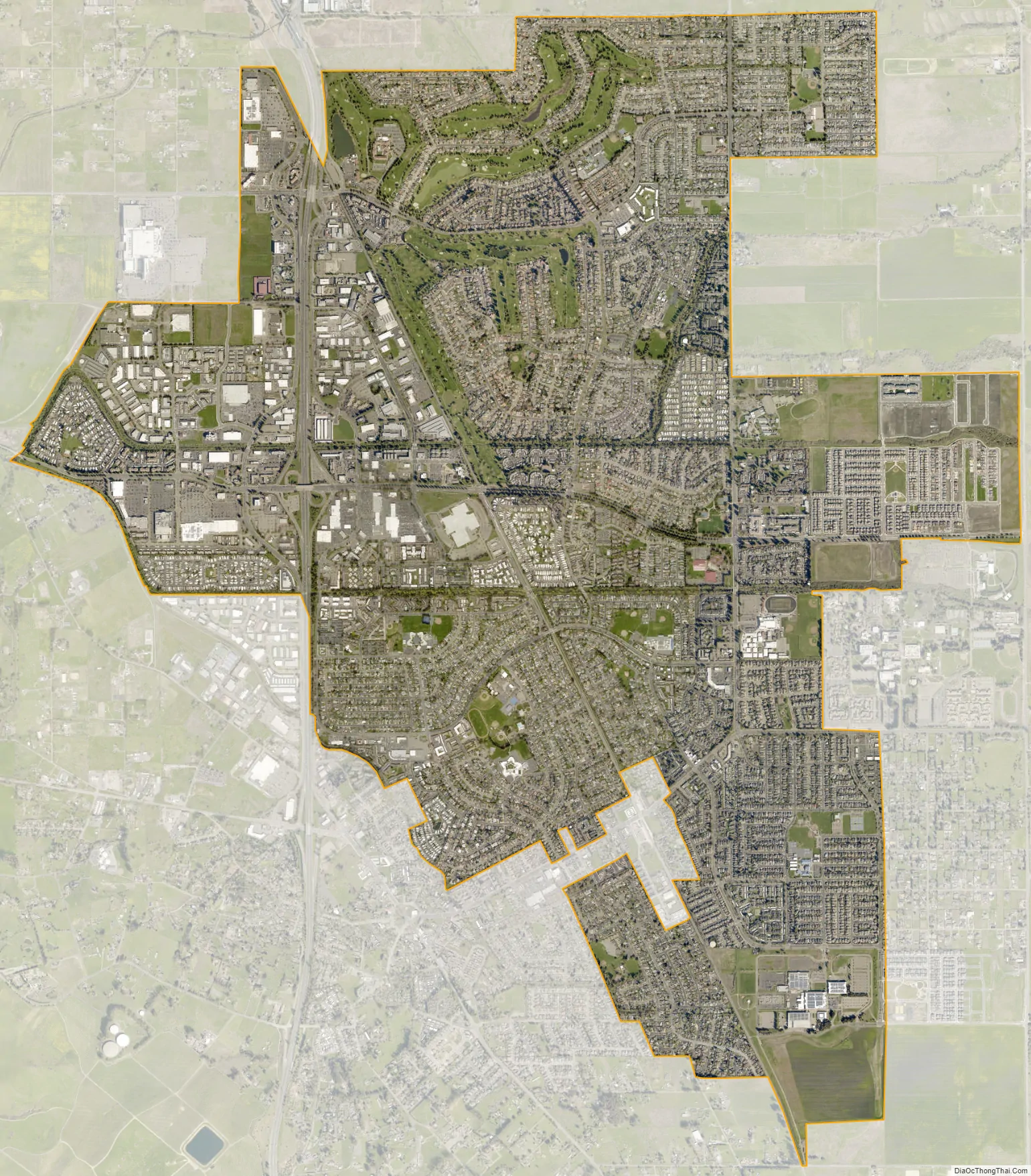
Rohnert Park city Satellite Map
Geography
According to the United States Census Bureau, Rohnert Park has a total area of 7.0 square miles (18 km), 99.93% of it land and 0.07% of it water.
The city neighborhoods east of Highway 101 are organized into sections, generally designated by the letters A–H, J-M, R, S, and W. In most cases, the names of streets and parks begin with the letter of the section they are in. K Section is also referred to as the “University District” and is the residential development of the City’s University Specific Plan Area; W Section is also referred to as “Willowglen” and is the residential development of the City’s Southeast Specific Plan Area.
There is a small reservoir called Roberts Lake at the north end of the city and a number of creeks. Important creeks include the Laguna de Santa Rosa (which forms part of the border with the City of Cotati), Copeland Creek, Hinebaugh Creek, Crane Creek and Five Creek. All creeks within the city limits have been channelized. Spivock Creek, Coleman Creek, Wilfred Channel, and Labath Channel are artificial channels designed to convey runoff.
Riparian communities within the city are limited by channelization of creekbeds. Vegetation alongside the city’s streams primarily consists of grass and sedge species. The Laguna de Santa Rosa contains bands of thick native riparian vegetation, including willow (Salix spp.) and alder (Alnus spp.) trees.
Sudden oak death fungus risks are present in the Rohnert Park area. Research is ongoing at the nearby Fairfield Osborn Preserve.
Geology
The Rodgers Creek Fault is an active fault influencing earthquake activity in the Rohnert Park area. The city also experiences earthquakes from the San Andreas Fault.
See also
Map of California State and its subdivision:- Alameda
- Alpine
- Amador
- Butte
- Calaveras
- Colusa
- Contra Costa
- Del Norte
- El Dorado
- Fresno
- Glenn
- Humboldt
- Imperial
- Inyo
- Kern
- Kings
- Lake
- Lassen
- Los Angeles
- Madera
- Marin
- Mariposa
- Mendocino
- Merced
- Modoc
- Mono
- Monterey
- Napa
- Nevada
- Orange
- Placer
- Plumas
- Riverside
- Sacramento
- San Benito
- San Bernardino
- San Diego
- San Francisco
- San Joaquin
- San Luis Obispo
- San Mateo
- Santa Barbara
- Santa Clara
- Santa Cruz
- Shasta
- Sierra
- Siskiyou
- Solano
- Sonoma
- Stanislaus
- Sutter
- Tehama
- Trinity
- Tulare
- Tuolumne
- Ventura
- Yolo
- Yuba
- Alabama
- Alaska
- Arizona
- Arkansas
- California
- Colorado
- Connecticut
- Delaware
- District of Columbia
- Florida
- Georgia
- Hawaii
- Idaho
- Illinois
- Indiana
- Iowa
- Kansas
- Kentucky
- Louisiana
- Maine
- Maryland
- Massachusetts
- Michigan
- Minnesota
- Mississippi
- Missouri
- Montana
- Nebraska
- Nevada
- New Hampshire
- New Jersey
- New Mexico
- New York
- North Carolina
- North Dakota
- Ohio
- Oklahoma
- Oregon
- Pennsylvania
- Rhode Island
- South Carolina
- South Dakota
- Tennessee
- Texas
- Utah
- Vermont
- Virginia
- Washington
- West Virginia
- Wisconsin
- Wyoming


