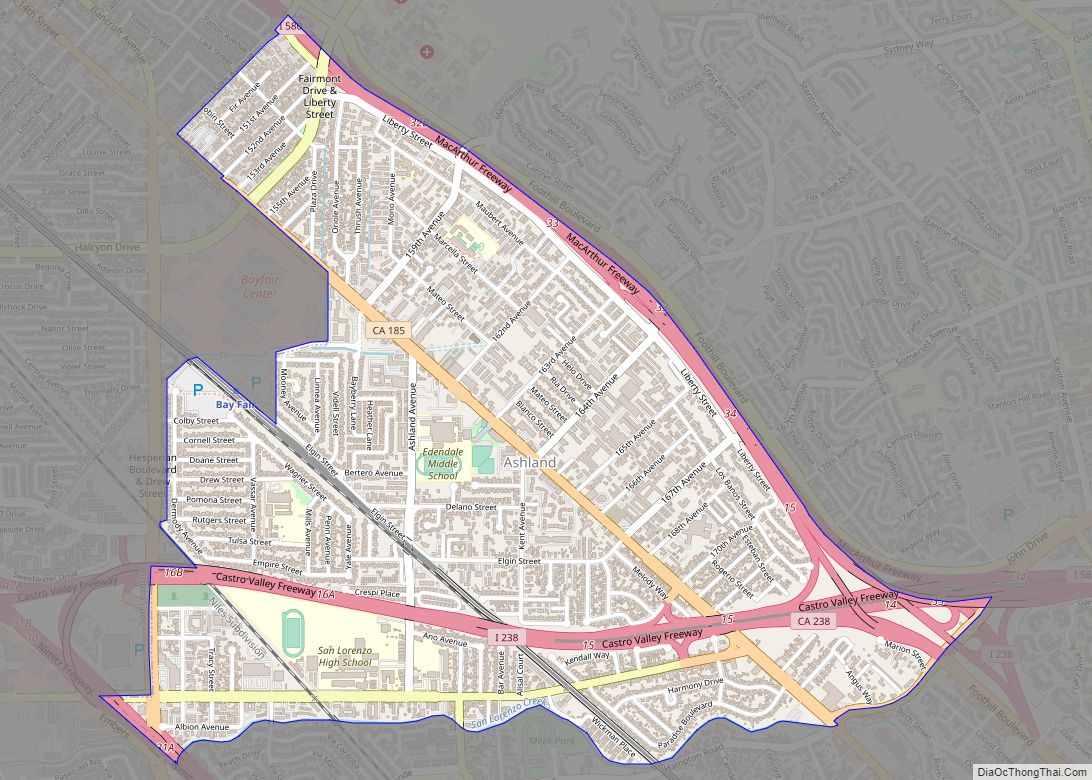
San Lorenzo (Spanish for “St. Lawrence”) is a census-designated place (CDP) located in the East Bay of the San Francisco Bay Area in Alameda County, California, United States. The population was 29,581 at the 2020 census. It is an unincorporated community, located at the banks of San Lorenzo Creek. It was originally named Squattersville in 1851, but later renamed to San Lorenzo.
In 1944, under contract to the U.S. Navy, The David D. Bohannon Company began construction of San Lorenzo Village, which was one of the nation’s first planned communities, with parcels designated for schools, churches, parks, and several retail centers. Bohannon’s pioneering pre-cutting techniques, referred to as the “California method,” were used in later developments, such as the more famous Levittown, Pennsylvania.
| Name: | San Lorenzo CDP |
|---|---|
| LSAD Code: | 57 |
| LSAD Description: | CDP (suffix) |
| State: | California |
| County: | Alameda County |
| Elevation: | 36 ft (11 m) |
| Total Area: | 2.770 sq mi (7.17 km²) |
| Land Area: | 2.763 sq mi (7.16 km²) |
| Water Area: | 0.007 sq mi (0.02 km²) 0.24% |
| Total Population: | 29,581 |
| Population Density: | 11,000/sq mi (4,100/km²) |
| ZIP code: | 94580 |
| Area code: | 510, 341 |
| FIPS code: | 0668112 |
Online Interactive Map
Click on ![]() to view map in "full screen" mode.
to view map in "full screen" mode.
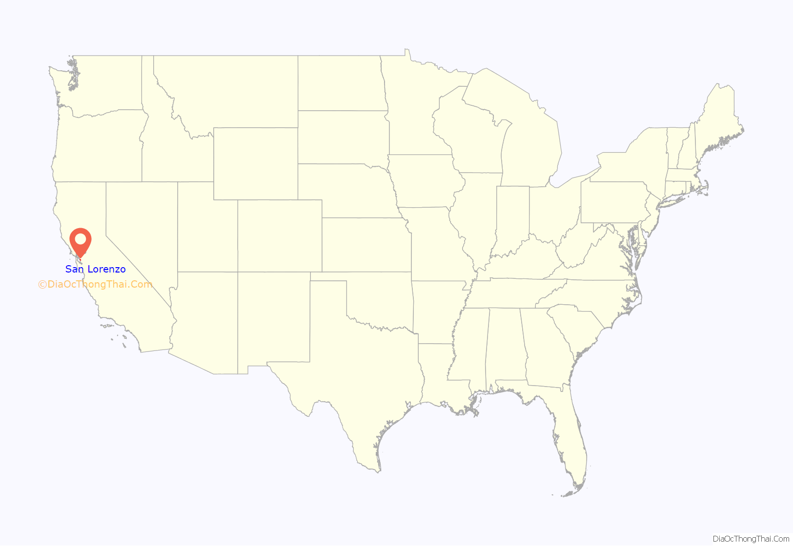
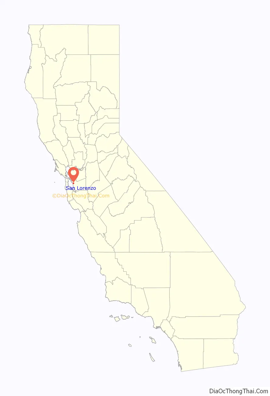
San Lorenzo location map. Where is San Lorenzo CDP?
History
San Lorenzo is located on the route of El Camino Viejo on land of the former Rancho San Lorenzo, a Mexican land grant given to Guillermo Castro in 1841, and the former Rancho San Leandro, granted to José Joaquin Estudillo in 1842.
Early residents during the California Gold Rush era lived here as squatters along the border between Rancho San Lorenzo and Rancho San Leandro. The informal name given to the area was Squatterville.
The first post office opened in San Lorenzo in 1854.
Many of the early inhabitants are buried in San Lorenzo Pioneer Cemetery, including Moses Wicks, who brought oysters to San Leandro Bay from Patchogue, Long Island. The cemetery is maintained by the county and the Hayward Area Historical Society.
San Lorenzo was mostly farmland, a significant center of production of fruit and flowers, from the mid-19th century to the mid-20th century.
In 1944, under contract to the U.S. Navy, The David D. Bohannon Company began construction of San Lorenzo Village, a tract of two- and three-bedroom homes for workers in the East Bay’s war industries. San Lorenzo Village was one of the nation’s first planned communities, with parcels designated for schools, churches, parks, and several retail centers. Bohannon’s pioneering pre-cutting techniques, referred to as the “California method,” were used in later developments, such as the more famous Levittown, Pennsylvania. Home construction continued into the 1950s to accommodate the region’s booming population.
San Lorenzo Village housing project launched as the largest privately financed housing project on the West Coast during WWII. San Lorenzo Shopping Center became one of the country’s first planned community shopping centers and was home to the first Mervyn’s Department Store.
Segregation
The original San Lorenzo Village homes were restricted to white owners, and re-sale of homes were limited to white owners through racially restrictive covenants on property deeds. “Sales brochures in the early to mid-1950s […] assured prospective buyers that the village was “a safe investment” because “farsighted protective restrictions … permanently safeguard your investment.” These restrictions, among others around fencing and house colors, were enforced by the San Lorenzo Village Association.
Legal enforcement of such covenants was deemed to violate the Equal Protection Clause of the Fourteenth Amendment by the Supreme Court in Shelley v. Kraemer (1948), meaning that while parties could choose to abide by the covenants, they could no longer be legally used to prevent non-white persons from buying properties with such restrictions. As a general note, without specific reference to San Lorenzo, after Shelley, homeowners associations still would bar non-white owners by requiring membership in the association before buying property, and federal and state governments refused to enforce the Shelley decision. In San Lorenzo, the black population remained under one-half percent in the early 1970s.
The language of these restrictions, even if not enforceable, may still be on property deeds.
San Lorenzo Road Map
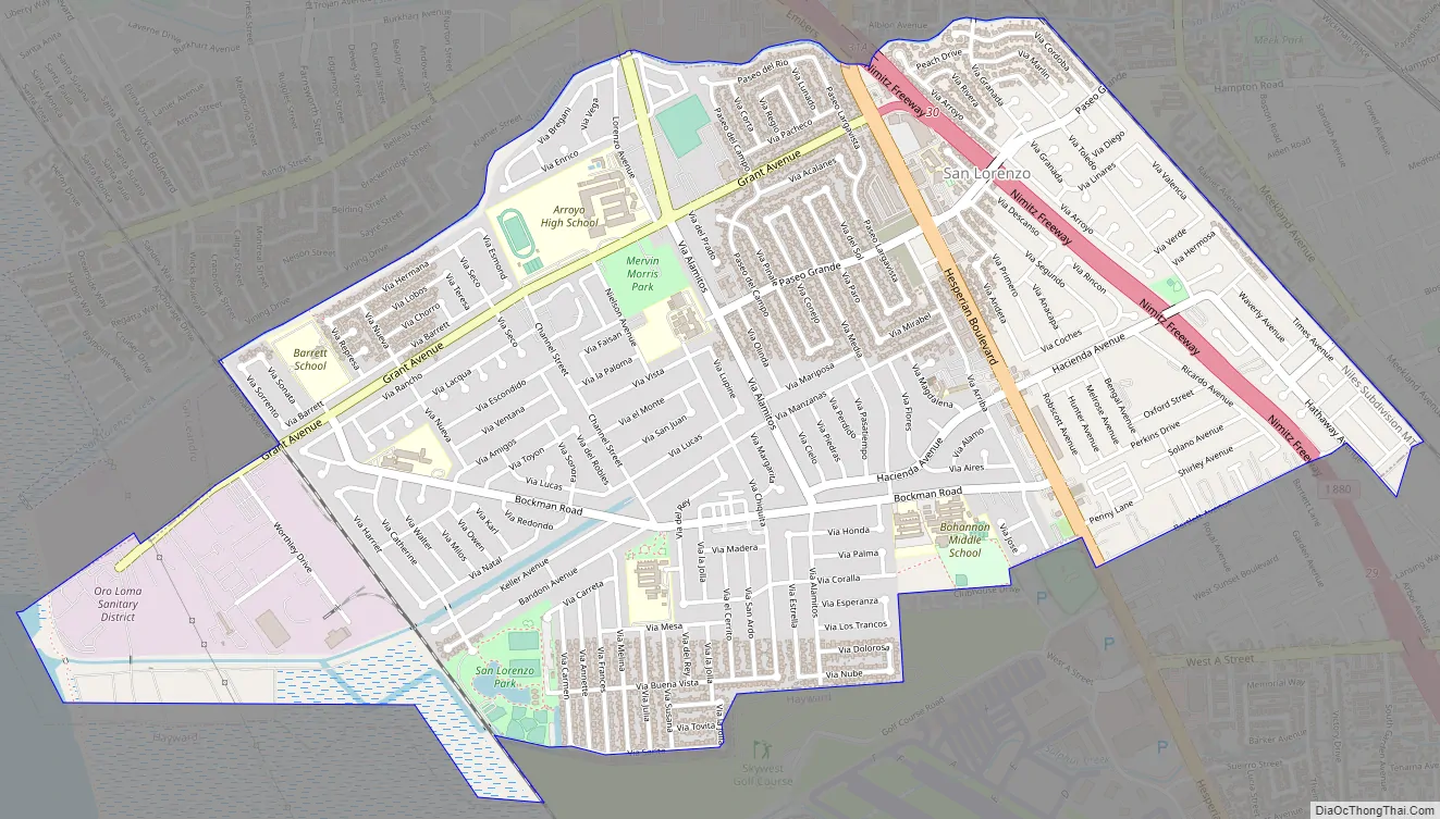
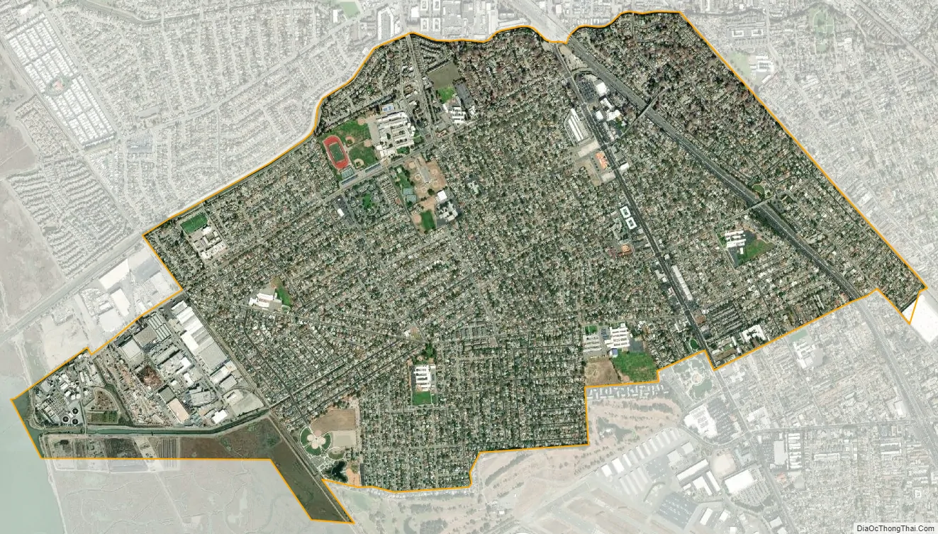
San Lorenzo city Satellite Map
Geography
According to the United States Census Bureau, the CDP has a total area of 2.8 square miles (7.3 km), of which, 2.8 square miles (7.3 km) island and 0.24% is water. San Lorenzo Creek runs partly through the town. It is located between the incorporated cities of San Leandro to the north and Hayward to the south.
See also
Map of California State and its subdivision:- Alameda
- Alpine
- Amador
- Butte
- Calaveras
- Colusa
- Contra Costa
- Del Norte
- El Dorado
- Fresno
- Glenn
- Humboldt
- Imperial
- Inyo
- Kern
- Kings
- Lake
- Lassen
- Los Angeles
- Madera
- Marin
- Mariposa
- Mendocino
- Merced
- Modoc
- Mono
- Monterey
- Napa
- Nevada
- Orange
- Placer
- Plumas
- Riverside
- Sacramento
- San Benito
- San Bernardino
- San Diego
- San Francisco
- San Joaquin
- San Luis Obispo
- San Mateo
- Santa Barbara
- Santa Clara
- Santa Cruz
- Shasta
- Sierra
- Siskiyou
- Solano
- Sonoma
- Stanislaus
- Sutter
- Tehama
- Trinity
- Tulare
- Tuolumne
- Ventura
- Yolo
- Yuba
- Alabama
- Alaska
- Arizona
- Arkansas
- California
- Colorado
- Connecticut
- Delaware
- District of Columbia
- Florida
- Georgia
- Hawaii
- Idaho
- Illinois
- Indiana
- Iowa
- Kansas
- Kentucky
- Louisiana
- Maine
- Maryland
- Massachusetts
- Michigan
- Minnesota
- Mississippi
- Missouri
- Montana
- Nebraska
- Nevada
- New Hampshire
- New Jersey
- New Mexico
- New York
- North Carolina
- North Dakota
- Ohio
- Oklahoma
- Oregon
- Pennsylvania
- Rhode Island
- South Carolina
- South Dakota
- Tennessee
- Texas
- Utah
- Vermont
- Virginia
- Washington
- West Virginia
- Wisconsin
- Wyoming