San Martin or San Martín (Spanish for Saint Martin) is a village and census-designated place (CDP) in Santa Clara County, California, in the southern Santa Clara Valley. Located to the south of Morgan Hill and north of Gilroy, San Martin is characterized by ranches, wineries, and orchards, as well as large estates in the foothills of the Santa Cruz Mountains.
| Name: | San Martin CDP |
|---|---|
| LSAD Code: | 57 |
| LSAD Description: | CDP (suffix) |
| State: | California |
| County: | Santa Clara County |
| Elevation: | 289 ft (88 m) |
| Total Area: | 11.596 sq mi (30.035 km²) |
| Land Area: | 11.596 sq mi (30.035 km²) |
| Water Area: | 0 sq mi (0 km²) 0% |
| Total Population: | 7,027 |
| Population Density: | 610/sq mi (230/km²) |
| ZIP code: | 95046 |
| Area code: | 408/669 |
| FIPS code: | 0668238 |
| GNISfeature ID: | 277595 |
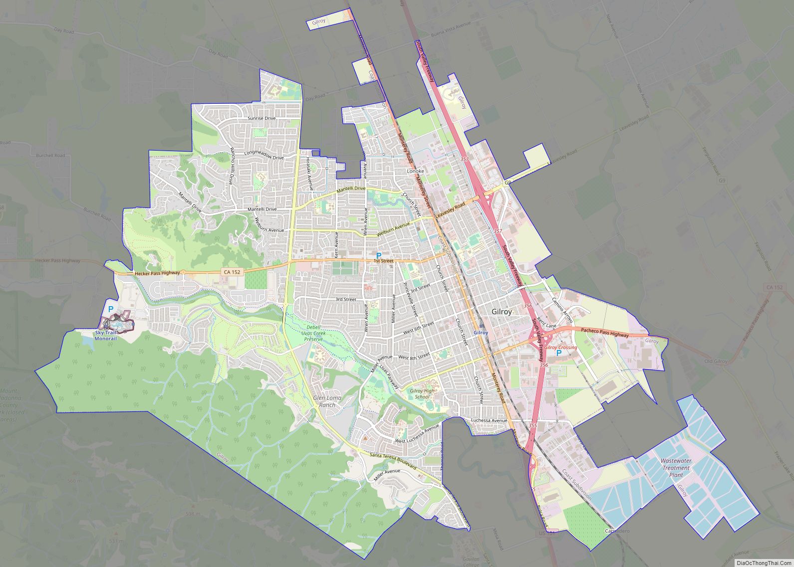
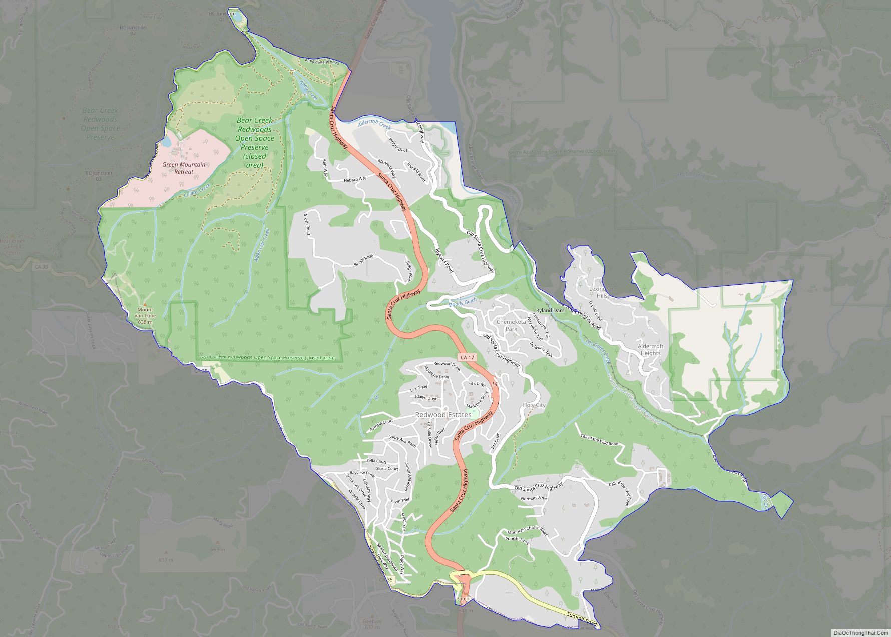
Online Interactive Map
Click on ![]() to view map in "full screen" mode.
to view map in "full screen" mode.
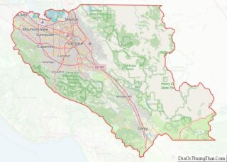
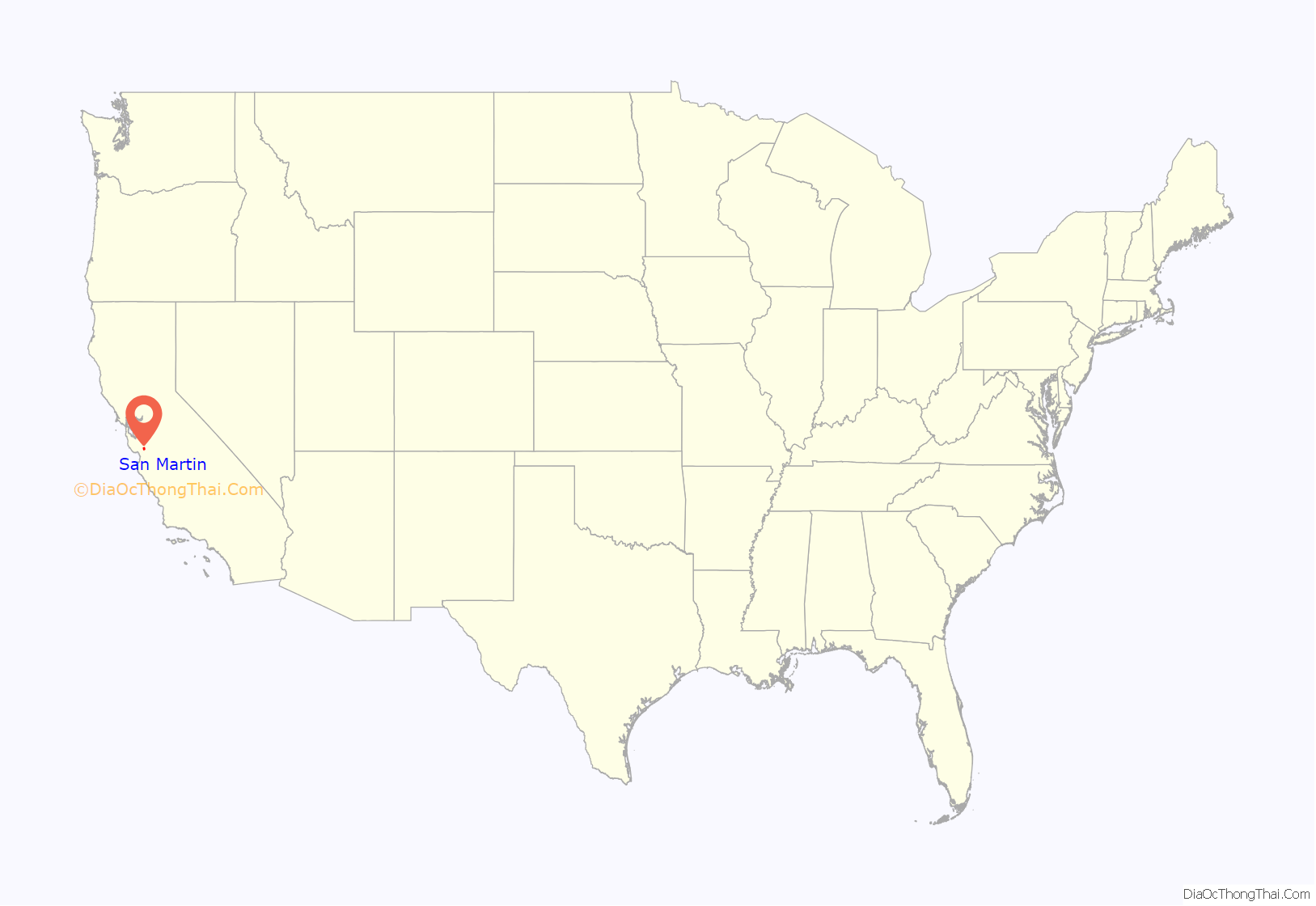
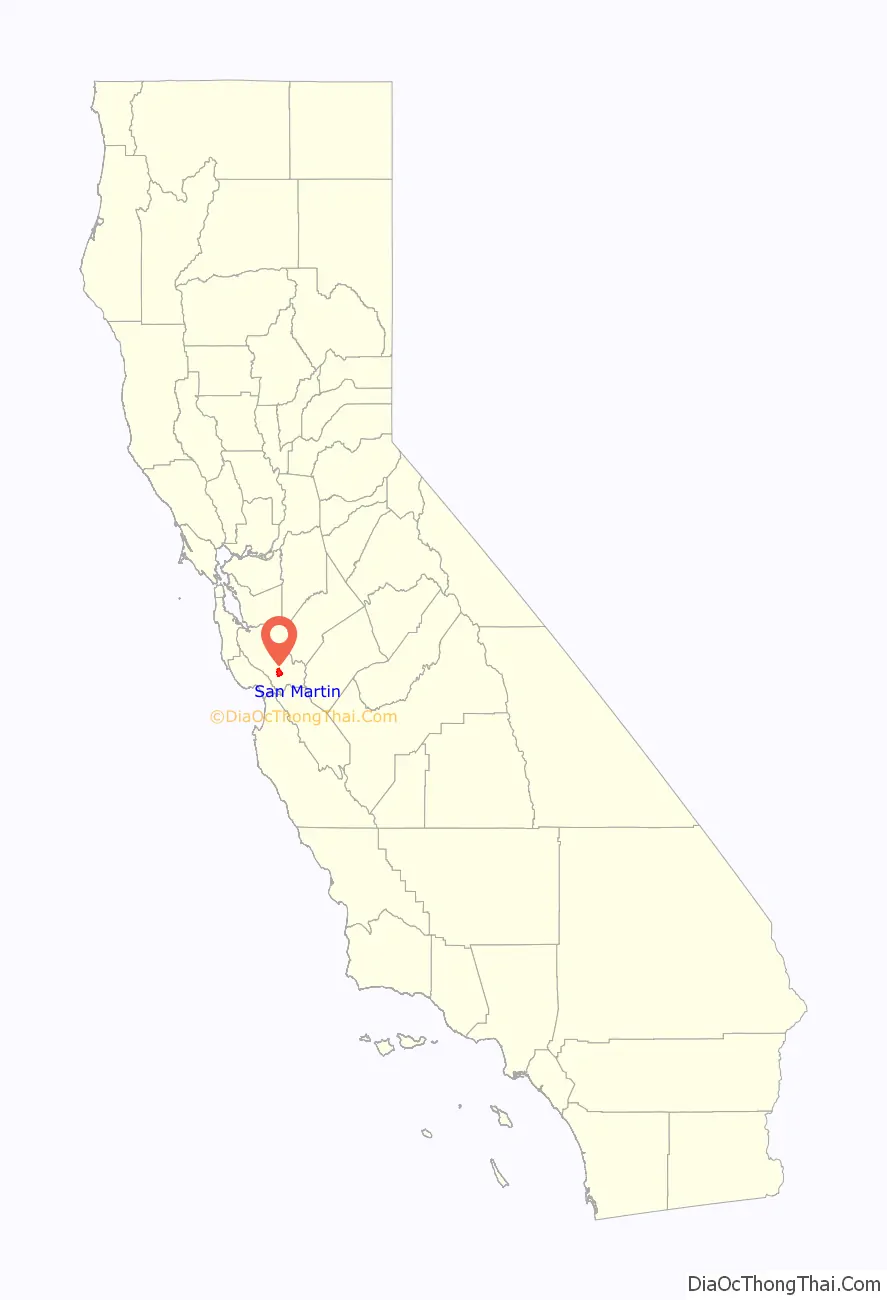
San Martin location map. Where is San Martin CDP?
History
San Martin was named after St. Martin of Tours, the patron saint of Santa Clara Valley pioneer Martin Murphy, a Mexican citizen who built the first Catholic church in the area.
The community has considered incorporating as a city since 2004, but concerns over the community’s small size and its ability to pay for municipal services have held efforts back. Other options considered have been annexation by Morgan Hill.
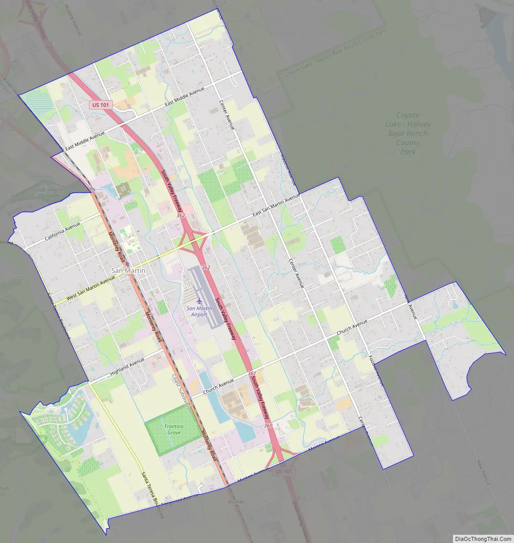
San Martin Road Map
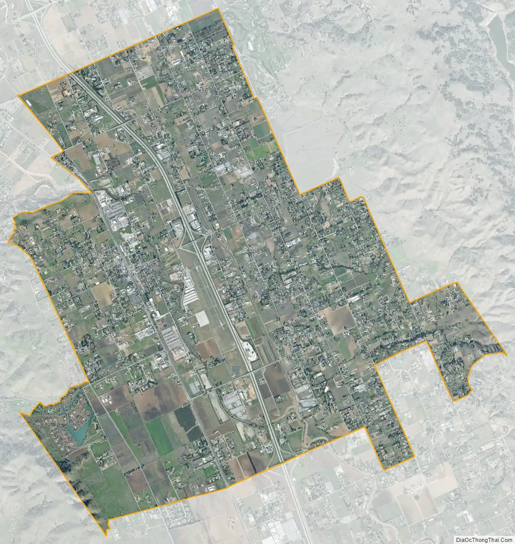
San Martin city Satellite Map
Geography
San Martin is approximately 48 km (30 mi) south of San Jose, California, 11 km (6.8 mi) north of Gilroy, California, and 24 km (15 mi) inland from the Pacific Coast. Lying in a roughly 6 km-wide (4-mi-wide) southern extension of the Santa Clara Valley, it is bounded by the Santa Cruz Mountains to the west and the Diablo Range to the east.
According to the United States Census Bureau, the CDP has a total area of 11.6 square miles (30 km), all of it land.
Climate
Due to the moderating influence of the Pacific Ocean, San Martin enjoys a warm, Mediterranean climate. Temperatures range from an average midsummer maximum of 90.2°F (32.3°C) to an average midwinter low of 33.6 °F (0.9 °C). Average annual rainfall is 480 mm (18.9 in), and the summer months are typically dry. Snowfall is rare, about once every 20 years, and is light and short-lived when it occurs. Summer months are characterized by coastal fog which arrives from the ocean around 10 p.m. and dissipates the next morning by 10 a.m. Winter months have many sunny and partly cloudy days, with frequent breaks between rainstorms. The local terrain is inconducive to tornadoes, severe windstorms and thunderstorms. The local climate supports chaparral and grassland biomes, with stands of live oak at higher elevations.
See also
Map of California State and its subdivision:- Alameda
- Alpine
- Amador
- Butte
- Calaveras
- Colusa
- Contra Costa
- Del Norte
- El Dorado
- Fresno
- Glenn
- Humboldt
- Imperial
- Inyo
- Kern
- Kings
- Lake
- Lassen
- Los Angeles
- Madera
- Marin
- Mariposa
- Mendocino
- Merced
- Modoc
- Mono
- Monterey
- Napa
- Nevada
- Orange
- Placer
- Plumas
- Riverside
- Sacramento
- San Benito
- San Bernardino
- San Diego
- San Francisco
- San Joaquin
- San Luis Obispo
- San Mateo
- Santa Barbara
- Santa Clara
- Santa Cruz
- Shasta
- Sierra
- Siskiyou
- Solano
- Sonoma
- Stanislaus
- Sutter
- Tehama
- Trinity
- Tulare
- Tuolumne
- Ventura
- Yolo
- Yuba
- Alabama
- Alaska
- Arizona
- Arkansas
- California
- Colorado
- Connecticut
- Delaware
- District of Columbia
- Florida
- Georgia
- Hawaii
- Idaho
- Illinois
- Indiana
- Iowa
- Kansas
- Kentucky
- Louisiana
- Maine
- Maryland
- Massachusetts
- Michigan
- Minnesota
- Mississippi
- Missouri
- Montana
- Nebraska
- Nevada
- New Hampshire
- New Jersey
- New Mexico
- New York
- North Carolina
- North Dakota
- Ohio
- Oklahoma
- Oregon
- Pennsylvania
- Rhode Island
- South Carolina
- South Dakota
- Tennessee
- Texas
- Utah
- Vermont
- Virginia
- Washington
- West Virginia
- Wisconsin
- Wyoming