Santa Paula (Spanish for “St. Paula”) is a city in Ventura County, California, United States. Situated amid the orchards of the Santa Clara River Valley, the city advertises itself to tourists as the “Citrus Capital of the World”. Santa Paula was one of the early centers of California’s petroleum industry. The Union Oil Company Building, the founding headquarters of the Union Oil Company of California in 1890, now houses the California Oil Museum. The population was 30,657 at the 2020 census, up from 29,321 at the 2010 census.
| Name: | Santa Paula city |
|---|---|
| LSAD Code: | 25 |
| LSAD Description: | city (suffix) |
| State: | California |
| County: | Ventura County |
| Founded: | 1872 |
| Incorporated: | April 22, 1902 |
| Elevation: | 279 ft (85 m) |
| Land Area: | 5.53 sq mi (14.32 km²) |
| Water Area: | 0.16 sq mi (0.42 km²) 2.41% |
| Population Density: | 5,543.76/sq mi (2,081.00/km²) |
| Area code: | 805 |
| FIPS code: | 0670042 |
| Website: | spcity.org |
Online Interactive Map
Click on ![]() to view map in "full screen" mode.
to view map in "full screen" mode.
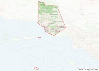
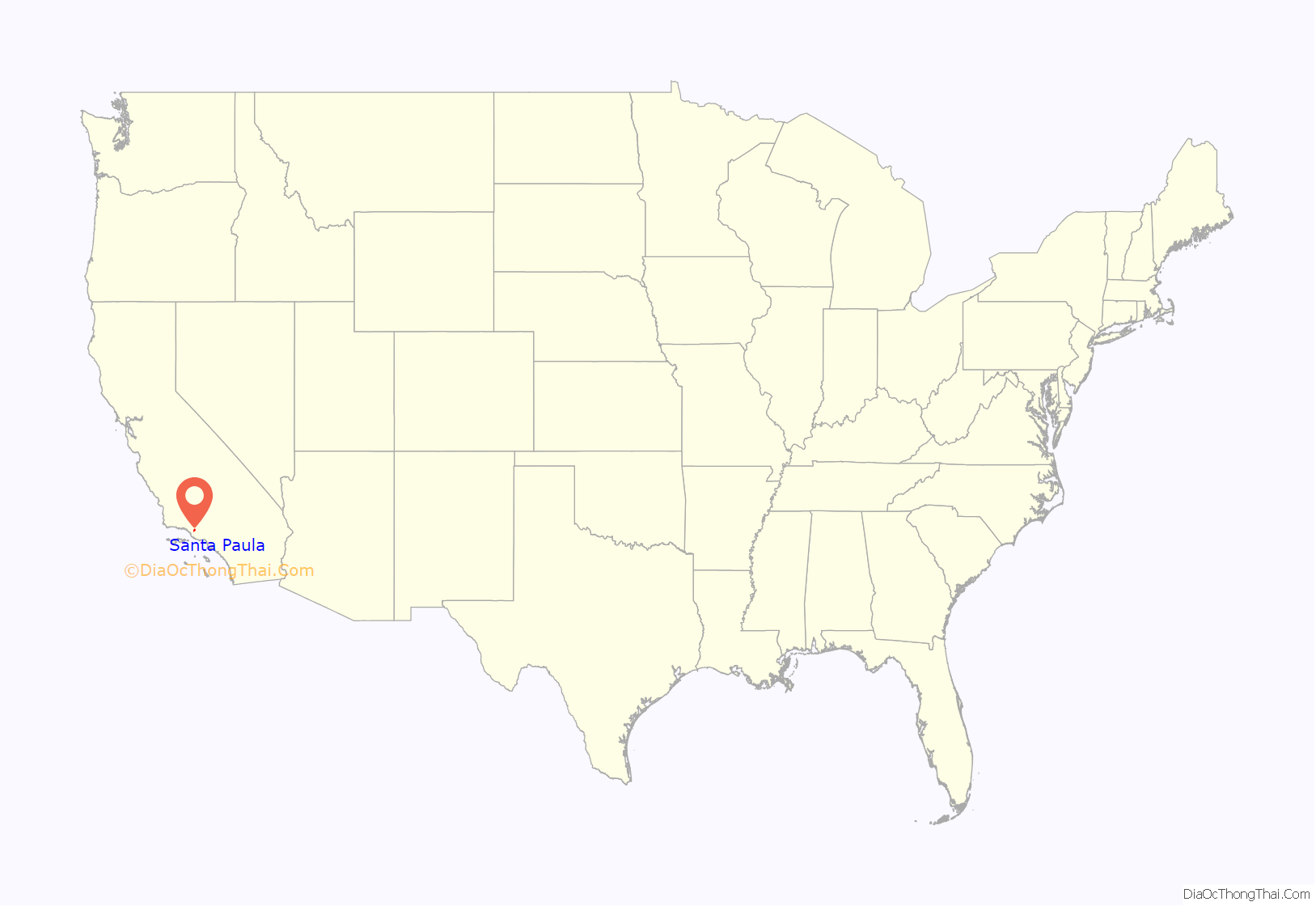
Santa Paula location map. Where is Santa Paula city?

History
The area of what today is Santa Paula was inhabited by the Chumash, a Native American people, before the Spanish arrived. In 1769, the Spanish Portola expedition, first Europeans to see inland areas of California, came down the Santa Clara River Valley from the previous night’s encampment near Fillmore and camped in the vicinity of Santa Paula on August 12, near one of the creeks coming into the valley from the north (most likely Santa Paula Creek). Fray Juan Crespi, a Franciscan missionary traveling with the expedition, had previously named the valley Cañada de Santa Clara. He noted that the party traveled about 9 to 10 miles (14 to 16 km) that day and camped near a large native village, which he named San Pedro Amoliano. The site of the expedition’s arrival has been designated California Historical Landmark No. 727.
Franciscan missionaries, led by Father Junipero Serra, became active in the area after the founding of the San Buenaventura Mission and established an Asistencia; the town takes its name from the Catholic Saint Paula. Santa Paula is located on the 1843 Rancho Santa Paula y Saticoy Mexican land grant.
In 1872 Nathan Weston Blanchard purchased 2,700 acres (10.9 km) and laid out the townsite. Considered the founder of the community, he planted seedling orange trees in 1874. Several small oil companies owned by Wallace Hardison, Lyman Stewart and Thomas R. Bard were combined and became the Union Oil Company in 1890.
Santa Paula was incorporated in April 1902. The first mayor was Lewis Arthur Hardison.
In April 1911, Gaston Méliès moved his Star Film Company from San Antonio, Texas to a site just north of Santa Paula.
The large South Mountain Oil Field southeast of town, just across the Santa Clara River, was discovered by the Oak Ridge Oil Company in 1916, and developed methodically through the 1920s, bringing further economic diversification and growth to the area. While the field peaked in production in the 1950s, Occidental Petroleum continues to extract oil through its Vintage Production subsidiary and remains a significant local employer.
A major expansion began in 2016 when construction started on a 500-acre (200 ha) master-planned community of 1,500 homes.
Disasters
The town has been devastated twice by floods and was affected by a nearby truck explosion that resulted in an industrial disaster.
The Great Flood of 1862 began on December 24, 1861, when it rained for almost four weeks, reaching a total of 35 inches (890 mm) at Los Angeles. The failure and near complete collapse of the St. Francis Dam took place in the middle of the night on March 12, 1928. The dam was holding a full reservoir of 12.4 billion gallons (47 billion liters) of water that surged down San Francisquito Canyon and emptied into the Santa Clara River. The town was first hit by the waters at approximately 3:00 a.m. Though hundreds of homes and structures were destroyed, the loss of life would have been greater if it were not for two motorcycle police officers that noisily warned as many people as possible. A sculpture called “The Watchers” in downtown Santa Paula depicts this act of heroism.
A vacuum truck exploded at the Santa Clara Waste Water plant in the early morning hours of November 18, 2014. Two workers were injured in the initial explosion, three responding fire-fighters were injured by the fumes from the spill of a highly volatile chemical mixture, and 50 others were exposed to fumes and required treatment at local hospitals. The driver was transporting waste from a temporary storage drum to a processing center when he stopped to take a meal break. The rear of the truck exploded, spreading a white liquid over a 300-by-400-foot area (91 by 122 m) that spontaneously combusted as it dried and was sensitive to shock, pressure and the application of water or oxygen. The tires of the first fire truck on the scene and the boots of three firefighters sparked small explosions when they drove and walked over the substance as they went to help the injured workers. The incident evolved into a disaster when later in the morning additional materials began to burn and explode, which resulted in a three-mile-long plume of toxic smoke (4.8 km) and the closing of Highway 126. Chemical smoke drifted over the area and nearby residents and businesses were required to evacuate.
What was initially reported as sewage was found to be about 1,000 US gallons (3,800 L; 830 imp gal) of a chemical mixture consisting of some sort of organic peroxide. In the first days of the investigation, officials speculated that two inert chemicals accidentally mixed in the truck and created an organic peroxide substance with sulfuric acid appearing to be part of the mix. Organic peroxide combines unstably bound oxygen together with hydrogen and carbon in the same molecule and ignites easily and then burns rapidly and intensely. While field testing was performed on the reactive material for initial identification, the county hazardous materials manager found that laboratories would not test the chemicals over concerns that lab personnel could be injured or their equipment damaged. Three weeks after the incident, the substance was still highly susceptible to friction and seemed to react to something as slight as wind. Sodium chlorite was identified in an internal investigation by the firm in the months following the disaster. They claimed that the chemical was being using as a water treatment agent for the first time and was stored in the same type of storage container as wastewater. The worker combined the chemical with wastewater in the vacuum truck where the chemical interacting with organic material caused an explosion that blew off the back of the truck. A former county district attorney, retained by a company attorney, issued a report in March 2015 that provided an explanation of events indicating that the worker may have accidentally combined the chemicals. Later, investigators found that an inspection by a Defense Logistics Agency contractor was scheduled for that morning and officials of the firm had directed the transfer of these hazardous materials to another location.
Although the explosion and resulting fumes caused injuries including the lungs of three fire-fighters who remained off-duty indefinitely, the material scattered around the site was found to be non-hazardous for clean-up purposes. The two fire engines that arrived first remained out of service for months and may ultimately have to be scrapped. The Ventura County Sheriff declared a local emergency so the Ventura County Board of Supervisors could ratify the action and allow the county to seek reimbursement for its costs from state disaster relief funds. The U.S. Environmental Protection Agency oversaw the decontamination of the site. The material was neutralized and solidified on site. Tons of material were eventually taken to the Chiquita Canyon Landfill in nearby Castaic. Almost three months later on February 10, 2015, the County Supervisors ended the emergency declaration. With the permit to operate suspended, the firm needed to finish removing the waste materials and provide a plan that would show how another such incident would be prevented before being allowed to start accepting liquid waste again. County regulators and county supervisors also wanted the city of Oxnard to agree to accept the waste water again after an analysis of the safety of the pipeline.
On August 7, 2015, a Ventura County grand jury indicted the Santa Clara Waste Water Co., the affiliated Green Compass and nine company executives and managers. Following the indictment, the district attorney had the nine defendants arrested on suspicion of several felonies and misdemeanors, including filing a false or forged instrument, dissuading a witness from reporting a crime, known failure to warn of serious concealed danger, withholding information regarding a substantial danger to public safety, conspiracy to commit a crime, causing impairment of an employee’s body, and disposal of hazardous waste. Eight individuals have pleaded guilty or no contest while one is awaiting trial. The two corporate entities reached an agreement in June 2019 after they had already paid about $800,000 in restitution.
The facility at 815 Mission Rock Road, Santa Paula, provided service to over 30,000 waste generators. At the time, it had received and processed over 2,000,000,000 US gallons (7.6×10 L) since it opened in 1959. The company says they treat about 100 different streams of waste. The owner of facility said that they never had a major problem such as this since the plant only takes non-hazardous waste. The capacity of the facility was increased to handle up to 100-US-gallon-per-minute (380 L; 83 imp gal) or 140,000-US-gallon-per-day (530,000 L) by 2014. The facility provides an environmentally safe and legal means of treating, disposing and recycling of contaminated but non-hazardous waste as an alternative to dumping untreated wastes into municipal sewer systems or into the environment. The plant uses centrifuges, electrocoagulation, carbon and micron filtration, ozone injection, dissolved air flotation, and chemical treatments. Treated waste water is sent through a pipeline to the Oxnard municipal treatment plant.
A consortium of six major oil companies (Chevron, Exxon, Mobil, Shell, Texaco and Unocal) established Santa Clara Waste Water to service their internal disposal needs. Eventually the site became a full-service disposal facility for most non-hazardous wastewater and was renamed Southern California Waste Water. The site is located in a 91-acre industrial area (37 ha) that is surrounded by agriculture and located about 2-mile southwest (3.2 km) of the Santa Paula city limits. Green Compass that operates the facility also operates a Class II injection well in Kern County that is tailored toward oilfield production and completion fluids. The only other commercial facility for disposal of oil field waste in the county, operated by Anterra Corp. in Oxnard, temporarily expanded operations after the incident.
Wildfires
In December 2017, the Thomas Fire broke out nearby. While it was the largest wildfire in modern California history at the time, the Santa Ana winds drove the fire toward Ventura and Santa Barbara. Over a thousand structures were destroyed which included a few out buildings just outside the city. It was finally confirmed to be fully contained in January 2018, and a reported 281,893 acres (440 sq mi; 114,078 ha) had burned. One firefighter and one civilian were the only fatalities directly caused by the fire. The cost of the fire rose to be an estimated $297 million.
On October 31, 2019, the Maria Fire was reported burning at the top of South Mountain between Santa Paula and Somis and expanded throughout that evening. Heavily influenced by 20–30 mph (32–48 km/h) winds within the canyons, the fire became a full scale conflagration, growing from 50 to 750 acres (20 to 304 ha) inside an hour, to over 4,000 acres (16 km) after several hours. The fire worked its way north towards Santa Paula where the topography of the Santa Clara River Valley which can serve as a funnel for Santa Ana winds. Mandatory evacuations were ordered for a wide swath of over 1,800 homes surrounding the fire area, affecting over 7,500 residences.
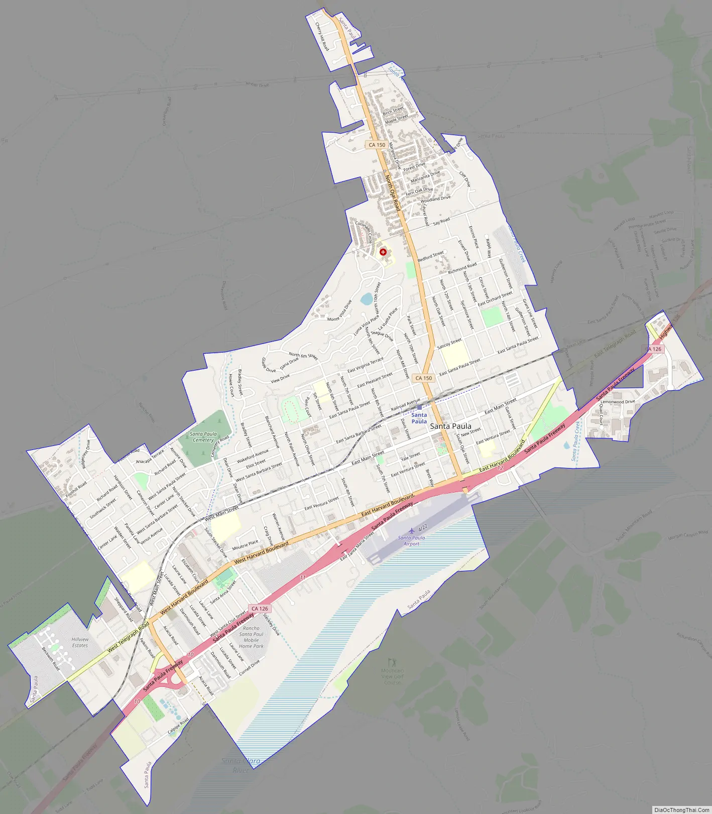
Santa Paula Road Map
Santa Paula city Satellite Map

Geography
The city of Santa Paula, according to the United States Census Bureau, has a total area of 4.7 square miles (12 km), 4.6 square miles (12 km) of it land and 0.1 square miles (0.26 km) of it (2.41%) water. Santa Paula is located in the Santa Clara River Valley on the north bank of the Santa Clara River and is surrounded by fruit orchards. The downtown area is centered around Main Street, which is home to the oldest homes in the city. Homes are often bungalows, cottages, Victorian-style houses and craftsman homes.
Climate
Santa Paula has a warm-summer mediterranean climate (Csb) typical of the coastal Southern California with warm summers and cool winters.
Ecology
Bears come down out of the hills and roam in or near the city.
See also
Map of California State and its subdivision:- Alameda
- Alpine
- Amador
- Butte
- Calaveras
- Colusa
- Contra Costa
- Del Norte
- El Dorado
- Fresno
- Glenn
- Humboldt
- Imperial
- Inyo
- Kern
- Kings
- Lake
- Lassen
- Los Angeles
- Madera
- Marin
- Mariposa
- Mendocino
- Merced
- Modoc
- Mono
- Monterey
- Napa
- Nevada
- Orange
- Placer
- Plumas
- Riverside
- Sacramento
- San Benito
- San Bernardino
- San Diego
- San Francisco
- San Joaquin
- San Luis Obispo
- San Mateo
- Santa Barbara
- Santa Clara
- Santa Cruz
- Shasta
- Sierra
- Siskiyou
- Solano
- Sonoma
- Stanislaus
- Sutter
- Tehama
- Trinity
- Tulare
- Tuolumne
- Ventura
- Yolo
- Yuba
- Alabama
- Alaska
- Arizona
- Arkansas
- California
- Colorado
- Connecticut
- Delaware
- District of Columbia
- Florida
- Georgia
- Hawaii
- Idaho
- Illinois
- Indiana
- Iowa
- Kansas
- Kentucky
- Louisiana
- Maine
- Maryland
- Massachusetts
- Michigan
- Minnesota
- Mississippi
- Missouri
- Montana
- Nebraska
- Nevada
- New Hampshire
- New Jersey
- New Mexico
- New York
- North Carolina
- North Dakota
- Ohio
- Oklahoma
- Oregon
- Pennsylvania
- Rhode Island
- South Carolina
- South Dakota
- Tennessee
- Texas
- Utah
- Vermont
- Virginia
- Washington
- West Virginia
- Wisconsin
- Wyoming