Sierra Madre (Spanish for “mother range”) is a city in Los Angeles County, California, whose population was 10,917 at the 2010 U.S. Census, up from 10,580 at the time of the 2000 U.S. Census. The city is in the foothills of the San Gabriel Valley below the southern edge of the Angeles National Forest. Pasadena and Altadena are to its west, with Arcadia to its south and east. Sierra Madre is known as “Wisteria City”, and its city seal is decorated with a drawing of the now widely known 500-foot (150 m) vine. It is also called the “Village of the Foothills” and was an All-America City in 2007.
| Name: | Sierra Madre city |
|---|---|
| LSAD Code: | 25 |
| LSAD Description: | city (suffix) |
| State: | California |
| County: | Los Angeles County |
| Incorporated: | February 2, 1907 |
| Elevation: | 827 ft (252 m) |
| Total Area: | 2.96 sq mi (7.65 km²) |
| Land Area: | 2.95 sq mi (7.64 km²) |
| Water Area: | 0.00 sq mi (0.01 km²) 0.15% |
| Total Population: | 10,917 |
| Population Density: | 3,657.40/sq mi (1,412.10/km²) |
| ZIP code: | 91024, 91025 |
| Area code: | 626 |
| FIPS code: | 0671806 |
| Website: | www.cityofsierramadre.com |
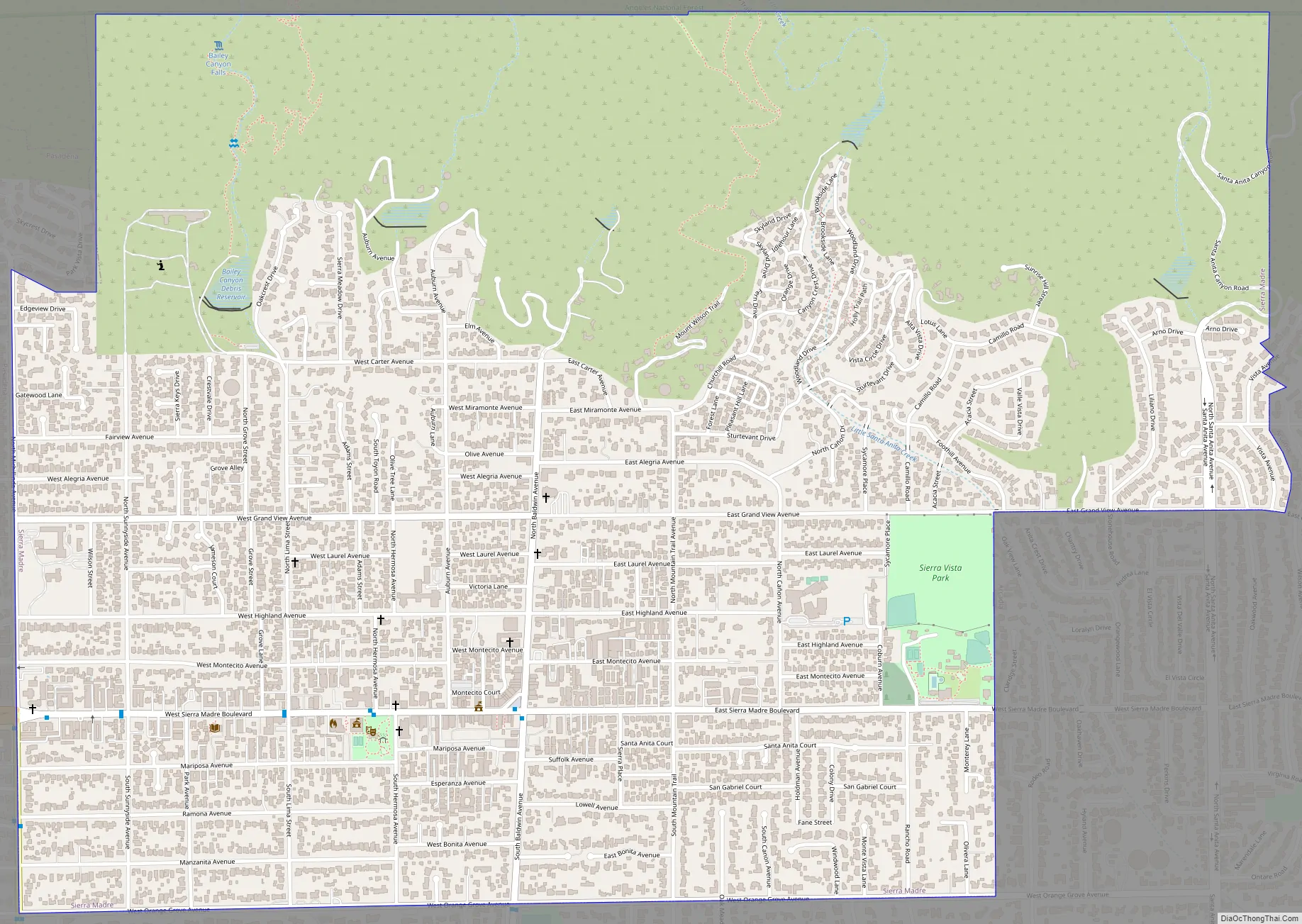
Online Interactive Map
Click on ![]() to view map in "full screen" mode.
to view map in "full screen" mode.
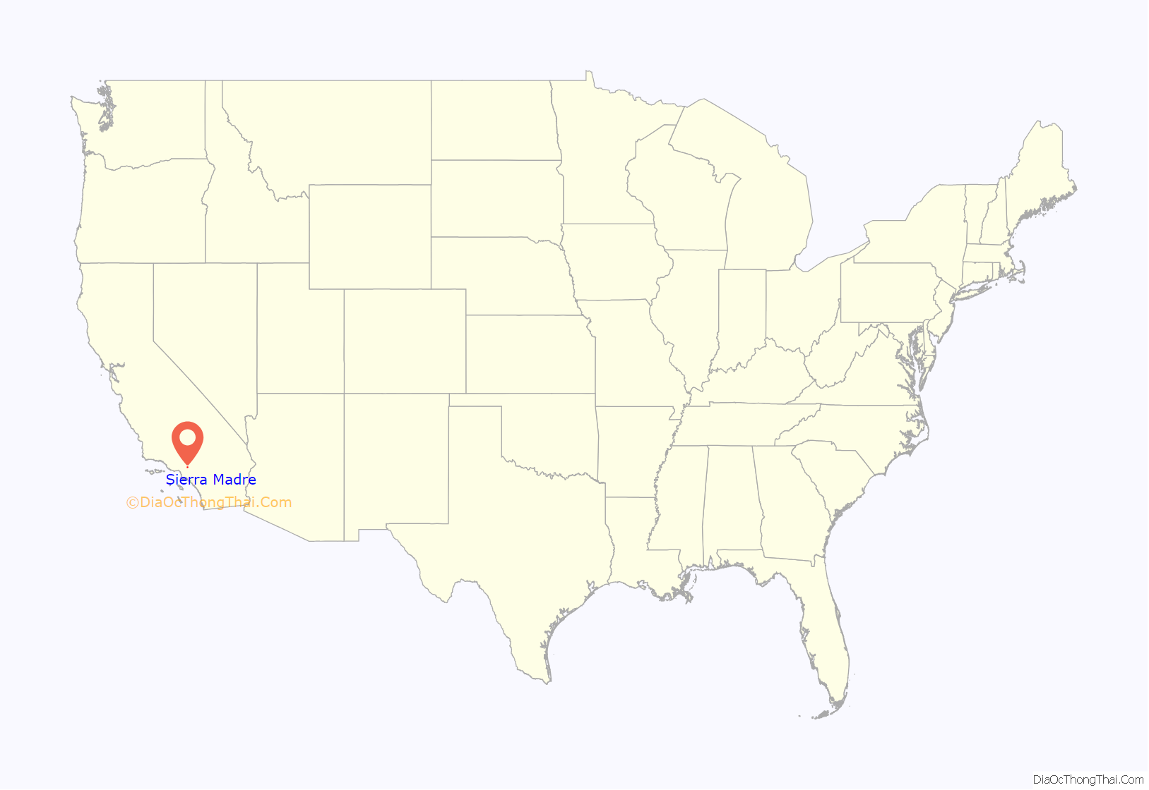
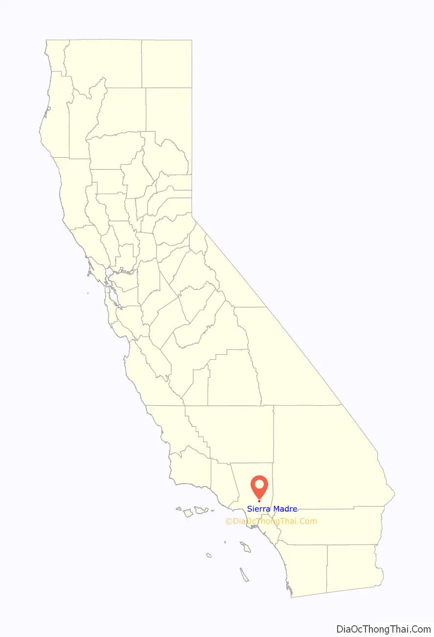
Sierra Madre location map. Where is Sierra Madre city?
History
Early history
In approximately 500 CE, Tongva Indians, the native people migrated from the Mojave area to what would become Los Angeles County (including the San Gabriel Valley). Their name means “People of the Earth”. Their primary language was Uto-Aztecan Shoshonean. In the 16th century, there were about 25 Tongva villages, with a population of approximately 400 people. By 1769, the first Spanish settlers arrived in the region, finding an estimated 5,000 Tongva living in 31 villages. Sierra Madre was the site of a settlement named Sonayna. Two years later, Mission San Gabriel Arcangel was founded in present-day Montebello. The mission was later moved to San Gabriel because of severe flooding from the Rio Hondo River, which ruined their crops. The original mission site is now marked by a California Historical Landmark. Tongvas were integrated into the culture of the mission, and the tribe were renamed Gabrielino Indians by the Spaniards. The first Mount Wilson trail was carved by the Gabrielino Indians, who used it when they carried timber down from the mountains for the construction of the San Gabriel Mission in 1771.
Using Mexican and Chinese laborers, Benjamin “Don Benito” Wilson expanded the Mount Wilson Trail in 1864. Nathaniel Carter purchased the original 1,103 acres (4.46 km) that comprise Sierra Madre in 1881: 845 acres (3.42 km) from “Lucky Baldwin”, 108 acres (0.44 km) from the Southern Pacific Railroad Company, and 150 acres (0.61 km) from John Richardson (1811–August 9, 1884). In 1888, the Santa Anita railroad station was built. The first of the year brought Pacific Electric Railway Red Car passenger service to Sierra Madre. Later that year the first electric lights were installed by the Edison Electric Company. In December 1906, the first telephones were installed (250 of them) by the Home Telephone Company of Monrovia.
On February 2, 1907, the first citywide election was held and 96 citizens voted 71–25 to officially incorporate Sierra Madre; the population was about 500. In February 1907, eighteen days after the election, Sierra Madre became incorporated as a California city. Charles Worthington Jones was the first mayor.
The new century
Sierra Madre is historically linked to the old mountain resorts of the San Gabriel Mountains and Valley. The Sierra Madre Villa Hotel was a pioneer of summer resorts that populated the San Gabriel Valley in the late 19th century. The municipality also operated and maintained the landmark “Lizzie’s Trail” inn at the head of Old Mount Wilson Trail.
Harvard College established the first Mount Wilson Observatory in 1889. The installation of the Harvard telescope in 1889, which brought its own problems of transporting the instrument up the old Wilson trail, caused an interest in a Mt. Wilson roadway, something more than a trail. The Harvard telescope was removed and in July the new toll road was officially opened to the public. The toll was set by the Los Angeles County Board of Supervisors at 25 cents for hikers and 50 cents for horseback. The new road was called the “New Mt. Wilson Trail” and it was more popular at the time than the old Sierra Madre trail. Foot and pack animal traffic became so heavy that in June 1893 the trail was widened to six feet (1.8 m). The Pacific Electric “Red Cars” established their route to Sierra Madre from 1906 until 1950. Thousands of people rode the cars to Sierra Madre to hike the original Mt. Wilson Trail.
In 1908, the first Mt. Wilson Trail Race was run. This annual race was discontinued during WWII and reestablished in 1966. The 102nd anniversary of the first running of the Mount Wilson Trail Race and the 44th annual race was run in May 2010. Because of rain, mudslides, falling trees, soil erosion and rockslides, the regularly monitored trail course changes almost every year, and no official records of running times are kept. The 8.6-mile (13.8 km) course starts and ends on pavement, but most of the race is run on a dirt path about three feet (0.91 m) wide, and the Mt. Wilson Trail has occasional steep vertical drops of hundreds of feet. Due to the trail’s narrowness and steepness, the race is limited to 300 male and 300 female runners. The path gains elevation to more than 2,100 feet (640 m); at 4.3 miles (6.9 km) from the start of the race is Orchard Camp, the turnaround point. Scout troops hike up to provide water at two locations, at the 2.3-mile (3.7 km) point and at the Orchard Camp turnaround. The Sierra Madre Search and Rescue Team provides emergency support on race day. The Mt. Wilson Trail Race has traditional and historical value to the community.
A year after the city’s incorporation, Catholic families contacted a priest from Chicago, Father M. W. Barth, who had moved west for his health, to ask if he could celebrate Mass for them. The construction of the first, very small, church of St. Rita’s parish, founded by Barth in 1908, was completed in 1910. In 1922, St. Rita’s Catholic Church parochial school opened. During the first 100 years of St. Rita’s Parish, it has on record 4,075 baptisms, 3,590 confirmations, 1,334 marriages and 1,469 funerals. The scattering of families that began with Barth in 1908 has grown to more than 1,200 Catholic parish homes today, in a city whose population is now approximately 10,917.
In 1914, after a long legal battle, the city acquired title to all water rights, lands, and distribution systems of the Baldwin Estate and the Sierra Madre Water Company.
In 1921, a disastrous bakery fire at Windsor Lane and Montecito Court prompted the official organization of the Sierra Madre Volunteer Fire Department. Sierra Madre had the last remaining volunteer fire department in greater Los Angeles before transitioning to a paid department in 2017.
On January 1, 1922, Bethany Temple was dedicated. The now historic domed cobblestone church was designed and built by the nearly blind Louis D. Corneulle. The new Congregational Church structure was completed on Sierra Madre Ave; the Romanesque Revival building was designed by Marsh, Smith, & Powell. In July 1927, the Sierra Madre Kiwanis Club was formed. On April 21, 1931, the first meeting of the Sierra Madre Historical Society took place, in conjunction with the city’s 50th anniversary celebration. In 1936, a city ordinance officially changed the name of Central Avenue to Sierra Madre Blvd. In March 1938, a disastrous storm and the resulting flood destroyed many resorts in the local mountains, and also ravaged the (John) Muir Lodge in Big Santa Anita Canyon above Sierra Madre. No trace remains of it today. In 1940, the city purchased 760 acres (3.1 km) of land in the San Gabriel Mountains near Orchard Camp to avoid contamination of the water supply.
A six-week Wisteria event took place in the 1930s. The crowds that traveled to see the giant Wisteria vine were estimated at over 100,000. With so many visitors, extra “Red Cars” were put on the Pacific Electric route to Sierra Madre.
On May 14, 1942, Sierra Madre’s Japanese population was required to depart for the detention facility in Tulare, California. During this decade, Sierra Madre Civic Club and the Sierra Madre Lions Club were organized. The Sierra Madre Community Nursery School also opened. In May 1947, the first Pioneer Days Parade was held. The heaviest recorded snow in Sierra Madre occurred in 1949, blanketing the town with 3 to 4 inches (7.6 to 10.2 cm) of snow overnight.
In 1948, the U.S. Supreme Court, in the case of Shelley v. Kraemer, ended racially restrictive covenants that had prevented black people from owning homes in Sierra Madre and some neighboring cities. However, residential segregation patterns had already become established and persisted up until 1968 when realtors began to routinely show homes to black people.
On October 6, 1950, the last Pacific Electric train left from Sierra Madre. In 1951, Sierra Madre Search and Rescue Team was established by Larry Shepherd and Fred LaLone. Sierra Madre joined the Pasadena Unified School District in 1961. In 1967, Princess Margaret visited the British Home in Sierra Madre. The Cultural Heritage Committee was established in 1969 by the Sierra Madre City Council with the intent of “defining cultural and aesthetic landmarks throughout the City of Sierra Madre and to recommend how such landmarks be preserved.” In 1969, the city purchased the Women’s Clubhouse, to be demolished and become the site of a new City Hall building.
Predominantly through the efforts of a few dedicated Sierra Madre residents, the Sierra Madre Historical Wilderness Area was established by declaration of the City Council on January 24, 1967. When it was dedicated on January 27, 1968, Sierra Madre was the first city in Southern California to own a wilderness preserve. The Sierra Madre City Council added the Mt. Wilson Trail to the Sierra Madre Register of Historic Cultural Landmarks on October 12, 1993.
In January 1971, the Sierra Madre Environmental Action Council was formed. In 1974, the Bell Tower in Kersting Court was dedicated; it houses the original school bell from the 1885 schoolhouse. In 1976, Sierra Madre Vistas was published by the Sierra Madre Historical Preservation Society. On March 19, 1976, the Bicentennial time capsule was buried beneath the flagpole at the new Fire and Police Department Facility, then dedicated in May. The New City Hall building was dedicated on Sierra Madre Boulevard in 1977.
In 1981, Sierra Madre celebrated the centennial of its founding, complete with a Centennial Royal Court and dance, a special Historical Society dinner, and rides on a Pacific Electric red car brought back to town on Independence Day weekend. On February 28, 1983, Queen Elizabeth visited the British Home and greeted each resident of the small town. In April 1999, “The Weeping Wall Veterans’ Memorial,” designed by Lew Watanabe, was dedicated in Memorial Park.
In 2003, the groundbreaking ceremony for the Senior Housing Project on Esperanza Avenue was held. The affordable housing project includes 46 units designed by PBWS Architects and developed by the Foundation for Quality Housing. Later that year, the Veterans’ Photo Wall, spearheaded by John Grijalva, was dedicated in Memorial Park. In 2007, Sierra Madre celebrated the centennial of its incorporation as a California city. Sierra Madre also won the All-America City Award given by the National Civic League. That same year, the refurbished World War I cannon in Memorial Park was dedicated.
In March 2008, the Milton & Harriet Goldberg Recreation Area was dedicated, as the city’s first such pocket park in over 30 years. In 2009, the Sierra Madre Historical Preservation Society published Southern California Story: Seeking the Better Life in Sierra Madre by Michele Zack.
In 2023, the city asked the California Department of Fish and Wildlife to change its approach to dealing with bears in the city.
Sierra Madre Road Map
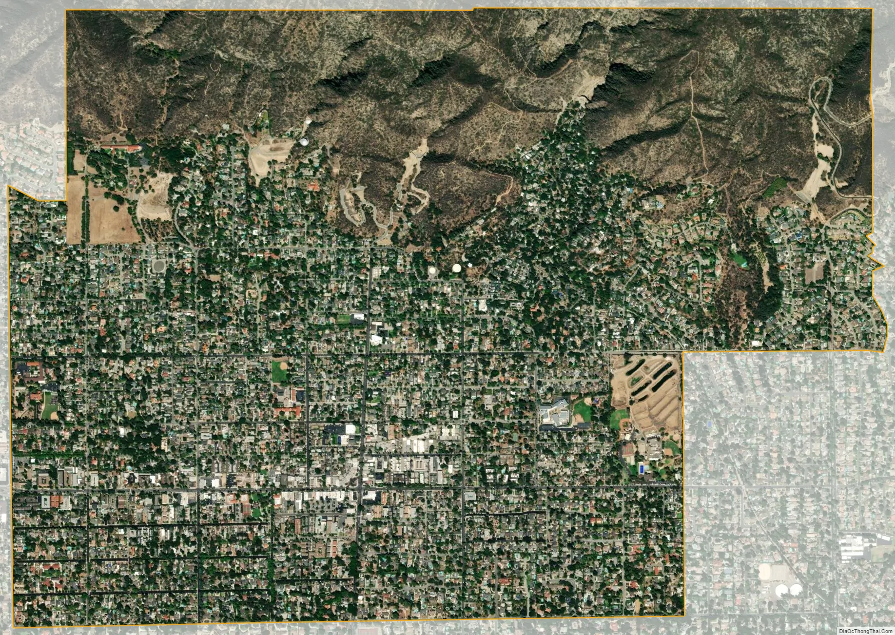
Sierra Madre city Satellite Map
Geography
According to the United States Census Bureau, the town has a total area of 3.0 square miles (7.7 km). 3.0 square miles (7.7 km) of it is land, and 0.15% is water.
Sierra Madre has warm, dry summers, and cool, wet winters (Mediterranean climate type). Annual precipitation is just about 24 inches, mostly falling between November and March. In fall months, a Southern California phenomenon called the Santa Ana winds can bring daytime temperatures into the 80s year round, and keep overnight lows above 60, even in winter. Winter, however, mostly consist of cool, rainy days followed by warm sunny ones. Frosts are not very common, with snow only being recorded 3 times. By May, Pacific storms no longer visit the region. In May and June, hot desert temperatures combined with cool ocean waters bring in low hanging clouds each morning called the Marine Layer. They dissipate by noon. These clouds make June the cloudiest month for Sierra Madre, even though it only receives an average 0.20″ of rain in June. From July through October, hot temperatures grip the region, with September being the hottest month, unlike the rest of the nation. During this period, it rarely rains.
The 1991 Sierra Madre earthquake was a M 5.8 tremor that hit at 07:43:55 local time on June 28, 1991. It caused regional damage, such as knocking over chimneys and fragmenting cinder block walls that run along major roads in the area.
Sierra Madre lies between Santa Anita Blvd. to the east and Michillinda Ave. to the west. To the south, it is bordered by Orange Grove Blvd. Its principal road is Sierra Madre Blvd.
See also
Map of California State and its subdivision:- Alameda
- Alpine
- Amador
- Butte
- Calaveras
- Colusa
- Contra Costa
- Del Norte
- El Dorado
- Fresno
- Glenn
- Humboldt
- Imperial
- Inyo
- Kern
- Kings
- Lake
- Lassen
- Los Angeles
- Madera
- Marin
- Mariposa
- Mendocino
- Merced
- Modoc
- Mono
- Monterey
- Napa
- Nevada
- Orange
- Placer
- Plumas
- Riverside
- Sacramento
- San Benito
- San Bernardino
- San Diego
- San Francisco
- San Joaquin
- San Luis Obispo
- San Mateo
- Santa Barbara
- Santa Clara
- Santa Cruz
- Shasta
- Sierra
- Siskiyou
- Solano
- Sonoma
- Stanislaus
- Sutter
- Tehama
- Trinity
- Tulare
- Tuolumne
- Ventura
- Yolo
- Yuba
- Alabama
- Alaska
- Arizona
- Arkansas
- California
- Colorado
- Connecticut
- Delaware
- District of Columbia
- Florida
- Georgia
- Hawaii
- Idaho
- Illinois
- Indiana
- Iowa
- Kansas
- Kentucky
- Louisiana
- Maine
- Maryland
- Massachusetts
- Michigan
- Minnesota
- Mississippi
- Missouri
- Montana
- Nebraska
- Nevada
- New Hampshire
- New Jersey
- New Mexico
- New York
- North Carolina
- North Dakota
- Ohio
- Oklahoma
- Oregon
- Pennsylvania
- Rhode Island
- South Carolina
- South Dakota
- Tennessee
- Texas
- Utah
- Vermont
- Virginia
- Washington
- West Virginia
- Wisconsin
- Wyoming


