West Hollywood is a city in Los Angeles County, California, United States. Incorporated in 1984, it is home to the Sunset Strip. As of the 2020 U.S. Census, its population was 35,757.
| Name: | West Hollywood city |
|---|---|
| LSAD Code: | 25 |
| LSAD Description: | city (suffix) |
| State: | California |
| County: | Los Angeles County |
| Incorporated: | November 29, 1984 (1984-11-29) |
| Elevation: | 282 ft (86 m) |
| Land Area: | 1.89 sq mi (4.89 km²) |
| Water Area: | 0.00 sq mi (0.00 km²) 0% |
| Population Density: | 19,000/sq mi (7,300/km²) |
| ZIP code: | 90038, 90046, 90048, 90069 |
| FIPS code: | 0684410 |
| Website: | www.weho.org |
Online Interactive Map
Click on ![]() to view map in "full screen" mode.
to view map in "full screen" mode.
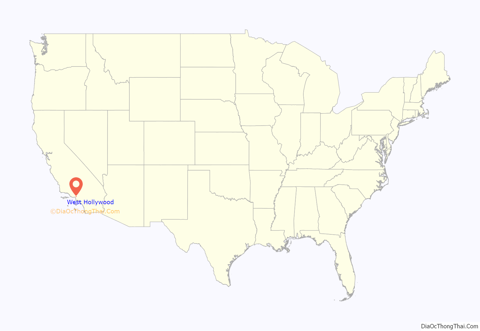
West Hollywood location map. Where is West Hollywood city?

History
Most historical writings about West Hollywood begin in the late-18th century with European colonization when the Portuguese explorer João Rodrigues Cabrilho traveled to and eventually laid claim on the region for Spain. Around 5,000 of the indigenous inhabitants from the Tongva Indian tribe canoed out to greet the ship. The Tongva tribe was a nation of hunter-gatherers known for their reverence for dance and courage. By 1771, these native people had been severely ravaged by the diseases brought in by the Europeans from across wide oceans. The Spanish mission system changed the name of the Tongva tribe to “Gabrielinos”, in reference to the Mission de San Gabriel. Early in 1770 Gaspar de Portola’s Mexican expeditionary force stopped just south of the Santa Monica Mountains near what would become West Hollywood. Here they collected pitch (brea in Spanish) from tar pits which they used to waterproof their belongings and to say Mass. The Gabrielinos are believed to have burned the pitch for fuel.
By 1780, what became the “Sunset Strip” was the major connecting road for El Pueblo de Los Angeles, and all ranches westward to the Pacific Ocean. This land passed through the hands of various owners during the next one hundred years, and it was called names such as “La Brea” and “Plummer” that are listed in historical records. Most of this area was part of the Rancho La Brea, and eventually it came to be owned by the Henry Hancock family.
During the final decade years of the nineteenth century, the first large land reconstruction of the town of “Sherman” significantly accelerated the development of the region. In what would later become West Hollywood—the town of “Sherman”—was established by Moses Sherman and his partners of the Los Angeles Pacific Railroad, an interurban railroad line which later became part of the Pacific Electric Railway system. Sherman became the location of the railroad’s main shops, railroad yards, and “car barns”. Many working-class employees of the railroad settled in this town. It was during this time that the city began to earn its reputation as a loosely regulated, liquor-friendly (during Prohibition) place for eccentric people wary of government interference. Despite several annexation attempts, the town elected not to become part of the City of Los Angeles. In a controversial decision, in 1925 Sherman adopted “West Hollywood”, “…a moniker pioneered earlier in the decade by the West Hollywood Realty Board” as its informal name, though it remained under the governance of Los Angeles County.
For many decades, the area that is now the city of West Hollywood was an unincorporated area in the midst of Los Angeles. Because gambling was illegal in the city of Los Angeles, but still legal in Los Angeles County, the 1920s saw the proliferation of many casinos, night clubs, etc., along Sunset Boulevard (which starts near downtown Los Angeles and runs westward). These businesses were immune from the sometimes heavy-handed law-enforcement of the L.A. Police Department.
Some people connected with movie-making were attracted to this less-restricted area of the County, and a number of architecturally distinctive apartment buildings and hotels were built. Many interior designers, decorators and “to the trade” furnishing showrooms located in West Hollywood date back to the middle of the century.
Eventually, the area and its extravagant nightclubs fell out of favor. However, the Sunset Strip and its restaurants, saloons, and nightclubs continued to be an attraction for out-of-town tourists. During the late 1960s, the Sunset Strip was transformed again during the hippie movement which brought a thriving music publishing industry coupled with the “hippie” culture. Some young people from all over the country flocked to West Hollywood.
The most recent migration to West Hollywood came about after the dissolution of the Soviet Union, when thousands of Russian Jews immigrated to the city. A majority of the 5,000 to 6,000 Russian Jews settled in two major immigration waves, 1978–79 and 1988–92. Other than New York, West Hollywood’s Russian-speaking community is the most concentrated single Russian-speaking region in the United States.
The Gauntlet was a body piercing business founded by Jim Ward in West Hollywood that is considered the first business of its type in the United States and was the beginning of the body piercing industry. The Gauntlet began in November 1975, with its original location in Ward’s West Hollywood home, but on the evening of Friday, November 17, 1978, it celebrated the grand opening of its first commercial location at 8720 Santa Monica Boulevard (also in West Hollywood).
Due to the expiration of rent control protections in L.A., a coalition of gay men, Russian Jews, and the elderly successfully held a vote to officially incorporate the City of West Hollywood in 1984; by electing a city council with an openly gay majority and immediately passing a series of rent control measures to protect its longtime citizens. West Hollywood then immediately adopted one of the strongest rent control laws in the nation.
The city of West Hollywood gave the keys to the city to Stormy Daniels on “Stormy Daniels Day”, May 23, 2018.
West Hollywood Road Map

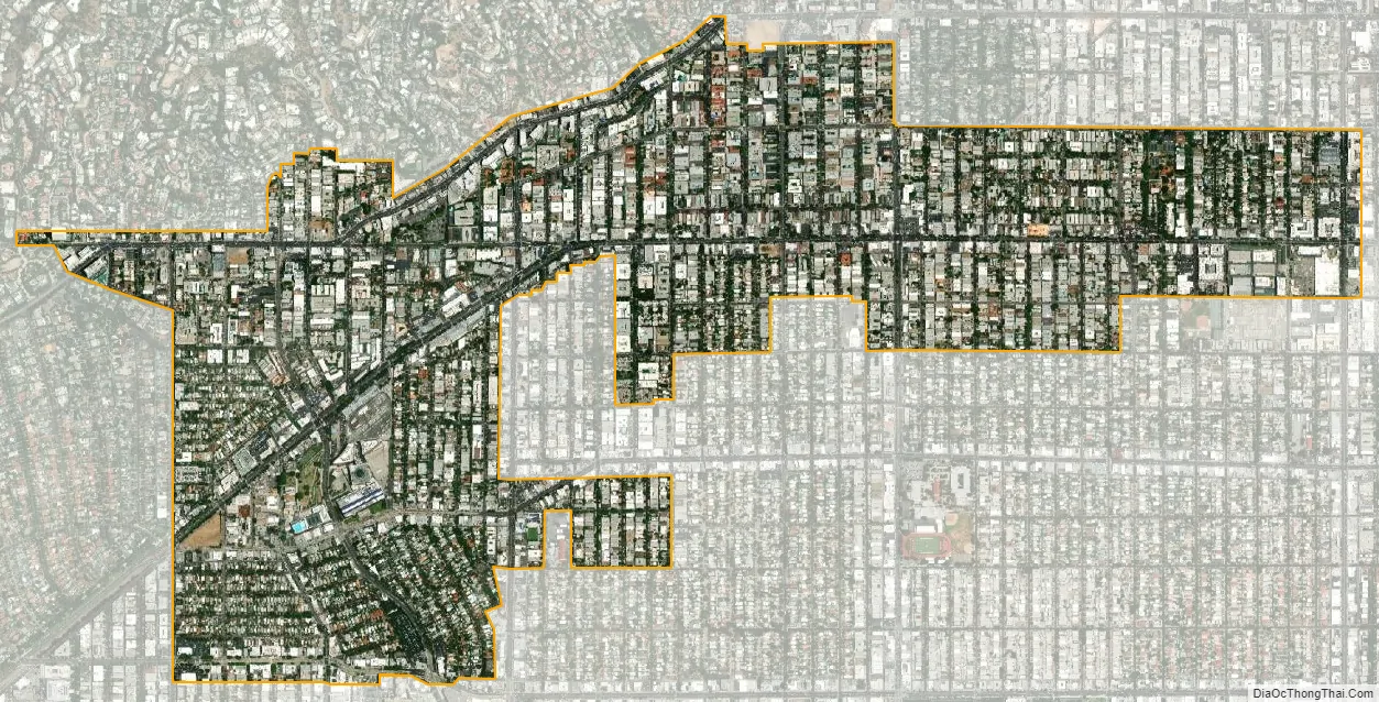
West Hollywood city Satellite Map
Geography
West Hollywood is bounded by the city of Beverly Hills on the west, and by neighborhoods of the city of Los Angeles: Hollywood Hills on the north, Hollywood on the east, the Fairfax District on the southeast, and Beverly Grove on the southwest. The city’s irregular boundary is featured in its logo; it was largely formed from the unincorporated Los Angeles County area which had not become part of the surrounding cities.
West Hollywood benefits from a very dense, compact urban form with small lots, mixed land use, and a walkable street grid. According to Walkscore, a website that ranks cities based on walkability, West Hollywood is the most walkable city in California with a Walkscore of 89. Commercial corridors include the nightlife and dining focused on the Sunset Strip, along Santa Monica Boulevard, and the Avenues of Art and Design along Robertson, Melrose, and Beverly Boulevard.
Residential neighborhoods in West Hollywood include the Norma Triangle, West Hollywood North, West Hollywood West, West Hollywood East, and West Hollywood Heights, all of which are only a few blocks long or wide. Major intersecting streets typically provide amenities within walking distance of adjacent neighborhoods.
Climate
West Hollywood has a subtropical-semi-arid climate with year-round warm weather, although winter nights are cool. The record high temperature of 111 °F was recorded on September 26, 1963, while the record low of 24 °F was recorded on January 4, 1949. Rainfall is sparse (only 13 inches annually), and falls mainly during the winter months. Snow is extraordinarily rare in West Hollywood, with the last accumulation occurring in 1949.
See also
Map of California State and its subdivision:- Alameda
- Alpine
- Amador
- Butte
- Calaveras
- Colusa
- Contra Costa
- Del Norte
- El Dorado
- Fresno
- Glenn
- Humboldt
- Imperial
- Inyo
- Kern
- Kings
- Lake
- Lassen
- Los Angeles
- Madera
- Marin
- Mariposa
- Mendocino
- Merced
- Modoc
- Mono
- Monterey
- Napa
- Nevada
- Orange
- Placer
- Plumas
- Riverside
- Sacramento
- San Benito
- San Bernardino
- San Diego
- San Francisco
- San Joaquin
- San Luis Obispo
- San Mateo
- Santa Barbara
- Santa Clara
- Santa Cruz
- Shasta
- Sierra
- Siskiyou
- Solano
- Sonoma
- Stanislaus
- Sutter
- Tehama
- Trinity
- Tulare
- Tuolumne
- Ventura
- Yolo
- Yuba
- Alabama
- Alaska
- Arizona
- Arkansas
- California
- Colorado
- Connecticut
- Delaware
- District of Columbia
- Florida
- Georgia
- Hawaii
- Idaho
- Illinois
- Indiana
- Iowa
- Kansas
- Kentucky
- Louisiana
- Maine
- Maryland
- Massachusetts
- Michigan
- Minnesota
- Mississippi
- Missouri
- Montana
- Nebraska
- Nevada
- New Hampshire
- New Jersey
- New Mexico
- New York
- North Carolina
- North Dakota
- Ohio
- Oklahoma
- Oregon
- Pennsylvania
- Rhode Island
- South Carolina
- South Dakota
- Tennessee
- Texas
- Utah
- Vermont
- Virginia
- Washington
- West Virginia
- Wisconsin
- Wyoming


