Centennial is a home rule municipality located in Arapahoe County, Colorado, United States. The city population was 108,418 at the 2020 United States Census, making Centennial the 11th most populous municipality in Colorado. Centennial is a part of the Denver–Aurora–Lakewood, CO Metropolitan Statistical Area and the Front Range Urban Corridor.
| Name: | Centennial city |
|---|---|
| LSAD Code: | 25 |
| LSAD Description: | city (suffix) |
| State: | Colorado |
| County: | Arapahoe County |
| Incorporated: | February 7, 2001 |
| Elevation: | 5,830 ft (1,777 m) |
| Total Area: | 29.867 sq mi (77.355 km²) |
| Land Area: | 29.721 sq mi (76.976 km²) |
| Water Area: | 0.146 sq mi (0.379 km²) |
| Total Population: | 108,418 |
| Population Density: | 3,648/sq mi (1,409/km²) |
| Area code: | Both 303 and 720 |
| FIPS code: | 0812815 |
| Website: | www.centennialco.gov |
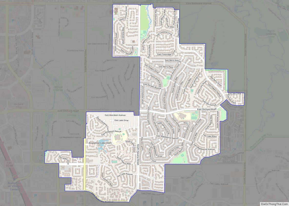
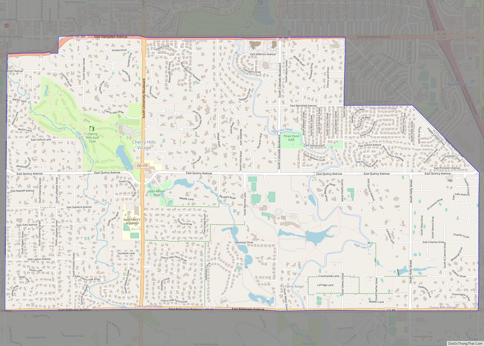
Online Interactive Map
Click on ![]() to view map in "full screen" mode.
to view map in "full screen" mode.
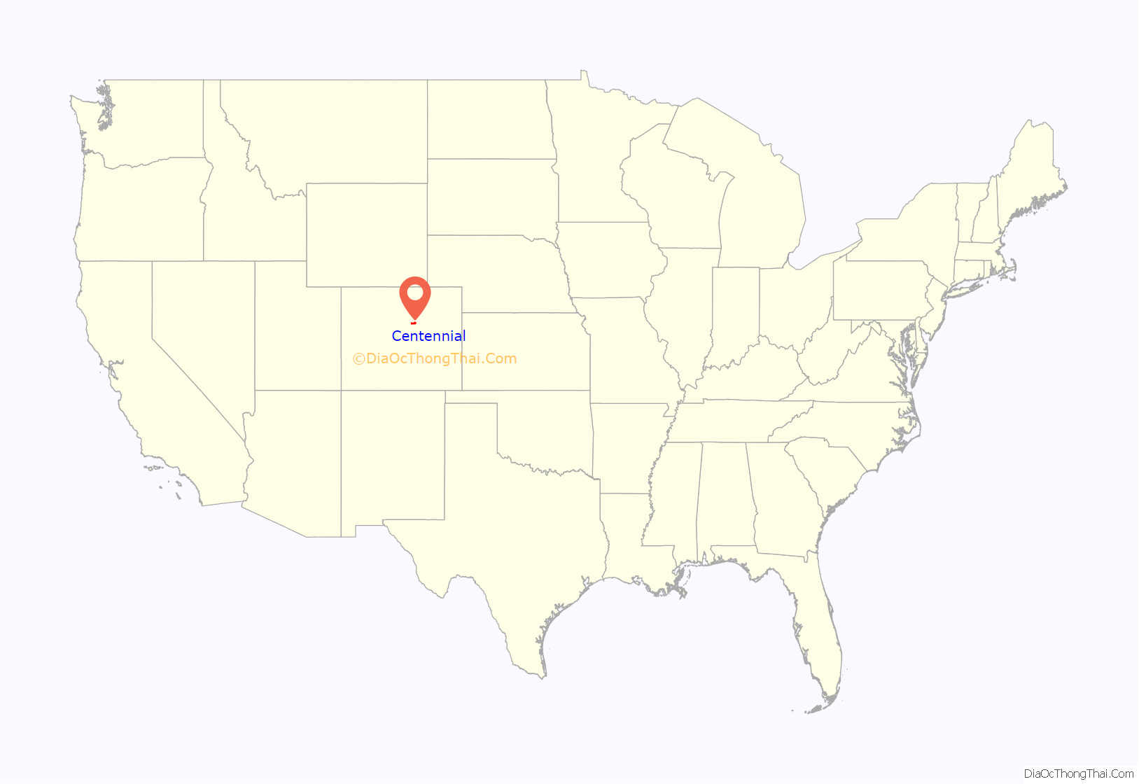
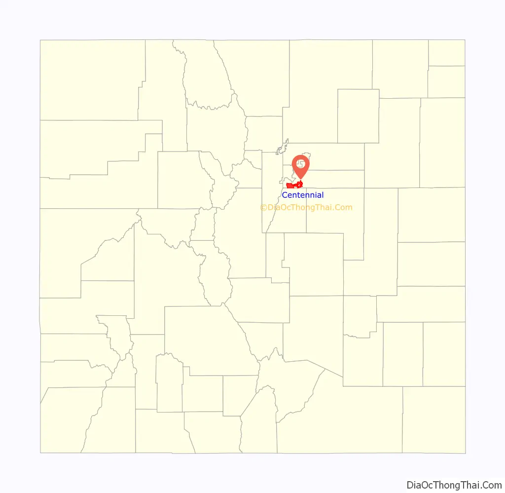
Centennial location map. Where is Centennial city?
History
Centennial was formed on February 7, 2001, from portions of unincorporated Arapahoe County, including the former Castlewood and Southglenn census-designated places (CDPs). The citizens of the area had voted to incorporate on September 12, 2000, choosing Centennial as the official name during the vote. The name reflects Colorado’s admission to the Union as the 38th state in 1876, the centennial year of the United States Declaration of Independence. The state of Colorado is nicknamed the “Centennial State”.
Incorporation was approved by 77% of the voters, and the population of the area at over 100,000 made it the largest incorporation in U.S. history as of its creation. The city was incorporated in large part to prevent further annexations of unincorporated areas by the city of Greenwood Village in an attempt to improve its tax base. The taxes generated from businesses in unincorporated portions of Arapahoe County funded the majority of the county’s services, including road work. A number of court cases eventually established the right of incorporation to take precedence over the right of annexation.
The city was incorporated on a promise to keep city taxes at 1%. (One of the campaigns against incorporation appealed to voters to maintain the 3.8% sales tax of the unincorporated county.) According to the Centennial website, the current sales tax rate is two-and-a-half times the promised rate, at 2.5%.
Since the city is relatively new, some people in the Denver-Aurora metropolitan area do not yet recognize the area by the name “Centennial”, especially since neighboring Aurora, Englewood and Littleton are the default place names assigned by the United States Postal Service for ZIP codes serving Centennial. Thus, mailing addresses designated as “Aurora”, “Englewood” or “Littleton” may actually be located in Centennial. This causes considerable confusion, as Centennial and Englewood do not even share a boundary, while some portions of Centennial are surrounded by Aurora and vice versa.
In 2008, Centennial voters approved a referendum by approximately a 2-to-1 margin making Centennial a home rule city.
Centennial Airport, formerly Arapahoe County Airport, lies adjacent to Centennial, but is located in unincorporated Arapahoe County. The airport is not named after the city, as it predates the city by over 30 years.
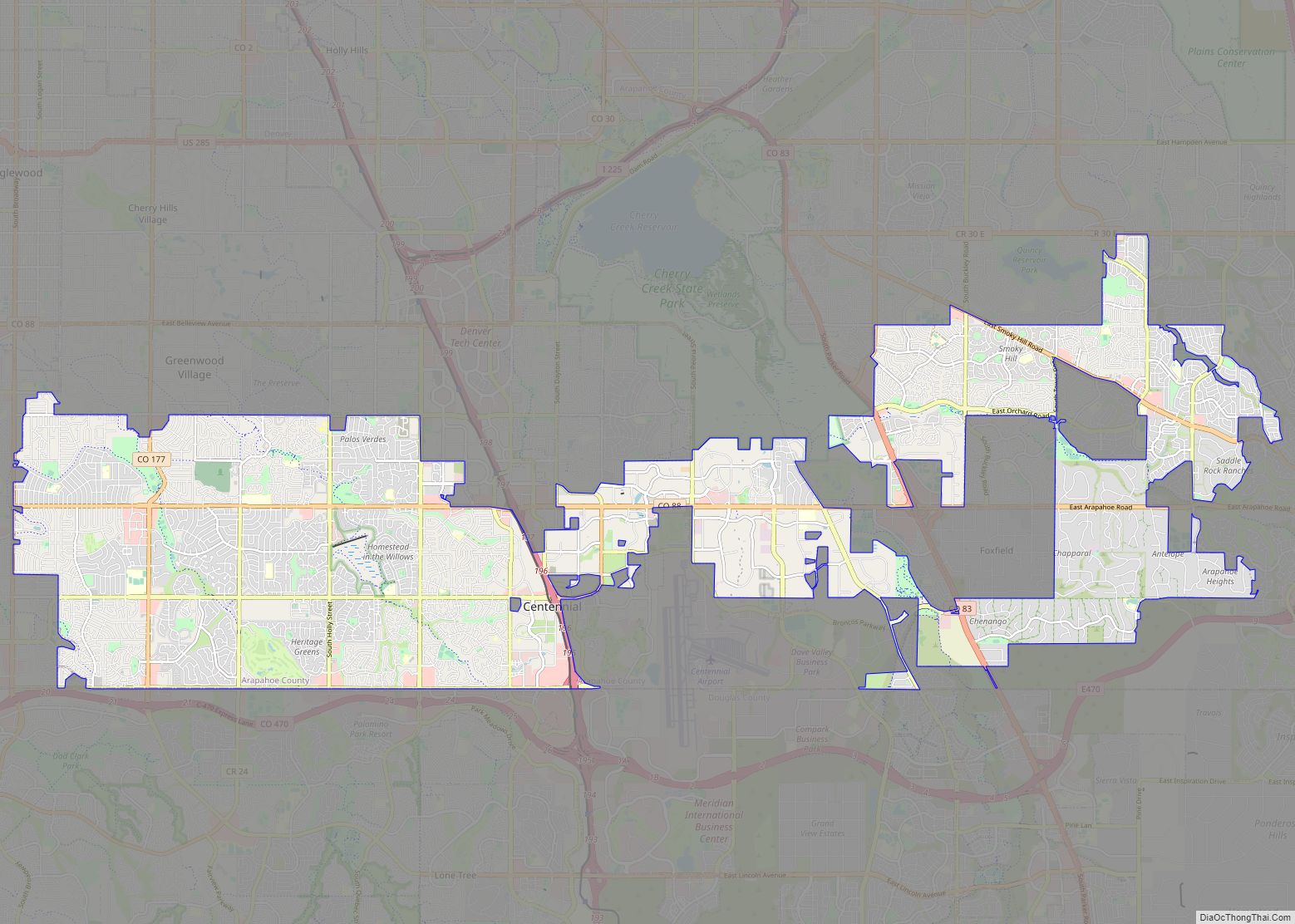
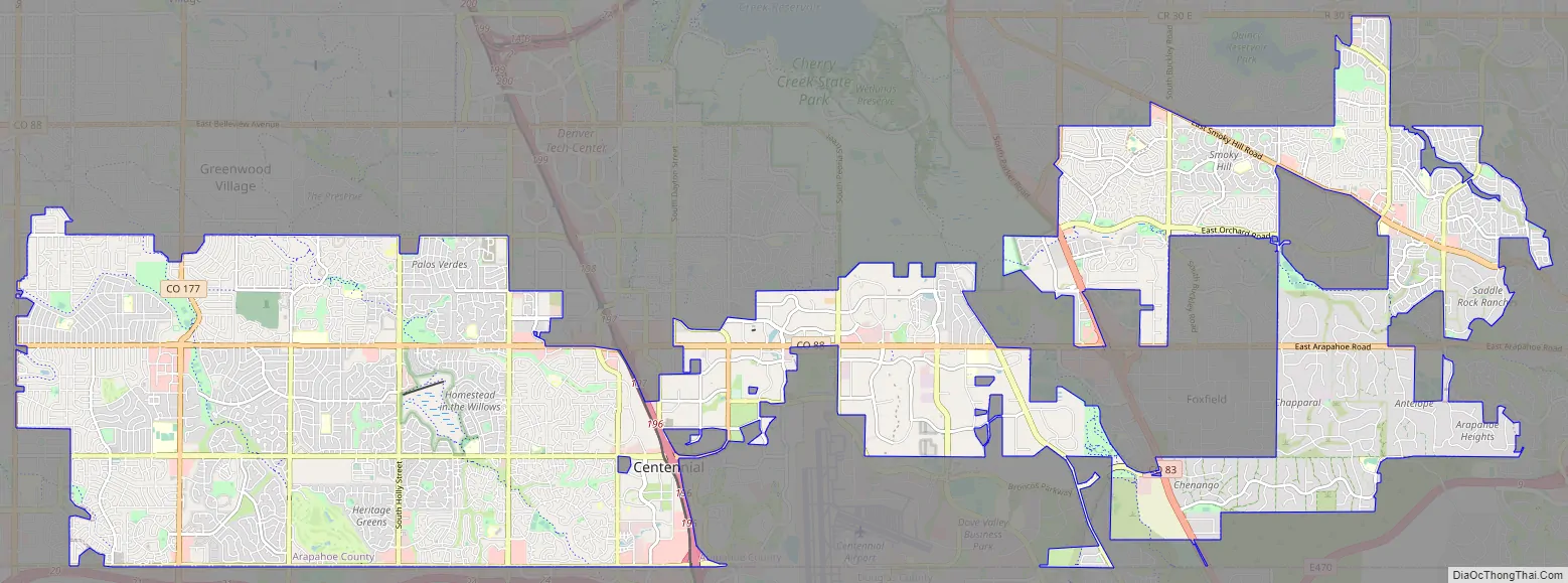
Centennial Road Map
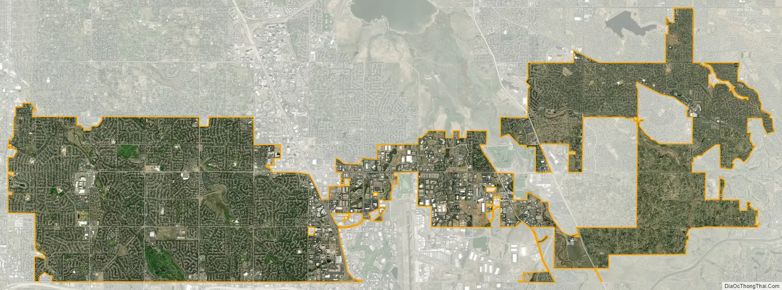
Centennial city Satellite Map
Geography
Centennial is roughly divided in half by Interstate 25, with most of its business and entertainment centers lying west of the highway. The city’s boundaries are highly irregular and evocative of a gerrymander, particularly the overwhelmingly residential eastern portions of the city, which appear with Foxfield, portions of Aurora, and unincorporated areas as a distorted checkerboard on the city’s map.
Centennial has many hills, gullies and ravines, and its open spaces are usually accompanied by recreational trails and parks, including Dry Creek Dam, DeKoevend Park, the High line Canal Trail, Willow Creek Trail, as well as Big Dry Creek and Little Dry Creek Trails. Centennial hosts most native wildlife and is a good reflection of Colorado’s front range ecosystem. Centennial has seen a boost in coyote populations in recent years, leading to resident education on how to deter coyotes from eating family pets.
Centennial is located at 39°35’47” North, 104°50’38” West (39.5963, −104.8439).
At the 2020 United States Census, the city had a total area of 19,115 acres (77.355 km) including 94 acres (0.379 km) of water.
See also
Map of Colorado State and its subdivision:- Adams
- Alamosa
- Arapahoe
- Archuleta
- Baca
- Bent
- Boulder
- Broomfield
- Chaffee
- Cheyenne
- Clear Creek
- Conejos
- Costilla
- Crowley
- Custer
- Delta
- Denver
- Dolores
- Douglas
- Eagle
- El Paso
- Elbert
- Fremont
- Garfield
- Gilpin
- Grand
- Gunnison
- Hinsdale
- Huerfano
- Jackson
- Jefferson
- Kiowa
- Kit Carson
- La Plata
- Lake
- Larimer
- Las Animas
- Lincoln
- Logan
- Mesa
- Mineral
- Moffat
- Montezuma
- Montrose
- Morgan
- Otero
- Ouray
- Park
- Phillips
- Pitkin
- Prowers
- Pueblo
- Rio Blanco
- Rio Grande
- Routt
- Saguache
- San Juan
- San Miguel
- Sedgwick
- Summit
- Teller
- Washington
- Weld
- Yuma
- Alabama
- Alaska
- Arizona
- Arkansas
- California
- Colorado
- Connecticut
- Delaware
- District of Columbia
- Florida
- Georgia
- Hawaii
- Idaho
- Illinois
- Indiana
- Iowa
- Kansas
- Kentucky
- Louisiana
- Maine
- Maryland
- Massachusetts
- Michigan
- Minnesota
- Mississippi
- Missouri
- Montana
- Nebraska
- Nevada
- New Hampshire
- New Jersey
- New Mexico
- New York
- North Carolina
- North Dakota
- Ohio
- Oklahoma
- Oregon
- Pennsylvania
- Rhode Island
- South Carolina
- South Dakota
- Tennessee
- Texas
- Utah
- Vermont
- Virginia
- Washington
- West Virginia
- Wisconsin
- Wyoming