Dacono is a home rule municipality located in southwestern Weld County, Colorado, United States. The city population was 6,297 at the 2020 United States Census, an increase of +51.66% since the 2010 United States Census. Dacono is a part of the Greeley, CO Metropolitan Statistical Area and the Front Range Urban Corridor.
| Name: | Dacono city |
|---|---|
| LSAD Code: | 25 |
| LSAD Description: | city (suffix) |
| State: | Colorado |
| County: | Weld County |
| Incorporated: | September 23, 1908 |
| Elevation: | 5,030 ft (1,533 m) |
| Total Area: | 8.796 sq mi (22.782 km²) |
| Land Area: | 8.790 sq mi (22.766 km²) |
| Water Area: | 0.006 sq mi (0.016 km²) |
| Total Population: | 6,297 |
| Population Density: | 716/sq mi (276/km²) |
| ZIP code: | 80514 |
| Area code: | 303 |
| FIPS code: | 0819080 |
| Website: | www.cityofdacono.com |
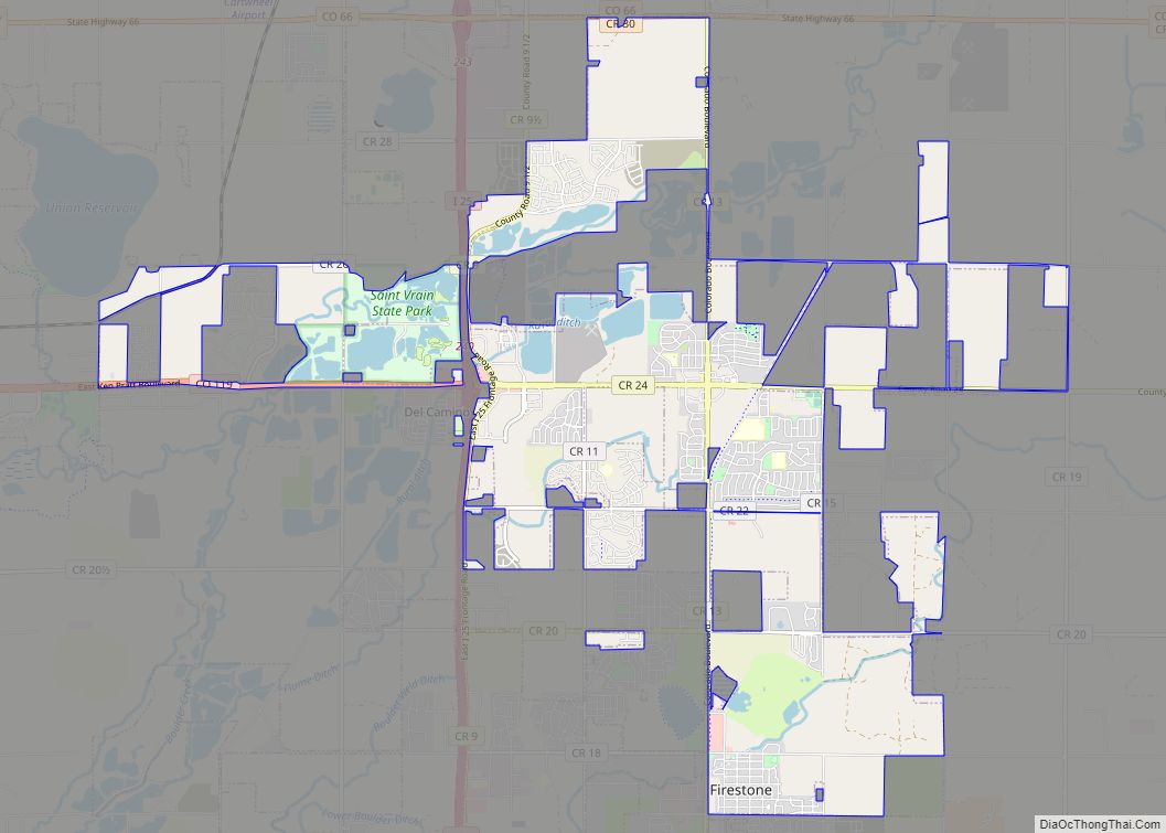
Online Interactive Map
Click on ![]() to view map in "full screen" mode.
to view map in "full screen" mode.
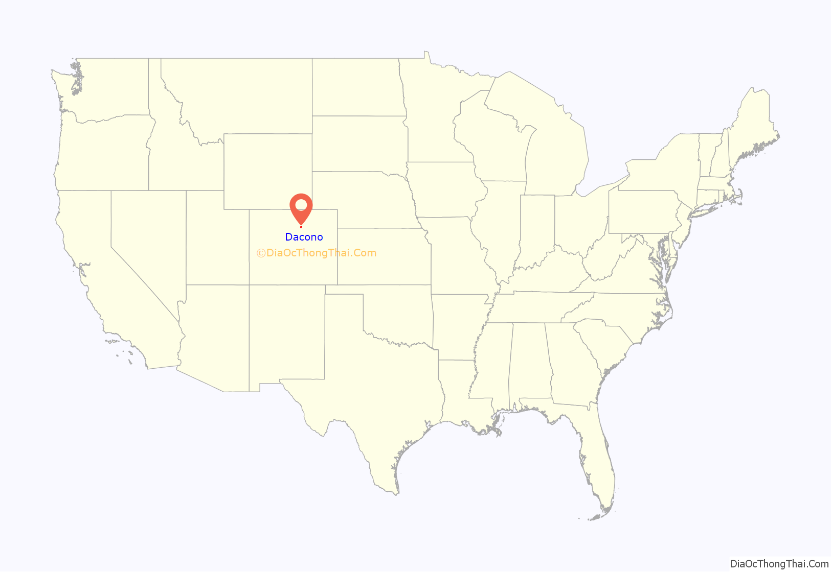
Dacono location map. Where is Dacono city?
History
The city name’s is an amalgamation of the names of Daisy Baum, Cora Van Vorhies, and Nora Brooks, local coal mine operators. Dacono was first settled in 1901, and early settlers moved there to work in the coal mines. The city was incorporated in 1908.
Dacono Road Map
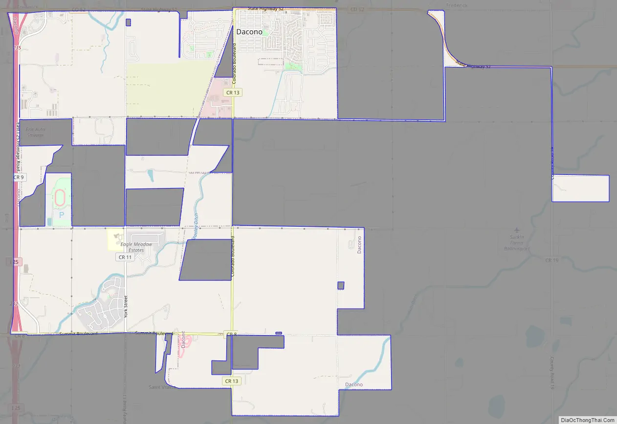
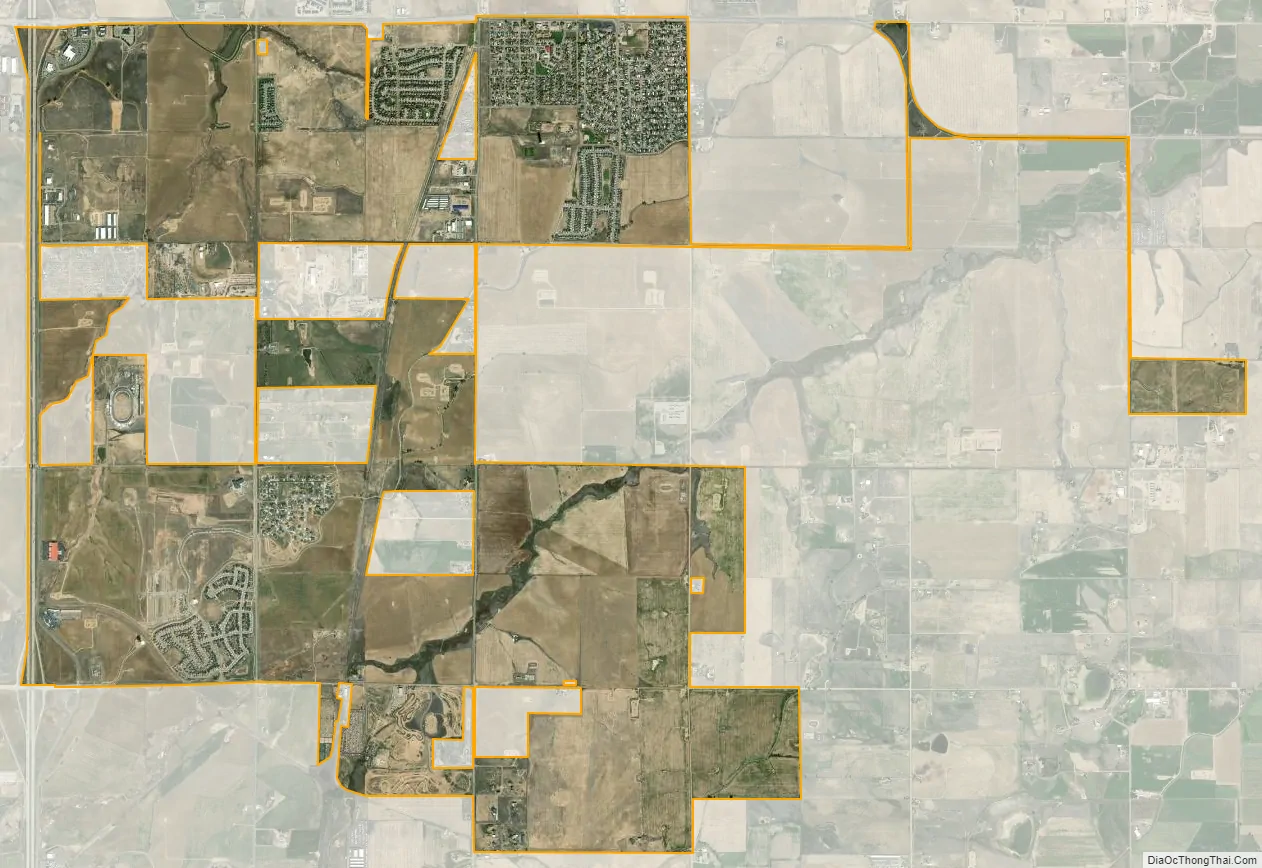
Dacono city Satellite Map
Geography
Dacono is located at 40°4′33″N 104°56′43″W / 40.07583°N 104.94528°W / 40.07583; -104.94528 (40.075772, -104.945353).
At the 2020 United States Census, the town had a total area of 5,630 acres (22.782 km) including 4 acres (0.016 km) of water.
See also
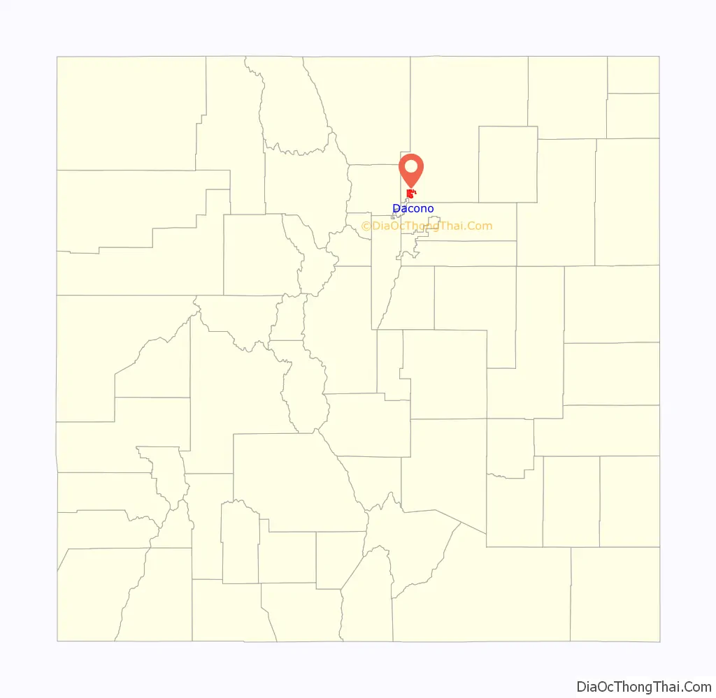
Map of Colorado State and its subdivision:- Adams
- Alamosa
- Arapahoe
- Archuleta
- Baca
- Bent
- Boulder
- Broomfield
- Chaffee
- Cheyenne
- Clear Creek
- Conejos
- Costilla
- Crowley
- Custer
- Delta
- Denver
- Dolores
- Douglas
- Eagle
- El Paso
- Elbert
- Fremont
- Garfield
- Gilpin
- Grand
- Gunnison
- Hinsdale
- Huerfano
- Jackson
- Jefferson
- Kiowa
- Kit Carson
- La Plata
- Lake
- Larimer
- Las Animas
- Lincoln
- Logan
- Mesa
- Mineral
- Moffat
- Montezuma
- Montrose
- Morgan
- Otero
- Ouray
- Park
- Phillips
- Pitkin
- Prowers
- Pueblo
- Rio Blanco
- Rio Grande
- Routt
- Saguache
- San Juan
- San Miguel
- Sedgwick
- Summit
- Teller
- Washington
- Weld
- Yuma
- Alabama
- Alaska
- Arizona
- Arkansas
- California
- Colorado
- Connecticut
- Delaware
- District of Columbia
- Florida
- Georgia
- Hawaii
- Idaho
- Illinois
- Indiana
- Iowa
- Kansas
- Kentucky
- Louisiana
- Maine
- Maryland
- Massachusetts
- Michigan
- Minnesota
- Mississippi
- Missouri
- Montana
- Nebraska
- Nevada
- New Hampshire
- New Jersey
- New Mexico
- New York
- North Carolina
- North Dakota
- Ohio
- Oklahoma
- Oregon
- Pennsylvania
- Rhode Island
- South Carolina
- South Dakota
- Tennessee
- Texas
- Utah
- Vermont
- Virginia
- Washington
- West Virginia
- Wisconsin
- Wyoming