The City of Evans is a home rule municipality located in Weld County, Colorado, United States. The city population was 22,165 at the 2020 United States Census, a 19.57% increase since the 2010 United States Census. Evans is a part of the Greeley, CO Metropolitan Statistical Area and the Front Range Urban Corridor.
| Name: | Evans city |
|---|---|
| LSAD Code: | 25 |
| LSAD Description: | city (suffix) |
| State: | Colorado |
| County: | Weld County |
| Founded: | 1867 |
| Incorporated: | November 15, 1885 |
| Elevation: | 4,652 ft (1,418 m) |
| Total Area: | 10.526 sq mi (27.263 km²) |
| Land Area: | 10.182 sq mi (26.372 km²) |
| Water Area: | 0.344 sq mi (0.891 km²) |
| Total Population: | 22,165 |
| Population Density: | 2,177/sq mi (841/km²) |
| ZIP code: | 80620 |
| Area code: | 970 |
| FIPS code: | 0825280 |
| GNISfeature ID: | 0202732 |
| Website: | www.evanscolorado.gov |
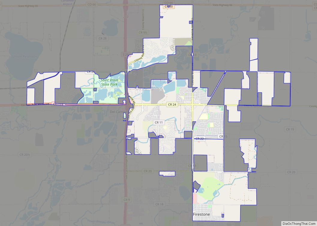
Online Interactive Map
Click on ![]() to view map in "full screen" mode.
to view map in "full screen" mode.
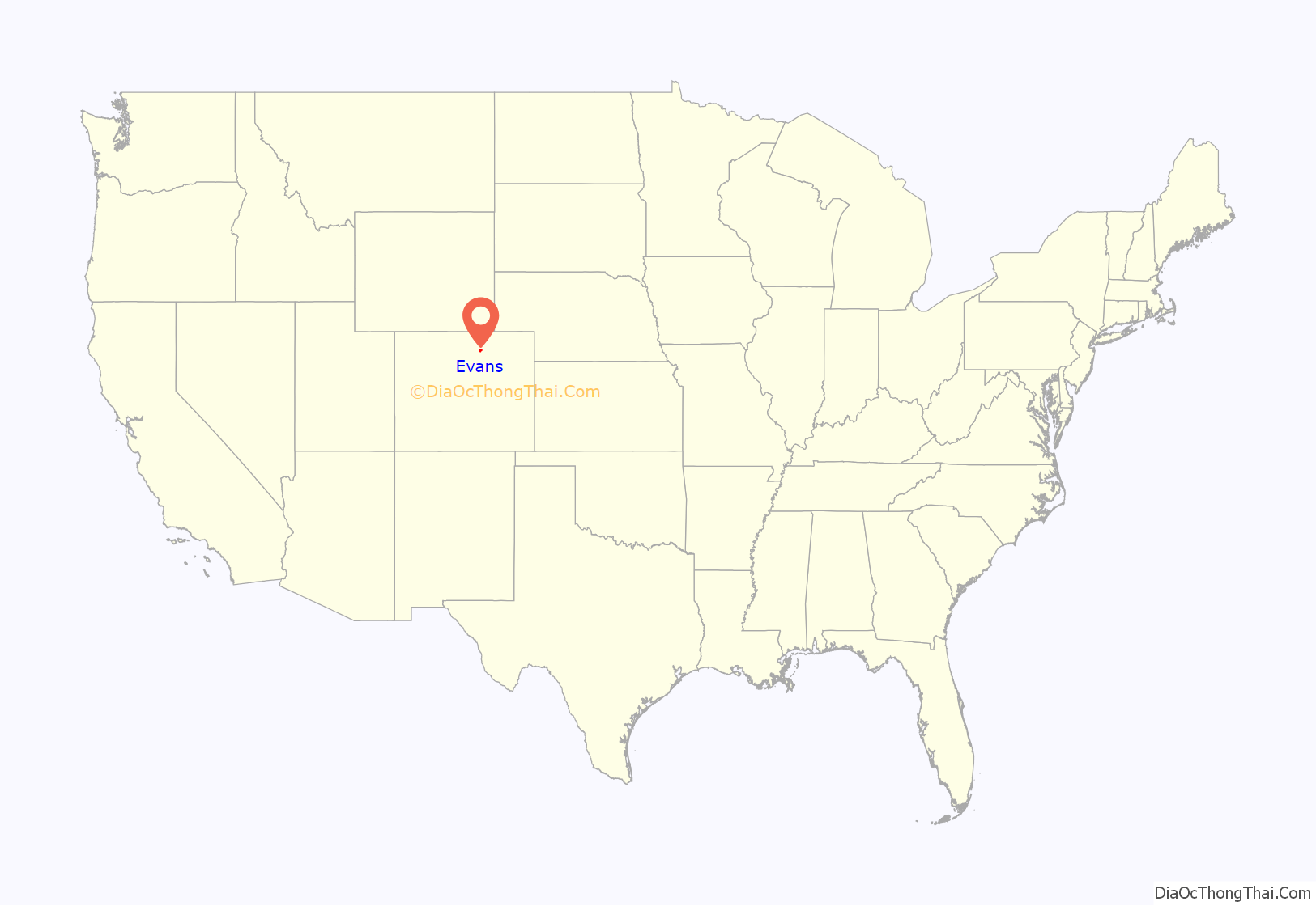
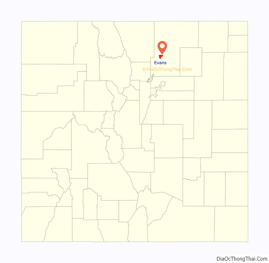
Evans location map. Where is Evans city?
History
Named for the second Territorial Governor of Colorado, John Evans, the town was established in 1867 and was Weld County’s seat of government twice before Greeley finally captured the honor. Legend in Evans is that the county records were stolen by night-riders from Greeley, who also burned the courthouse down with the county seat documents. The town was incorporated in 1885.
Today, Evans, like other towns in Colorado along the South Platte River, is home to a rapidly growing Hispanic population. Evans has several primary commercial areas located along US 85 just south of its junction with US 34, as well along 23rd Avenue and on 37th Street with new commercial areas developing as the city expands to the west and south of the South Platte River.
Evans Road Map
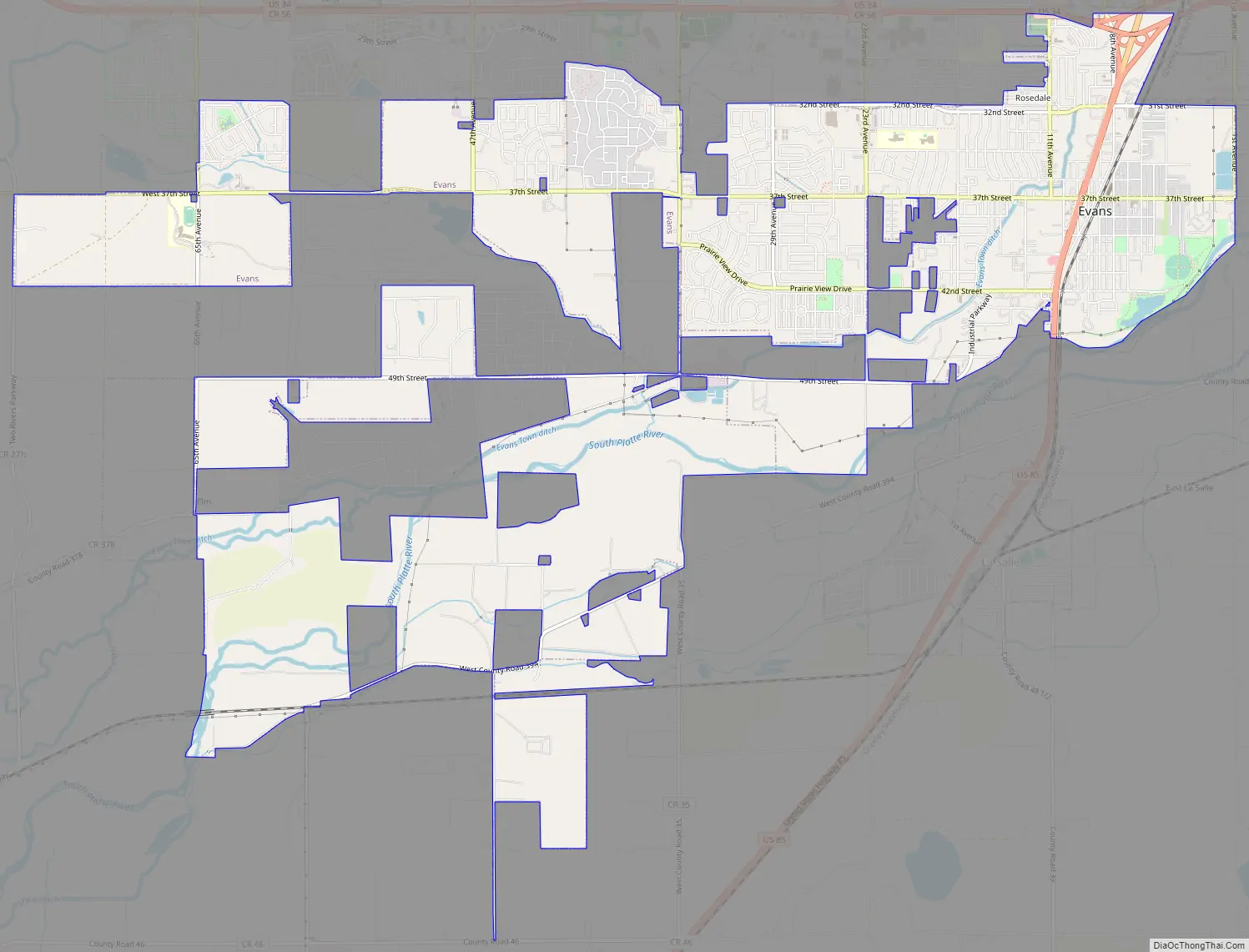
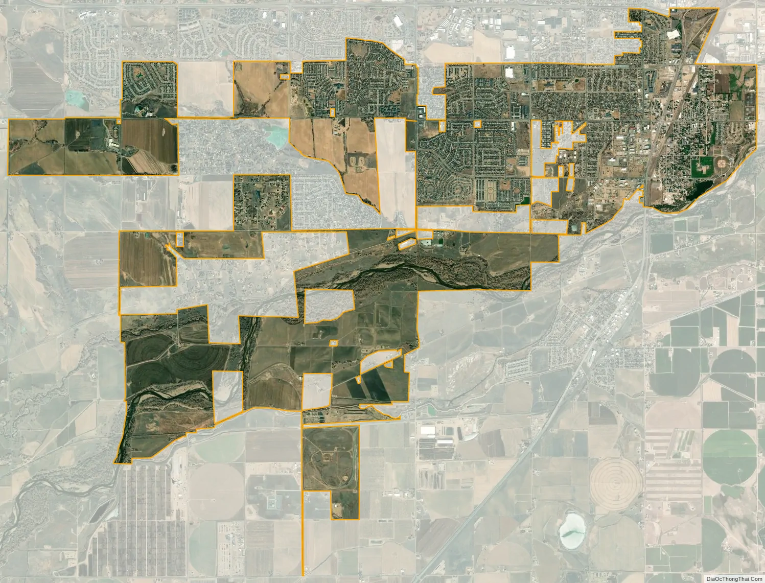
Evans city Satellite Map
Geography
Evans is located at 40°22′46″N 104°42′38″W / 40.37944°N 104.71056°W / 40.37944; -104.71056 (40.379310, −104.710450).
At the 2020 United States Census, the town had a total area of 6,737 acres (27.263 km) including 220 acres (0.891 km) of water.
See also
Map of Colorado State and its subdivision:- Adams
- Alamosa
- Arapahoe
- Archuleta
- Baca
- Bent
- Boulder
- Broomfield
- Chaffee
- Cheyenne
- Clear Creek
- Conejos
- Costilla
- Crowley
- Custer
- Delta
- Denver
- Dolores
- Douglas
- Eagle
- El Paso
- Elbert
- Fremont
- Garfield
- Gilpin
- Grand
- Gunnison
- Hinsdale
- Huerfano
- Jackson
- Jefferson
- Kiowa
- Kit Carson
- La Plata
- Lake
- Larimer
- Las Animas
- Lincoln
- Logan
- Mesa
- Mineral
- Moffat
- Montezuma
- Montrose
- Morgan
- Otero
- Ouray
- Park
- Phillips
- Pitkin
- Prowers
- Pueblo
- Rio Blanco
- Rio Grande
- Routt
- Saguache
- San Juan
- San Miguel
- Sedgwick
- Summit
- Teller
- Washington
- Weld
- Yuma
- Alabama
- Alaska
- Arizona
- Arkansas
- California
- Colorado
- Connecticut
- Delaware
- District of Columbia
- Florida
- Georgia
- Hawaii
- Idaho
- Illinois
- Indiana
- Iowa
- Kansas
- Kentucky
- Louisiana
- Maine
- Maryland
- Massachusetts
- Michigan
- Minnesota
- Mississippi
- Missouri
- Montana
- Nebraska
- Nevada
- New Hampshire
- New Jersey
- New Mexico
- New York
- North Carolina
- North Dakota
- Ohio
- Oklahoma
- Oregon
- Pennsylvania
- Rhode Island
- South Carolina
- South Dakota
- Tennessee
- Texas
- Utah
- Vermont
- Virginia
- Washington
- West Virginia
- Wisconsin
- Wyoming