Ault is a statutory town located in Weld County, Colorado, United States. The town population was 1,887 at the 2020 United States Census, a +24.23% increase since the 2010 United States Census. Ault is a part of the Greeley, CO Metropolitan Statistical Area and the Front Range Urban Corridor.
| Name: | Ault town |
|---|---|
| LSAD Code: | 43 |
| LSAD Description: | town (suffix) |
| State: | Colorado |
| County: | Weld County |
| Incorporated: | April 11, 1904 as the Town of Bergdorf |
| Elevation: | 4,938 ft (1,505 m) |
| Total Area: | 1.728 sq mi (4.476 km²) |
| Land Area: | 1.728 sq mi (4.476 km²) |
| Water Area: | 0.000 sq mi (0.000 km²) |
| Total Population: | 1,887 |
| Population Density: | 1,092/sq mi (422/km²) |
| ZIP code: | 80610 |
| Area code: | 970 |
| FIPS code: | 0803950 |
| GNISfeature ID: | 0180544 |
| Website: | www.townofault.org |
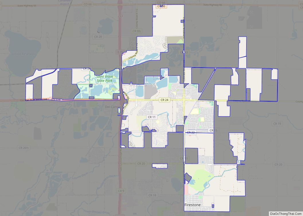
Online Interactive Map
Click on ![]() to view map in "full screen" mode.
to view map in "full screen" mode.
Ault location map. Where is Ault town?


History
First called High Land, the town’s name was changed to Burgdorff Siding, sometimes called Bergdorf Switch (after a railroad worker, who was deceased in an accident), before it acquired its current name in 1897. The town was named after Alexander Ault, a Fort Collins, Colorado resident and owner of a flour mill. Mr. Ault had helped to avert financial disaster to the agricultural base by purchasing the entire grain harvest during a year of severe economic hardship. The town was incorporated in 1904.
Much of the residential area of the town, as well as surrounding farmland, is on land given by the United States government to the Union Pacific Railroad, to be sold to finance railroad construction. A north–south segment of the railroad connecting Denver, Colorado, and Cheyenne, Wyoming, passes through the town, parallel to U.S. Highway 85. On February 21, 1910, Rabbi I. Idleson of Denver, Colorado, purchased 640 acres (2.6 km) for farming purposes near Ault, proposing “to employ Jewish farmers and devote land to practical philanthropy”. Little came of this venture, and within a few decades there were apparently no Jewish residents in the town.
Ault Public Emergency Radio Tower, a former emergency transmission facility, was located here.
Ault Road Map

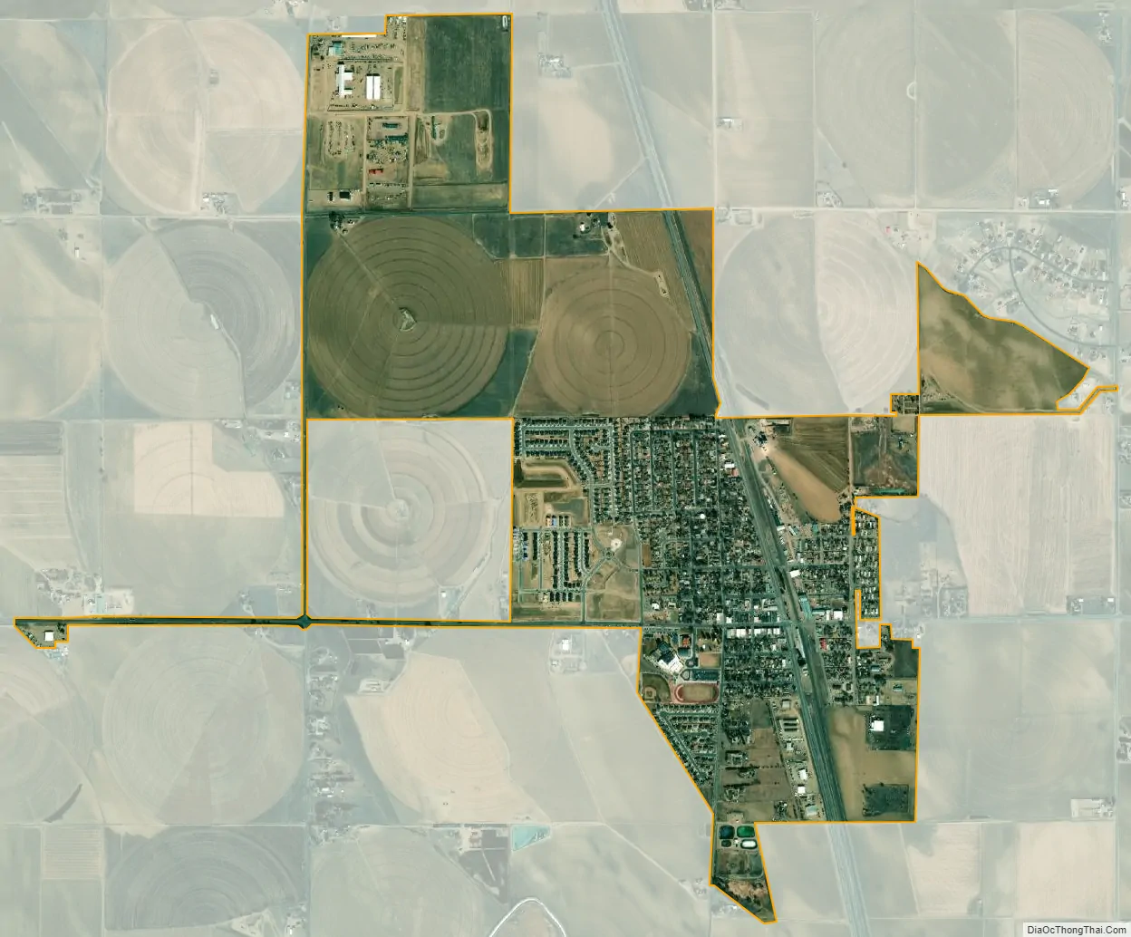
Ault city Satellite Map
Geography
Ault is located at 40°35′2″N 104°44′1″W / 40.58389°N 104.73361°W / 40.58389; -104.73361 (40.583999, -104.733648), at the intersection of U.S. Highway 85 and State Highway 14.
At the 2020 United States Census, the town had a total area of 1,106 acres (4.476 km), all of it land.
See also
Map of Colorado State and its subdivision:- Adams
- Alamosa
- Arapahoe
- Archuleta
- Baca
- Bent
- Boulder
- Broomfield
- Chaffee
- Cheyenne
- Clear Creek
- Conejos
- Costilla
- Crowley
- Custer
- Delta
- Denver
- Dolores
- Douglas
- Eagle
- El Paso
- Elbert
- Fremont
- Garfield
- Gilpin
- Grand
- Gunnison
- Hinsdale
- Huerfano
- Jackson
- Jefferson
- Kiowa
- Kit Carson
- La Plata
- Lake
- Larimer
- Las Animas
- Lincoln
- Logan
- Mesa
- Mineral
- Moffat
- Montezuma
- Montrose
- Morgan
- Otero
- Ouray
- Park
- Phillips
- Pitkin
- Prowers
- Pueblo
- Rio Blanco
- Rio Grande
- Routt
- Saguache
- San Juan
- San Miguel
- Sedgwick
- Summit
- Teller
- Washington
- Weld
- Yuma
- Alabama
- Alaska
- Arizona
- Arkansas
- California
- Colorado
- Connecticut
- Delaware
- District of Columbia
- Florida
- Georgia
- Hawaii
- Idaho
- Illinois
- Indiana
- Iowa
- Kansas
- Kentucky
- Louisiana
- Maine
- Maryland
- Massachusetts
- Michigan
- Minnesota
- Mississippi
- Missouri
- Montana
- Nebraska
- Nevada
- New Hampshire
- New Jersey
- New Mexico
- New York
- North Carolina
- North Dakota
- Ohio
- Oklahoma
- Oregon
- Pennsylvania
- Rhode Island
- South Carolina
- South Dakota
- Tennessee
- Texas
- Utah
- Vermont
- Virginia
- Washington
- West Virginia
- Wisconsin
- Wyoming