The Town of Berthoud is a Statutory Town located in Larimer and Weld counties, Colorado, United States. The town population was 10,332 at the 2020 United States Census with 10,071 residing in Larimer County and 261 residing in Weld County. Berthoud is situated north of the Little Thompson River, 21 miles (34 km) south of Fort Collins and 43 miles (69 km) north of Denver in the Front Range Urban Corridor.
| Name: | Berthoud town |
|---|---|
| LSAD Code: | 43 |
| LSAD Description: | town (suffix) |
| State: | Colorado |
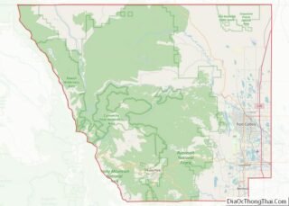
| County: | Larimer County, Weld County |
| Incorporated: | August 28, 1888 |
| Elevation: | 5,030 ft (1,533 m) |
| Total Area: | 13.067 sq mi (33.844 km²) |
| Land Area: | 12.933 sq mi (33.497 km²) |
| Water Area: | 0.134 sq mi (0.347 km²) |
| Total Population: | 10,332 |
| Population Density: | 799/sq mi (308/km²) |
| ZIP code: | 80513 |
| Area code: | 970 |
| FIPS code: | 0806255 |
| Website: | www.berthoud.org |
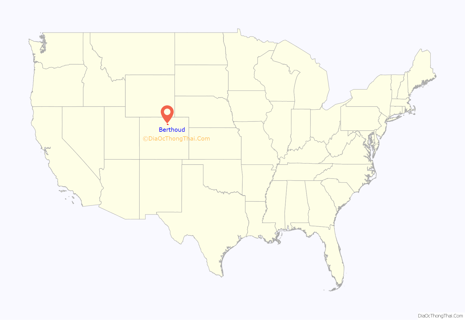
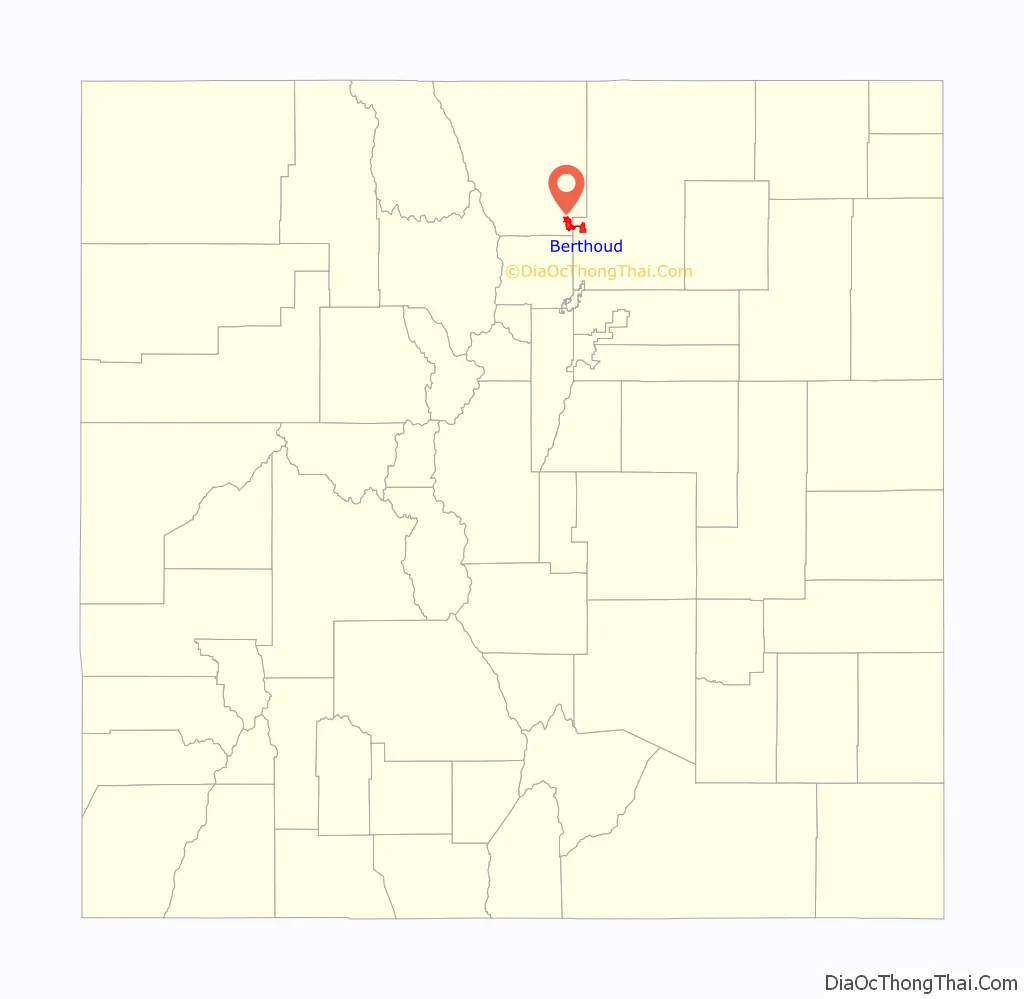
Online Interactive Map
Click on ![]() to view map in "full screen" mode.
to view map in "full screen" mode.
Berthoud location map. Where is Berthoud town?
History
White settlers first came to the present-day Berthoud area in the early 1860s, following the Colorado Gold Rush. Many settlers filed homestead claims, but most bellied up and left the valley to hardier souls who ranched and farmed the arid prairie that straddled the river bottom.
In 1872, a miner-turned-rancher from Central City, Colorado, Lewis Cross, staked the first homestead claim where the Colorado Central Railroad planned to cross Little Thompson creek. When the tracks were laid through the valley in 1877 a depot, section house, and water tank were installed at this strategic site. The tiny settlement known as Little Thompson was renamed Berthoud in honor of Edward L. Berthoud, who had surveyed the rail route through the valley.
Over the next few years the settlement grew to include a handful of homes, a blacksmith shop, a mercantile store, a small grain elevator, and a log cabin that served as school and church for the community.
In the early 1880s, the Colorado Central Railroad recognized that Berthoud’s location on the river bottom caused their steam-powered locomotives to labor excessively to ascend the grade out of the valley. At their urging, during the winter of 1883–84, several buildings of the town were loaded on wheels and pulled by teams of draft animals to the town’s present-day location on the bluff one mile (1.6 km) north of the river.
Agriculture in the Berthoud area flourished. Farmers diverted water from the Little and Big Thompson Rivers into a network of reservoirs and ditches that allowed the arid uplands to be irrigated. Harvests of alfalfa, sugar beets, wheat, corn, and barley were sold on the open market or used to fatten pens of sheep and cattle. The town grew as merchants and shopkeepers set up businesses to serve farmers and ranchers from the nearby countryside.
In 1886, the Welch Addition doubled the size of the Berthoud as town boundaries extended south beyond present-day Mountain Avenue for the first time. A year later a hose company was hastily formed to protect the town from fire after the Davis & Hartford Mercantile store burned to the ground. In 1888 a town board was elected and within a short time they hired a marshal to keep the peace and light the street lamps. By the early 1900s, Berthoud sported a business district on Third Street and Massachusetts and Mountain Avenues.
In the 1920s Mountain Avenue became part of a paved state highway system which would become U.S. Highway 287 connecting the larger towns of northern Colorado. In 2007, Highway 287 was rerouted to the north and west of Berthoud, bypassing downtown Berthoud and eliminating Mountain Avenue from the highway route.
In October 1941, Berthoud opened the sugar beet harvest. In the area surrounding Berthoud beets were harvested to be processed in Loveland, Colorado, to the north. According to the Berthoud historical society, “Berthoud growers delivered beets to several rural dumping stations where the beets were loaded into boxcars and hauled to sugar factories in nearby Loveland and Longmont.” This industry relied both on WWII German Prisoners of War as well as migrant farm workers from Mexico.
On June 25, 2019, Berthoud became the only municipality in Colorado to ban the sale of puppy mill dogs.
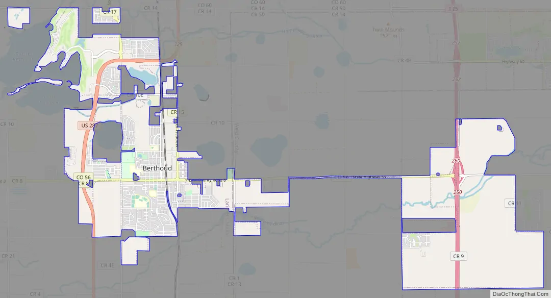
Berthoud Road Map
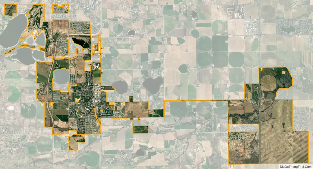
Berthoud city Satellite Map
Geography
Berthoud is located at 40°17′05″N 104°57′56″W / 40.284667°N 104.965504°W / 40.284667; -104.965504 (40.284667 -104.965504).
At the 2020 United States Census, the town had a total area of 8,363 acres (33.844 km) including 86 acres (0.347 km) of water.
See also
Map of Colorado State and its subdivision:- Adams
- Alamosa
- Arapahoe
- Archuleta
- Baca
- Bent
- Boulder
- Broomfield
- Chaffee
- Cheyenne
- Clear Creek
- Conejos
- Costilla
- Crowley
- Custer
- Delta
- Denver
- Dolores
- Douglas
- Eagle
- El Paso
- Elbert
- Fremont
- Garfield
- Gilpin
- Grand
- Gunnison
- Hinsdale
- Huerfano
- Jackson
- Jefferson
- Kiowa
- Kit Carson
- La Plata
- Lake
- Larimer
- Las Animas
- Lincoln
- Logan
- Mesa
- Mineral
- Moffat
- Montezuma
- Montrose
- Morgan
- Otero
- Ouray
- Park
- Phillips
- Pitkin
- Prowers
- Pueblo
- Rio Blanco
- Rio Grande
- Routt
- Saguache
- San Juan
- San Miguel
- Sedgwick
- Summit
- Teller
- Washington
- Weld
- Yuma
- Alabama
- Alaska
- Arizona
- Arkansas
- California
- Colorado
- Connecticut
- Delaware
- District of Columbia
- Florida
- Georgia
- Hawaii
- Idaho
- Illinois
- Indiana
- Iowa
- Kansas
- Kentucky
- Louisiana
- Maine
- Maryland
- Massachusetts
- Michigan
- Minnesota
- Mississippi
- Missouri
- Montana
- Nebraska
- Nevada
- New Hampshire
- New Jersey
- New Mexico
- New York
- North Carolina
- North Dakota
- Ohio
- Oklahoma
- Oregon
- Pennsylvania
- Rhode Island
- South Carolina
- South Dakota
- Tennessee
- Texas
- Utah
- Vermont
- Virginia
- Washington
- West Virginia
- Wisconsin
- Wyoming