The City of Fort Lupton is a Statutory City located in southern Weld County, Colorado, United States. The town population was 7,955 at the 2020 United States Census. Fort Lupton is a part of the Greeley, Colorado Metropolitan Statistical Area and the Front Range Urban Corridor.
| Name: | Fort Lupton city |
|---|---|
| LSAD Code: | 25 |
| LSAD Description: | city (suffix) |
| State: | Colorado |
| County: | Weld County |
| Elevation: | 4,908 ft (1,496 m) |
| Total Area: | 12.199 sq mi (31.596 km²) |
| Land Area: | 12.146 sq mi (31.459 km²) |
| Water Area: | 0.053 sq mi (0.137 km²) |
| Total Population: | 7,955 |
| Population Density: | 655/sq mi (253/km²) |
| ZIP code: | 80621 |
| Area code: | 303 |
| FIPS code: | 0827700 |
| GNISfeature ID: | 0180857 |
| Website: | www.fortluptonco.gov |
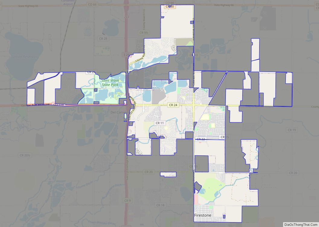
Online Interactive Map
Click on ![]() to view map in "full screen" mode.
to view map in "full screen" mode.
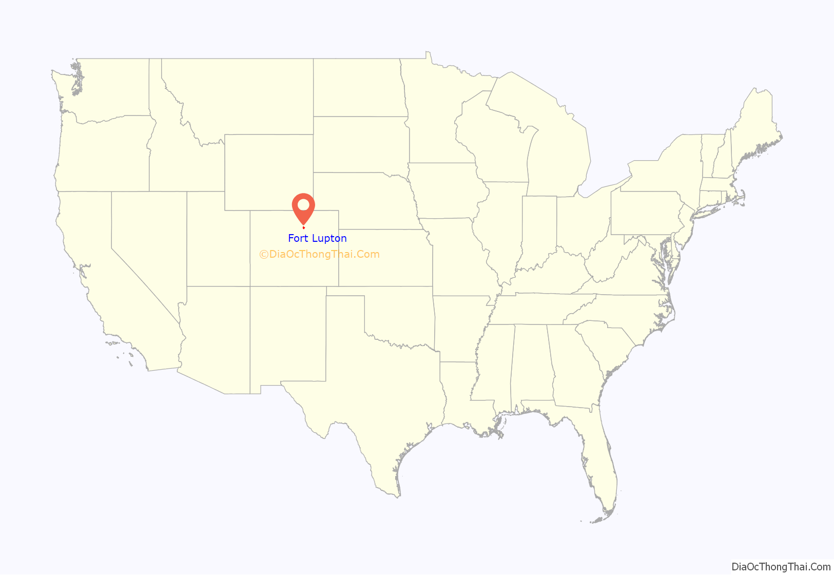
Fort Lupton location map. Where is Fort Lupton city?
History
The city was named for Lieutenant Lancaster Lupton, who built a trading post on Adobe Creek in 1838. The trading post, Fort Lupton, has been reconstructed near the site of the original fort using some of the original adobe bricks at the South Platte Valley Historical Park, which was established by the South Platte Valley Historical Society northwest of the city of Fort Lupton. It is a historical park about early area settlement.
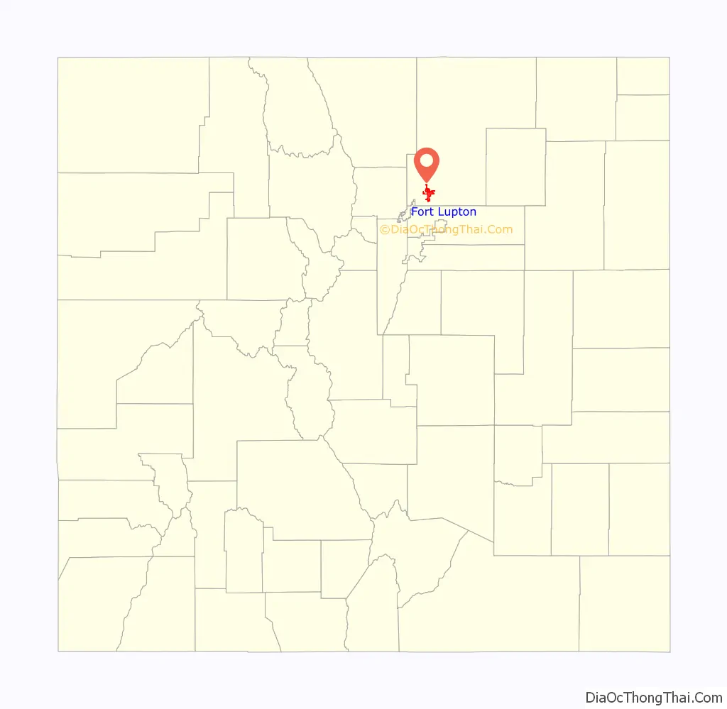
Fort Lupton Road Map
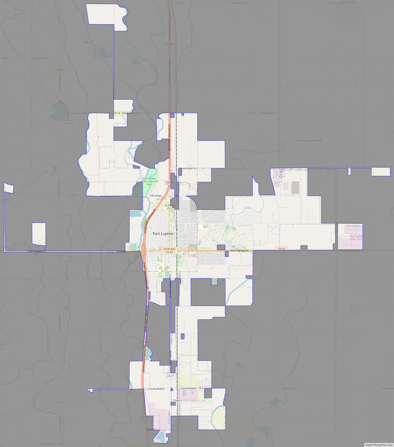
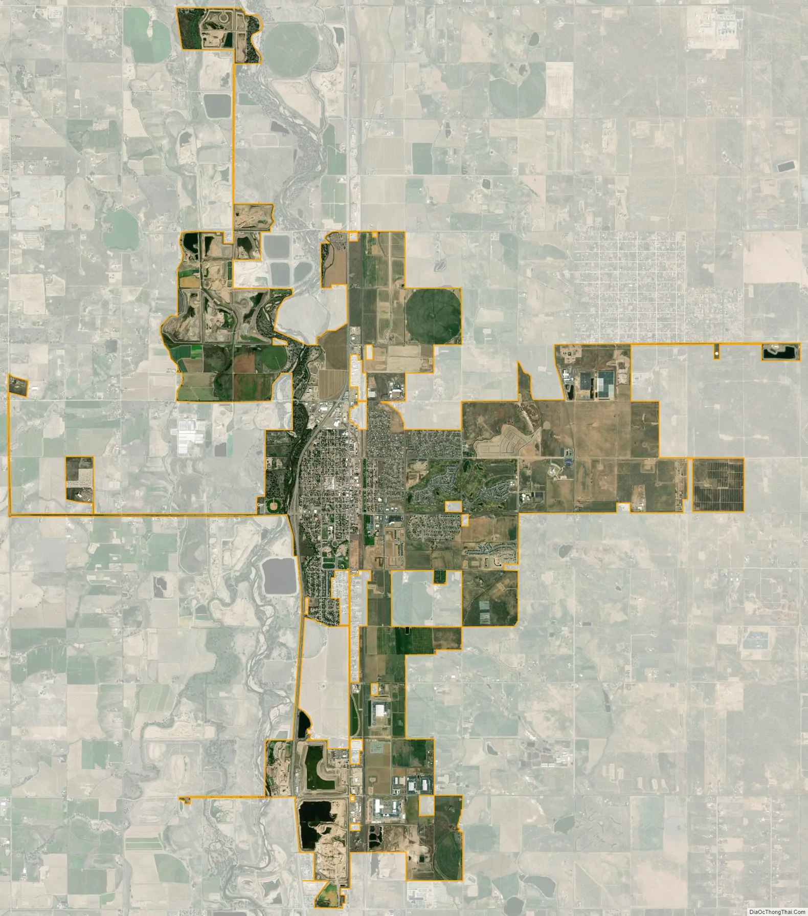
Fort Lupton city Satellite Map
Geography
The city of Fort Lupton is located at 40°5′N 104°48′W / 40.083°N 104.800°W / 40.083; -104.800 (40.0849, -104.8030).
At the 2020 United States Census, the town had a total area of 7,808 acres (31.596 km) including 34 acres (0.137 km) of water.
See also
Map of Colorado State and its subdivision:- Adams
- Alamosa
- Arapahoe
- Archuleta
- Baca
- Bent
- Boulder
- Broomfield
- Chaffee
- Cheyenne
- Clear Creek
- Conejos
- Costilla
- Crowley
- Custer
- Delta
- Denver
- Dolores
- Douglas
- Eagle
- El Paso
- Elbert
- Fremont
- Garfield
- Gilpin
- Grand
- Gunnison
- Hinsdale
- Huerfano
- Jackson
- Jefferson
- Kiowa
- Kit Carson
- La Plata
- Lake
- Larimer
- Las Animas
- Lincoln
- Logan
- Mesa
- Mineral
- Moffat
- Montezuma
- Montrose
- Morgan
- Otero
- Ouray
- Park
- Phillips
- Pitkin
- Prowers
- Pueblo
- Rio Blanco
- Rio Grande
- Routt
- Saguache
- San Juan
- San Miguel
- Sedgwick
- Summit
- Teller
- Washington
- Weld
- Yuma
- Alabama
- Alaska
- Arizona
- Arkansas
- California
- Colorado
- Connecticut
- Delaware
- District of Columbia
- Florida
- Georgia
- Hawaii
- Idaho
- Illinois
- Indiana
- Iowa
- Kansas
- Kentucky
- Louisiana
- Maine
- Maryland
- Massachusetts
- Michigan
- Minnesota
- Mississippi
- Missouri
- Montana
- Nebraska
- Nevada
- New Hampshire
- New Jersey
- New Mexico
- New York
- North Carolina
- North Dakota
- Ohio
- Oklahoma
- Oregon
- Pennsylvania
- Rhode Island
- South Carolina
- South Dakota
- Tennessee
- Texas
- Utah
- Vermont
- Virginia
- Washington
- West Virginia
- Wisconsin
- Wyoming