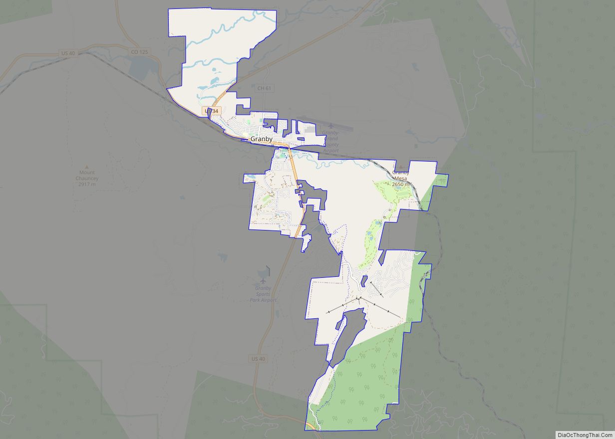
The Town of Granby is the Statutory Town that is the most populous municipality in Grand County, Colorado, United States. The town population was 2,079 at the 2020 United States Census. Granby is situated along U.S. Highway 40 in the Middle Park basin, and it is about 85 miles (137 km) northwest of Denver and 14 miles (23 km) southwest of Rocky Mountain National Park.
| Name: | Granby town |
|---|---|
| LSAD Code: | 43 |
| LSAD Description: | town (suffix) |
| State: | Colorado |
| County: | Grand County |
| Founded: | 1905 |
| Elevation: | 7,935 ft (2,428 m) |
| Total Area: | 12.682 sq mi (32.845 km²) |
| Land Area: | 12.682 sq mi (32.845 km²) |
| Water Area: | 0.000 sq mi (0.000 km²) |
| Total Population: | 2,079 |
| Population Density: | 164/sq mi (63/km²) |
| ZIP code: | 80446 |
| Area code: | 970 |
| FIPS code: | 0831605 |
| GNISfeature ID: | 0178402 |
| Website: | www.townofgranby.com |
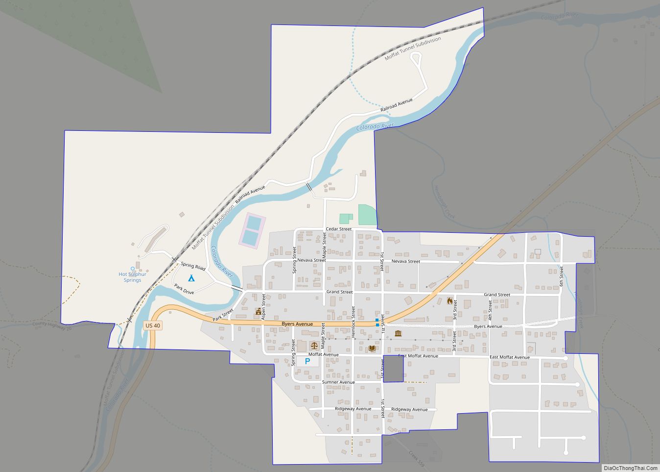
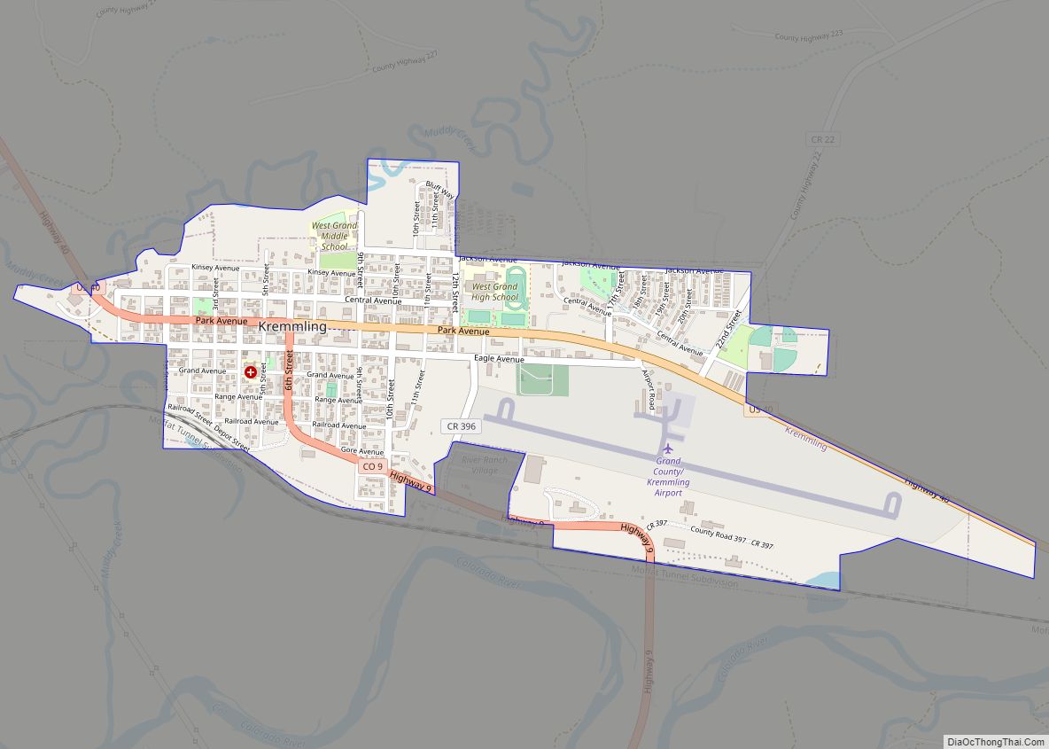
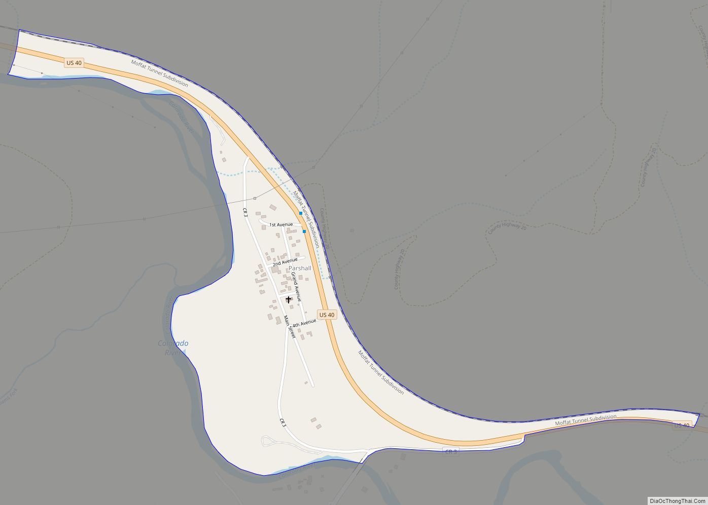
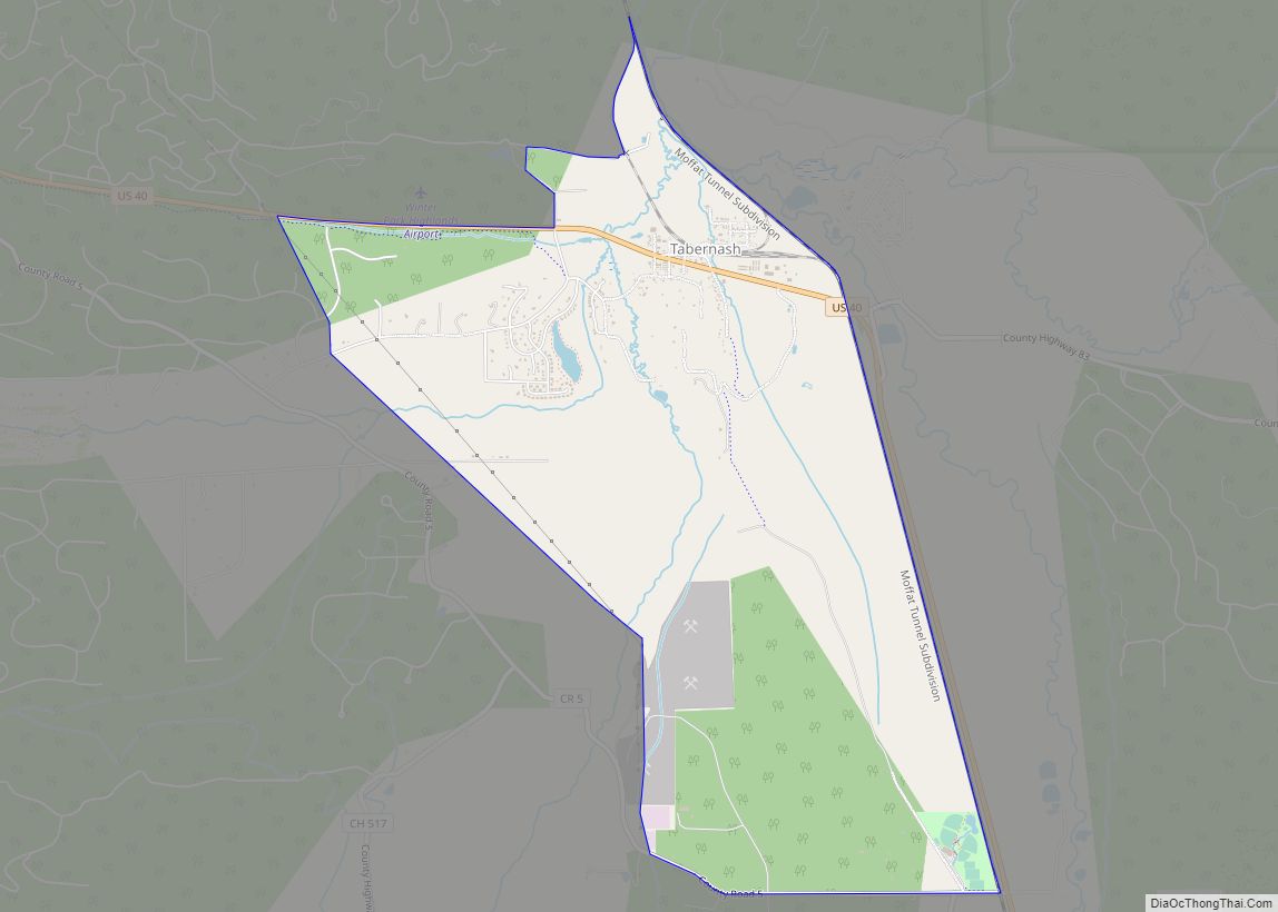
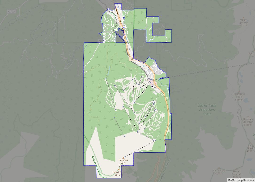
Online Interactive Map
Click on ![]() to view map in "full screen" mode.
to view map in "full screen" mode.
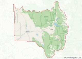
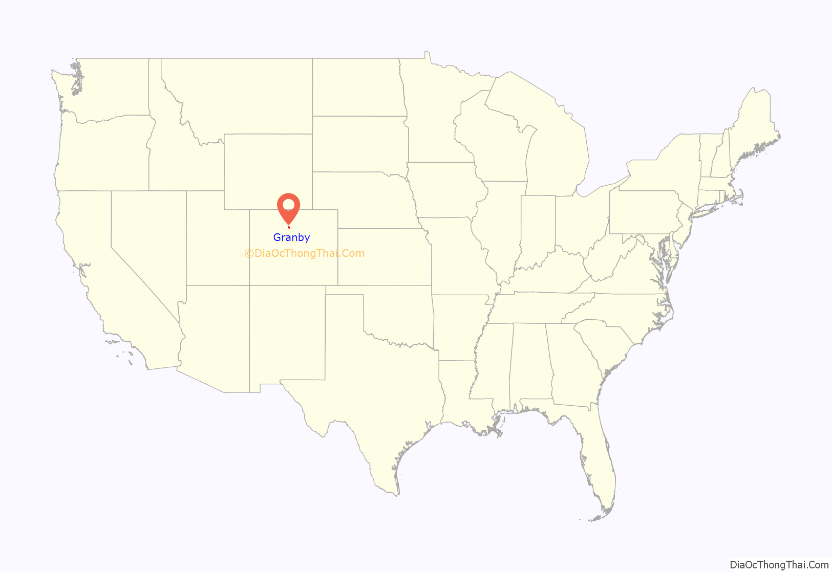
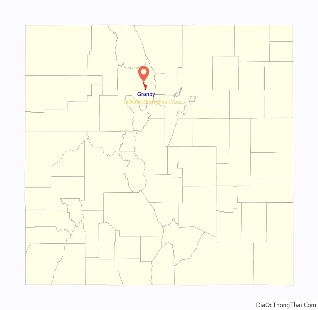
Granby location map. Where is Granby town?
History
The town was founded in 1904 along the route of the Denver, Northwestern & Pacific Railway and was incorporated one year later. It was named after Granby Hillyer, a Denver lawyer who later served as the United States Attorney for that city’s district.
Many Granby and Grand County residents are descended from pioneer settlers who arrived before the country was fully surveyed. Early families established themselves under the Homestead Act of 1862, which allowed easy access to land to those who would inhabit and improve upon the territory.
Since the turn of the century, families have contended for prime ranch land. The Hudlers and Cooks are descended from original homesteaders. Their waning ranch once covered approximately 20,000 acres (81 km) and was rich in cattle and hay.
Bulldozer rampage
Marvin Heemeyer was a local auto muffler shop owner and entrepreneur who was denied access to his own business property when a factory was approved by the town and built, cutting off his road access. The town later prevented him from building a new driveway that would again allow his business to operate. Later his connection to the local sewage line was destroyed by construction of the neighboring factory, but the town fined him for the damage caused by the new factory construction.
On June 4, 2004, Heemeyer went on a rampage through town, driving a modified bulldozer. Several buildings were damaged, including a bank, a hardware store, the concrete company, a utility service center, the town hall, the police department, and a former mayor’s home, all involved in Heemeyer’s business having been destroyed. The rampage lasted 2 hours and 7 minutes, ending when the bulldozer got stuck attempting to go through the alleyway of Gambles Hardware Store. Heemeyer then committed suicide with a handgun. No other deaths occurred, but an estimated $7 million in damage was done.
Granby Road Map
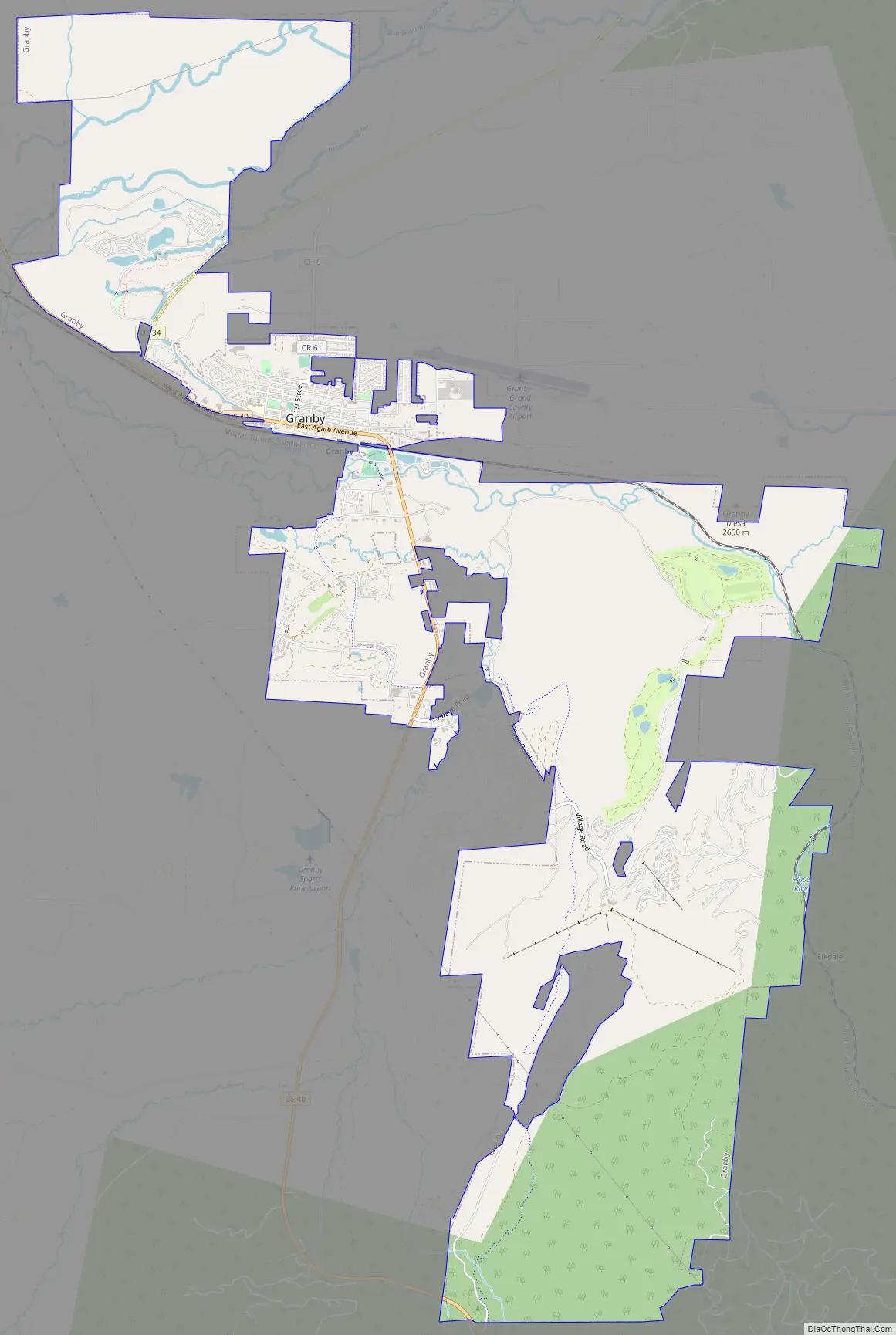
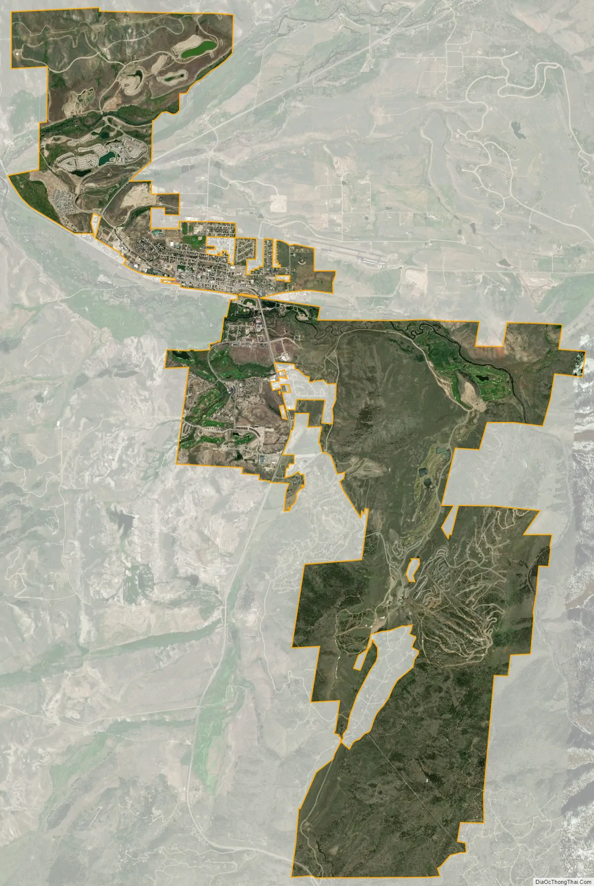
Granby city Satellite Map
Geography
Granby sits at 7,935 feet (2,419 m) above sea level in the valley of the Fraser River, 2 miles (3 km) east of its mouth at the Colorado River. It is located in eastern Grand County at 40°5′11″N 105°56′11″W / 40.08639°N 105.93639°W / 40.08639; -105.93639 (40.086396, -105.936487), in an area subject to average annual rainfall of 12+1⁄4 inches and annual snowfall of more than 128 inches (3,300 mm).
U.S. Route 40 passes through the center of town as Agate Avenue, leading south and east over Berthoud Pass to the Denver area, west 10 miles (16 km) to Hot Sulphur Springs, the Grand County seat. Kremmling is 27 miles (43 km) to the west on US 40. U.S. Route 34 intersects US 40 on the west side of Granby and leads northeast into Rocky Mountain National Park, crossing the mountains as Trail Ridge Road and reaching Estes Park 60 miles (97 km) northeast of Granby.
At the 2020 United States Census, the town had a total area of 8,116 acres (32.845 km), all of it land.
Climate
This climate type is dominated by the winter season, a long, bitterly cold period with short, clear days, relatively little precipitation mostly in the form of snow, and low humidity. According to the Köppen Climate Classification system, Granby has a warm summer humid continental climate, abbreviated “Dfb” on climate maps.
See also
Map of Colorado State and its subdivision:- Adams
- Alamosa
- Arapahoe
- Archuleta
- Baca
- Bent
- Boulder
- Broomfield
- Chaffee
- Cheyenne
- Clear Creek
- Conejos
- Costilla
- Crowley
- Custer
- Delta
- Denver
- Dolores
- Douglas
- Eagle
- El Paso
- Elbert
- Fremont
- Garfield
- Gilpin
- Grand
- Gunnison
- Hinsdale
- Huerfano
- Jackson
- Jefferson
- Kiowa
- Kit Carson
- La Plata
- Lake
- Larimer
- Las Animas
- Lincoln
- Logan
- Mesa
- Mineral
- Moffat
- Montezuma
- Montrose
- Morgan
- Otero
- Ouray
- Park
- Phillips
- Pitkin
- Prowers
- Pueblo
- Rio Blanco
- Rio Grande
- Routt
- Saguache
- San Juan
- San Miguel
- Sedgwick
- Summit
- Teller
- Washington
- Weld
- Yuma
- Alabama
- Alaska
- Arizona
- Arkansas
- California
- Colorado
- Connecticut
- Delaware
- District of Columbia
- Florida
- Georgia
- Hawaii
- Idaho
- Illinois
- Indiana
- Iowa
- Kansas
- Kentucky
- Louisiana
- Maine
- Maryland
- Massachusetts
- Michigan
- Minnesota
- Mississippi
- Missouri
- Montana
- Nebraska
- Nevada
- New Hampshire
- New Jersey
- New Mexico
- New York
- North Carolina
- North Dakota
- Ohio
- Oklahoma
- Oregon
- Pennsylvania
- Rhode Island
- South Carolina
- South Dakota
- Tennessee
- Texas
- Utah
- Vermont
- Virginia
- Washington
- West Virginia
- Wisconsin
- Wyoming