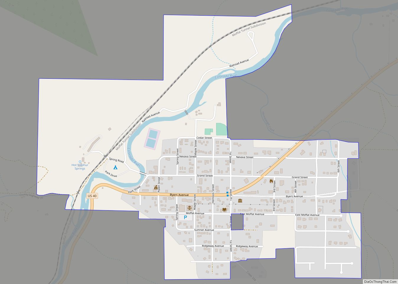
Hot Sulphur Springs is a statutory town and the county seat of Grand County, Colorado, United States. The town is located near Byers Canyon between Granby and Kremmling, 95 miles (153 km) northwest of Denver and 30 miles (48 km) northwest of Winter Park. The town population was 687 at the 2020 census. Its elevation is 7,680 feet (2,340 m).
| Name: | Hot Sulphur Springs town |
|---|---|
| LSAD Code: | 43 |
| LSAD Description: | town (suffix) |
| State: | Colorado |
| County: | Grand County |
| Elevation: | 7,680 ft (2,341 m) |
| Total Area: | 0.77 sq mi (1.99 km²) |
| Land Area: | 0.77 sq mi (1.99 km²) |
| Water Area: | 0.00 sq mi (0.00 km²) |
| Total Population: | 687 |
| Population Density: | 890/sq mi (350/km²) |
| ZIP code: | 80451 (PO Box) |
| Area code: | 970 |
| FIPS code: | 0837600 |
| GNISfeature ID: | 0173265 |
| Website: | www.hotsulphurspringsco.com |
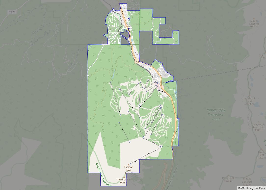
Online Interactive Map
Click on ![]() to view map in "full screen" mode.
to view map in "full screen" mode.
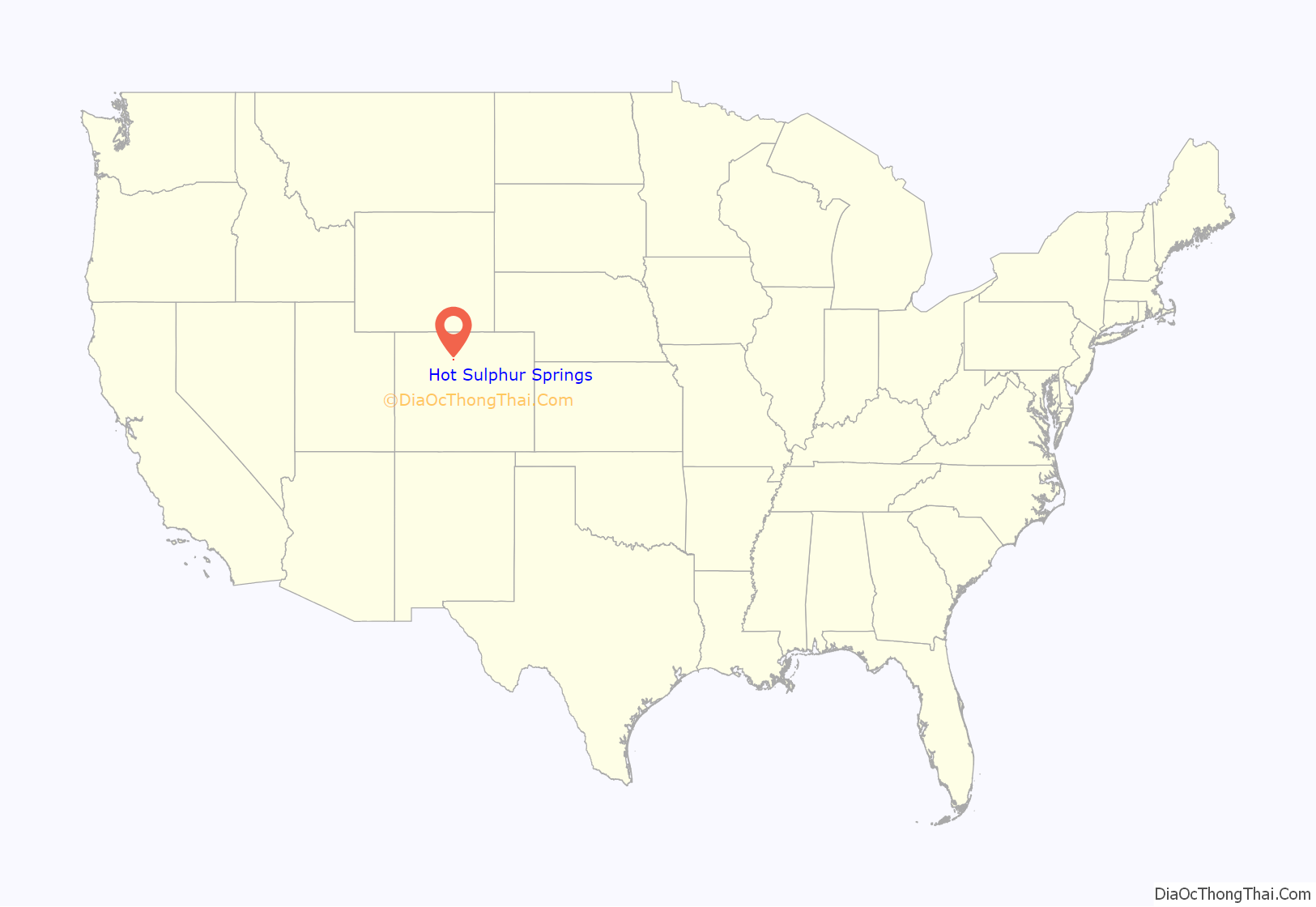
Hot Sulphur Springs location map. Where is Hot Sulphur Springs town?

History
Hot Sulphur Springs was originally a winter campground for Native Americans who came to use the hot springs for medicinal purposes. In 1840 William Newton Byers, founder of the Rocky Mountain News, was the first European American to document the springs. The town was established in 1860, making it the oldest town in the county, originally named “Saratoga West” and sometimes called “Warm Springs”.
In 1863 the town site was bought by Byers in a backroom deal with a Minnesota Sioux woman despite a treaty naming the Ute tribe as the lawful owners, who unsuccessfully sued Byers, while Byers and territorial governors William Gilpin and John Evans launched a “The Utes Must Go” campaign with the help of the U.S. Cavalry. Wishing to create a world-famous spa and resort (“the American Switzerland”), Byers changed the name and surveyed, platted, and named the streets, attracting famous visitors including Zane Grey and John Wesley Powell. The first pool house was built ca. 1900.
When Grand County was formed, Hot Sulphur Springs was the first county seat from 1874 to 1882, after which it moved to Grand Lake. The county seat returned in 1888 and has been there ever since.
Byers died on March 25, 1903. The town was incorporated on April 1, 1903. His original family cabin is located at 204 Byers Avenue along what is now Highway 40. The building is currently the county’s only mortuary.
The first winter carnival in Hot Sulphur Springs was held on December 31, 1911. The success of this event led to a three-day carnival which took place on February 10–12, 1912. The following winter, a second annual winter carnival was planned in conjunction with the first Steamboat Springs Winter Sports Carnival. This series of events led to the creation of Howelsen Hill Ski Area in Steamboat Springs, and is credited with playing a large role in the birth of the Colorado ski industry.
The big plans of Byers were prevented by the slow arrival of the railroad in 1928 (after the construction of the Moffat Tunnel), and eventually the railroad quit stopping there, although the town is still a resort attracting many visitors. The first lodging rooms opened in 1926.
In 1997 the resort was extensively renovated, and the Ute tribal spiritual leader blessed the waters at the opening ceremony, attended by almost 1,000, which welcomed the Utes to use the springs once again.
Payday was always the last day of the month and was considered a dangerous day because of the many gunfights that occurred. Because Halloween is October 31, the last day of the month, the people of the town celebrated Halloween on the 30th to keep children safe, which continues to the present day.
The Pioneer Village Museum is also located in Hot Sulphur Springs.
Hot Sulphur Springs Road Map

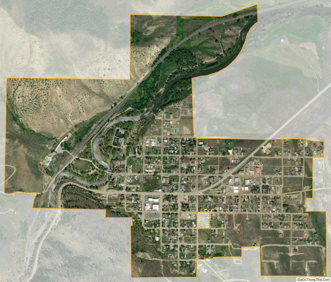
Hot Sulphur Springs city Satellite Map
Geography
Hot Sulphur Springs is located in central Grand County, along the Colorado River, just east (upstream) of where the river enters Byers Canyon. U.S. Route 40 passes through the center of town as Byers Avenue; it leads 10 miles (16 km) east to Granby, the largest town in the county, and 17 miles (27 km) west to Kremmling.
According to the United States Census Bureau, the town has a total area of 0.77 square miles (2.0 km), all of it land.
Climate
This climate type is dominated by the winter season, a long, bitterly cold period with short, clear days, relatively little precipitation mostly in the form of snow, and low humidity. According to the Köppen Climate Classification system, Hot Sulphur Springs has a subarctic climate, abbreviated “Dfc” on climate maps.
See also
Map of Colorado State and its subdivision:- Adams
- Alamosa
- Arapahoe
- Archuleta
- Baca
- Bent
- Boulder
- Broomfield
- Chaffee
- Cheyenne
- Clear Creek
- Conejos
- Costilla
- Crowley
- Custer
- Delta
- Denver
- Dolores
- Douglas
- Eagle
- El Paso
- Elbert
- Fremont
- Garfield
- Gilpin
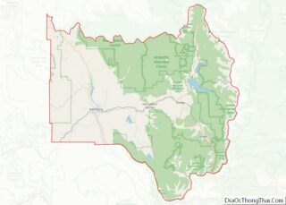
- Grand
- Gunnison
- Hinsdale
- Huerfano
- Jackson
- Jefferson
- Kiowa
- Kit Carson
- La Plata
- Lake
- Larimer
- Las Animas
- Lincoln
- Logan
- Mesa
- Mineral
- Moffat
- Montezuma
- Montrose
- Morgan
- Otero
- Ouray
- Park
- Phillips
- Pitkin
- Prowers
- Pueblo
- Rio Blanco
- Rio Grande
- Routt
- Saguache
- San Juan
- San Miguel
- Sedgwick
- Summit
- Teller
- Washington
- Weld
- Yuma
- Alabama
- Alaska
- Arizona
- Arkansas
- California
- Colorado
- Connecticut
- Delaware
- District of Columbia
- Florida
- Georgia
- Hawaii
- Idaho
- Illinois
- Indiana
- Iowa
- Kansas
- Kentucky
- Louisiana
- Maine
- Maryland
- Massachusetts
- Michigan
- Minnesota
- Mississippi
- Missouri
- Montana
- Nebraska
- Nevada
- New Hampshire
- New Jersey
- New Mexico
- New York
- North Carolina
- North Dakota
- Ohio
- Oklahoma
- Oregon
- Pennsylvania
- Rhode Island
- South Carolina
- South Dakota
- Tennessee
- Texas
- Utah
- Vermont
- Virginia
- Washington
- West Virginia
- Wisconsin
- Wyoming