The Town of Kersey is a Statutory Town in Weld County, Colorado, United States. The population was 1,495 at the 2020 United States Census.
| Name: | Kersey town |
|---|---|
| LSAD Code: | 43 |
| LSAD Description: | town (suffix) |
| State: | Colorado |
| County: | Weld County |
| Elevation: | 4,619 ft (1,408 m) |
| Total Area: | 2.03 sq mi (5.25 km²) |
| Land Area: | 2.02 sq mi (5.24 km²) |
| Water Area: | 0.01 sq mi (0.01 km²) |
| Total Population: | 1,495 |
| Population Density: | 740/sq mi (280/km²) |
| ZIP code: | 80644 |
| Area code: | 970 |
| FIPS code: | 0840515 |
| GNISfeature ID: | 0204695 |
| Website: | www.kerseygov.com |
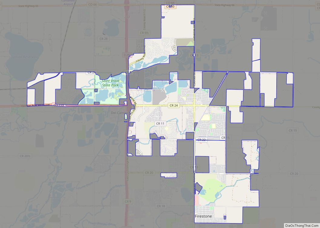
Online Interactive Map
Click on ![]() to view map in "full screen" mode.
to view map in "full screen" mode.
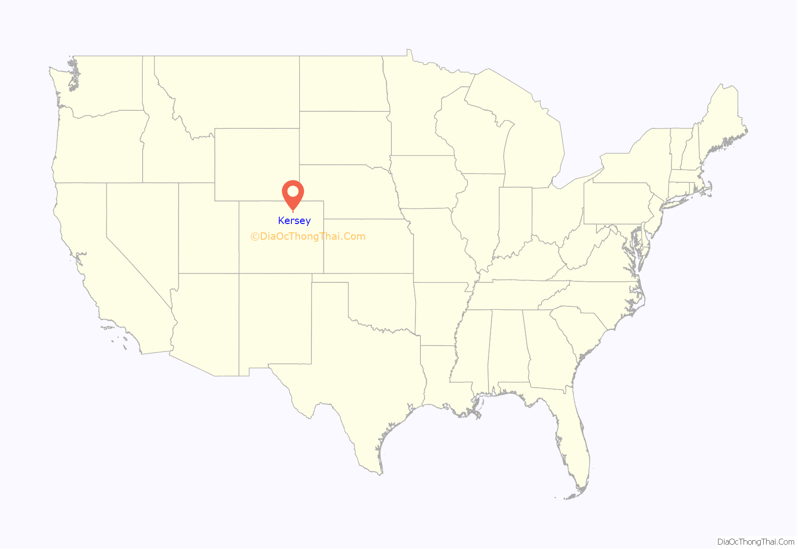
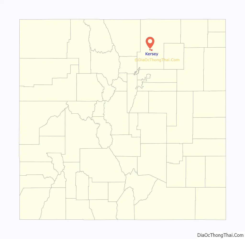
Kersey location map. Where is Kersey town?
History
Elbridge Gerry established a trading post called Fort Gerry on the South Platte River near the present-day town of Kersey, Colorado in the 1830s. He had two Native American wives who helped him run the post. In 1840, Gerry abandoned the site and built a post on the south bank of the river. Gerry is said to be the first white man to settle in what is now Weld County.
A post office called Kersey has been in operation since 1894. A railroad official gave Kersey the maiden name of his mother.
Kersey Road Map
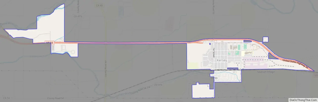
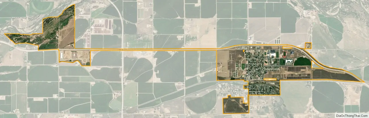
Kersey city Satellite Map
Geography
Kersey is located at 40°23′10″N 104°33′41″W / 40.38611°N 104.56139°W / 40.38611; -104.56139 (40.386060, -104.561453).
According to the United States Census Bureau, the town has a total area of 1.0 square mile (2.6 km), all of it land.
See also
Map of Colorado State and its subdivision:- Adams
- Alamosa
- Arapahoe
- Archuleta
- Baca
- Bent
- Boulder
- Broomfield
- Chaffee
- Cheyenne
- Clear Creek
- Conejos
- Costilla
- Crowley
- Custer
- Delta
- Denver
- Dolores
- Douglas
- Eagle
- El Paso
- Elbert
- Fremont
- Garfield
- Gilpin
- Grand
- Gunnison
- Hinsdale
- Huerfano
- Jackson
- Jefferson
- Kiowa
- Kit Carson
- La Plata
- Lake
- Larimer
- Las Animas
- Lincoln
- Logan
- Mesa
- Mineral
- Moffat
- Montezuma
- Montrose
- Morgan
- Otero
- Ouray
- Park
- Phillips
- Pitkin
- Prowers
- Pueblo
- Rio Blanco
- Rio Grande
- Routt
- Saguache
- San Juan
- San Miguel
- Sedgwick
- Summit
- Teller
- Washington
- Weld
- Yuma
- Alabama
- Alaska
- Arizona
- Arkansas
- California
- Colorado
- Connecticut
- Delaware
- District of Columbia
- Florida
- Georgia
- Hawaii
- Idaho
- Illinois
- Indiana
- Iowa
- Kansas
- Kentucky
- Louisiana
- Maine
- Maryland
- Massachusetts
- Michigan
- Minnesota
- Mississippi
- Missouri
- Montana
- Nebraska
- Nevada
- New Hampshire
- New Jersey
- New Mexico
- New York
- North Carolina
- North Dakota
- Ohio
- Oklahoma
- Oregon
- Pennsylvania
- Rhode Island
- South Carolina
- South Dakota
- Tennessee
- Texas
- Utah
- Vermont
- Virginia
- Washington
- West Virginia
- Wisconsin
- Wyoming