The Town of Mead is a Statutory Town in Weld County, Colorado, United States. The town population was 4,781 at the 2020 United States Census.
| Name: | Mead town |
|---|---|
| LSAD Code: | 43 |
| LSAD Description: | town (suffix) |
| State: | Colorado |
| County: | Weld County |
| Elevation: | 5,003 ft (1,525 m) |
| Total Area: | 12.73 sq mi (32.98 km²) |
| Land Area: | 12.64 sq mi (32.75 km²) |
| Water Area: | 0.09 sq mi (0.23 km²) |
| Total Population: | 4,781 |
| Population Density: | 380/sq mi (140/km²) |
| ZIP code: | 80542 |
| Area code: | 970 |
| FIPS code: | 0849600 |
| Website: | www.townofmead.org |
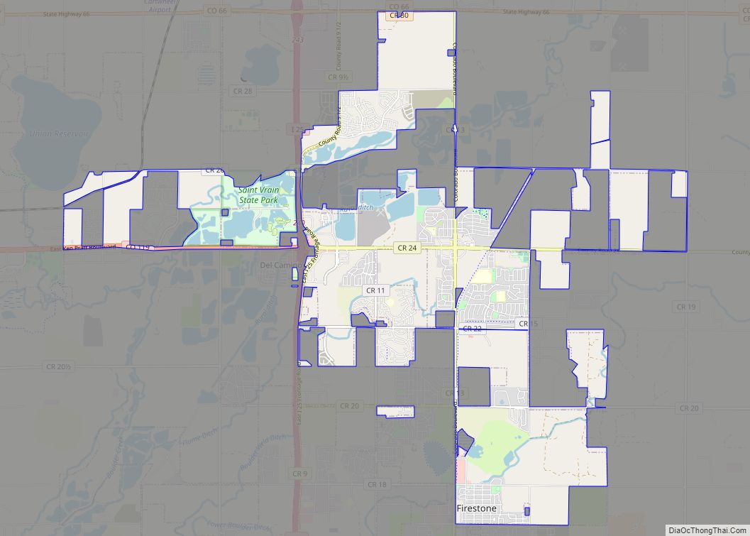
Online Interactive Map
Click on ![]() to view map in "full screen" mode.
to view map in "full screen" mode.
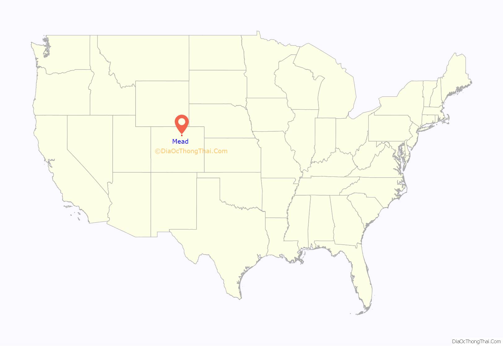
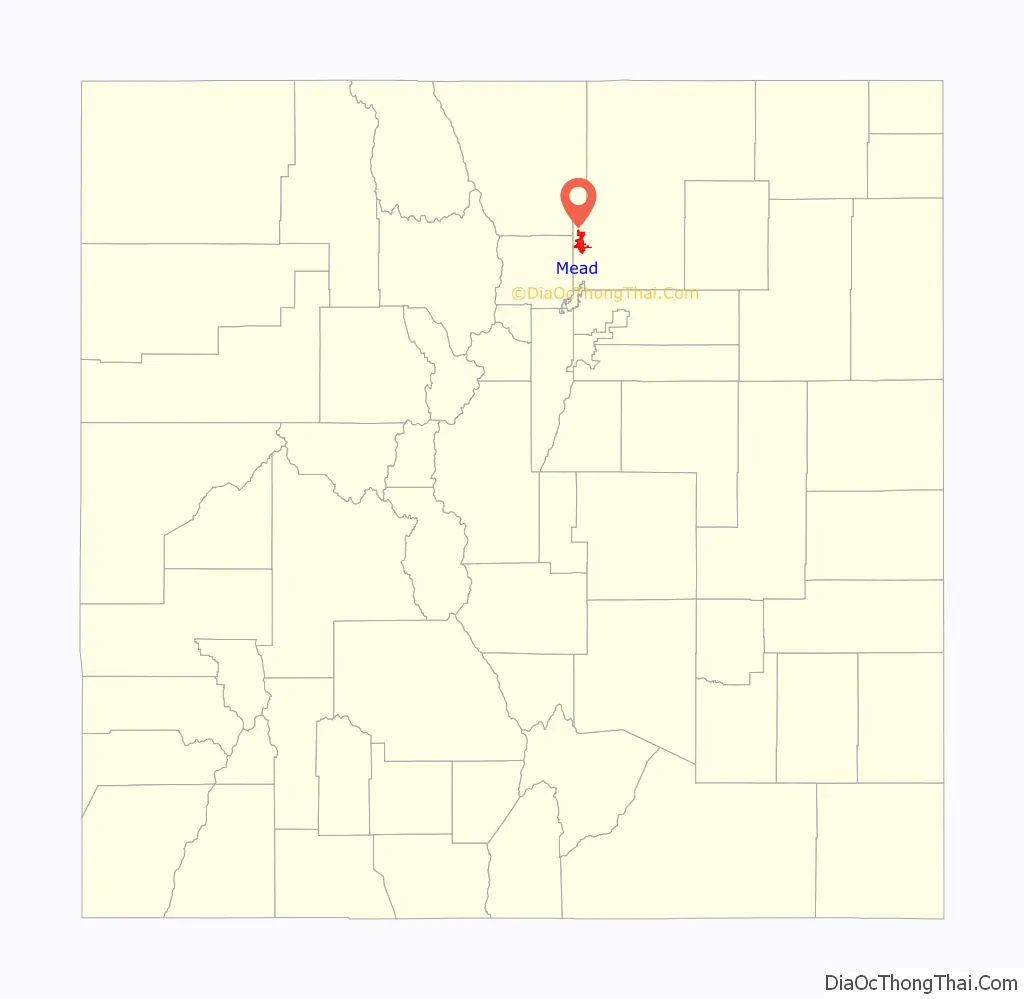
Mead location map. Where is Mead town?
History
A post office called Mead has been in operation since 1907. The town was named after Dr. Martin S. Mead, a pioneer settler.
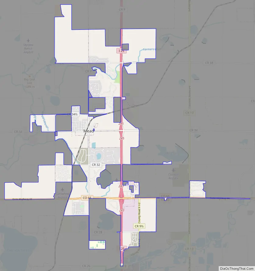
Mead Road Map
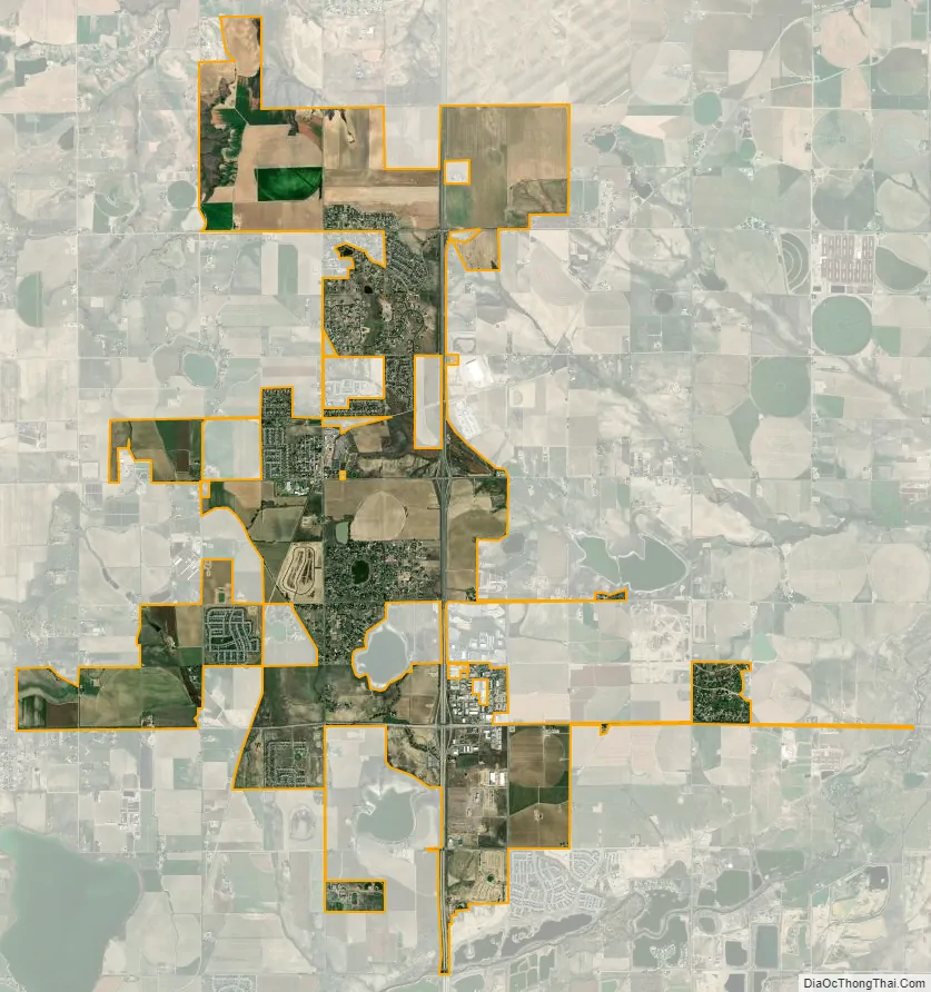
Mead city Satellite Map
Geography
Mead is located at 40°13′29″N 104°59′19″W / 40.22472°N 104.98861°W / 40.22472; -104.98861 (40.224781, -104.988573). It sits approximately 35 miles north of the State Capitol in Denver.
According to the United States Census Bureau, the town has a total area of 4.4 square miles (11 km), of which, 4.3 square miles (11 km) of it is land and 0.1 square miles (0.26 km) of it (2.71%) is water.
See also
Map of Colorado State and its subdivision:- Adams
- Alamosa
- Arapahoe
- Archuleta
- Baca
- Bent
- Boulder
- Broomfield
- Chaffee
- Cheyenne
- Clear Creek
- Conejos
- Costilla
- Crowley
- Custer
- Delta
- Denver
- Dolores
- Douglas
- Eagle
- El Paso
- Elbert
- Fremont
- Garfield
- Gilpin
- Grand
- Gunnison
- Hinsdale
- Huerfano
- Jackson
- Jefferson
- Kiowa
- Kit Carson
- La Plata
- Lake
- Larimer
- Las Animas
- Lincoln
- Logan
- Mesa
- Mineral
- Moffat
- Montezuma
- Montrose
- Morgan
- Otero
- Ouray
- Park
- Phillips
- Pitkin
- Prowers
- Pueblo
- Rio Blanco
- Rio Grande
- Routt
- Saguache
- San Juan
- San Miguel
- Sedgwick
- Summit
- Teller
- Washington
- Weld
- Yuma
- Alabama
- Alaska
- Arizona
- Arkansas
- California
- Colorado
- Connecticut
- Delaware
- District of Columbia
- Florida
- Georgia
- Hawaii
- Idaho
- Illinois
- Indiana
- Iowa
- Kansas
- Kentucky
- Louisiana
- Maine
- Maryland
- Massachusetts
- Michigan
- Minnesota
- Mississippi
- Missouri
- Montana
- Nebraska
- Nevada
- New Hampshire
- New Jersey
- New Mexico
- New York
- North Carolina
- North Dakota
- Ohio
- Oklahoma
- Oregon
- Pennsylvania
- Rhode Island
- South Carolina
- South Dakota
- Tennessee
- Texas
- Utah
- Vermont
- Virginia
- Washington
- West Virginia
- Wisconsin
- Wyoming