Milliken is a statutory town in Weld County, Colorado, United States. The town population was 8,386 at the 2020 United States Census.
| Name: | Milliken town |
|---|---|
| LSAD Code: | 43 |
| LSAD Description: | town (suffix) |
| State: | Colorado |
| County: | Weld County |
| Elevation: | 4,751 ft (1,448 m) |
| Total Area: | 12.90 sq mi (33.41 km²) |
| Land Area: | 12.81 sq mi (33.19 km²) |
| Water Area: | 0.09 sq mi (0.22 km²) |
| Total Population: | 8,386 |
| Population Density: | 650/sq mi (250/km²) |
| ZIP code: | 80543 |
| Area code: | 970 |
| FIPS code: | 0850480 |
| GNISfeature ID: | 0180708 |
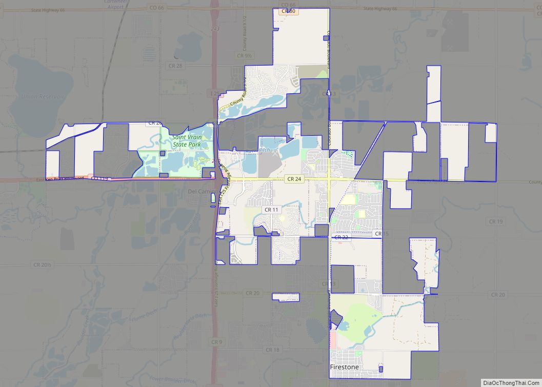
Online Interactive Map
Click on ![]() to view map in "full screen" mode.
to view map in "full screen" mode.
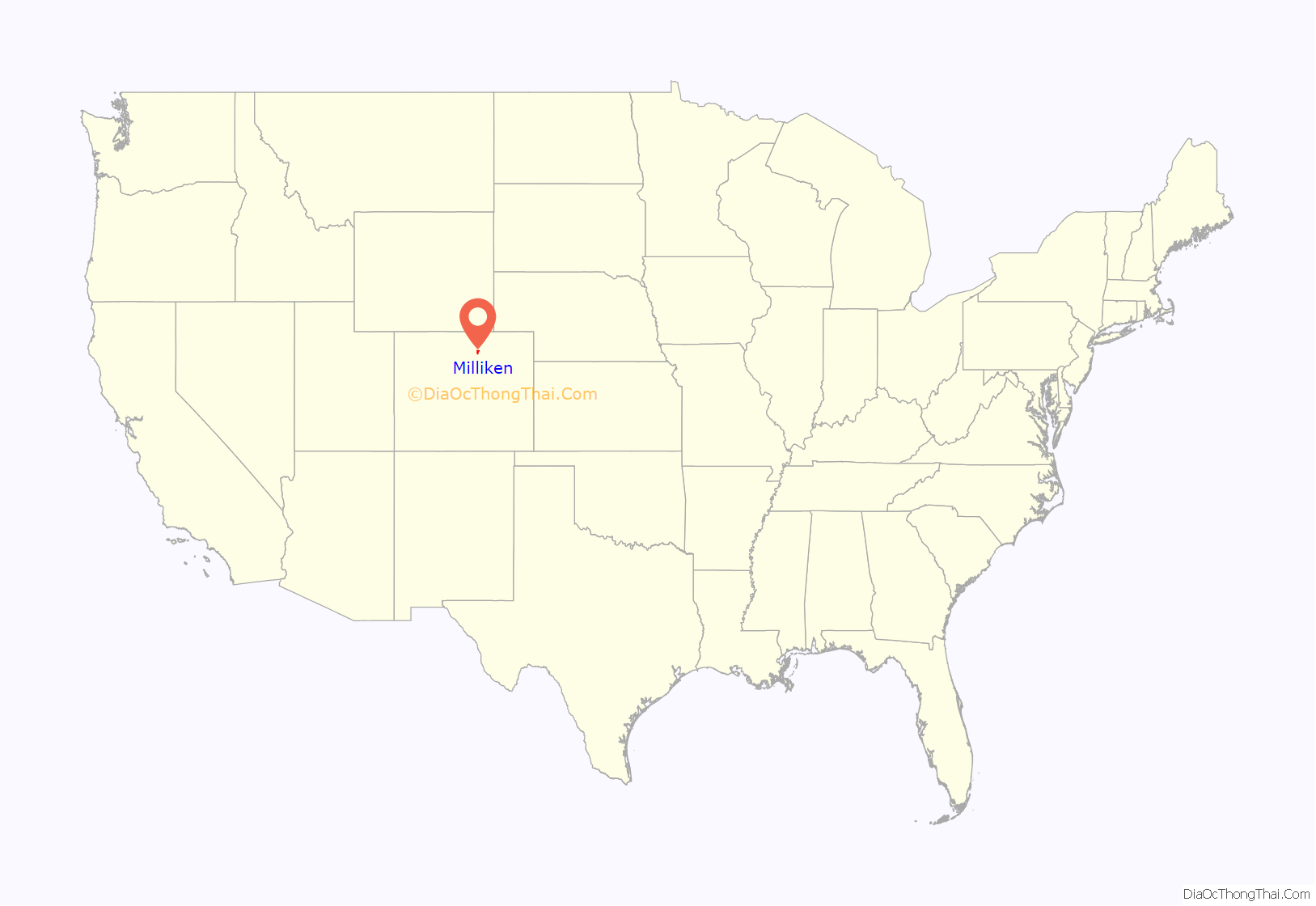
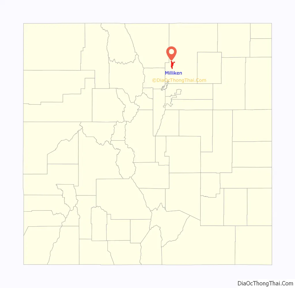
Milliken location map. Where is Milliken town?
History
The town was named for John D. Milliken, a Judge.
The first community located near the Milliken townsite was initially known as Hillsboro. The community began as a trading post on the Denver, Laramie, and Northwestern Railroad for agricultural goods in the 1860s. By 1908 the town of Milliken had grown up nearby Hillsboro, and in 1910 Hillsboro was annexed by Milliken.
Fires in the 1910s destroyed much of the town, and in 1917 the Denver, Laramie, and Northwestern Railroad was abandoned.
Milliken continued as a primarily farming community through the depression and world wars. In the 1950s two large potato decks were constructed. The late 1960s and early 1970s brought a housing boom.
In 1985 and 1986 the town roads were paved. The town continued to grow, causing the town government to move its facilities, in 1996, into the Milliken Community Complex. Additional facilities were added, including the Milliken Public Work Facility in 2004, and a new police station in 2009.
Milliken Road Map
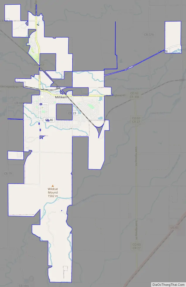
Milliken city Satellite Map
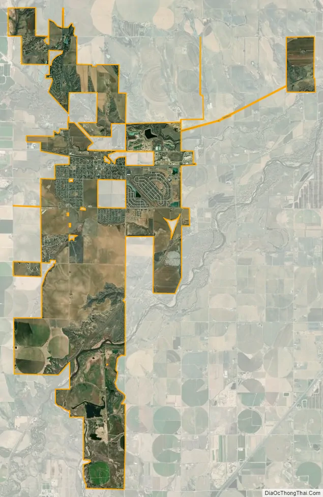
Geography
Milliken is located at 40°19′52″N 104°51′36″W / 40.33111°N 104.86000°W / 40.33111; -104.86000 (40.331073, -104.859878).
According to the United States Census Bureau, the town has a total area of 5.7 square miles (15 km), all of it land.
See also
Map of Colorado State and its subdivision:- Adams
- Alamosa
- Arapahoe
- Archuleta
- Baca
- Bent
- Boulder
- Broomfield
- Chaffee
- Cheyenne
- Clear Creek
- Conejos
- Costilla
- Crowley
- Custer
- Delta
- Denver
- Dolores
- Douglas
- Eagle
- El Paso
- Elbert
- Fremont
- Garfield
- Gilpin
- Grand
- Gunnison
- Hinsdale
- Huerfano
- Jackson
- Jefferson
- Kiowa
- Kit Carson
- La Plata
- Lake
- Larimer
- Las Animas
- Lincoln
- Logan
- Mesa
- Mineral
- Moffat
- Montezuma
- Montrose
- Morgan
- Otero
- Ouray
- Park
- Phillips
- Pitkin
- Prowers
- Pueblo
- Rio Blanco
- Rio Grande
- Routt
- Saguache
- San Juan
- San Miguel
- Sedgwick
- Summit
- Teller
- Washington
- Weld
- Yuma
- Alabama
- Alaska
- Arizona
- Arkansas
- California
- Colorado
- Connecticut
- Delaware
- District of Columbia
- Florida
- Georgia
- Hawaii
- Idaho
- Illinois
- Indiana
- Iowa
- Kansas
- Kentucky
- Louisiana
- Maine
- Maryland
- Massachusetts
- Michigan
- Minnesota
- Mississippi
- Missouri
- Montana
- Nebraska
- Nevada
- New Hampshire
- New Jersey
- New Mexico
- New York
- North Carolina
- North Dakota
- Ohio
- Oklahoma
- Oregon
- Pennsylvania
- Rhode Island
- South Carolina
- South Dakota
- Tennessee
- Texas
- Utah
- Vermont
- Virginia
- Washington
- West Virginia
- Wisconsin
- Wyoming