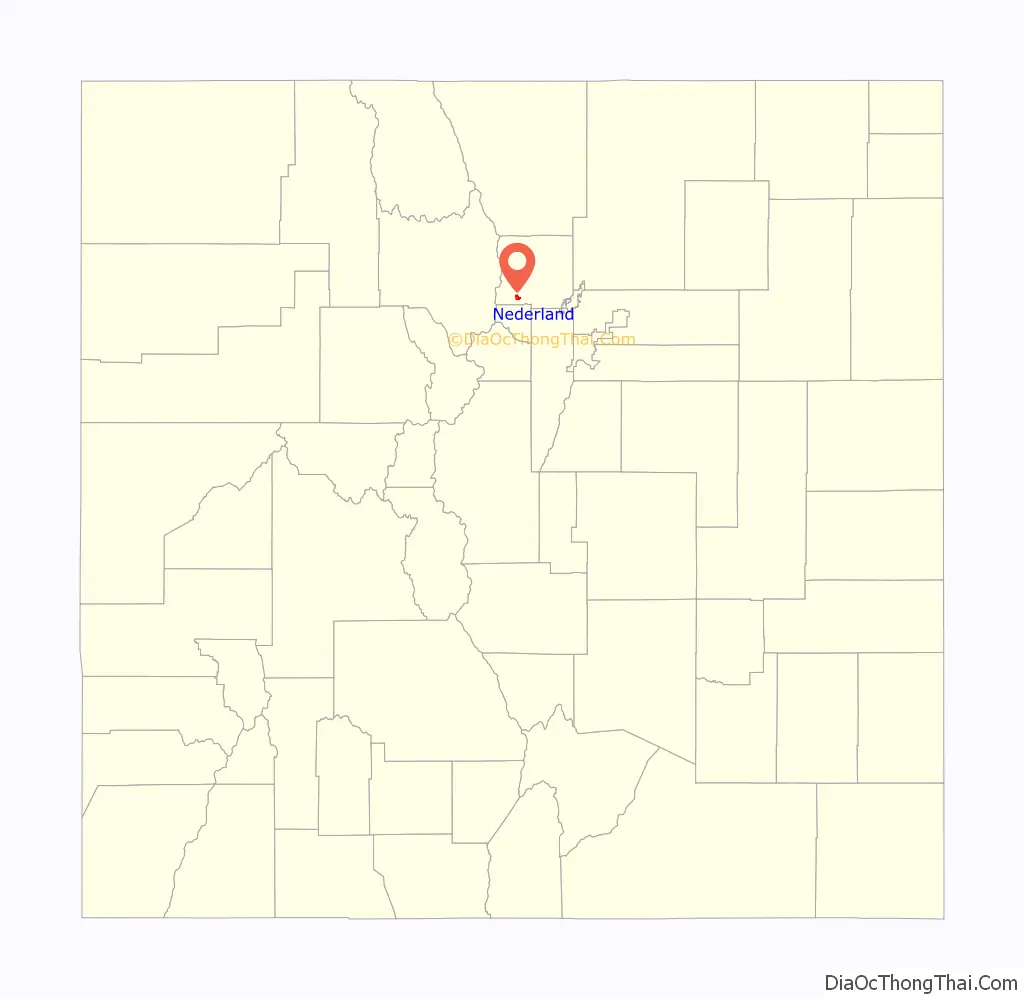
Nederland (/ˈnɛdərlənd/, NED-ər-lənd) is a statutory town located near Barker Meadow Reservoir in the foothills of southwest Boulder County, Colorado, United States. As of the 2010 United States Census it had a population of 1,445.
| Name: | Nederland town |
|---|---|
| LSAD Code: | 43 |
| LSAD Description: | town (suffix) |
| State: | Colorado |
| County: | Boulder County |
| Elevation: | 8,232 ft (2,509 m) |
| Total Area: | 1.55 sq mi (4.01 km²) |
| Land Area: | 1.48 sq mi (3.83 km²) |
| Water Area: | 0.07 sq mi (0.18 km²) |
| Total Population: | 1,471 |
| Population Density: | 1,035.81/sq mi (400.00/km²) |
| ZIP code: | 80466 |
| Area code: | 303 |
| FIPS code: | 0853175 |
| GNISfeature ID: | 0204702 |
| Website: | townofnederland.colorado.gov |
Online Interactive Map
Click on ![]() to view map in "full screen" mode.
to view map in "full screen" mode.
Nederland location map. Where is Nederland town?

History
Nederland was established in 1874. The town started as a trading post between Ute Indians and European settlers during the 1850s. The town’s first economic boom came when minerals such as tungsten, silver, and gold were discovered near Tungsten (east of Nederland), Caribou (northwest of Nederland, 1859), and Eldora (west of Nederland, 1875).
Today Nederland is better known as a gateway to outdoor recreation in the nearby Indian Peaks Wilderness, Rocky Mountain National Park, Roosevelt National Forest, and the recently established James Peak Wilderness. Nederland is located 17 miles (27 km) west of Boulder, 41 miles (66 km) south of Estes Park, and 47 miles (76 km) northwest of Denver at the Junction of SH 119 and SH 72 on the Peak to Peak Highway.
Name origin
In the mid-19th century the first homesteaders gave a variety of names for the area. The town was first called Dayton, then Browns Crossing. In 1871, when the US Postal Service first set up an office, the name was changed to Middle Boulder after the creek that flows through the center of town (and continues eastward to become Boulder Creek).
In 1873 the Caribou Mine, at an elevation of roughly 10,000 feet (3,000 m) and 6 miles (10 km) northwest of the town, was sold to the Mining Company Nederland from the Netherlands. The high elevation meant fierce winds and deep winter snow, so the new owners of the mine decided that it was beneficial to bring ore from Caribou down to Middle Boulder for milling. In the Dutch language, Nederland (“Netherlands” in English) means low land, and based on casual usage by the Dutch miners, Middle Boulder came to be known as Nederland. In 1874 the town was incorporated and adopted Nederland as the official name.
Nederland Road Map

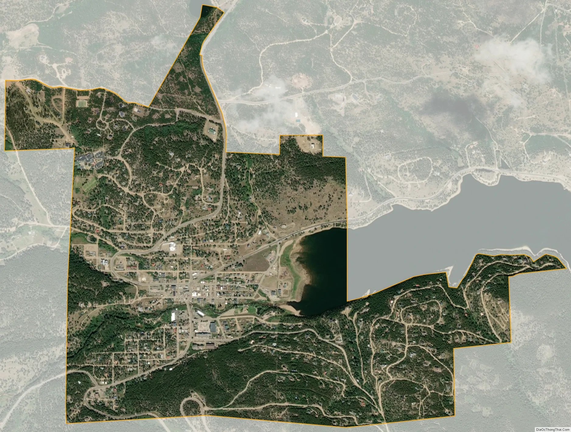
Nederland city Satellite Map
Geography
Nederland is located in southwest Boulder County at 39°57′43″N 105°30′38″W / 39.96194°N 105.51056°W / 39.96194; -105.51056 (39.961986, −105.510604).
The elevation in the center of town is 8,234 feet (2,510 m) above sea level. Due west from the town is the Indian Peaks Wilderness within Roosevelt National Forest. The Continental Divide passes through the Wilderness 8 miles (13 km) west of Nederland.
The town of Nederland has a total area of 1.6 square miles (4.1 km), of which 1.5 square miles (3.9 km) is land and 0.077 square miles (0.2 km), or 4.29%, is water, consisting primarily of the west end of Barker Reservoir on Middle Boulder Creek.
Climate
Nederland has an alpine subarctic climate (Dfc) due to its high altitude. Summer days are warm but nights are cool and frost is possible even in mid-summer. Snowfall is possible most of the year.
See also
Map of Colorado State and its subdivision:- Adams
- Alamosa
- Arapahoe
- Archuleta
- Baca
- Bent
- Boulder
- Broomfield
- Chaffee
- Cheyenne
- Clear Creek
- Conejos
- Costilla
- Crowley
- Custer
- Delta
- Denver
- Dolores
- Douglas
- Eagle
- El Paso
- Elbert
- Fremont
- Garfield
- Gilpin
- Grand
- Gunnison
- Hinsdale
- Huerfano
- Jackson
- Jefferson
- Kiowa
- Kit Carson
- La Plata
- Lake
- Larimer
- Las Animas
- Lincoln
- Logan
- Mesa
- Mineral
- Moffat
- Montezuma
- Montrose
- Morgan
- Otero
- Ouray
- Park
- Phillips
- Pitkin
- Prowers
- Pueblo
- Rio Blanco
- Rio Grande
- Routt
- Saguache
- San Juan
- San Miguel
- Sedgwick
- Summit
- Teller
- Washington
- Weld
- Yuma
- Alabama
- Alaska
- Arizona
- Arkansas
- California
- Colorado
- Connecticut
- Delaware
- District of Columbia
- Florida
- Georgia
- Hawaii
- Idaho
- Illinois
- Indiana
- Iowa
- Kansas
- Kentucky
- Louisiana
- Maine
- Maryland
- Massachusetts
- Michigan
- Minnesota
- Mississippi
- Missouri
- Montana
- Nebraska
- Nevada
- New Hampshire
- New Jersey
- New Mexico
- New York
- North Carolina
- North Dakota
- Ohio
- Oklahoma
- Oregon
- Pennsylvania
- Rhode Island
- South Carolina
- South Dakota
- Tennessee
- Texas
- Utah
- Vermont
- Virginia
- Washington
- West Virginia
- Wisconsin
- Wyoming


