Olathe is a statutory town in Montrose County, Colorado, United States. The population was 2,019 as of the 2020 census, up from 1,849 at the 2010 census. A post office called Olathe has been in operation since 1896. The community was named after Olathe, Kansas.
| Name: | Olathe town |
|---|---|
| LSAD Code: | 43 |
| LSAD Description: | town (suffix) |
| State: | Colorado |
| County: | Montrose County |
| Elevation: | 5,364 ft (1,634 m) |
| Total Area: | 1.50 sq mi (3.89 km²) |
| Land Area: | 1.50 sq mi (3.89 km²) |
| Water Area: | 0.00 sq mi (0.00 km²) |
| Total Population: | 2,019 |
| Population Density: | 1,300/sq mi (520/km²) |
| ZIP code: | 81425 |
| Area code: | 970 |
| FIPS code: | 0855540 |
| Website: | www.townofolathe.org |
Online Interactive Map
Click on ![]() to view map in "full screen" mode.
to view map in "full screen" mode.
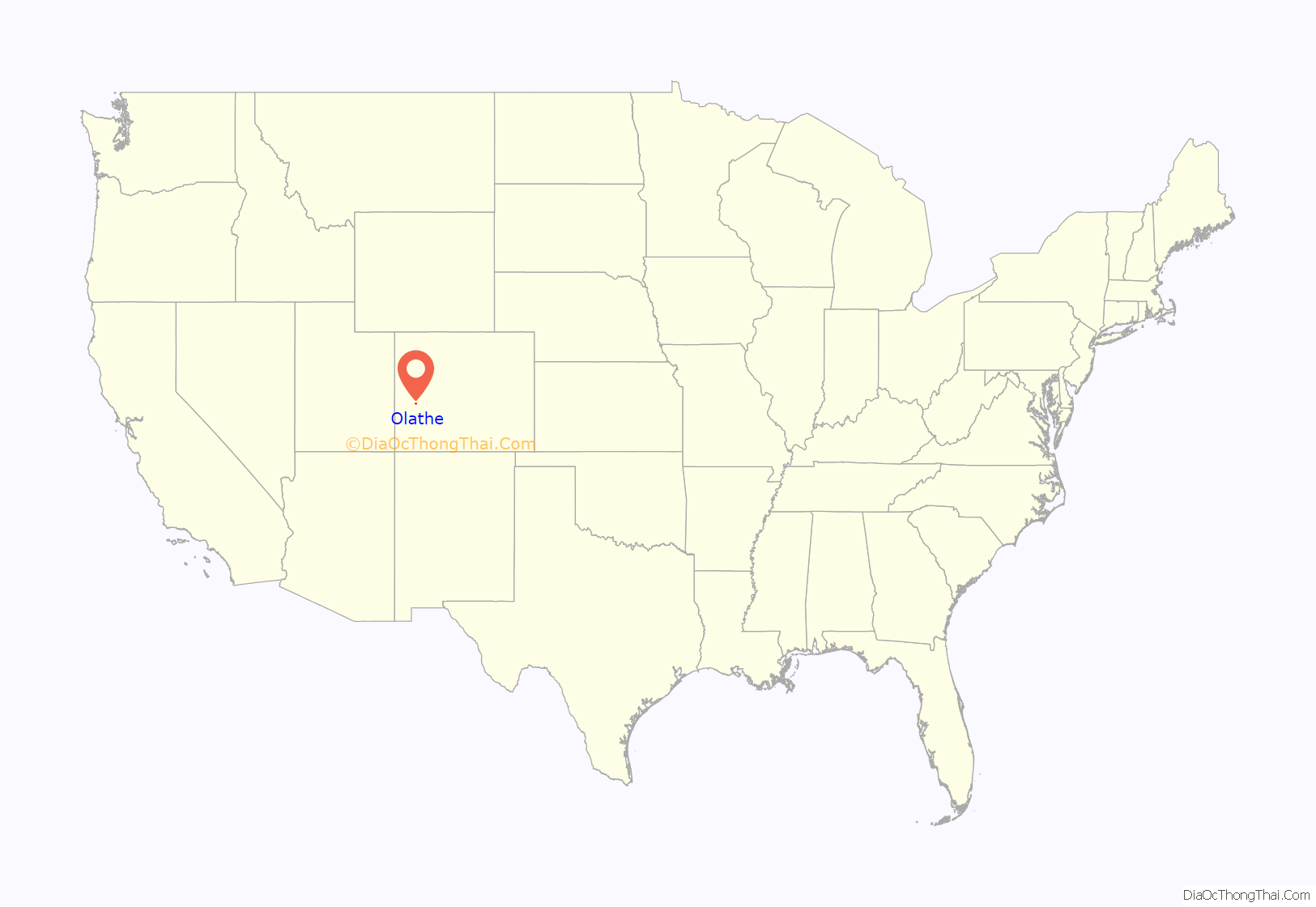
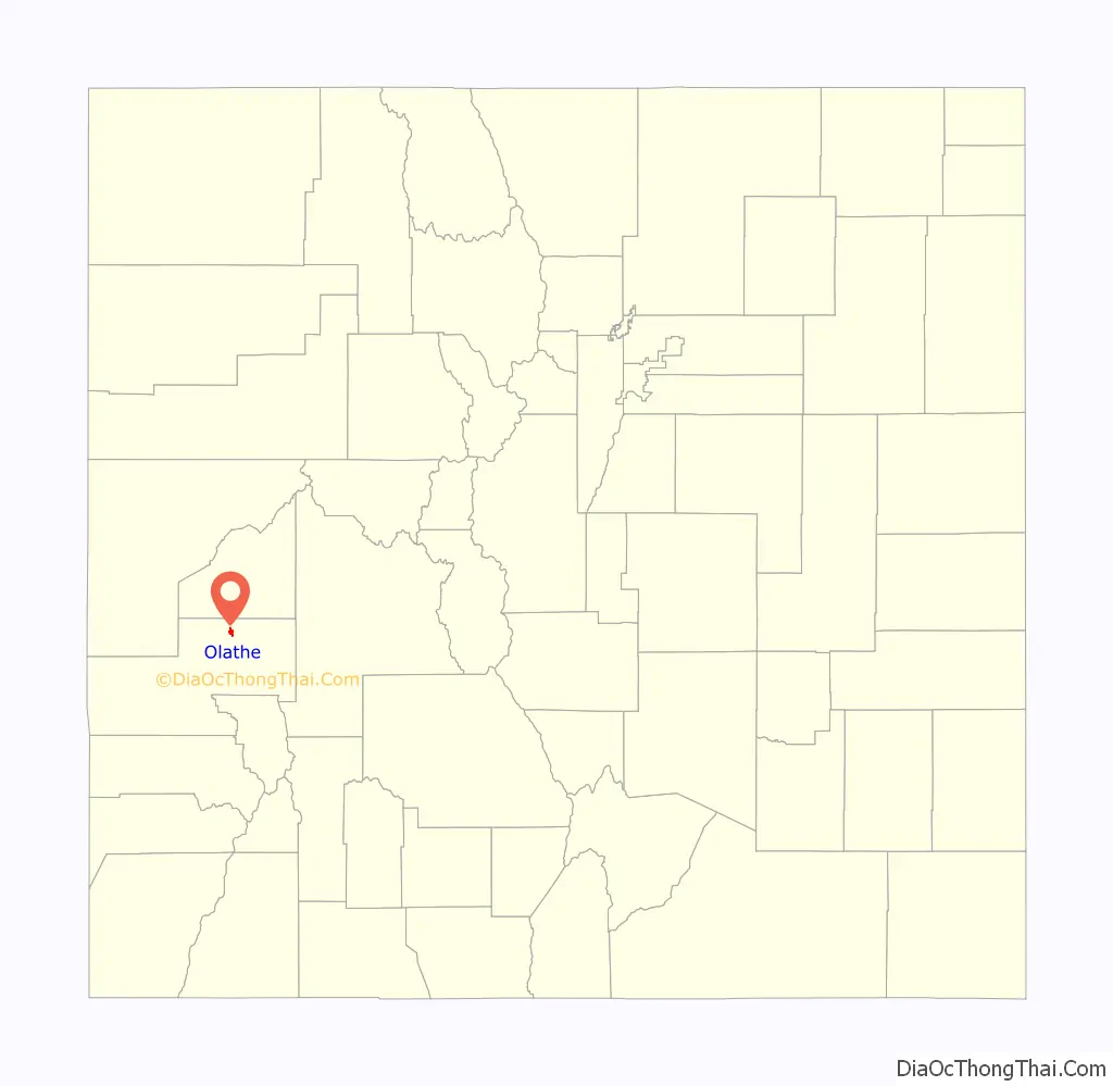
Olathe location map. Where is Olathe town?
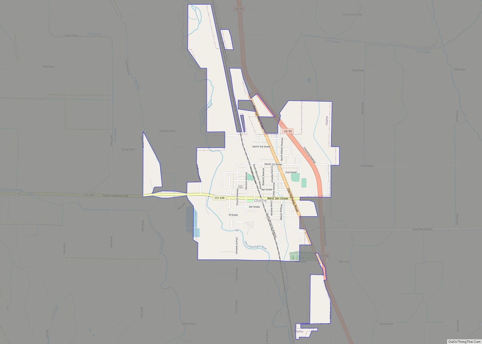
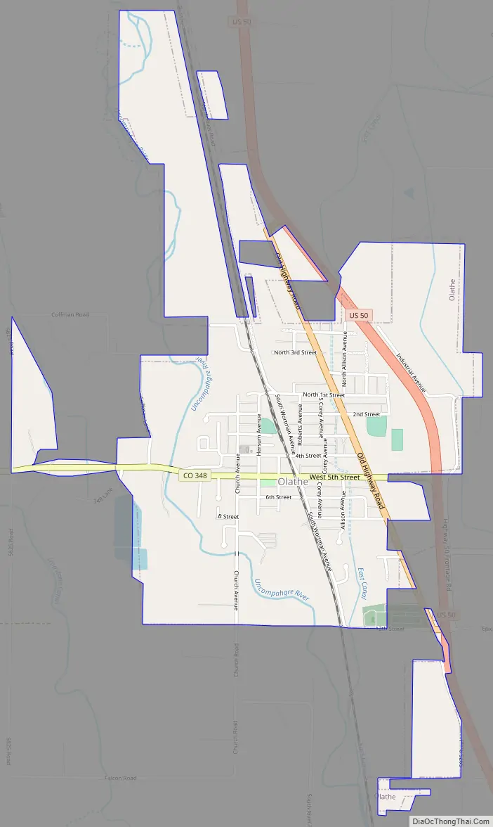
Olathe Road Map
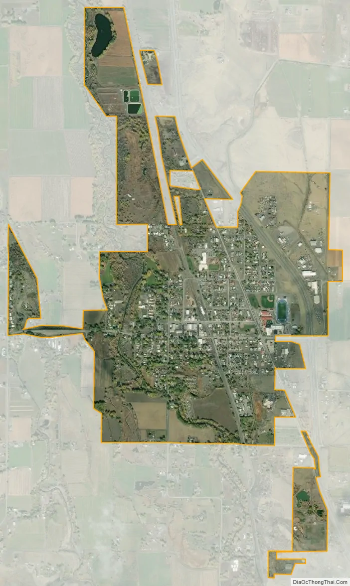
Olathe city Satellite Map
Geography
Olathe is located in northeastern Montrose County at 38°36′23″N 107°58′52″W / 38.606450°N 107.981054°W / 38.606450; -107.981054, in the valley of the Uncompahgre River. U.S. Route 50 passes through the east side of the town, leading southeast 10 miles (16 km) to Montrose, the county seat, and northwest 11 miles (18 km) to Delta.
According to the United States Census Bureau, the town has a total area of 1.5 square miles (3.9 km), all of it land. The Uncompahgre River passes along the western edge of the town, flowing northwest to the Gunnison River at Delta. Ash Mesa rises 100 feet (30 m) over the town to the west.
See also
Map of Colorado State and its subdivision:- Adams
- Alamosa
- Arapahoe
- Archuleta
- Baca
- Bent
- Boulder
- Broomfield
- Chaffee
- Cheyenne
- Clear Creek
- Conejos
- Costilla
- Crowley
- Custer
- Delta
- Denver
- Dolores
- Douglas
- Eagle
- El Paso
- Elbert
- Fremont
- Garfield
- Gilpin
- Grand
- Gunnison
- Hinsdale
- Huerfano
- Jackson
- Jefferson
- Kiowa
- Kit Carson
- La Plata
- Lake
- Larimer
- Las Animas
- Lincoln
- Logan
- Mesa
- Mineral
- Moffat
- Montezuma
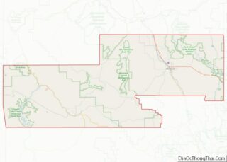
- Montrose
- Morgan
- Otero
- Ouray
- Park
- Phillips
- Pitkin
- Prowers
- Pueblo
- Rio Blanco
- Rio Grande
- Routt
- Saguache
- San Juan
- San Miguel
- Sedgwick
- Summit
- Teller
- Washington
- Weld
- Yuma
- Alabama
- Alaska
- Arizona
- Arkansas
- California
- Colorado
- Connecticut
- Delaware
- District of Columbia
- Florida
- Georgia
- Hawaii
- Idaho
- Illinois
- Indiana
- Iowa
- Kansas
- Kentucky
- Louisiana
- Maine
- Maryland
- Massachusetts
- Michigan
- Minnesota
- Mississippi
- Missouri
- Montana
- Nebraska
- Nevada
- New Hampshire
- New Jersey
- New Mexico
- New York
- North Carolina
- North Dakota
- Ohio
- Oklahoma
- Oregon
- Pennsylvania
- Rhode Island
- South Carolina
- South Dakota
- Tennessee
- Texas
- Utah
- Vermont
- Virginia
- Washington
- West Virginia
- Wisconsin
- Wyoming