Platteville is a Statutory Town in Weld County, Colorado, United States. The population was 2,955 at the 2020 census. It is adjacent to Fort Vasquez on U.S. Highway 85.
| Name: | Platteville town |
|---|---|
| LSAD Code: | 43 |
| LSAD Description: | town (suffix) |
| State: | Colorado |
| County: | Weld County |
| Founded: | 1871 |
| Elevation: | 4,813 ft (1,467 m) |
| Total Area: | 3.08 sq mi (7.99 km²) |
| Land Area: | 3.07 sq mi (7.96 km²) |
| Water Area: | 0.01 sq mi (0.03 km²) |
| Total Population: | 2,955 |
| Population Density: | 960/sq mi (370/km²) |
| ZIP code: | 80651 |
| Area code: | 970 |
| FIPS code: | 0860160 |
| GNISfeature ID: | 0180790 |
| Website: | plattevillegov.org |
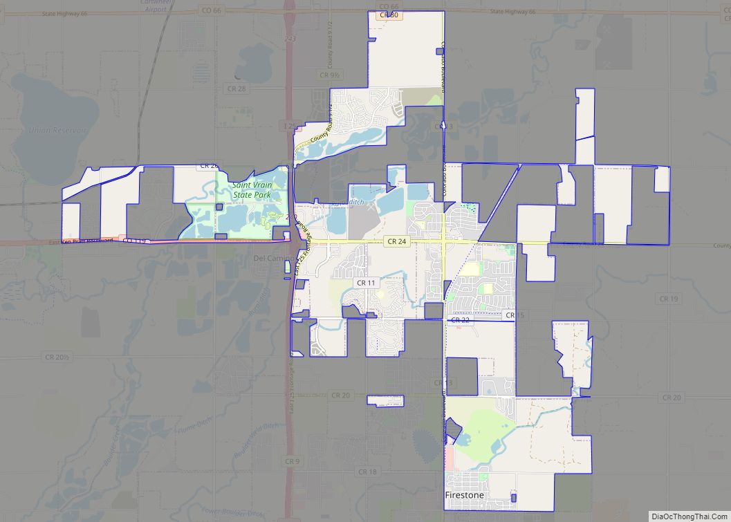
Online Interactive Map
Click on ![]() to view map in "full screen" mode.
to view map in "full screen" mode.
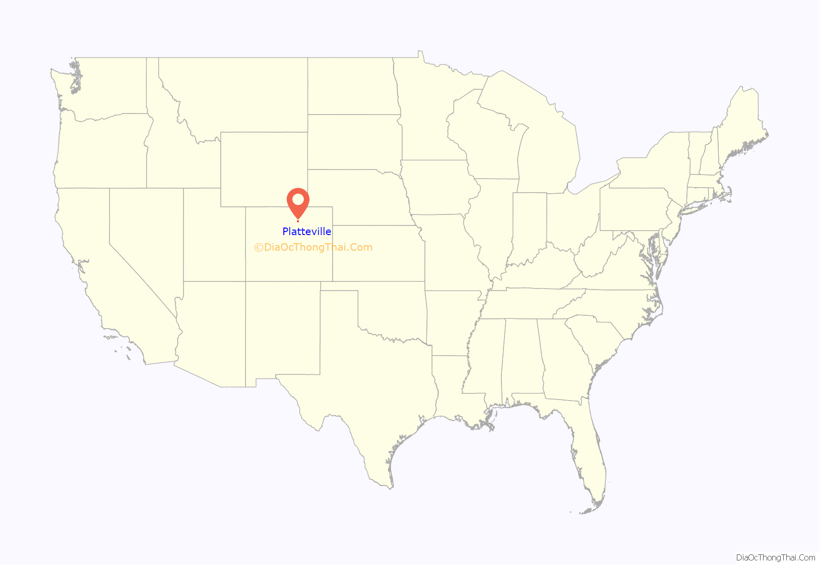
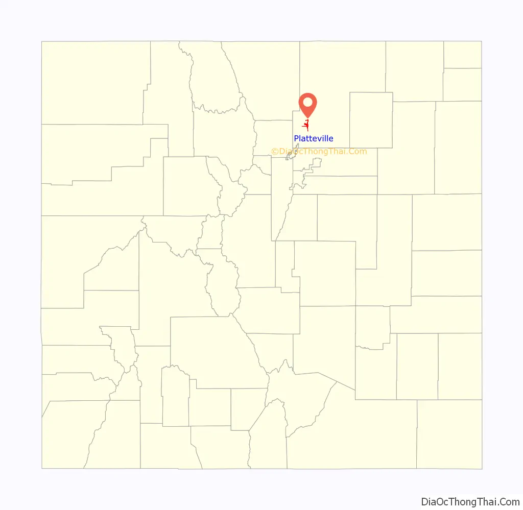
Platteville location map. Where is Platteville town?
History
Platteville was founded on May 27, 1871, and was incorporated on January 1, 1887. The town was named for its location on the Platte River.
Platteville Road Map
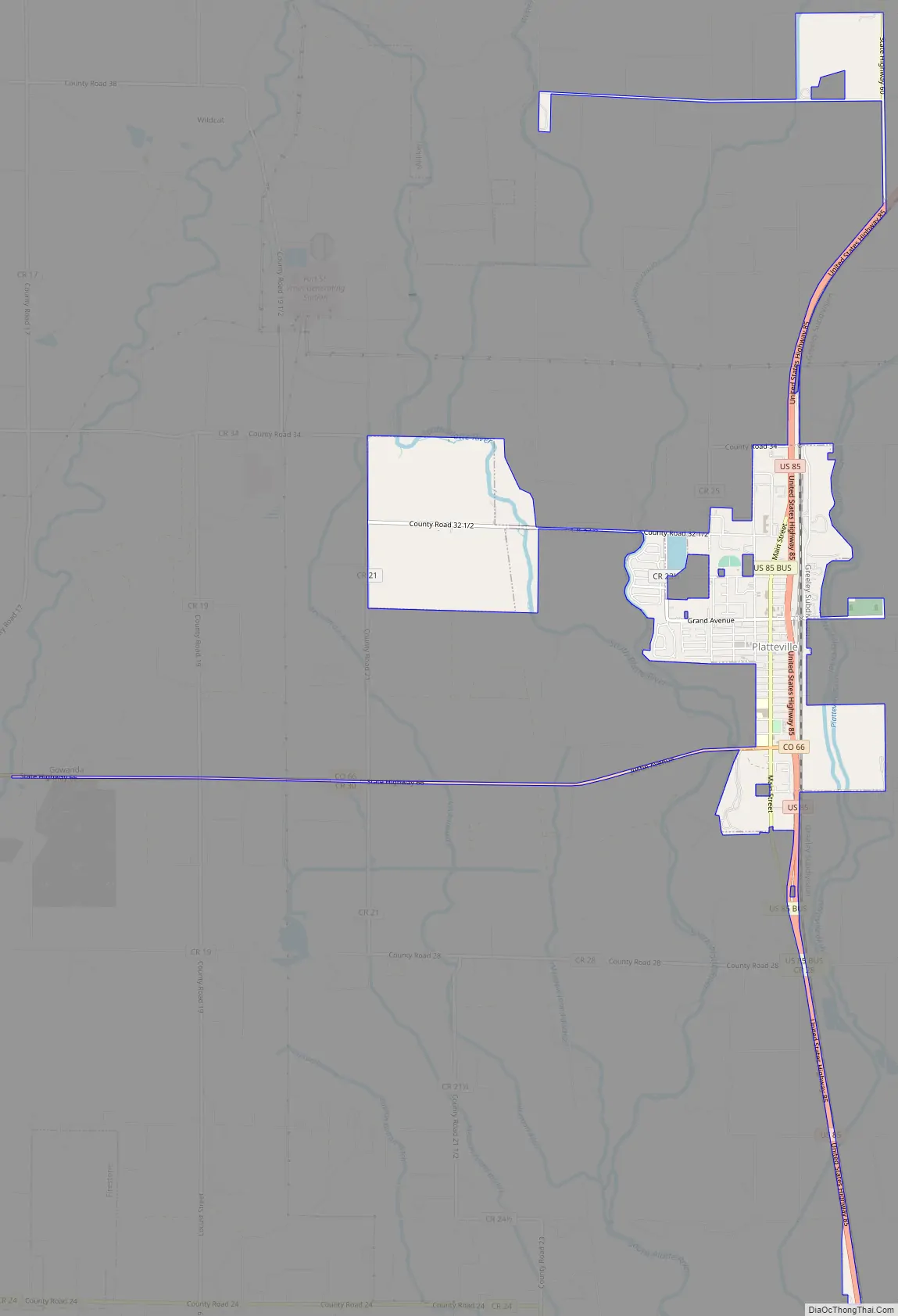
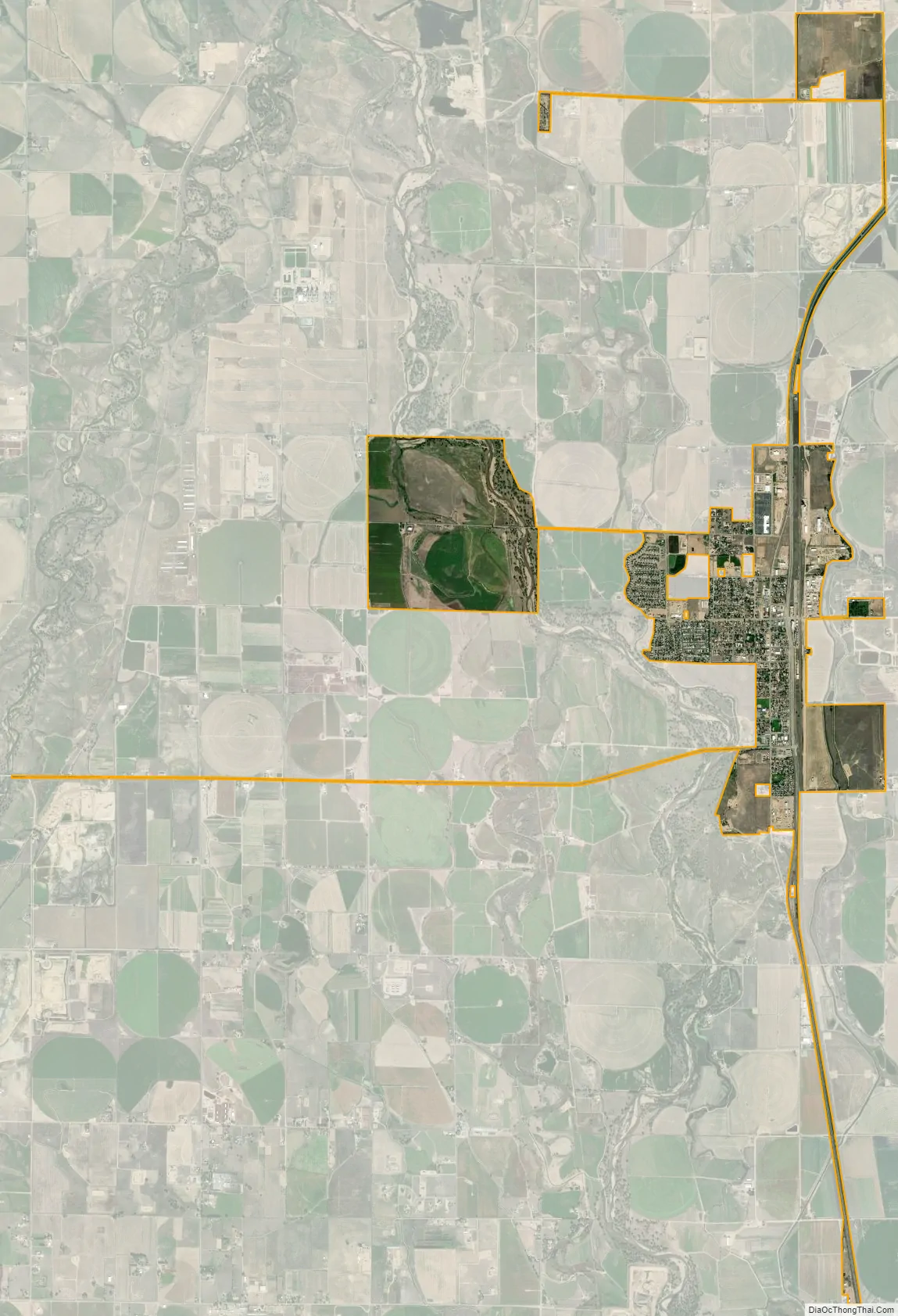
Platteville city Satellite Map
Geography
Platteville is located at 40°12′52″N 104°49′27″W / 40.21444°N 104.82417°W / 40.21444; -104.82417 (40.214468, -104.824070).
The town is situated along the east bank of the South Platte River at the intersection of U.S. Highway 85 and State Highway 66.
The Fort St. Vrain Generating Station, originally a nuclear power plant and now operating as a natural gas powered electricity generating facility operated by Xcel Energy, is approximately one-quarter-mile northwest of Platteville.
According to the United States Census Bureau, Platteville has a total area of 2.527 square miles (6.54 km), all of it land.
See also
Map of Colorado State and its subdivision:- Adams
- Alamosa
- Arapahoe
- Archuleta
- Baca
- Bent
- Boulder
- Broomfield
- Chaffee
- Cheyenne
- Clear Creek
- Conejos
- Costilla
- Crowley
- Custer
- Delta
- Denver
- Dolores
- Douglas
- Eagle
- El Paso
- Elbert
- Fremont
- Garfield
- Gilpin
- Grand
- Gunnison
- Hinsdale
- Huerfano
- Jackson
- Jefferson
- Kiowa
- Kit Carson
- La Plata
- Lake
- Larimer
- Las Animas
- Lincoln
- Logan
- Mesa
- Mineral
- Moffat
- Montezuma
- Montrose
- Morgan
- Otero
- Ouray
- Park
- Phillips
- Pitkin
- Prowers
- Pueblo
- Rio Blanco
- Rio Grande
- Routt
- Saguache
- San Juan
- San Miguel
- Sedgwick
- Summit
- Teller
- Washington
- Weld
- Yuma
- Alabama
- Alaska
- Arizona
- Arkansas
- California
- Colorado
- Connecticut
- Delaware
- District of Columbia
- Florida
- Georgia
- Hawaii
- Idaho
- Illinois
- Indiana
- Iowa
- Kansas
- Kentucky
- Louisiana
- Maine
- Maryland
- Massachusetts
- Michigan
- Minnesota
- Mississippi
- Missouri
- Montana
- Nebraska
- Nevada
- New Hampshire
- New Jersey
- New Mexico
- New York
- North Carolina
- North Dakota
- Ohio
- Oklahoma
- Oregon
- Pennsylvania
- Rhode Island
- South Carolina
- South Dakota
- Tennessee
- Texas
- Utah
- Vermont
- Virginia
- Washington
- West Virginia
- Wisconsin
- Wyoming