The Town of Raymer is a Statutory Town located in Weld County, Colorado, United States. The population was 110 at the U.S. Census 2020.
The community has two official names:
- Raymer – The legal name of the incorporated Town of Raymer.
- New Raymer – The official United States Postal Service designation.
Raymer hosts a Minuteman Missile launch site from Warren Air Force Base.
| Name: | Raymer (New Raymer) town |
|---|---|
| LSAD Code: | 43 |
| LSAD Description: | town (suffix) |
| State: | Colorado |
| County: | Weld County |
| Incorporated: | 1919 |
| Elevation: | 4,777 ft (1,456 m) |
| Total Area: | 0.78 sq mi (2.03 km²) |
| Land Area: | 0.78 sq mi (2.03 km²) |
| Water Area: | 0.00 sq mi (0.00 km²) 0.0% |
| Total Population: | 110 |
| Population Density: | 140/sq mi (54/km²) |
| ZIP code: | New Raymer 80742 |
| Area code: | 970 |
| FIPS code: | 0863045 |
| GNISfeature ID: | 0182778 |
Online Interactive Map
Click on ![]() to view map in "full screen" mode.
to view map in "full screen" mode.
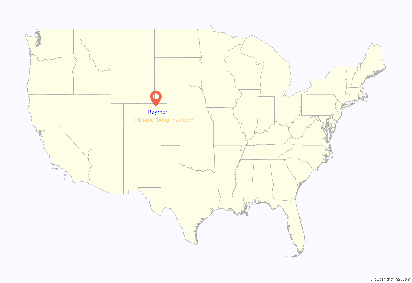
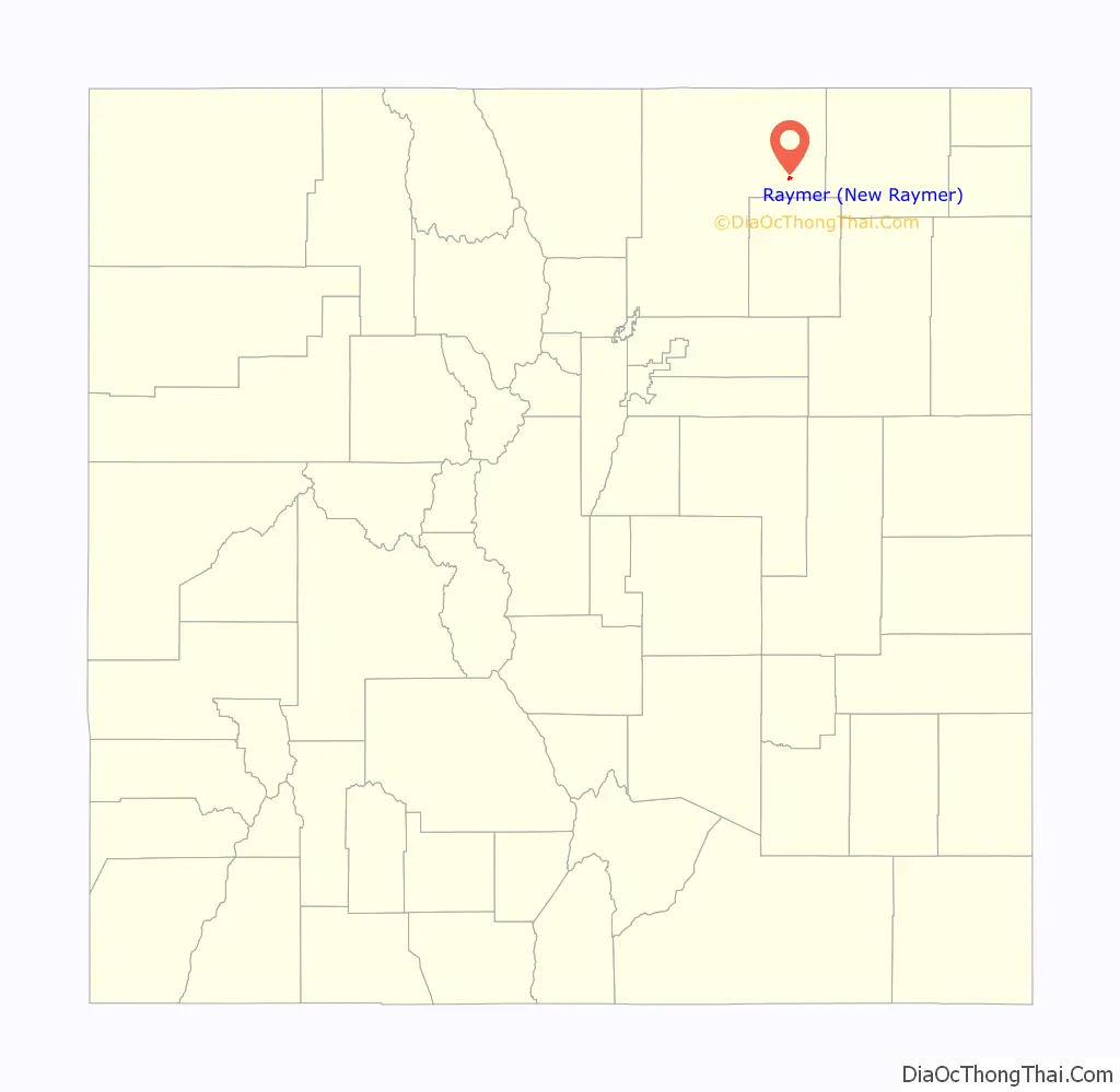
Raymer location map. Where is Raymer (New Raymer) town?
History
The Chicago, Burlington and Quincy Railroad platted the Raymer townsite in Weld County in 1888. The town was named for George Raymer, an assistant chief engineer for the railroad. The Raymer Post Office opened on June 27, 1888. The town flourished for a while, but families eventually moved away and the Post Office closed on May 14, 1895.
The town was given a second life when it was replatted in 1909. On November 13, 1909, the United States Post Office Department open a new post office named New Raymer to distinguish it from the old Raymer post office. The town was incorporated in 1919 under its original name as the Town of Raymer.
The State of Colorado uses the name Raymer for the town, but the United States Postal Service uses the name New Raymer (ZIP code 80742) and refuses to accept the name Raymer for postal delivery. Either name may appear on maps or in gazetteers.
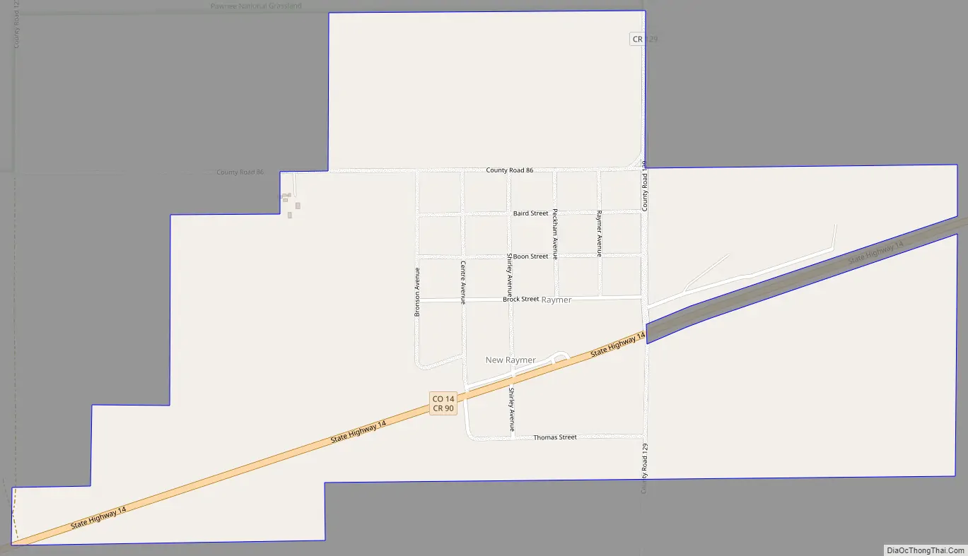
Raymer Road Map
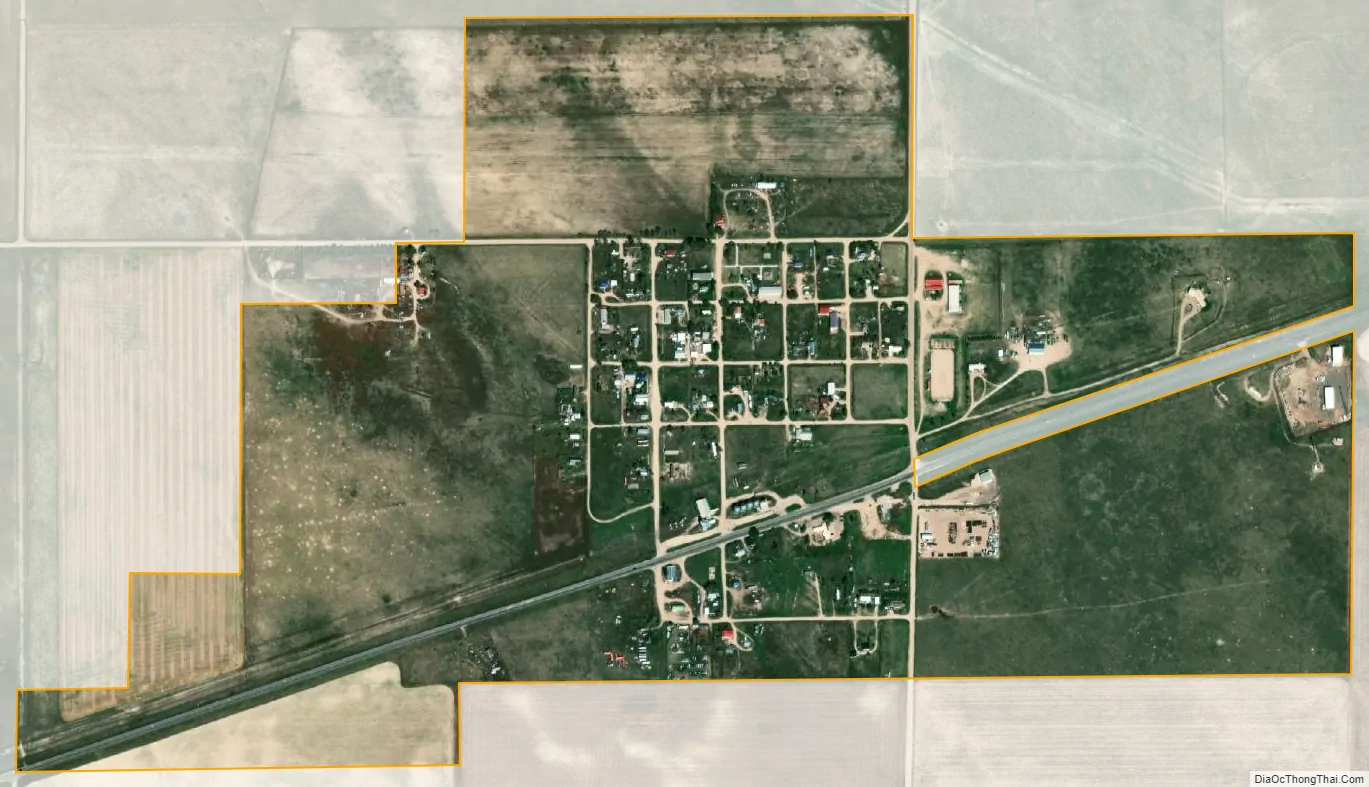
Raymer city Satellite Map
Geography
Raymer (New Raymer) is located at 40°36′31″N 103°50′35″W / 40.60861°N 103.84306°W / 40.60861; -103.84306 (40.608649, -103.842963).
According to the United States Census Bureau, the town has a total area of 0.7 square miles (1.8 km), all of it land.
See also
Map of Colorado State and its subdivision:- Adams
- Alamosa
- Arapahoe
- Archuleta
- Baca
- Bent
- Boulder
- Broomfield
- Chaffee
- Cheyenne
- Clear Creek
- Conejos
- Costilla
- Crowley
- Custer
- Delta
- Denver
- Dolores
- Douglas
- Eagle
- El Paso
- Elbert
- Fremont
- Garfield
- Gilpin
- Grand
- Gunnison
- Hinsdale
- Huerfano
- Jackson
- Jefferson
- Kiowa
- Kit Carson
- La Plata
- Lake
- Larimer
- Las Animas
- Lincoln
- Logan
- Mesa
- Mineral
- Moffat
- Montezuma
- Montrose
- Morgan
- Otero
- Ouray
- Park
- Phillips
- Pitkin
- Prowers
- Pueblo
- Rio Blanco
- Rio Grande
- Routt
- Saguache
- San Juan
- San Miguel
- Sedgwick
- Summit
- Teller
- Washington
- Weld
- Yuma
- Alabama
- Alaska
- Arizona
- Arkansas
- California
- Colorado
- Connecticut
- Delaware
- District of Columbia
- Florida
- Georgia
- Hawaii
- Idaho
- Illinois
- Indiana
- Iowa
- Kansas
- Kentucky
- Louisiana
- Maine
- Maryland
- Massachusetts
- Michigan
- Minnesota
- Mississippi
- Missouri
- Montana
- Nebraska
- Nevada
- New Hampshire
- New Jersey
- New Mexico
- New York
- North Carolina
- North Dakota
- Ohio
- Oklahoma
- Oregon
- Pennsylvania
- Rhode Island
- South Carolina
- South Dakota
- Tennessee
- Texas
- Utah
- Vermont
- Virginia
- Washington
- West Virginia
- Wisconsin
- Wyoming