Simla is a statutory town in Elbert County, Colorado, United States. It is 48 miles (77 km) northeast of Colorado Springs. The population was 601 at the time of the 2020 United States Census.
| Name: | Simla town |
|---|---|
| LSAD Code: | 43 |
| LSAD Description: | town (suffix) |
| State: | Colorado |
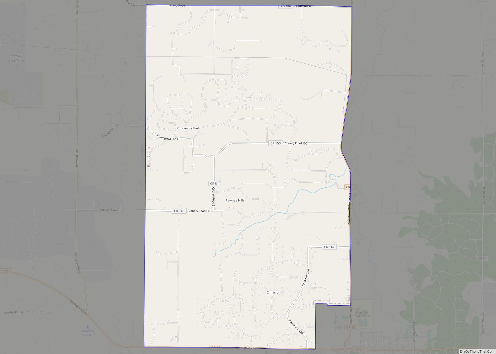
| County: | Elbert County |
| Incorporated: | January 15, 1912 |
| Elevation: | 5,978 ft (1,822 m) |
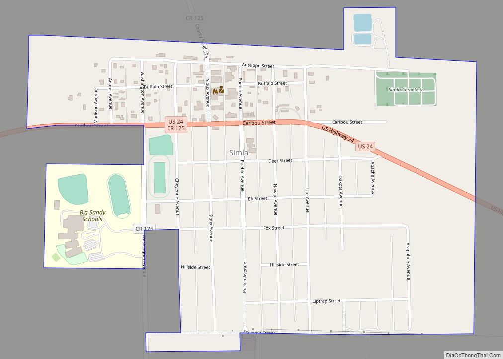
| Total Area: | 0.62 sq mi (1.60 km²) |
| Land Area: | 0.62 sq mi (1.60 km²) |
| Water Area: | 0.00 sq mi (0.00 km²) |
| Total Population: | 601 |
| Population Density: | 972.9/sq mi (375.63/km²) |
| ZIP code: | 80835 |
| Area code: | 719 |
| FIPS code: | 0870635 |
| GNISfeature ID: | 0193219 |
| Website: | townofsimla.com |
Online Interactive Map
Click on ![]() to view map in "full screen" mode.
to view map in "full screen" mode.
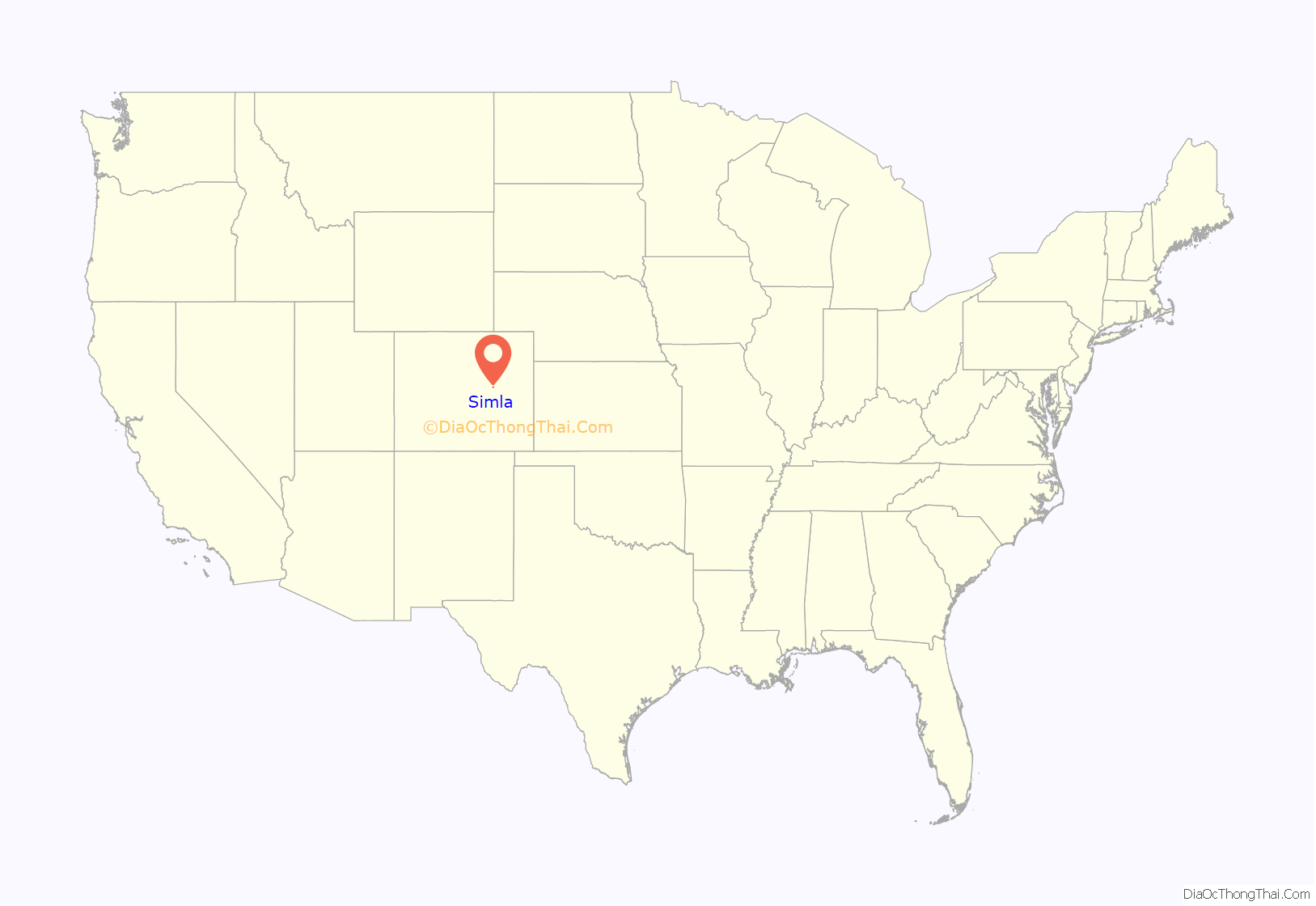
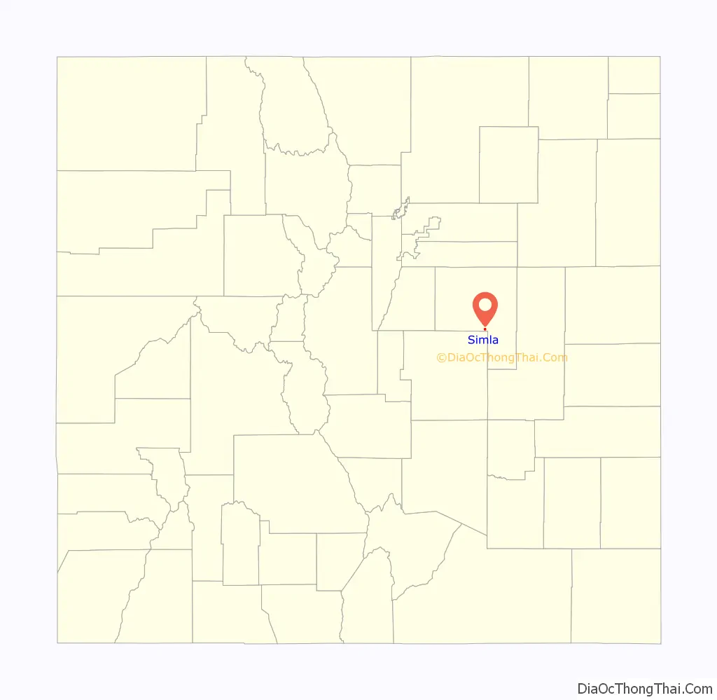
Simla location map. Where is Simla town?
History
Simla was founded in 1909 by a man with the name of Altman. Simla was named because the daughter of a railroad official was reading a book about India when she came across the name, Simla. Settled in the 1880s, Simla was incorporated in 1912. The first newspaper was started in 1911. It was a center for the shipping of the area’s potato harvest each year.
Simla received national attention when it became the place where the first so-called “English Variant” of SARS-COV-2 (Covid-19 virus) was diagnosed in the United States.
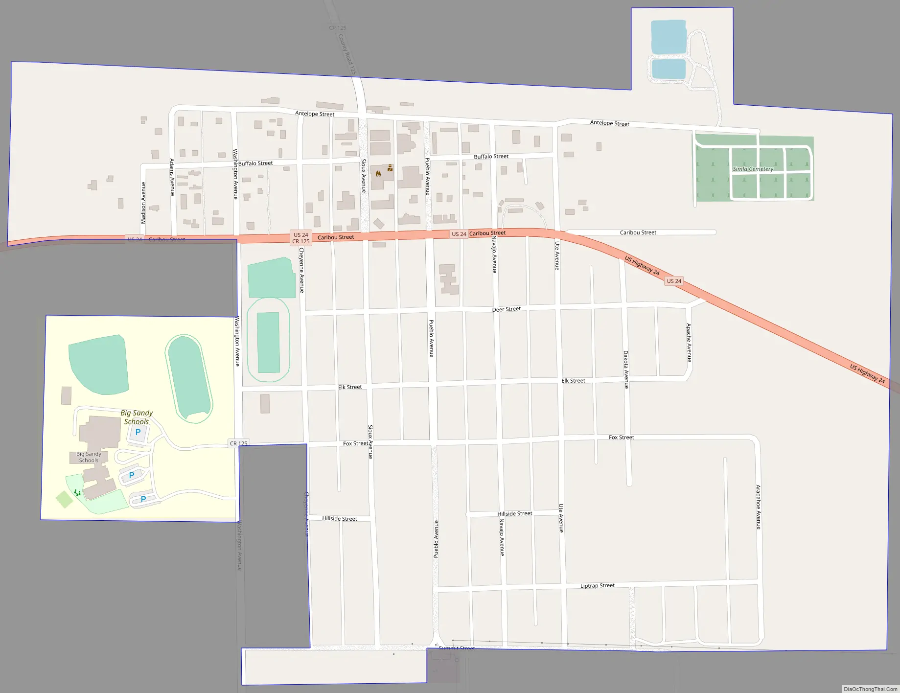
Simla Road Map
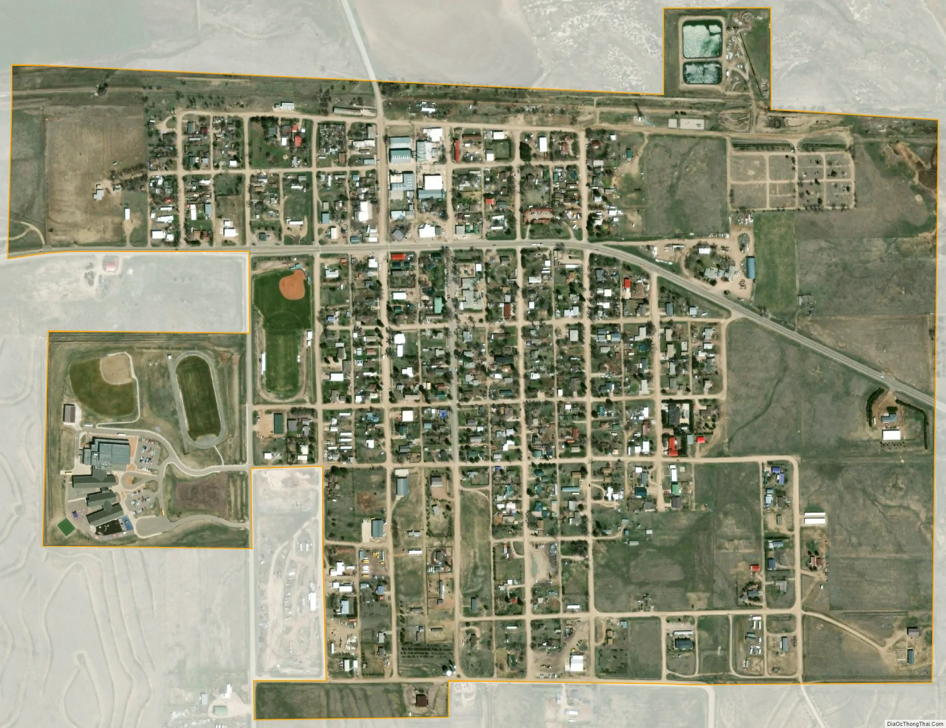
Simla city Satellite Map
Geography
Simla is located in southern Elbert County at 39°8′27″N 104°4′58″W / 39.14083°N 104.08278°W / 39.14083; -104.08278 (39.140746, -104.082836). It lies to the south of Big Sandy Creek, an east-flowing tributary of the Arkansas River. U.S. Route 24 passes through the town, leading southwest to Colorado Springs and northeast 24 miles (39 km) to Limon.
According to the United States Census Bureau, Simla has a total area of 0.54 square miles (1.4 km), all of it land.
See also
Map of Colorado State and its subdivision:- Adams
- Alamosa
- Arapahoe
- Archuleta
- Baca
- Bent
- Boulder
- Broomfield
- Chaffee
- Cheyenne
- Clear Creek
- Conejos
- Costilla
- Crowley
- Custer
- Delta
- Denver
- Dolores
- Douglas
- Eagle
- El Paso
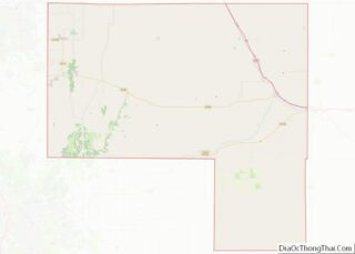
- Elbert
- Fremont
- Garfield
- Gilpin
- Grand
- Gunnison
- Hinsdale
- Huerfano
- Jackson
- Jefferson
- Kiowa
- Kit Carson
- La Plata
- Lake
- Larimer
- Las Animas
- Lincoln
- Logan
- Mesa
- Mineral
- Moffat
- Montezuma
- Montrose
- Morgan
- Otero
- Ouray
- Park
- Phillips
- Pitkin
- Prowers
- Pueblo
- Rio Blanco
- Rio Grande
- Routt
- Saguache
- San Juan
- San Miguel
- Sedgwick
- Summit
- Teller
- Washington
- Weld
- Yuma
- Alabama
- Alaska
- Arizona
- Arkansas
- California
- Colorado
- Connecticut
- Delaware
- District of Columbia
- Florida
- Georgia
- Hawaii
- Idaho
- Illinois
- Indiana
- Iowa
- Kansas
- Kentucky
- Louisiana
- Maine
- Maryland
- Massachusetts
- Michigan
- Minnesota
- Mississippi
- Missouri
- Montana
- Nebraska
- Nevada
- New Hampshire
- New Jersey
- New Mexico
- New York
- North Carolina
- North Dakota
- Ohio
- Oklahoma
- Oregon
- Pennsylvania
- Rhode Island
- South Carolina
- South Dakota
- Tennessee
- Texas
- Utah
- Vermont
- Virginia
- Washington
- West Virginia
- Wisconsin
- Wyoming