Sugar City is a Statutory Town in Crowley County, Colorado, United States. The population was 259 at the 2020 census.
A post office called Sugar City has been in operation since 1900. The community was named for the fact it once was a sugar manufacturing center.
| Name: | Sugar City town |
|---|---|
| LSAD Code: | 43 |
| LSAD Description: | town (suffix) |
| State: | Colorado |
| County: | Crowley County |
| Incorporated: | July 2, 1900 |
| Elevation: | 4,304 ft (1,312 m) |
| Total Area: | 0.39 sq mi (1.00 km²) |
| Land Area: | 0.39 sq mi (1.00 km²) |
| Water Area: | 0.00 sq mi (0.00 km²) |
| Total Population: | 259 |
| Population Density: | 660/sq mi (260/km²) |
| ZIP code: | 81076 |
| Area code: | 719 |
| FIPS code: | 0874815 |
| GNISfeature ID: | 0195392 |
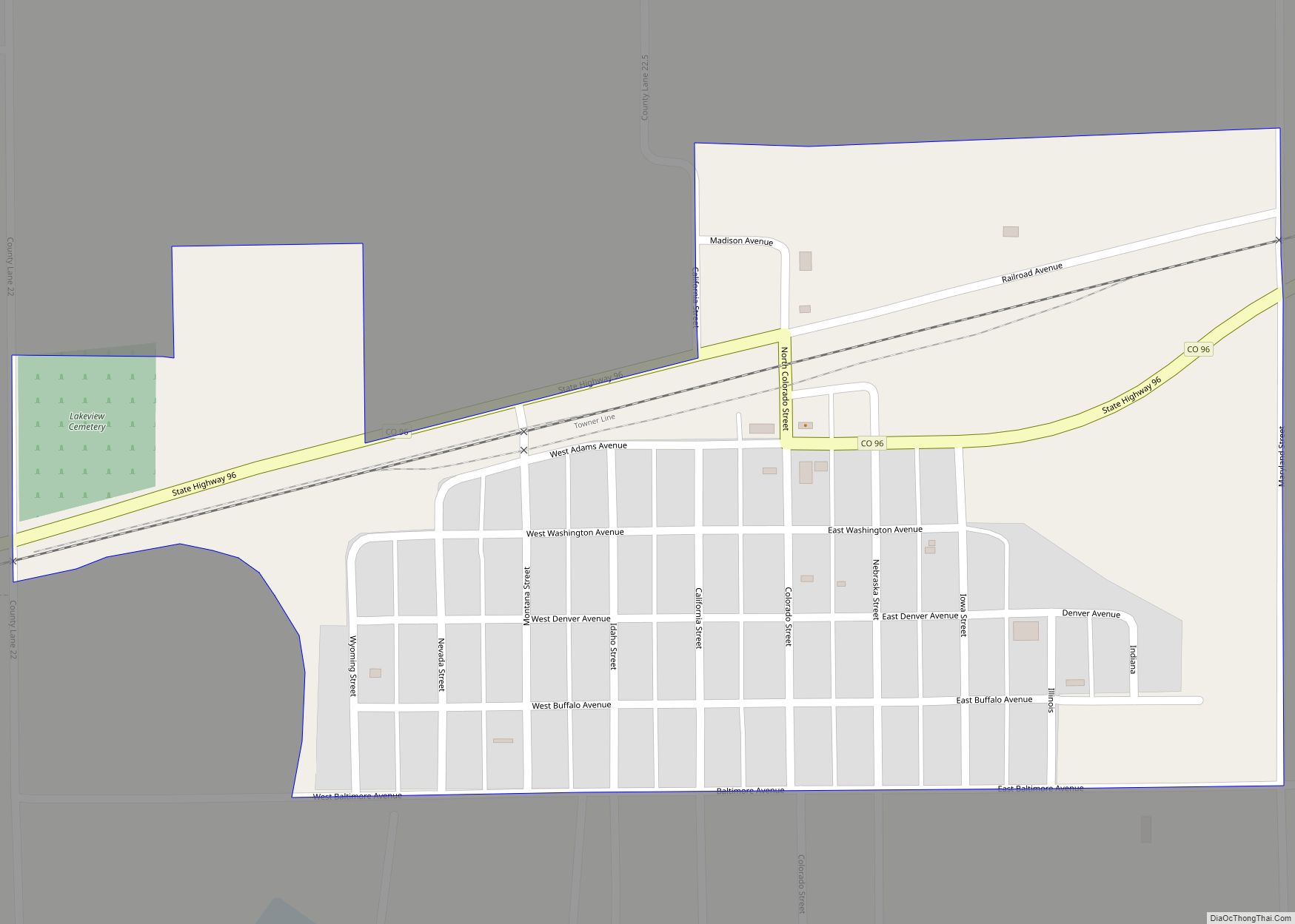
Online Interactive Map
Click on ![]() to view map in "full screen" mode.
to view map in "full screen" mode.
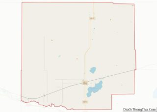
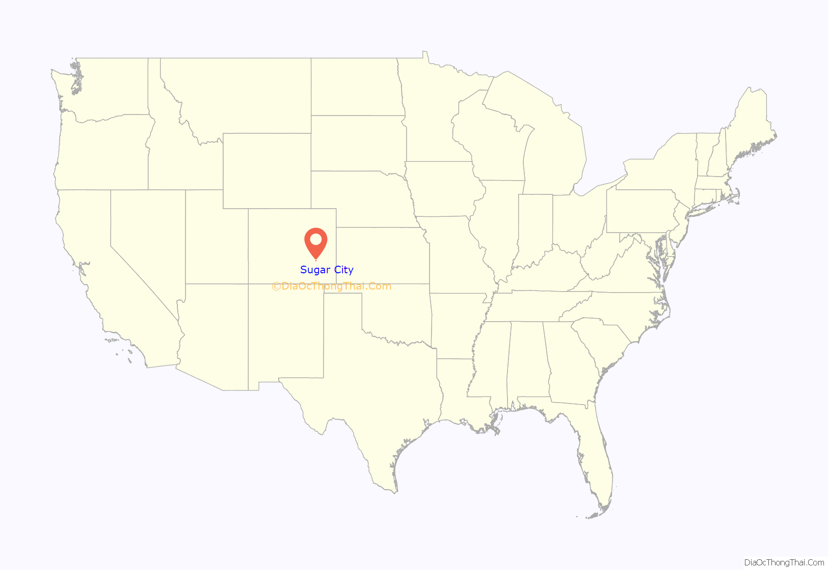
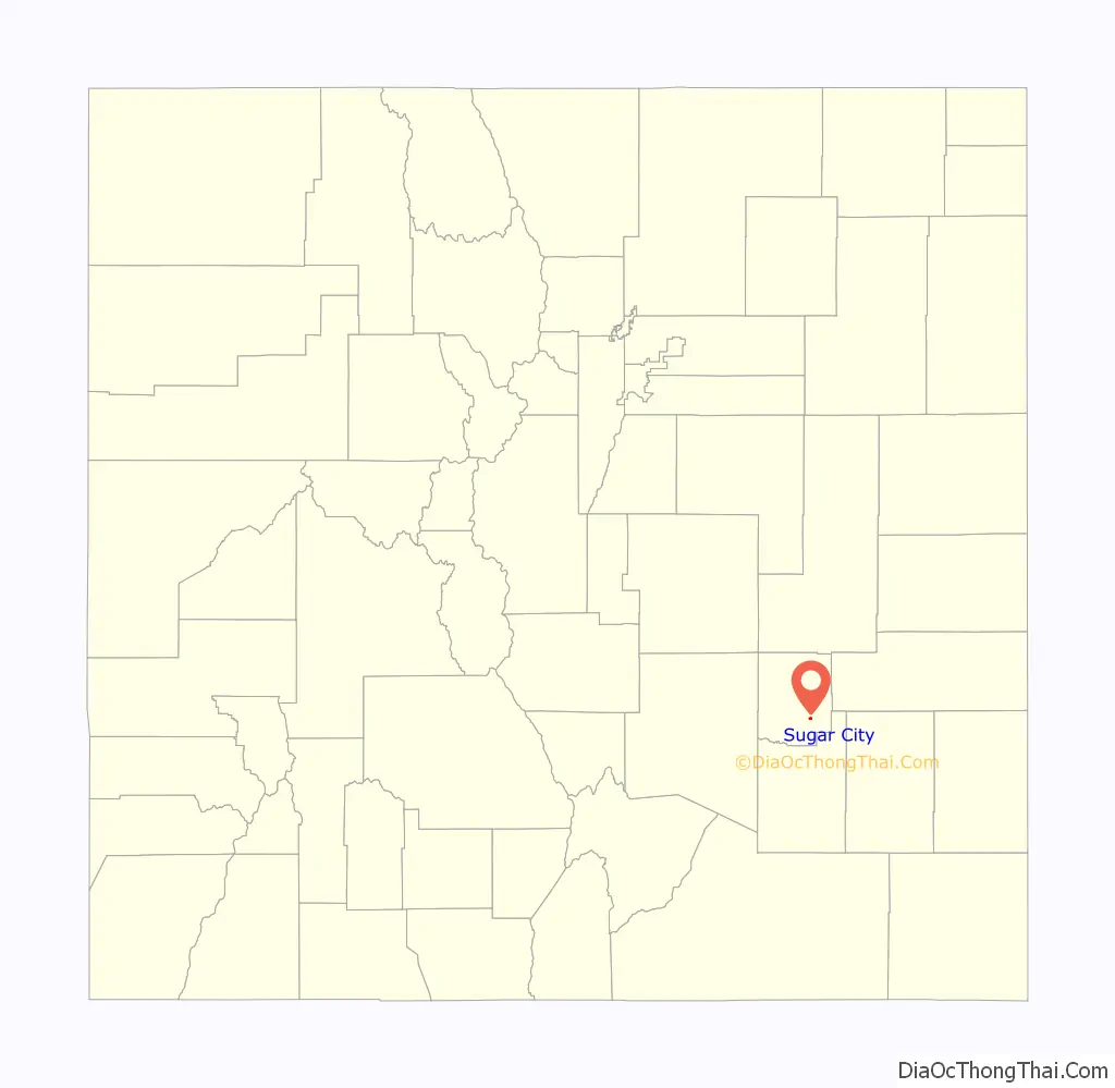
Sugar City location map. Where is Sugar City town?
History
Sugar City was named for its sugar beet factory, established in 1899. It was owned by the National Beet Sugar Company. During a drought in the 1950s the wastewater lagoons at the factory dried, producing a smell that overwhelmed the town. The factory closed in 1967.
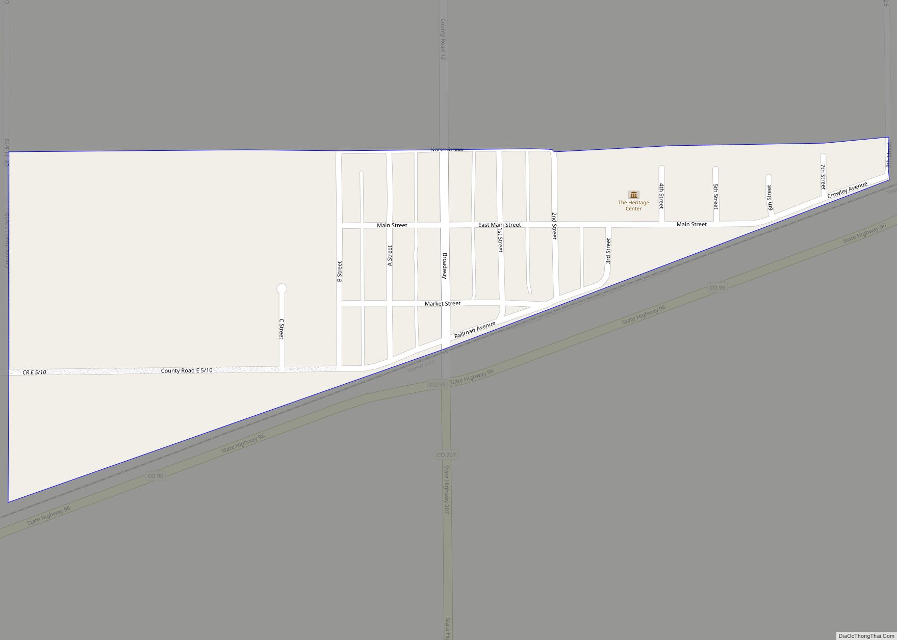
Sugar City Road Map
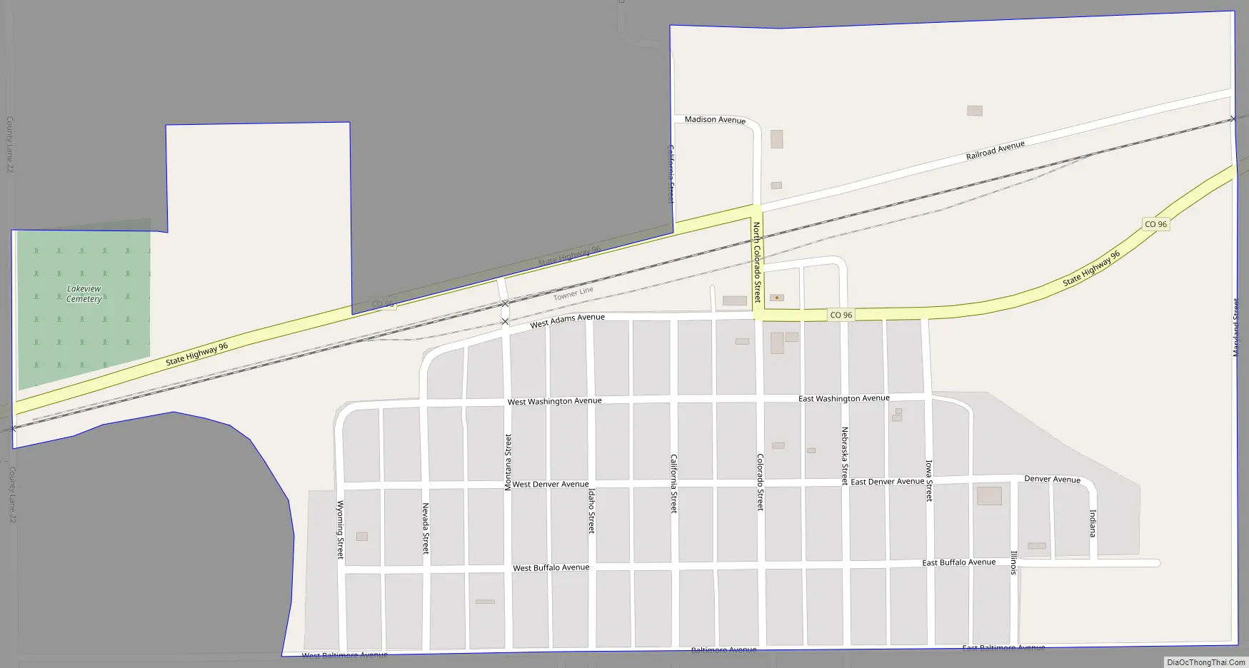
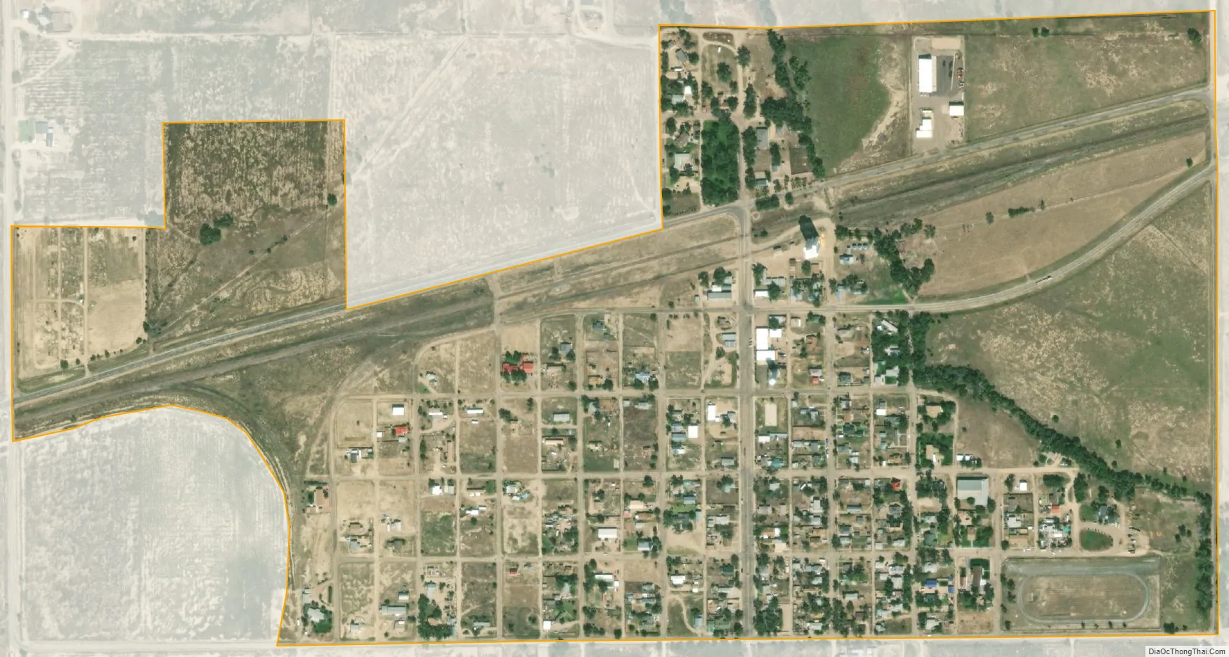
Sugar City city Satellite Map
Geography
Sugar City is located in southeastern Crowley County at 38°13′55″N 103°39′53″W / 38.23194°N 103.66472°W / 38.23194; -103.66472 (38.231866, -103.664851). Colorado State Highway 96 leads west 5 miles (8 km) to Ordway, the county seat, and northeast 33 miles (53 km) to Haswell.
According to the United States Census Bureau, Sugar City has a total area of 0.4 square miles (1.0 km), all of it land.
See also
Map of Colorado State and its subdivision:- Adams
- Alamosa
- Arapahoe
- Archuleta
- Baca
- Bent
- Boulder
- Broomfield
- Chaffee
- Cheyenne
- Clear Creek
- Conejos
- Costilla
- Crowley
- Custer
- Delta
- Denver
- Dolores
- Douglas
- Eagle
- El Paso
- Elbert
- Fremont
- Garfield
- Gilpin
- Grand
- Gunnison
- Hinsdale
- Huerfano
- Jackson
- Jefferson
- Kiowa
- Kit Carson
- La Plata
- Lake
- Larimer
- Las Animas
- Lincoln
- Logan
- Mesa
- Mineral
- Moffat
- Montezuma
- Montrose
- Morgan
- Otero
- Ouray
- Park
- Phillips
- Pitkin
- Prowers
- Pueblo
- Rio Blanco
- Rio Grande
- Routt
- Saguache
- San Juan
- San Miguel
- Sedgwick
- Summit
- Teller
- Washington
- Weld
- Yuma
- Alabama
- Alaska
- Arizona
- Arkansas
- California
- Colorado
- Connecticut
- Delaware
- District of Columbia
- Florida
- Georgia
- Hawaii
- Idaho
- Illinois
- Indiana
- Iowa
- Kansas
- Kentucky
- Louisiana
- Maine
- Maryland
- Massachusetts
- Michigan
- Minnesota
- Mississippi
- Missouri
- Montana
- Nebraska
- Nevada
- New Hampshire
- New Jersey
- New Mexico
- New York
- North Carolina
- North Dakota
- Ohio
- Oklahoma
- Oregon
- Pennsylvania
- Rhode Island
- South Carolina
- South Dakota
- Tennessee
- Texas
- Utah
- Vermont
- Virginia
- Washington
- West Virginia
- Wisconsin
- Wyoming