Towner is a census-designated place (CDP) in and governed by Kiowa County, Colorado, United States. The population of the Towner CDP was 18 at the United States Census 2020. The Sheridan Lake post office (Zip Code 81071) serves Towner postal addresses.
| Name: | Towner CDP |
|---|---|
| LSAD Code: | 57 |
| LSAD Description: | CDP (suffix) |
| State: | Colorado |
| County: | Kiowa County |
| Elevation: | 3,927 ft (1,197 m) |
| Total Area: | 0.037 sq mi (0.097 km²) |
| Land Area: | 0.037 sq mi (0.097 km²) |
| Water Area: | 0.000 sq mi (0.000 km²) |
| Total Population: | 18 |
| Population Density: | 480/sq mi (190/km²) |
| ZIP code: | 81071 |
| Area code: | 719 |
| FIPS code: | 0878335 |
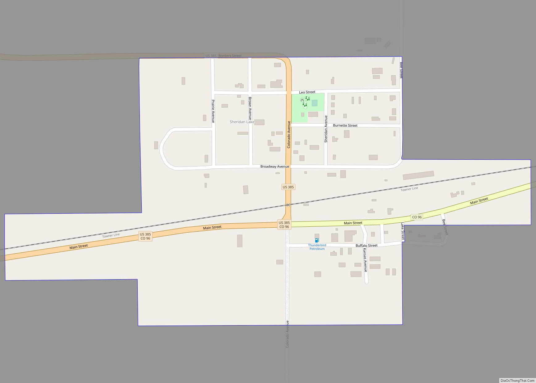
Online Interactive Map
Click on ![]() to view map in "full screen" mode.
to view map in "full screen" mode.
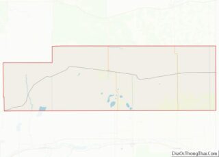
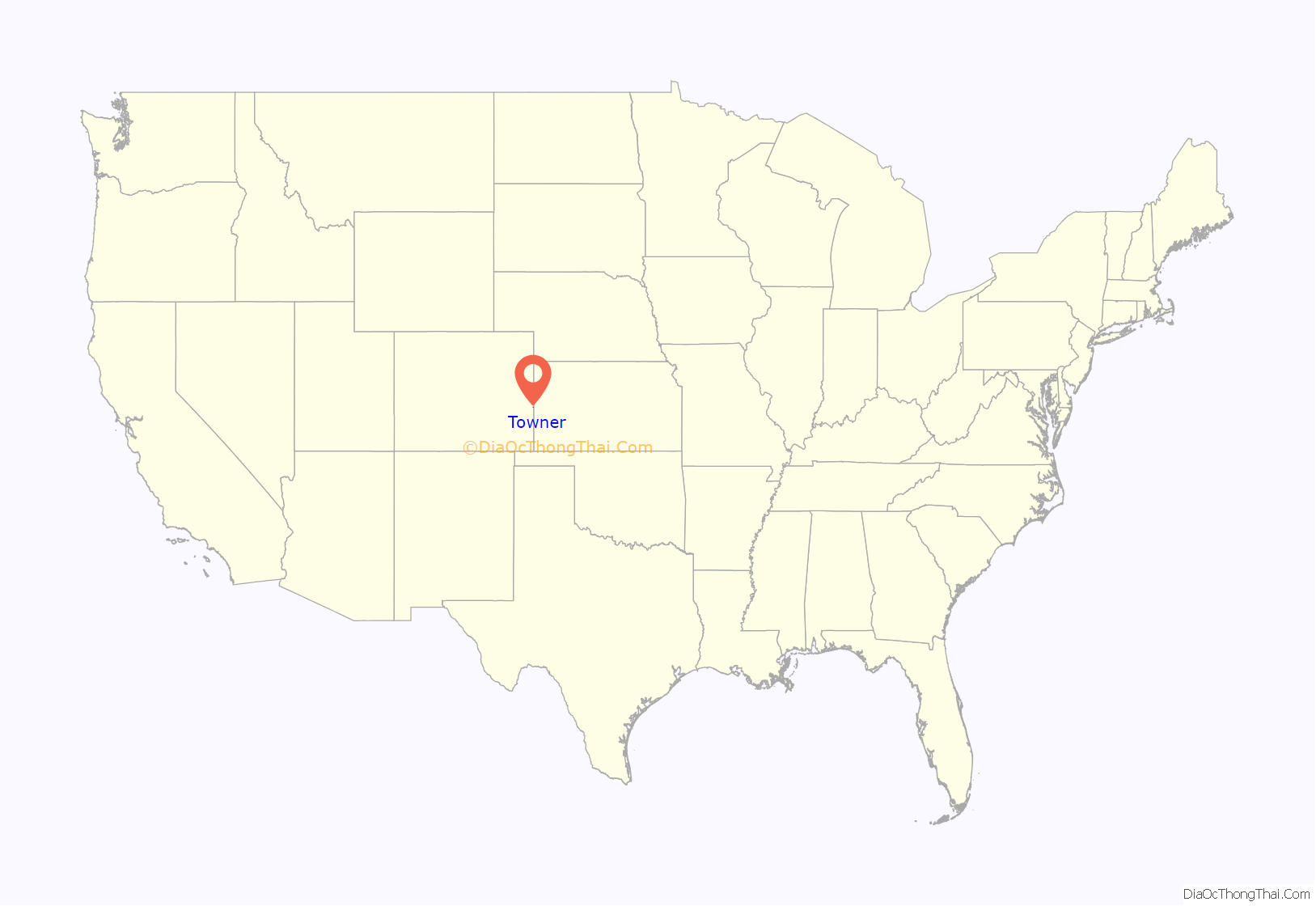
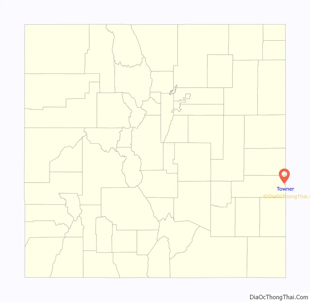
Towner location map. Where is Towner CDP?
History
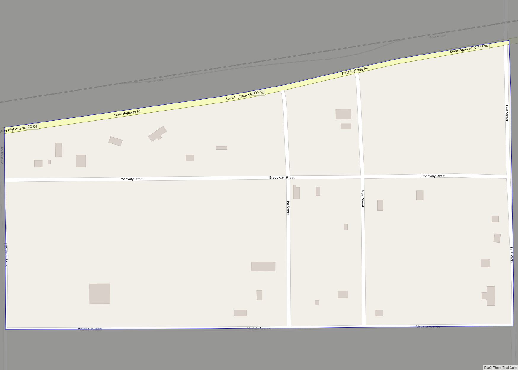
Towner was originally known as “Memphis”. It was a frequent attraction for Kansans when their state was “dry”. Towner is the easternmost town in Colorado, located less than 2 miles (3 km) from the Kansas border.
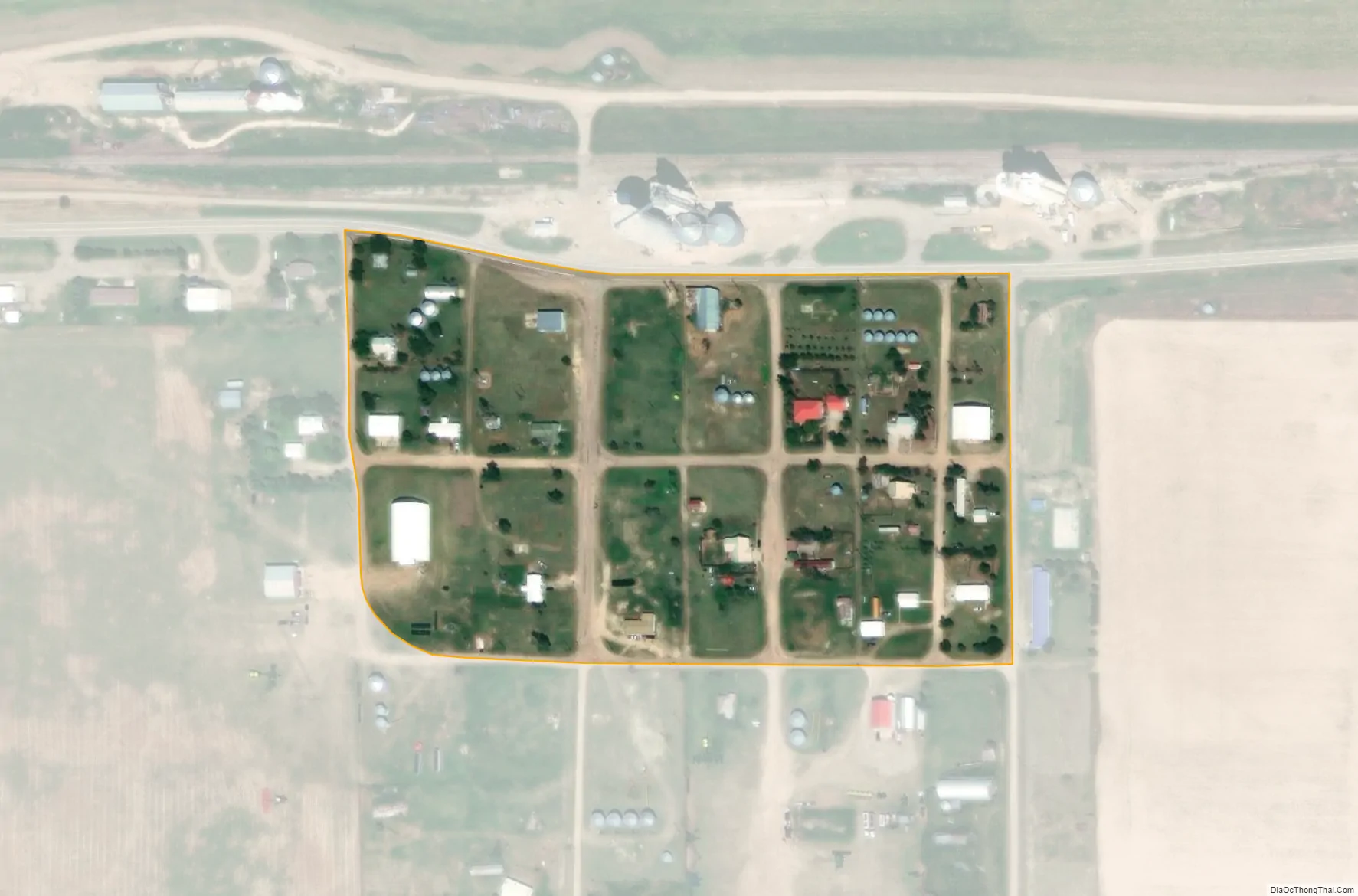
The town currently supports two grain elevators. Its population swells during harvest due to the influx of agricultural crews who often camp in the town. Towner students attend Plainview School, close to Sheridan Lake. It is responsible for the education of students in grades pre-kindergarten through grade 12.
Hunting opportunities are abundant in the area, with deer, pronghorn, and pheasant commonplace, as well as an occasional elk sighting.
In 1931, five students and their bus driver died in the Pleasant Hill bus tragedy near Towner.
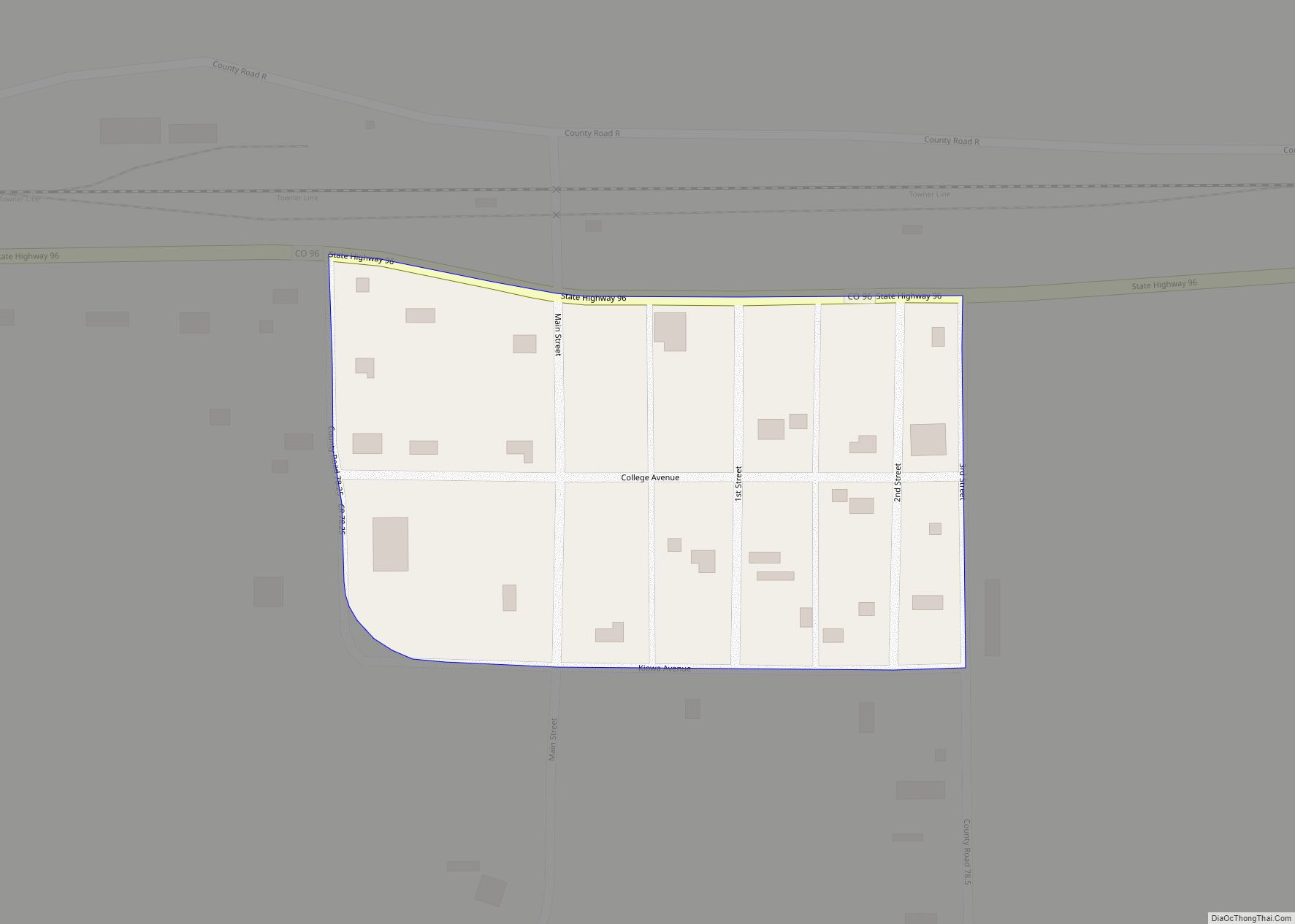
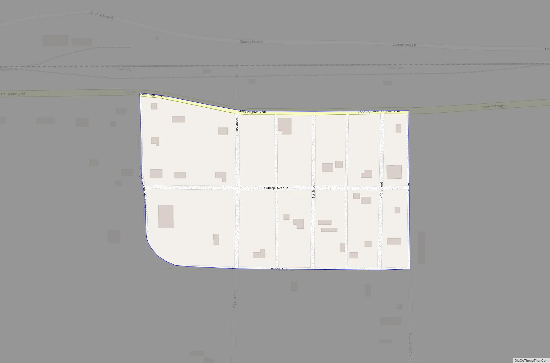
Towner Road Map
Towner city Satellite Map
Geography
Towner is located in eastern Kiowa County. Colorado State Highway 96 passes through the community. The closest gas station is about 11 miles (18 km) to the west on Highway 96 in the town of Sheridan Lake. The Kansas state line is 2 miles (3 km) to the east, and Tribune, Kansas, is 18 miles (29 km) to the east of Towner via Kansas State Highway 96.
The Towner CDP has an area of 24 acres (0.097 km), all land.
See also
Map of Colorado State and its subdivision:- Adams
- Alamosa
- Arapahoe
- Archuleta
- Baca
- Bent
- Boulder
- Broomfield
- Chaffee
- Cheyenne
- Clear Creek
- Conejos
- Costilla
- Crowley
- Custer
- Delta
- Denver
- Dolores
- Douglas
- Eagle
- El Paso
- Elbert
- Fremont
- Garfield
- Gilpin
- Grand
- Gunnison
- Hinsdale
- Huerfano
- Jackson
- Jefferson
- Kiowa
- Kit Carson
- La Plata
- Lake
- Larimer
- Las Animas
- Lincoln
- Logan
- Mesa
- Mineral
- Moffat
- Montezuma
- Montrose
- Morgan
- Otero
- Ouray
- Park
- Phillips
- Pitkin
- Prowers
- Pueblo
- Rio Blanco
- Rio Grande
- Routt
- Saguache
- San Juan
- San Miguel
- Sedgwick
- Summit
- Teller
- Washington
- Weld
- Yuma
- Alabama
- Alaska
- Arizona
- Arkansas
- California
- Colorado
- Connecticut
- Delaware
- District of Columbia
- Florida
- Georgia
- Hawaii
- Idaho
- Illinois
- Indiana
- Iowa
- Kansas
- Kentucky
- Louisiana
- Maine
- Maryland
- Massachusetts
- Michigan
- Minnesota
- Mississippi
- Missouri
- Montana
- Nebraska
- Nevada
- New Hampshire
- New Jersey
- New Mexico
- New York
- North Carolina
- North Dakota
- Ohio
- Oklahoma
- Oregon
- Pennsylvania
- Rhode Island
- South Carolina
- South Dakota
- Tennessee
- Texas
- Utah
- Vermont
- Virginia
- Washington
- West Virginia
- Wisconsin
- Wyoming